|
SEASON IN REVIEW: HURRICANE EARL After hurricane Danielle got the attention of hurricane trackers everywhere, signaling the true beginning to the meat of the hurricane season, Earl quickly surpassed the "D" storm for its place in the season's history. Earl formed from yet another strong tropical wave that emerged from Africa in late August. Fueled by water temps that were above normal in the deep tropics, Earl developed in to a strong hurricane and a large one at that. From the beginning of the advisories, the NHC indicated a chance that the persistent trough or hole in the subtropical ridge of high pressure over the western Atlantic just might keep Earl away from the Leeward Islands. There was also the fact the Danielle had pushed through the ridge just a few days prior, possibly leaving the door open, so to speak, for Earl to escape harmlessly out to sea as well. However, the large area of high pressure waxes and wanes and it grew strong enough in the late summer atmosphere to allow Earl to track farther south than was thought early on. As it turned out, the hurricane directly impacted the northern Leeward Islands as well as the Virgin Islands- all while strengthening in to a powerful hurricane. Once past the islands, the attention shifted to the U.S. East Coast and thus began several days of uncertainty as to how strong the subtropical high would get. A fairly weak area of low pressure in the upper atmosphere did swing through but this was transient and Earl tracked to 75.2 degrees west longitude before it rounded the western side of the high and turned away from the coast. This kept the core of the hurricane well offshore of North Carolina but a small portion of the Outer Banks did receive hurricane force gusts for a brief period during the early morning hours of September 3. Earl then went on to pass well to the southeast of Cape Cod before making landfall in Nova Scotia. Had the hurricane tracked only 100 miles farther west, it would have made a potentially devastating landfall in eastern North Carolina before riding up the length of the Mid Atlantic and Northeast coast lines. As it turned out, Earl was just a close call and caused minor damage due to wind and heavy surf. Tomorrow I will examine hurricane Igor which was one of the largest Atlantic hurricanes on record. As for the tropics right now, 94L is not likely to develop and this should do it for the 2010 hurricane season unless we get some kind of development out in the open waters of the Atlantic though I do not see that happening in any of the long range models. We should finish the season with 19 named storms, 12 hurricanes and 5 major hurricanes- almost exactly what was predicted by several organizations this year. I'll have more here tomorrow morning. 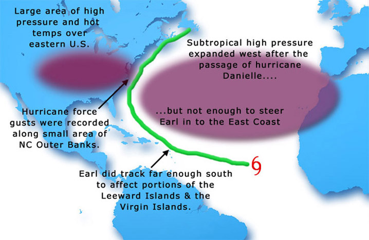
UPDATED: 2:00 pm EDT, November 14, 2010 by Mark Sudduth email me 94L NOT DEVELOPING SO FAR With just over two weeks to go in the hurricane season, we are still watching one active area of disturbed weather. 94L continues to persist over the southwest Caribbean Sea but, so far, has not done much more than produce limited convection. The NHC notes that conditions are still favorable for additional development but looking at the various computer models, I have my doubts this time around. Time will run out for the system to organize and become a tropical cyclone before more hostile upper level winds set in and scrub away any chance of this becoming a concern for land areas. Tomorrow, I will resume my discussion on the hurricane season's 12 hurricanes that managed to form but not hit the U.S. coast. I will pick up with hurricane Earl which came close at the end of August and in to early September. The post will be online by 8am tomorrow morning. UPDATED: 11 am EDT, November 13, 2010 by Mark Sudduth email me TROPICS STILL ACTIVE WITH YET ANOTHER CARIBBEAN DEVELOPMENT POTENTIAL. ALSO, LARGE OCEAN STORM CAUSING PROBLEMS ALONG EAST COAST I will continue the write-up on the season's 12 hurricanes and why they did not hit the U.S. coast on Monday's post. Right now, I want to focus on the current conditions in the tropics. Here we are at November 13 and we have yet another area of disturbed weather to monitor in the Caribbean Sea. It is designated as 94L and seems to be getting better organized off the coast of Colombia. Upper level winds are currently favorable with decent diffluence or spreading out of the air high in the atmosphere. This allows the deep tropical thunderstorms to blossom and get rid of their exhaust without the clouds being ripped away in one direction. These favorable conditions should persist for a few more days and allow 94L to slowly develop- possibly reaching tropical storm strength along the way. If it does, the name would be Virginie, the 20th named storm of the season. The track forecast from the computer models suggests a fairly slow trek across the western Caribbean with possible impacts on Central America. I do not see any way that this comes north from there as strong, dense high pressure builds over North America effectively blocking any significant northward progression later next week. It is something to watch and could add to the list of storms in this very busy hurricane season. Elsewhere, a powerful and expansive ocean storm continues to spin over the waters of the west-central Atlantic. It is cut off from the upper level stream flow and has thus been sitting out in the Atlantic for several days now. As a result, large swells have built up along all around the storm system with those on the western side reaching the East Coast of the U.S. these past few days. The result has been an increase in surf to the extent that some coastal areas are under advisories for flooding at the time of high tide. I was in Nags Head and Kitty Hawk yesterday and filmed some of the effects of the long period swell reaching the shores and over washing in to the streets. Some minor damage has occurred along the immediate beach front which includes damage to the under portion of front row homes. Check out the video clip below. I also have a live camera streaming from a cottage in Kill Devil Hills over in the right hand column. I'll post another update on 94L here tomorrow and will resume the discussion on the hurricane season on Monday. UPDATED: 9:30 am EDT, November 10, 2010 by Mark Sudduth email me A LOOK AT THE SEASON'S 12 HURRICANES AND WHY THEY DID NOT HIT THE U.S. Before I take a look at Danielle's track and why it did not impact the U.S. directly, let's first examine the current situation in the tropics. The NHC has an area outlined in the eastern Caribbean associated with a surface area of low pressure that has quite a bit of shower and thunderstorm activity. This disturbance has been bringing heavy rains and squally weather to Puerto Rico and the northern Leeward Islands. This pattern is expected to persist for about another day and then clear out. I really do not see this system having much of a chance to develop as upper level winds are not forecast to become favorable. Next week, there is a chance of another disturbance developing in the southwest Cairbbean Sea as depicted by several of the global computer models. Even though it is getting very late in the season for this to be happening, water temps in that region are still plenty warm and surface pressures remain a little below normal which allows for better conditions than we would expect to see in mid-November. The models indicate possible development early next week which is not too far out in time and so we'll watch things closely. Otherwise, the tropics are not an issue right now. Part Two: Hurricane Danielle After hurricane Alex formed in late June, the tropics were quite inactive despite the forecasts for a very busy season. As we entered the first week or so of August, there was still a considerable amount of dry, stable air being advected off the coast of Africa and in to the Atlantic Basin. This kept a lid on development up until the third week of that month and had a lot people wondering if the huge predicitons were going to bust. All of that wondering began to wane around the 21st as what would become hurricane Danielle formed in the deep tropics from a formidable tropical wave. Almost from the beginning it looked as though Danielle would never reach the U.S. coast. Here is a line from the very first tropical cyclone discussion from the NHC on Saturday, August 21: MOST OF THE MODELS SHOW THE CYCLONE TURNING TOWARD THE NORTHWEST DUE TO A WEAKNESS IN THE RIDGE ALONG 50W IN ABOUT 3 DAYS. That is in fact what happened and Danielle basically stair-stepped its way across the Atlantic as the strong Azores High pulsed but did not build westward enough to allow the Bermuda High extension to strengthen and send Danielle west. It is important to understand that the Bermuda-Azores High couplet is always in flux. It moves, changes shape, shrinks and grows. High pressure is like a mountain of air in the atmosphere. The more air there is associated with the high, the thicker it is in the lower atmosphere. Sometimes it can be expansive and take up a great deal of the Atlantic Basin, dominating the trade winds and steering tropical cyclones westward for weeks at a time. This was the case in 2004 and to some extent, 2008. However, in this hurricane season, the Azores High was the dominant pressure pattern with a much weaker to non-exsitent Bermuda High. Thus, a weakness or area of lower high pressure in the mid and upper levels of the atmosphere persisted over the western Atlantic. This pattern did not allow Danielle to get any farther west than about 61 degrees west longitude before it turned back to the northeast. Danielle did manage to become a powerful category four hurricane and it was a large one at that. This resulted in massive swells being sent out towards many land masses of the western Basin. Surfers were delighted while life guards earned their pay and then some during the extreme surf conditions. Danielle was followed quickly by another Cape Verde hurricane which would pass much closer to the East Coast but not quite close enough for a landfall. Tomorrow I will take a look at hurricane Earl and play a little "what if". 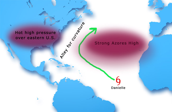 UPDATED: 6:30 am EDT, November 9, 2010 by Mark Sudduth email me A LOOK AT THE SEASON'S 12 HURRICANES AND WHY THEY DID NOT HIT THE U.S. Part One: Hurricane Alex This season, as in infamous ones like 2004 and 2005, came down to steering patterns. In 2004, a fairly strong Bermuda High set up over the western Atlantic from mid to late August through the end of September and allowed several powerful hurricanes to come plowing across the Atlantic and in to the Southeast U.S. with Florida being the main target. The same type of pattern set up again in 2005 and this, coupled with ideal conditions for development, made that year the most destructive on record. In fact, of all the hurricanes that impacted the U.S. in 2005, none of them were tropical storms in the deep tropics. In other words, in 2005, we had no Cape Verde hurricanes to hit the U.S. They formed close to land and had no chance to curve away in to the open Atlantic. If we look at 2008, there was period of time from mid-August through mid-September that also allowed several hurricanes to form and track west towards the U.S. and other land masses of the Caribbean Sea. TS Fay, though not a hurricane, was the lead-off system followed by powerful hurricane Gustav which blasted Cuba before making landfall in Louisiana. Then, there was Ike. This hurricane formed out of a strong tropical wave west of the Cape Verde Islands and traveled the entire length of the Atlantic to reach Galveston, TX on September 13. The reason is quite simple: a strong subtropical high pressure area was prevalent during Ike's life span and thus it was steered west and even south of west for a time. There was basically a lid over the tropics during that time period, not allowing Ike to turn north and out to sea. If you think about it, a track like that, from Africa to Texas, is incredible. Especially considering this season. Fast foward to 2010. Hurricane Alex formed in the Caribbean Sea in late June and headed west in to northern Mexico. Why? Strong high pressure, that lid I mentioned, was positioned over the Deep South and Texas. This forced Alex west as the hurricane cannot turn north in to this dense dome of air. Here is a section of an early forecast discussion from the NHC regarding Alex. It was fairly clear early on that the first hurricane of the season had no chance to speak of to hit the U.S. FOR THE NEXT 24 TO 36 HOURS THE DEPRESSION IS EXPECTED TO MOVE WEST-NORTHWESTWARD TO THE SOUTH OF A MID-LEVEL RIDGE CENTERED ALONG THE U.S. GULF COAST. AS THE RIDGE WEAKENS IN 36 TO 48 HOURS...THE CYCLONE IS EXPECTED TO TURN NORTHWESTWARD AFTER IT CROSSES THE YUCATAN PENINSULA. BY DAYS 3 TO 5 MOST OF THE TRACK GUIDANCE HAS SHIFTED WESTWARD...SUGGESTING THAT THE CYCLONE WILL NOT GAIN ENOUGH LATITUDE TO INTERACT WITH A LONGWAVE TROUGH AMPLIFYING OVER EASTERN NORTH AMERICA. As shown in the graphic below, the ridge of high pressure over the northern Gulf Coast acted as a shield and did not allow Alex to track far enough north to be drawn in to Texas or the Central Gulf Coast. It is a good thing too since Alex strengthened very quickly near landfall and had a pressure of around 947 millibars and a well defined eye. As it turned out, Alex made landfall in a fairly sparsely populated area of northern Mexico causing some damage but not nearly as bad as it would have been had Alex struck a more densely populated city. 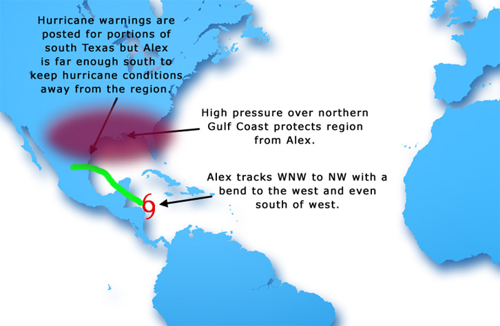 Tomorrow, I will examine the first Cape Verde hurricane of the season and why it missed far to the east of the U.S. coastline. UPDATED: 11:55 pm EDT, November 5, 2010 by Mark Sudduth email me HURRICANE TOMAS MOVING THROUGH TURKS AND CAICOS Tomas has top winds near 75 mph tonight as it moves through the Turks and Caicos. It was just southeast of Great Inagua Island heading towards the northeast at a steady pace. By later in the day Saturday, Tomas will have cleared the region and the weather should begin to improve. However, there are still large bands of rain moving over Hispaniola and even Puerto Rico. You can see this on the radar shot out of San Juan. Several more hours of this off and on rainy pattern will persist until Tomas can move far enough away to drag the pesky rain bands with it. The forecast track takes Tomas northeast and then bends towards the east with time over the open waters of the Atlantic Ocean. It should be far enough north of the Greater Antilles to keep any residual moisture away from the region. It could take a few days for Tomas to spin down and weaken in to a post-tropical low or remnant low. Since it is not forecast to be caught up in the larger scale weather pattern to the north, it will not be whisked out in to the far north Atlantic like other systems that we have seen this year. After Tomas, I do not see anything too concerning in the global models as far as future development. We'll watch the Caribbean Sea once again as a genesis area but it is really getting late in the season for anything to get going. Water temps are still warm but are coming down, well off their highs from earlier in the season. Strong westerly winds and drier, more stable air is encroaching much of the tropical Atlantic and soon, the season will be over. I will have a lengthy write up on how this season measured up to forecasts and more sometime next week. I'll post another update on Tomas tomorrow afternoon. UPDATED: 2:40 pm EDT, November 5, 2010 by Mark Sudduth email me TOMAS MOVING BETWEEN CUBA AND HAITI EN ROUTE TO TURKS AND CAICOS Hurricane Tomas is now passing between Cuba and Haiti through the Windward Passage. Looking at satellite images from recent hours, it looks as though the worst may be over for Haiti with the exception of continued periods of heavy rain. However, the great news in all of this is that the strongest part of the hurricane tracked well west of the hardest hit areas from last winter's earthquake. We'll see what news comes out of Port-au-Prince and surrounding areas but I would imagine that things are not too bad with hopefully only spotty reports of any serious issues. Next up for Tomas will be the Turks and Caicos Islands along the extreme southeast Bahamas. The hurricane will lash this region tonight with hurricane conditions but should move through quickly enough to make for a nice second half to the weekend ahead. We should be seeing the top end of Tomas' strength now with not much room left for it to get too much stronger as negative conditions will soon take over. Keep in mind though that hurricanes can pulse up or down very quickly and it would not be a surprise to see Tomas reach 100 mph briefly before the weakening ensues. Once past the Turks and Caicos, Tomas will move on out in to the southwest Atlantic and eventually fade away- posing no threat to land areas after the current encounter. The rest of the Atlantic Basin is free of any trouble spots and I really do not see much chance for significant development after Tomas. We might still eek out one or two more named storms since water temps are still running above normal in many places. It has been a very busy hurricane season and we don't have much longer to go until winter sets in and shuts things down for good- until next year anyway. I'll have another post here late tonight. UPDATED: 7:00 pm EDT, November 4, 2010 by Mark Sudduth email me DISORGANIZED TOMAS BRINGING RAIN TO PORTIONS OF THE GREATER ANTILLES So far, Tomas is not getting much better organized than it was earlier today. The still lopsided storm is bringing heavy rains to portions of Hispaniola, Cuba and perhaps even Jamaica- though conditions will improve there soon. The main culprit, if you want to call it that, in Tomas' inability to strengthen, is the fact that it is still being sheared due to its proximity to an upper level high pressure area. Tomas is not sitting underneath the upper high but is instead situated along the northwestern portion of the high which is not nearly as favorable. The result is that Tomas has not been able to regain its earlier intensity and may not ever before it comes under attack from even stronger upper level winds early next week. None the less, the potential exists for heavy rain which could lead to several problems associated with the people recovering from the earthquake in Haiti from this past winter. A lot of attention is being placed on this situation which is good- people are ready and efforts have been and will continue to be underway to mitigate further loss of life or damage in Haiti. A lot will depend on how much rain does in fact fall and how close the storm tracks to the region. So far, optimism abounds in that we are not seeing a truly terrible situation unfold. We do need to watch the Caribbean Sea for possible additional development next week. Some of the global computer models are indicating that yet another tropical cyclone could form as the pattern continues to be one that is at least minimally favorable for such genesis to take place. For now, we'll deal with Tomas and its effects. I'll post more here tomorrow morning. UPDATED: 11:40 am EDT, November 4, 2010 by Mark Sudduth email me TOMAS THE CENTER OF ATTENTION RIGHT NOW Tropical storm Tomas is closing in on Jamaica and could skirt the eastern portion of the island later today. The good news is that it is not a hurricane and poses only a rain threat for the most part. I say "only" a rain threat, this should taken seriously due to the obvious chances of mudslides and flash flooding but I assure you the people of Jamaica are quite happy with Tomas NOT being any stronger. Tomas will pass the eastern end of Jamaica and then head towards eastern Cuba, passing between there and Haiti. Then, what could be a hurricane, should track in to the southeast Bahamas and on out in to the southwest Atlantic Ocean. Overall, the news is not too bad for Haiti where the most attention is being paid to Tomas' track and intensity. There is certainly a risk for very heavy rains which could cause major problems for Haiti but the shift west in the track brings hope that things may turn out far better than the terrible alternative of a hurricane plowing right over the vulnerable nation. There is no way to know this soon how much rain will fall and for how long. Tomas is expected to pick up some forward speed which will help to minimize the duration of any torrential rain that falls. As for the Dominican Republic, the shift in the track is even better news for the folks there as the effects will be limited to off and on showers with a few squalls. There is also a risk here too for flooding issues but not nearly as bad as it would be if Tomas were passing much closer. After passing the southeast Bahamas, Tomas has a couple of choices, so to speak. Some of the model data suggests a turn to the east over the southwest Atlantic where it could sit around for a while and slowly lose its tropical nature and die away. Other data indicates a possible transition in to a powerful sub-tropical storm which could then pinwheel back to the NNW and towards the Northeast United States. This is the latest solution offered by the GFS model but until I see it develop some run to run consistency and other models following along, I will not worry about it too much. Recall Ida last year did a similar transition off the Mid-Atlantic coast and ended up far more damaging than the tropical version along the central Gulf Coast. It is a complicated pattern developing and we'll have to watch things closely. First, we'll focus on the Caribbean and especially Haiti. I'll have another update here early this evening. UPDATED: 8:40 pm EDT, November 2, 2010 by Mark Sudduth email me LOOKS CAN BE DECEIVING Tomas looks poor this evening and this is good news. But how it looks now matters not, it's how it looks and is come later Thursday and in to Friday and beyond. It is this time period that will be most important. Right now, the storm is still suffering from some dry air entrainment and upper level winds that are not allowing the storm to stack in the vertical. All of the negative factors should slacken off soon and allow the cyclone to really begin to intensify. While this is no guarantee, it is the forecast. So far, a hurricane watch has been posted for Jamaica not because the eye or center of Tomas is forecast to pass over the island but because of the chance of hurricane conditions. This is important and was not much of an issue this season for the U.S. Hurricane conditions mean more than just the center or core of the hurricane passing over a location. A hurricane can pass close enough to land to cause hurricane force winds, dangerous seas and torrential rain without the eye making landfall. This is what could very well happen in Jamaica on Thursday. Of course, Tomas could track more west than forecast and indeed bring the center right over the area but this is not necessarily why the watch was posted. Of greater concern due to the earthquake aftermath in Haiti is Tomas' effect on that nation. A slow moving tropical cyclone of any intensity is not what anyone wanted to see for Haiti or the Dominican Republic for that matter. The latest forecast track has shifted some to the west and just barely has the center crossing over western Haiti. This would keep the worst of the wind away from Port-au-Prince but not the heavy rain bands. So there is some good news but not quite enough to breathe a sigh of relief just yet. There will be considerable monitoring of the storm by the NHC and the various aerial reconnaissance to provide excellent data until Tomas has passed the region. A lot of people are hoping for the best for Haiti and of course for Jamaica and the Dominican Republic. Only time will tell what the ultimate outcome is. I'll have more here in the morning. UPDATED: 10:55 am EDT, November 2, 2010 by Mark Sudduth email me HAITI BRACES FOR TOMAS BUT JAMAICA COULD GET TAGGED FIRST It looks like Tomas is making the predicted comeback this morning as deep thunderstorm activity has developed in association with the storm. The stronger upper level winds that were pushing the convection away have relaxed and a more moist environment has set up. This is allowing Tomas to regain intensity slowly but steadily. The NHC is forecasting it to become a hurricane again fairly soon and reach a peak intensity of around 90 mph. The forecast track is such that any deviation to the west could bring Tomas very near or even right over Jamaica before it ever reaches Haiti. I suspect that a hurricane watch will be posted for Jamaica and Haiti soon. People traveling to Jamaica need to be aware of the situation and plan accordingly. The longer Tomas travels west before turning north, the more impact it will have on Jamaica. As for Haiti- the situation is tough to call right now. We are still a few days away from a potential landfall and the latest info from the NHC suggests that Tomas could linger near Hispaniola longer than previously forecast. This is due to the huge trough moving through the western Atlantic by-passing Tomas to some extent, leaving it in weak steering currents. When and if this happens is critical for folks in Haiti and the Dominican Republic. The main threat will be excessive rain and the longer it takes Tomas to pass by, the greater the potential for life-threatning flooding to take place. We'll be watching the situation closely as will many in the international community from relief organizations to the media and of course the National Hurricane Center. I'll post another update on Tomas here this evening. UPDATED: 10:50 pm EDT, November 1, 2010 by Mark Sudduth email me NHC FORECASTING TOMAS TO PASS OVER HAITI AS A HURRICANE It looks like the run of fairly good luck may come to an end as far as the hurricane season goes. Tomas could end up being the poster child of "it only takes one" for 2010. The tropical storm has been responsible for quite a bit of damage in portions of the Windward Islands with flooding, damage to infrastructure and even structural damage being reported. The worst, however, may be yet to come. The latest forecast from the NHC puts Tomas on a path over western Haiti by the end of the week as a fairly potent hurricane. The storm is currently fighting off shear and some dry air in the mid levels of the atmosphere. These negative factors are likely to abate and allow Tomas to regain quite a bit of intensity as it nears the battered nation on Friday. The biggest threat will likely be heavy rains which could induce serious flooding and more misery for the people of Haiti. If Tomas gets really strong, then additional damage to the fragile rebuilding effort is possible. There is no way to know this far out how bad things will be. People there need to prepare and you can be assured that the US National Hurricane Center is in close contact with officials in Haiti as this threat looms. There is a chance that Tomas does not recover much and remains weak. That would be great news. There is also a chance that it could be the worst hurricane event of the year and this is something that was feared back in March when the NHC director, Bill Read, mentioned that his #1 concern for the season was Haiti. We'll see how it all plays out- it won't be too long before a hurricane watch is posted for Haiti. And also of note- once Tomas passes over the region, it could affect the extreme southeast Bahamas/Turks and Caicos over the weekend. I'll have more here Tuesday morning. UPDATED: 8:45 am EDT, November 1, 2010 by Mark Sudduth email me THE GOOD NEWS: TOMAS IS WEAKENING BUT THE BAD NEWS IS THAT IT COULD AFFECT HAITI AS A HURRICANE Tomas has taken a punch from shear and has thus weakened considerably since earlier in the weekend. Top winds are now down to around 50 mph and they could drop even further while the negative conditions prevail. However, later in the week, conditions are expected to improve in the atmosphere which should allow the storm to become a hurricane once again. It does not appear that there will be enough support for it to reach category three intensity but this cannot be completely ruled out. The forecast track is very important for a number of reasons. First, the storm has a chance to continue west enough to directly impact Jamaica before turning north. People with plans in Jamaica this week need to monitor Tomas closely. It could be a hurricane at that point in time and it won't take much of a continued westward track to get the system close enough to cause problems- mainly rain and squally weather. The next big issue is Haiti. It goes without saying that Tomas could cause quite a bit of damage in the already vulnerable nation which was hit by the terrible earthquake last winter. What we need to keep in mind is that it won't take a direct hit for there to be considerable problems. Heavy rains could easily cause flash floods and disrupt the fragile infrastructure and relief efforts. Of course, a full on landfall by a hurricane would be even worse but this is one of those situations where it is a matter of degree as to how bad it could be for the region. With any luck, Tomas will pass between Haiti and eastern Cuba, remain weak and not do much more than bring some rain bands and high anxiety. That is certainly better than the alternative. For those who have emailed asking about potential impacts to Central America and/or the Yucatan, I see no reason why Tomas would continue west towards that area of the Caribbean at this time. Tomas would have to miss the connection with the huge trough that is going to build in over the eastern portions of North America and then get steered westward from there. I do not see this happening in any of the long range computer models. The rest of the tropics are quiet which is expected this time of year. The season to date has produced 19 named storms, 12 hurricanes with 5 of those hurricanes becoming category three or higher. The current ACE index or accumulated cyclone energy index stands at roughly 153 now- almost in to the seldom seen hyper-active season status. And yet, so far, no major catastrophes have taken place and we are almost to the finish line. If we can get Tomas out of the way without it ruining the fairly incredible run of good luck, we can look back on this season and know how lucky we really were. I'll have posts all throughout the week. UPDATED: 3:00 pm EDT, October 30, 2010 by Mark Sudduth email me TOMAS MOVING THROUGH THE WINDWARD ISLANDS ON ITS WAY IN TO CARIBBEAN Tomas became a hurricane this morning and moved over Barbados where it caused some damage according to a report from the NHC earlier today. The hurricane is now moving towards St. Vincent and St. Lucia where hurricane conditions are likely, especially within the stronger bursts of convection that manage to fire up. It will take several more hours before conditions improve in the region and then Tomas will enter the Caribbean Sea. The latest forecast for Tomas indicates that it could become a category three hurricane as it tracks just south of the Greater Antilles. Puerto Rico, Cuba and Hispaniola should be far enough north of the track to keep the worst of conditions away- for the next few days at least. After the five day forecast period, things become quite complicated. The GFS model indicates that Tomas will slow down significantly just east of Jamaica and south of Hispaniola at around day six or seven. It is possible that Tomas could turn north after day seven and directly impact Hispaniola. A lot will have to do with the strength of an unseasonable upper level trough that the models are forecasting to move in to the East later next week. The amplitude of the trough, how far south it digs longitude-wise, is incredible for early November. By itself, it would make for news as cold air, snow and a sizeable coastal storm look to be taking shape a little over a week from now for the East Coast. Now we have to think about what could happen with Tomas, a tremendous source of energy, being positioned just to the south of the base of this huge trough. It looks like the trough will kick Tomas out of the Caribbean and not leave it behind to mill around. When this happens is critical to land masses that could be in harm's way. It is also possible, as indicated to some extent by the Canadian computer model, that Tomas gets pulled in to the trough and ignites a phenomenal coastal storm for much of the East Coast and Canadian Maritimes. We are too far out in time to rely on one model over the other at this point and probably need another 48 to 72 hours before the picture becomes clearer. One thing is certain- Tomas makes 12 hurricanes to have formed this season. This is almost twice the 100 year normal and actually a little above the projected forecasts for this season from most agencies. Whether or not this last gasp of the hurricane season ends with a memorable finale or yet another close call remains to be seen. Folks in the Caribbean should pay close attention to the future of Tomas and hopefully it can avoid being tangled up in any vulnerable areas such as Haiti. I'll post another update here tomorrow morning. UPDATED: 11:25 pm EDT, October 29, 2010 by Mark Sudduth email me SHARY PAST BERMUDA NOW AS TOMAS NEARS BARBADOS AND THEN THE CARIBBEAN TS Shary is now past Bermuda. The small tropical storm ramped up quickly today and almost became a hurricane. The storm is moving very quickly now off to the northeast and will be well out in to the northeast Atlantic by this time tomorrow. The weather in Bermuda will improve drastically overnight and throughout the weekend. As for Tomas, the storm is very impressive and this does not bode well for the Windward Islands. There are now hurricane warnings posted for a portion of the Windward Islands including Barbados, St. Lucia, St. Vincent and Martinique. It is possible that hurricane conditions will be felt across this area tonight and tomorrow as Tomas passes by. The latest info from the NHC continues to indicate a very strong hurricane entering and moving through the Caribbean Sea next week. The official forecast calls for Tomas to reach category three intensity and it would not surprise me at all to see it get stronger than that. The reason being simply that we have seen so many hurricanes this season outpeform their forecast intensity, why stop now? The good news to some extent is that Tomas will be in the open waters of the Caribbean for a few days after passing the Windwards. The current track forecast puts Tomas just to the south of Jamaica in about five days. This is subject to change of course and we will really need to monitor the situation closely. It may take a day or two more of model data before we know whether or not Tomas will impact Haiti. The size of the storm is a problem since it could dump very heavy rains without the core coming very close. Again, this is something we'll need to watch closely. I'll have more updates throughout the weekend on this developing situation. UPDATED: 5:45 pm pm EDT, October 29, 2010 by Mark Sudduth email me BUSY SEASON CONTINUES WITH SERIOUS THREAT DEVELOPING FOR CARIBBEAN It is going to be a rough night for Bermuda once again as TS Shary, almost a hurricane, blasts by. That is the good thing this time around- Shary will be in and out in no time, leaving a majority of weekend intact for the small Atlantic island. The next big story is developing now in the waters east of the Windward Islands. The NHC has upgraded 91L to TS Tomas with 40 mph winds. The forecast is bold- calling for Tomas to become a powerful hurricane in the central Caribbean next week. This is very serious and in fact, people in the Windward Islands need to be ready for an intensifying tropical cyclone to pass through this weekend. Once in to the Caribbean, Tomas should steadily strengthen with an amazingly well developed upper level high situated with the cyclone. This will provide the exhaust for the low level convergence going on at the surface and mid levels. The NHC notes also how moist the atmosphere is around the cyclone which will only add to its chances of becoming a very powerful hurricane. I am amazed at its shear size. Shary would fit neatly inside the developing CDO or central core area of thunderstorms of Tomas. We may well be looking at an extremely powerful hurricane next week in the Caribbean. So that begs the question of "where will it go"? Well, right now the NHC forecasts a track in to and across the Caribbean Sea without any land interaction for the next five days. This is good and bad. Good for obvious reasons and bad because it will allow Tomas to strengthen almost without limits. It is beyond the five days that is worrisome. The last place we need to see this future hurricane track is towards Haiti. Of course, we don't want it anywhere that encounters land but Haiti is off limits, so to speak. Folks in Puerto Rico, Hispaniola, Cuba and Jamaica all need to pay very close attention to the track and progress of Tomas. As far as potential impact on the U.S. goes, we are too early in the evolution of the pattern to know if Tomas will continue WNW and turn in to the Yucatan channel, head due west for the Yucatan itself or get caught in an approaching trough of low pressure over North America later next week. There is at least a chance, however small, that Tomas could interact with the trough and come north in such rapid fashion to affect portions of the Southeast United States. It's just something to keep in mind and it has happened before. For now, we'll watch closely as it develops and moves fairly quickly to the WNW and towards the Windwards. I'll have another post here near 11pm ET tonight. UPDATED: 12:20 pm EDT, October 29, 2010 by Mark Sudduth email me SHARY HEADING FOR AND OVER BERMUDA AS WE LOOK FOR TOMAS IN SE CARIBBEAN It is remarkable how active this season has been. We are up to 18 named storms, 10 hurricanes and five major hurricanes. This is exactly what was predicted back in early June by Colorado State University hurricane seasonal forecaster Dr. Phil Klotzbach. The point is that the season was forecast to be very busy and it has turned out to be exactly that. The up side, so far, is that no catastrophes have taken place and only minor to moderate hurricane impact for the land masses of the Atlantic Basin. Is that about to change? Let's examine. Right now, TS Shary is turning towards Bermuda and will pass near or over the island by later tonight and be racing out in to the Atlantic from there. Expect squalls and rough seas for Bermuda than a fine weekend afterwards. The bigger story in the longer term will be what should easily be our next named storm: Tomas. It is located a few hundred miles southeast of the Windward Islands and is very impressive for this time of year. Satellite images show a well defined and large circulation with healthy upper level outflow spiraling out in a clock-wise fashion in the upper atmosphere. All of these are signs that a tropical cyclone is developing and it won't take much now for the NHC to upgrade it to a depression. In fact, a Hurricane Hunter crew will investigate the system later this afternoon and I think they may well find a tropical storm if current trends in organization continue. People with interests in the Windward Islands need to be ready for tropical storm conditions this weekend. As far as intensity goes, the SHIP model, which stands for Statistical Hurricane Intensity Prediction, suggests that this system will steadily strengthen and become a hurricane as it tracks WNW in to the eastern Caribbean Sea. Wind shear will be light with a very favorable upper level pattern developing and following the system along. Sea surface temps are plenty warm with fairly high ocean heat content available. All signs point to this becoming the 11th hurricane of the season. Now for the tricky part- track. Most models show a steady, fairly tighly clustered track towards the WNW over the next several days. This would put the future storm/hurricane on a path across the Windwards and in to the eastern Caribbean Sea by Monday. The GFS gets it as far west and just south of Jamaica in about five days. Other models slow it down farther east. This is critical to one area in particular- Haiti. That region can ill afford any kind of tropical cyclone interaction due to the recovery efforts still ongoing in the wake of the devastating earthquake earlier this year. It is too soon to know with any degree of certainty how close to Haiti this system might track. There is potential for it to be a problem, especially given the size of the system. Any impact to the U.S. right now is not known either and for now, the focus will be on the Caribbean. I'll post another update here this evening but will have short updates on our Twitter feed and Facebook page. UPDATED: 7:25 EDT, October 28, 2010 by Mark Sudduth email me TROPICS STILL VERY MUCH ALIVE WITH ONE SYSTEM OF PARTICULAR INTEREST There remain three areas of interest in the Atlantic Basin this evening but one in partciular has me a bit concerned. Not so much for the U.S. as for portions of the Caribbean Sea. First, let's look at what is going on out there right now. 90L This system had its chance but seems less likely to develop now. Which one is it? It's located around 26N and 41W out in the open Atlantic Ocean. Upper level winds are not going to allow it to do much from here on out. 91L This is the system that I am most concerned about in the longer term. It is located to the east-southeast of the southern Windward Islands and has a large envelope of energy associated with it. Conditions look to be getting more favorable by the hour. The SHIPS intensity model is quite bullish on this developing down the road and it could reach the Windwards as a tropical storm. Once it enters the Caribbean Sea, it looks as though it should have gained enough latitude to stay clear of the South American land mass. This means we could be looking at a strengthening tropical cyclone moving through the eastern and central Caribbean early next week. What we do not want to see is this getting anywhere near Haiti and moving slowly at that. This time of year, tropical cyclones can move quite slowly and be sprawling weather systems- capable of dumping a lot of rain. Haiti has been very fortunate this season to avoid any tropical issues but we will need to monitor this situation very closely. There is also a chance this feature eventually threatens Jamaica and southeast Cuba but we're talking well beyond the normal time frame of reliable forecasts. I expect that the NHC will upgrade 91L to "high" chance of development later this evening. 92L This vigorous system is located near 25N and 60W and has a decent chance of becoming a named sub-tropical or tropical storm soon. It is already fairly close to Bermuda and people visiting or living there should pay attention to the progress of 92L as it moves generally NW over the next day or two. The NHC already has it pegged at "high" chance for developing in to a tropical or sub-tropical storm. If it is going to do so, it had better get on with it as upper level winds are going to become quite hostile after tomorrow. Even if it does impact Bermuda, effects should be limited to a few squalls, gusty winds and increase surf- nothing like Igor brought to the island last month. The bottom line is that the tropics remain very active with the potential to produce adverse weather conditions for land masses. As I mentioned, I think that people in the southern Windwards need to pay close attention to 91L as it treks westward toward that region. We'll know more from the NHC tonight and of course throughout the day tomorrow. It won't be long until we get the Hurricane Hunters to fly out to this system for further investigation. In fact, they are scheduled to head out tomorrow if conditions warrant. I'll have more here in the morning on all of these systems. UPDATED: 9:20 am EDT, October 28, 2010 by Mark Sudduth email me TROPICS PRETTY ACTIVE FOR LATE OCTOBER There are three areas of interest that the NHC is watching- as are we. One is way down south neat 7 north and 48 west. It is labeled 91L by the NHC and has a chance to become a tropical depression as it moves west or slightly north of west over the next few days. While it is not posing a threat to land right now, it does appear that the Windward Islands and northern South America could be in line for some rather nasty weather as the system moves in to the region from the east. Whether or not it will be a named storm by that time remains to be seen- the potential certainly exists for this to happen as upper level winds are gradually becoming more favorable for development. In the longer term, beyond five days, it appears that it will track in to the eastern Caribbean where it could strengthen significantly if it does not encounter land. Interests throughout the Caribbean Sea should at least keep an eye on the system over the next several days. Elsewhere, the other two weather systems that could become tropical cyclones (or sub-tropical) are out in the open Atlantic and pose no threat to land areas now or in the future. The western most feature, 92L, has the most promise of developing in the short term. If it does, it would be named Shary. However, 90L, the eastern most system, also has a good chance of developing if it can maintain deep thunderstorm activity near its well defined low level circulation center. All of it adds up to meaning that it is possible that we will jump up to 20 named storms before the end of the week leaving only "Walter" left on the list if this happens. This would make it even more remarkable that not a single hurricane made landfall along U.S. shores this season. I'll post another update early this evening on all three systems. UPDATED: 6:30 pm EDT, October 27, 2010 by Mark Sudduth email me THREE AREAS TO WATCH AS WE GET CLOSE TO USING UP ALL 21 NAMES So far, we are at 17 named storms. The naming protocol is such that Q,U,X,Y and Z are not used for Atlantic Basin names. Thus, we are only four away from exhausting this year's list. While it is not a big deal in the scheme of things, especially since the season has been quite tame in terms of impact overall, it is interesting and a novelty to reach the end of the naming list. Is there a shot? Yes. Right now the NHC has three suspect areas- 90L, 91L, and 92L that could potentiall all develop at some point. None pose any threat to land areas as each system is either way out in the open Atlantic or are too far south to warrant much concern. None the less, it is still hurricane season and there is a chance that we'll see one, two, perhaps three more named storms fairly soon. That would leave us one short of 21- Walter. Not sure if that is attainable or not but November could put us over the top and get us to 21 named storms. As long as they don't bother anyone, I suppose we can root for it. We shall see. UPDATED: 8:45 pm EDT, October 26, 2010 by Mark Sudduth email me UPPER MIDWEST STORM AS STRONG AS MANY HISTORIC US LANDFALLING HURRICANES No doubt you have heard news about the gargantuan storm system over the upper Midwest centered over northern Minnesota. It has spawned widespread severe weather on its warm sector and is generating huge waves across a good deal of the western Great Lakes. The surface low has generated record low pressure readings with many locations in northern Minnestota and North Dakota lower than 960 millibars. In addition, the size of the storm is incredible. If it were a hurricane, it would take up most of the western Atlantic between Bermuda and the East Coast and would fill the entire Gulf of Mexico with ease. It is truly a storm for the ages and not one that we'll likely see again for a long, long time. To compare it to other more familiar events such as hurricanes, let's look at some recent ones and their pressures at landfall: Ike: 2008 - 951 millibars at Galveston pleasure pier Gustav: 2008 - 955 millibars near Cocodrie, LA Frances: 2004 - 960 millibars near Port Salerno, FL Isabel: 2003 - 959 millibars near Drum Inlent, NC Floyd: 1999 - 956 millibars at Wrightsville Beach, NC There are numerous other examples but these hurricanes of the recent past all caused extensive coastal and inland damage due to their low air pressures and associated effects. Thankfully, the current storm is extra-tropical in nature meaning that it is not born of warm water and latent heat in the atmosphere and has a different overall structure. None the less, it will continue to bring strong winds, high waves over the Great Lakes, snow, severe weather and tornadoes for the next day or so until it begins to fill (central pressure rises). It will be remembered for its ferocity and meterological perfection for generations to come. In the tropics, all is fairly quiet with only one area worth monitoring right now. Even Richard has died out over the southwest Gulf of Mexico, the victim, if you will, of strong upper level winds, partly associated with the enormous circulation of ths mid-latitude storm. There is some chance of seeing development later next week in the Caribbean Sea but time is quickly running out as we approach November. It looks like the United States is almost a shoe-in to escape this season with not a single hurricane strike. But who needs hurricanes from the ocean when we have the type of storm system we are seeing now over the upper Midwest? At least we don't have ten of those each year! I'll have more here tomorrow. UPDATED: 9:00 pm EDT, October 25, 2010 by Mark Sudduth email me RICHARD ALMOST GONE AND SO NOW WHAT? Richard has been dying out quite rapidly over Central America- its small circulation no match for the occasional rugged land mass of the region. It will have almost no chance of redeveloping in the Bay of Campeche or southern Gulf of Mexico due to extremely hostile conditions. So what's next? Where can we look for additional development over the next week to 10 days? It looks like two places right now. The first is a large area of showers and thunderstorms in the east-central Atlantic. This has some potential of becoming a sub-tropical storm meaning that it would not have purely warm-core tropical characteristics and a more spread out wind field. Even if this does come to pass and develops, it will not affect land areas. The steering pattern does not favor a threat to land. The other area will be the Caribbean Sea in about a week, perhaps less. Global computer models are in fairly good agreement that one more tropical cyclone will spin up somewhere in the Caribbean Sea before all is said and done. A more favorable upward motion pattern is evolving which would allow for one last chance for something to develop before cold, dry air invades the tropics. It is too soon to know exactly where such development would take place but we'll watch the Caribbean closely over the coming days. It has been a very busy season- 17 named storms with 10 hurricane forming. Out of those 10, five became category three or higher. This is almost exactly was was predicted by Colorado State University forecasters back on June 2. Not bad this year, not bad at all. I'll have continuing posts throughout the week ahead. UPDATED: 11:15 pm EDT, October 24, 2010 by Mark Sudduth email me ROUGH NIGHT IN BELIZE AS RICHARD PASSES THROUGH Hurricane Richard made landfall along the coast of Belize a few hours ago. Top winds were around 90 mph with higher gusts. Since Richard is a fairly small hurricane, its impact is being felt across a rather small area. It will take at least another 24 hours for the circulation to cross the land mass which includes a portion of Guatelmala and then Mexico. Once back out over the water in the Bay of Campeche, there is little chance that Richard will last long and/or make any kind of significant comeback. Upper level winds are not supportive of this happening but we never say never in the hurricane world. Later this week, we will need to pay attention to the eastern Caribbean as several reliable computer models are indicating yet another tropical cyclone developing and moving slowly westward. In addition, there may also be a sub-tropical storm to form in the open Atlantic well north of Puerto Rico. We are getting very close to using up all 21 names of the 2010 list and with all of November ahead of us, it is possible that this feat will be attained. The last time this happened was in 2005 when we had a total of 28 named storms. We'll see how the coming week goes in terms of what may or may not develop and where. So far, there appear to be no threats to the U.S. coast. I'll have more here before Noon on Monday. UPDATED: 1:15 pm EDT, October 24, 2010 by Mark Sudduth email me RICHARD MAKES 10 Richard has found itself an environment that has allowed intensification and has thus become the 10th hurricane of the 2010 season. Top winds as of 11am ET were 85 mph and there is time for Richard to get stronger- perhaps to near 100 mph - bfore landfall. The good news is that the hurricane is small in size and will not affect a large area of Belize. However, since Richard is strengthening, it will likely pack quite a punch for the area that it does affect. It has been our personal observation that an intensifying hurricane tends to have more pronounced effects, such as strong stabs of wind gusts, than a hurricane that is weakening. It will be a rough afternoon and evening for Belize but Richard is moving steadily enough to the WNW that it will be in and out in fairly short order. After a trek across the southern Yucatan peninsula, Richard stands little chance of making a comeback over the Bay of Campeche as strong upper level winds await which should shear the system and finally cause it to dissipate. I will post another update early tonight. UPDATED: 1:00 am EDT, October 24, 2010 by Mark Sudduth email me RICHARD NEARING HURRICANE INTENSITY AS IT CLOSES IN ON BELIZE TS Richard now has winds to 70 mph within its small circulation and while there is still room for it to become a hurricane, it appears the threat of it becoming a very powerful hurricane is diminishing. It will make landfall later tomorrow in Belize with heavy rains the main hazard for that portion of Central America. Richard will quickly fade as it crosses the terrain and there should not be much left of the system by the time it reaches the eastern Bay of Campeche. I do not see any indication that it will be able to re-intensify next week. Elsewhere, the tropics are mostly quiet but I do see in some of the longer range computer models that one or two more named storms may be in the line up as we progress through next week and then in to early November. The first place to watch is the open Atlantic well north and east of Puerto Rico while the second area appears to be the western Caribbean once again. We just might come really close to using up all 21 names this season- we are at 17 now. This makes it all the more incredible to think that there have been no major catastrophies from this season's hurricanes or tropical storms. Yes, there have been a few localized events with flooding being the main issue but we have been spared the kind of destruction the likes of 2004, 2005 and 2008 brought to many areas of the western Atlantic Basin. With only a little over a month to go in the season, we just may end up dancing on the edge of a mighty fine razor blade and come out ahead when the music quits. UPDATED: 1:30 pm EDT, October 23, 2010 by Mark Sudduth email me TS RICHARD GETTING BETTER ORGANIZED BUT STILL NOT ALL THAT IMPRESSIVE Richard managed to gain some strength over the last 12 hours or so and is now a 65 mph storm. This has prompted a hurricane warning for portions of the northern coast of Honduras and extreme eastern Guatemala. It won't be long now until we see a hurricane warning issued for Belize as Richard should move towards that country and make landfall there later tomorrow night. How strong it will be is tough to say, there is still potential for Richard to become a strong hurricane though until it can really organize and develop banded clouds and a central core of deep convection, it will strengthen only slowly. For people with plans and interests along the northeast Yucatan (Cancun and Cozumel) you will be fine. There may be some rain squalls associated with Richard but nothing more- certainly not a hurricane threat. Once Richard crosses Central America, it should eventually dissipate over the Bay of Campeche as there appears to be little chance of it reorganizing. Strong upper level winds, dry mid level air and cooling sea surface temps will hopefully mean that it cannot make much of a comeback if at all. Elsewhere in the tropics, there are no issues from any organized areas convection but computer models are beginning to suggest that we could see one more named storm in the Caribbean Sea over the next 10 days or so. This is quite a long way out in time but the pattern favors something developing perhaps in the central or eastern Caribbean in very early November. I'll have more here late tonight. UPDATED: 3:45 pm EDT, October 22, 2010 by Mark Sudduth email me THE PROBLEM WITH RICHARD IS A GOOD PROBLEM TO HAVE If there is one thing we can say about TS Richard, it is that the storm has been an under-achiever. So far, it has lacked a central organized core and convection has been off and on with no real spiral banding of the cloud mass. This means that the storm has remained weak and will continue to do so until and unless it can consolidate and stack up its low level center with its mid and upper level centers. This alignment is what typically sets off a more rapid intensification process. The good news with this problem is that Richard is not strengthening much and that could limit the amount of power it has as it approaches Belize in a couple of days. There is still time for it to pull things together and really crank up, but each hour that it remains weak is an hour less that it has to become strong. The forecast track brings what would be a hurricane, at least that is the forecast right now, over Belize and across the northeast side of Guatemala. The main threat I think will be heavy rains that can lead to mudslides and flash flooding. This is not to be underestimated as a hazard even though the cyclone is not forecast to become too intense. Richard should cross the central Yucatan and emerge in the southwest Gulf of Mexico where it should eventually dissipate due to negative conditions in its environment. It is still remarkable to think that yesterday morning we were concerned about a possible Florida hurricane threat and now that threat is almost completely gone. It can't get too much better than this for coastal interests in the United States. I will post more updates throughout the weekend. UPDATED: 8:30 am EDT, October 22, 2010 by Mark Sudduth email me RICHARD SLOW MOVING AND POSES NO THREAT TO U.S. ANYTIME SOON TS Richard is not moving much. The weather pattern around it is evolving towards one that should push the storm westward but for now, it is just about stationary. Intensity wise, Richard looks more impressive this morning on satellite but we won't know if this translates to an increase in strength until the recon plane gets in there later on. The NHC remains steady on their forecast for Richard to become a hurricane. Interestingly, the models that showed the most strengthening, the GFDL and HWRF, are now backing off somewhat to more reasonable levels given the pattern and the time of year. There is still some potential for Richard to become a strong hurricane but hopefully nothing out of control. The first impact area will be the northern coast of Honduras as Richard skirts by over the next couple of days. Heavy rains will be the primary threat unless the center crosses the coast- which it might but is not currently forecast to do. Then, it appears as though a solid area of high pressure will build across the Gulf of Mexico and send the storm westward to west-northwestward in to the central Yucatan. It looks as though landfall would be well south of Cancun and Cozumel and thus folks in Belize would be at greatest risk of a hurricane landfall. It is a tricky pattern and if Richard does not move much soon, things could change again. One thing that is almost certain at this point, as certain as can be anyway, is that Florida's west coast is not at much risk at all of Richard coming in that direction in the short term. As you may recall, there were some indications yesterday that Richard could get caught in the northeasterly steering flow rather quickly and get whisked up in to western Florida early next week. This now appears to be quite unlikely as high pressure builds over and across Florida- literally providing a shield of protection. It is uncanny to see such amazing strokes of luck this season with so many possible threats, one after another after another. Just goes to show that not every year will be like 2004 or 2005, despite high numbers of named storms and hurricanes. We'll see what Richard does in the longer term but water temps are cooling and strong upper level winds coupled with dry air is going to be rule from here out. Time is running out for any major impacts to U.S. interests but folks along the Yucatan and Central America are still at considerable risk. I'll have more here later this afternoon. UPDATED: 9:10 pm EDT, October 21, 2010 by Mark Sudduth email me RICHARD NOT LOOKING TOO HEALTHY TONIGHT BUT IT DOES HAVE POTENTIAL Latest recon info that I have seen indicates that Richard is holding its own as a weak tropical storm. Pressures are not lowering all that much as deep thunderstorm activity is having a hard time sustaining and expanding. Without this deep convective process, the pressure will not lower much and the storm cannot rapidly strengthen. There is potential though for it to become a hurricane and quite a strong one. There are a lot of things that have to come together for that to happen and it may be that Richard simply runs out of time before hitting land. This would be yet another case of land masses in the western Atlantic Basin avoiding possible catastrophe although heavy rains alone can cause enough problems. For now, Richard is not strengthening much if at all and it may take some time for it get going. The track seems to be ping-ponging back and forth somewhat. It looked earlier today like a track near the Yucatan channel could lead to a Florida landfall next week. That scenario seems to be slipping some as the major models have shifted quite a bit to the west. It is possible that Richard goes inland over Central America and never makes it out. We also have to be ready for the chance that the models swing back to the east over the next day or two as the weather pattern changes. There is no easy answer to what the storm will end up doing, we are just goin to have to wait and see. It does look a little less ominous for the west coast of Florida right now but who knows- that could change again before all is said and done. One thing to note is that sea surface temps are not very warm relative to their peaks earlier this season along the eastern Gulf Coast states. Richard would have to be quite strong, large and moving quickly to have a major impact. We'll see. I'll post more here in the morning. UPDATED: 9:45 am EDT, October 21, 2010 by Mark Sudduth email me NHC LIKELY TO UPGRADE TD19 TO RICHARD AT 11AM AND IT COULD HAVE MAJOR IMPACT ON LAND AREAS TD 19 is on its way to becoming TS Richard and I expect it will named as such on the 11am ET advisory from the NHC. It is already forecast to become a hurricane and the latest intensity models suggest it could become quite a strong one at that. The process may be slow at first as the atmosphere is changing around the system to one that will eventually be more conducive for development. Water temps are plenty warm in the northwest Caribbean and there is potential for what would be Richard to get strong. People along the Yucatan peninsula and western Cuba will want to closely monitor what happens over the next day or two. I imagine it won't be too long before we see a hurricane watch posted for portions of the NW Caribbean land masses. As for the longer term, there are beginning to be subtle but increasingly firm indications that this system could affect the United States and Florida in particular. Right now, the cyclone is being bumped around the Caribbean by overall weak steering currents. Over the next few days, the Bermuda High will set up shop off the Southeast coast and nudge soon-to-be-Richard west and then probably northwest towards the Yucatan. Then, it becomes very interesting what may happen next. If this ridge holds firm, the would-be hurricane might get stuck over the Yucatan and weaken considerably before moving off and turning northward in to the Gulf of Mexico. On the other hand, there is a chance that an approaching trough in the upper atmosphere comes along and kicks the system out and towards Florida. This is what the GFDL and HWRF indicate in their last few runs. In fact, they are very consistent from run to run and must be taken in to consideration- though I think they might be a little too fast with the track. On the other hand, we have the GFS and ECMWF which do not show as strong a trough coming in and thus delay the turn in to the southern Gulf of Mexico. One thing I noticed was the TVCN model or the much talked about concensus model that the NHC refers to a lot in their discussions. It has trended more and more north with time and now barely nicks the Yucatan with the cyclone before turning it NE and in to the southern Gulf. I suspect we will see this reflected in the next forecast plots from the NHC at 11am. I would advise that people with interests in Cancun, Cozumel and surrounding areas, as well as the western portion of Cuba be thinking about a possible hurricane threat. Additionally, folks along the west coast of Florida should be paying close attention to how this all evolves. I am going to produce a live video update here at 2pm ET on our Ustream player. I will go over the very latest on what should be Richard by that time. If you cannot watch live, I will post a link to the archived video below. For our Premium Services members, we are talking about this actively in our live chat and I encourage our Florida members to jump in throughout the day today for constant updates and discussions. Not a member? No worries, you can sign up now and it will be good through this time next year as the memberships are annual, not monthly. I'll be back here at 2pm for the video and will post another text update early this evening. UPDATED: 11:10 pm EDT, October 20, 2010 by Mark Sudduth email me TD NINETEEN FORMS IN THE CARIBBEAN SEA The NHC is now issuing advisories on the 19th tropical depression of the season. When you say it like that, it sounds like we have had quite a busy season and indeed we have. It's just that no hurricanes have made landfall along the U.S. coast and so it seems like a quiet year. None the less, we now have TD19 and it is forecast to become TS Richard soon and make its way towards the central Yucatan peninsula over the next few days. Conditions do not support it becoming a hurricane according to the latest discussion from the NHC but this cannot be ruled out. It is also worthy to note that their discussion mentions the HWRF model which takes the depression towards Florida within about five days. This is not the favored track forecast from the NHC right now but they do mention that it cannot be completely discounted. Obviously, people with travel plans to the northwest Caribbean Sea and those living in the Florida peninsula should keep a close watch on what TD 19 does over the next few days. I'll have another update on this system tomorrow morning. UPDATED: 3:25 pm EDT, October 20, 2010 by Mark Sudduth email me MUCH UNCERTAINTY SURROUNDS 99L'S FUTURE The next few days are going to be very interesting with regards to 99L. There are several solutions offered by various computer models that all have their own implications for who could get affected by this system and to what degree. First of all- what we know: the NHC still indicates a 70% chance of this system becoming a tropical depression within the next two days. Right now, strong upper level winds and some mid-level dry air is keeping 99L fairly disorganized. However, as noted in the NHC's latest outlook, conditions could improve some over the next couple of days and allow the low pressure area to become a tropical depression or tropical storm. But then the question becomes how strong will it get? The statistical hurricane intensity model, SHIPS, does not show much strengthening at all. I suppose it sees too much shear in the upper levels and overall less than ideal conditions. On the other hand, the GFDL and HWRF hurricane models both make 99L a strong hurricane and have a track that would affect a good deal of the land masses of the northwest Caribbean Sea. In fact, the latest HWRF model brings what would be a hurricane northeast towards SW Florida in about five days as a hurricane. I am sure there are arguments for and against this scenario but it is what one of the models is indicating. Converesly, the GFS, which is a global model and not necessarily meant for tropical cyclone forecasting per se, shows 99L heading south and then west towards Central America where it dissipates over land. So you can see the inherent uncertainties with this system. There is at least potential for it to become a powerful hurricane and history shows us this can be the case. It is also entirely possible that it will remain weak and not amount to much. I wish I had the answer as to what will ultimately happen with 99L but as of now, it is a wait and see situation. People in the NW Caribbean from Jamaica to the Caymans, Cuba and the Yucatan need to pay close attention to the future progress of this weather system. I will post another update here later tonight. UPDATED: 8:00 am EDT, October 20, 2010 by Mark Sudduth email me 99L POISED TO BECOME DEPRESSION AND POSSIBLY TS RICHARD AFTER THAT The NHC's latest outlook suggests that 99L could eventually become a tropical depression as it appears that upper level winds will switch to being more favorable. This is also indicated within the GFDL and HWRF models which both make this system a formidable hurricane. Sea surface temperatures are certainly warm enough and 99L is quite well organized with a low level center. However, it still lacks significant organized convection or thunderstorm activity near that center and until that changes, it will remain lopsided and weak. There are indications that this will in fact change and thus the NHC is giving it a 70% chance of becoming a tropical cyclone within the next two days. Another Air Force Reserves recon crew will head in to the region later today for more detailed information. As far as track is concerned- the global models such as the GFS and ECMWF, as two examples, indicate a track towards Honduras and Nicaragua. The regional hurricane models, GFDL and HWRF, show a track towards the Yucatan. Considering that the GFS especially has not handled this system very well at all, perhaps it is the GFDL that will be most correct over the next five days. This would imply a threat to the Yucatan peninsula and people from the Caymans, to western Cuba and all the way over to the Yucatan need to be monitoring this system closely. It looks like the process will be fairly slow. Sometimes it can take days for these Caribbean systems to get going but once they do, they can become very strong. We have been extremely lucky this season to have avoided major calamities from the tropics but as they say, it only takes one. Whether or not this system will be the one for 2010 remains to be seen. I'll post another update near 2pm ET. UPDATED: 7:30 pm EDT, October 19, 2010 by Mark Sudduth email me 99L HAS DECENT SHOT A DEVELOPING- FOLKS ALONG EASTERN YUCATAN NEED TO BE WATCHING CLOSELY The NHC tasked a recon plane out to 99L this afternoon and the recon crew found a slowly organizing system but not quite to depression status just yet. We are talking really close though. In fact, it could be upgraded at any time if only a slight increase in convection and/or overall organization takes place. The process is probably going to be fairly slow but it appears that 99L has a good shot at becoming at least a tropical depression and probably a tropical storm. The name would be Richard. There is some concern looking at the GFDL and HWRF models that the system could become a hurricane but hopefully those models are over-doing the situation. None the less, interests along the eastern Yucatan, the Caymans and even western Cuba should keep a close eye on how this feature progresses. Thus far, the global models have not been much help with 99L and maybe the regional hurricane models (GFDL and HWRF) will do a better job down the road. I'll post more here on this developing system tomorrow morning by 9am ET. UPDATED: 9:40 am EDT, October 19, 2010 by Mark Sudduth email me I MIGHT HAVE JINXED THE SYSTEM Even though we humans have no control over the large scale weather systems such as hurricanes, we can often joke about jinxing things one way or another. This may be one of those cases. I said yesterday that I did not think 99L would develop- this was due to land interaction and the fact that the global models were pushing it west in to Central America and/or out in to the east Pacific. Well, this is clearly not happening and it may be that sooner rather than later we have a depression on our hands. We may know more later today as the NHC has tasked a recon plane to go out and investigate the system if it looks to be on the uptick this afternoon. Just looking at satellite shots, you can clearly see it is growing in size and organization- and it is not moving in to Central America. The GFDL model was the most robust with development- showing it becoming quite a strong hurricane in the northwest Caribbean over the next five days. Even the HWRF model is suggesting fairly significant development- though at a slow pace. The bottom line is that we will need to monitor this system closer now. People with interests in the northwest Caribbean from the Caymans to western Cuba to the Yucatan could be dealing with off and on squalls as the system organizes and drifts slowly around the region. I'll post another update later this afternoon when/if the recon plane heads out to investigate. UPDATED: 9:00 am EDT, October 18, 2010 by Mark Sudduth email me 99L NOT LIKELY TO DEVELOP Last week, several of the major global computer models were indicating the development of a potent tropical cyclone in the western Caribbean Sea this week. While there is an area of disturbed weather in the region, it looks now like that prediction was a false alarm. However, to the credit of the computer models that showed this, it is only because of land interaction that 99L will not be able to do much. It is bringing heavy rains to portions of Central America but beyond that, unless it gets more of its circulation over water, development will be limited at best. This may mean that we are almost home free for the season and will escape without a single hurricane landfall along the U.S. coast. With a little more than six weeks to go, those odds look pretty good right now. We won't completely ignore the tropics just yet but to have nine hurricanes form and none hit the U.S. is truly remarkable. In the western Pacific, things are quite a bit different. Super-typhoon Megi made landfall across the island of Luzon (Philippines_, the northern portion, early this morning East Coast time. Top winds were perhaps near 180 mph but I doubt that anyone was there to measure them. Typhoons are common this time of year but ones this strong are very rare. When they do occur they can be unpleasant to say the least. We'll monitor news headlines to see what info comes out of the Philippines in the aftermath of this massive typhoon. It will now track westward and turn more north towards China over the next few days but in a much weakened state. I'll post more here throughout the week. UPDATED: 2:15 pm EDT, October 17, 2010 by Mark Sudduth email me 99L IS THE AREA TO WATCH NOW IN THE ATLANTIC BASIN MEANWHILE, FIERCE TYPHOON HEADING FOR PHILIPPINES The NHC has designated the area of disturbed weather in the southwest Caribbean Sea as 99L. It remains fairly disorganized and only has limited computer model support for it to develop much over the next few days. There is also a chance that it simply imteracts with Central America and never has a chance to organize in to a tropical cyclone. It should be a fairly slow moving system and if it does move closer to Central America, it could pose a major threat for rain in that region. We'll keep an eye on it but things are looking quite a bit different now in the global models (the ones that were indicating a strong system last week) and this means perhaps good news for Jamaica, the Caymans and the Yucatan. There is not much good news for the island of Luzon in the Philippines. A very danerous typhoon, Megi, is heading right for the island with winds of 180 mph and gusts to near 220. This is a category five, just like we have with hurricanes in the Atlantic Basin. There is no difference between a typhoon and a hurricane- both are tropical cyclones, they just have a different name. There is a chance that Megi will weaken slightly before crossing Luzon but it will still be a very rough situation for the people there. I am sure this will make news worldwide tomorrow as word gets out as to what happened in the wake of this extreme event. I'll have another update here around 9am ET tomorrow morning. UPDATED: 2:15 pm EDT, October 16, 2010 by Mark Sudduth email me NHC OUTLINES AREA OF CONCERN IN SW CARIBBEAN SEA As I mentioned yesterday evening, there is considerable model support for the development of a tropical cyclone in the western or southwestern Caribbean Sea over the next several days. The NHC has now outlined an area to the north of Costa Rica and Panama that warrants attention. Right now, disorganized showers and thunderstorms are gathering in the region and it is possible that early next week, a tropical depression could form. It looks to be a rather slow-going process and if the system is close to land, it could spread quite a bit of rain over portions of Central America next week. In the longer term, the models vary in where this system might track. The GFS had been indicating a northward track up along 80 degrees west longititude but has now trended quite a bit more west- sending this feature in to Central America. The latest run of the Canadian model shows a track to the north and then stalling with a turn back south. The ECMWF shows almost nothing developing in the area at all. What is interesting is that it appears a fairly nice ridge of high pressure will build over the western Atlantic and Gulf of Mexico over the course of the next week. This would tend to keep any tropical development pushed south of the United States or Cuba. If this pattern does in fact turn out to be correct, the biggest threat could very well be to Central America where flooding rains would be an enormous concern. I'll have more here tomorrow about this developing situation. UPDATED: 7:00 pm EDT, October 15, 2010 by Mark Sudduth email me WILL RICHARD BE KING? Paula is now gone after quite a run considering the hostile environment in which it formed. Very few of the larger global models "saw" Paula's development at all and had to play catch up once it was on the maps. The hurricane reached category two strength but had little in the way of major impact on land. So what's next? There is a growing concensus among many of the global models that we will see "Richard" develop later next week. The GFS has been very persistent in showing this happening in the western to southwestern Caribbean Sea. As of now, there is a fairly large area of showers and thunderstorms across that region and the NHC had a yellow "low chance" outline for the area until this morning. What is somewhat concerning is the forecast of rather favorable upper level conditions by most of the models which could in turn lead to quite a significant tropical cyclone developing. Oddly, the ECMWF model shows pretty much nothing except perhaps an overall lowering of the surface pressures across the SW Caribbean. However, there are strong signals from other models such as the Canadian, GFS, NOGAPS and even the UKMET that a tropical cyclone will spin up over the next five to seven days. People planning a trip to Jamaica, the Caymans and the Yucatan should just keep an eye on things over the next few days. There is no clear signal just yet but I think that by Monday we'll know if this is a false alarm by these models or if in fact we will have to deal with Richard this time next week. At the risk of sounding too alarmist here, it is important to note that some late October hurricanes have been really strong and this has happened a lot in history with the most recent examples being Mitch in 1998 and Wilma in 2005. Being aware early is key to understanding any potential threat and this is why I point that fact out. It may be the not much comes of this but then again, we want to be ready in case Richard-to-be ends up being the king of the season. I'll post more updates over the weekend and on our Facebook and Twitter feeds. |
|
UPDATED: 11:55 am EDT, October 14, 2010 by Mark Sudduth email me LIFE AFTER PAULA Paula is now weakening at a quickening pace as it encounters hostile conditions all around. Land interaction with Cuba will put the finishing touches on the storm's demise and it will be only a remnant low fairly soon. As I mentioned in my post last night, folks planning a trip to Cancun, the Caymans or Cozumel next week should be ready for some excellent weather. Paula will have cleared the pattern completely and will not be an issue. So what about after Paula? Well, the GFS model in particular wants to give it one last shot apparently and develops another tropical system in the western Caribbean over the course of the next several days. Other models do not show this, not even really close at all. So I am a little skeptical that it will happen although Paula was not really detected by the major global models either. While it is possible and makes climatological sense to look for development in the western Caribbean this time of year, I do not see any solid evidence of that taking place just yet. If the GFS continues to indicate development and is joined by other global computer models, then I can put more stock in that scenario. Otherwise, Paula might, just might, be the last threat we will have to face this season. Here's hoping, right? Now on to other business. In 2005 we began a subscription service to offer access to our live streaming video feeds to people who signed up. We pretty much had to do it this way because of the cost of providing streaming media at the time. Simply getting a sponsor to pay for it was not feasible since we had no idea how many people would end up watching. The bandwidth bill could have been $50,000 or more easily- especially in that historic season. We also found it to be a reliable means of funding our work. Yes, it takes money to educate the public, post information about hurricanes, keep the website running and conduct field missions. We have had excellent support from corporate sponsors over the years and have also put more weight on our subscription service as a way to fund our annual operations. Through this season, we offered a one time per year subscription to a variety of products, not just live video of our field missions. After careful consideration and talking with our current members (not all of them but as many as we could reach out to) we have decided to change things dramatically. The short version is this: limit the number of members to 500 per year. Also, the name of the service will change to HurricaneTrack.com Client Services from Premium Services. It will be tailored much more for people who have a long term vested interest in hurricane news, information, education and live reporting. It will cost $9.95 per month or a once per year rate of $99.95 with the expectation that our clients will benefit from year 'round information, educational opportunities, the development of new technologies and much more. I announced the plans to our current members back on October 6th in a sort of state-of-the-union address. I am pleased to say that the response was immediate and overwhelmingly positive. We had instant feedback from current members and have thus developed a plan for the future. We need to raise between $50,000 and $60,000 a year to meet the goals that we have set for expanding our educational programs (talking to school children, civic groups and attending hurricane awareness events), adding to our technological capabilities and designing a brand new tracking and modeling product suite for our clients. The end result will be a service that is supported by its clients and one that evolves because of its clients' needs. In fact, one of the features we will implement, allowing our clients to stream live video from THEIR location to us during hurricanes or other severe weather, was the idea born from them, not us. The details are seven pages long. We are going to officially put this in to play on December 1, 2010. If you are interested in becoming part of our new Client Services, click the link below. For our current members of Premium Services, I encourage you to read the outline as well. If anyone has any questions, please feel free to email. I'll have more here tomorrow. UPDATED: 10:50 pm EDT, October 13, 2010 by Mark Sudduth email me CLIMATOLOGY TAKING ITS TOLL ON PAULA It is almost mid-October and this time of year the atmosphere can be ugly when it comes to treatment of tropical cylcones. While the opposite can also be true, more often than not, we see strong winds aloft, dry air and cooler SSTs prevail over tropical cylcones. This is the case with Paula as winds are now down to 80 mph. Strong winds in the upper atmosphere are blowing the deep convection away from the core of the hurricane and disrupting its ability to maintain itself. Land interaction with Cuba is soon to come and Paula will meet its demise rather quickly there after. The main issue will be torrential rains over Cuba as the circulation dies out. I think that even the Florida Keys will see very little in the way of rough weather from this system. Once again, we remain perfect with no hurricanes making landfall in the U.S. The remainder of the tropics are quiet and I do not see anything viable over the coming days that warrants much concern. For those planning a trip to the Caribbean Sea for a cruise or visit to places like Cancun and Cozumel, the week ahead looks perfect. It is getting rather late in the season for us to be worrying too much more about a significant hurricane affecting the U.S. We cannot rule it out just yet but we're getting close to that point in time. Tomorrow, I will talk about some major changes we have made to our subscription service. I wanted to wait until after Paula was no longer an issue before I announced our plans to the public. Our current members should log in and read the info on the Premium Services homepage. I'll have more here by Noon on Thursday. |
|
UPDATED: 3:30 pm EDT, October 13, 2010 by Mark Sudduth email me PAULA HEADING FOR WESTERN CUBA WITH POSSIBLE BRUSH FOR FLORIDA KEYS I do not know what happened to my morning update. It was uploaded around 7:30am and has apparently vanished in to the Internet cloud. Anyhow, this update made it as I checked to make sure. Paula is now beginning to undergo some changes that should weaken it considerably over the next day or so. Strong upper level winds await the tiny hurricane just to its north and these winds will rip away the deep thunderstorm activity near the core- thus bringing the cyclone to its knees. This spells good news for folks in western Cuba where Paula should cross the coast tomorrow. After that, the rugged terrain of that land mass will add to the decline of Paula and it should weaken to a remnant low very quickly. The only problem here is the inherent uncertainty in the track and intensity forecast skill. It is possible, though not foreacst and not likely, that Paula will move north of its forecast track and through the FL Straits- impacting the Keys. This is why the tropical storm watch has been posted for a good deal of the Keys. I think though that even if Paula does make it up that far north that the strong upper level winds will win out and keep the system weak. None the less, folks in the Keys should keep aware of the latest developments just in case there are any last hour surprises. Outside of Paula, there appears to be only a slight chance of seeing another development later next week in the western Caribbean Sea. There is some model support for this scenario but not much. We'll wait and see over the coming days but the season, though not officially over until November 30, is in its last days as far as significant impacts to the U.S. is concerned. I'll post another update tonight near 11pm ET. |
|
UPDATED: 10:25 am EDT, October 12, 2010 by Mark Sudduth email me HURRICANE PAULA A PROBLEM BUT NOT A MAJOR DISASTER- SO FAR Once again, it appears that luck will be on our side and this time I mean the Yucatan as well as the U.S. It looks as though Paula will not have a lot of time to strengthen before quite negative conditions move in and take out the ninth hurricane of the season. None the less, the hurricane is a problem, obviously, but this is not the vicious beast that Wilma was in 2005 which impacted the Yucatan. As it stands now, Paula is a category one hurricane and is not very large in size. This should keep the worst of the weather off the coast assuming that the center does not make landfall. I do not want to downplay the situation but considering past hurricanes that have visited this region, Paula is not too bad. I think the weather will clear for the resort areas in just a few days as even the remnants of Paula should move east and then south over the western Caribbean Sea. Beyond the next week or so, it might be that we have to deal with the ghost of Paula or another system entirely. The GFS model in particular, which has done a fairly good job at sniffing out development this season (not perfect but still quite reliable overall), is indicating one more tropical cyclone forming within the next ten days in the area where Paula's genesis took place. This is something to watch since this time of year favors the western Caribbean. We have come a long way with nine hurricanes forming and not one having a major impact on the U.S. I think the odds favor a no-hit season but we do have perhaps one more window here where things could get interesting for Florida especially. I don't think it will be Paula, not now anyway, but rather another system later next week. I'll have more here early this evening. UPDATED: 7:00 pm EDT, October 12, 2010 by Mark Sudduth email me PAULA STRONG, SMALL AND WILL HOPEFULLY HAVE MINIMAL IMPACT OVERALL We may just get lucky once again and dodge quite the bullet with Paula. The small hurricane intensified quite a bit today and is now a 100 mph hurricane. The good news is that it is indeed small in size. Hurricane force winds extend out from the center only up to 15 miles. This could easily keep the resort areas of the Yucatan from feeling anything too significant especially now that the track forecast is more east. However, Cuba could now deal with Paula as a hurricane because of this track change and thus a hurricane warning has been posted for the western part of the island. With any luck, negative conditions will set in soon and begin to weaken Paula. Right now, there appears to be no threat from the hurricane to Florida although it cannot be ruled out that Paula tracks a little more north than forecast, bringing tropical storm conditions to the Keys. This is not forecast but folks in the Keys should keep an eye on Paula until it is moving past the Sunshine State in a few days. I don't think this is the last of the issues we may have to face from the western Caribbean this month. There are indications by some of the longer range computer models that another tropical cyclone could form near where Paula did sometime next week. This is far enough out in time that it may not happen but the pattern seems to favor this scenario and considering the time of year, we will certainly want to keep monitoring the region until a shot of cold, dry air can make its way that far south. I'll have more here tomorrow morning by around 9am ET. UPDATED: 10:55 pm EDT, October 11, 2010 by Mark Sudduth email me PAULA NEARLY A HURRICANE AND SHOULD BE SOON, COULD REACH CATEGORY TWO STRENGTH- YUCATAN MOST AT RISK The NHC indicates that Paula is now up to 70 mph and from the looks of satellite images, it may soon be a hurricane. The storm is situated over very warm water with plenty of heat content. This means the water is not only warm at the surface, but also to a fairly substantial depth. This all adds up to providing Paula with ample heat energy to thrive off of. Right now, the official forecast calls for Paula to peak at 100 mph in about 36 hours. Do not be surprised to see Paula get a lot stronger than that. History has shown that hurricanes over the NW Caribbean Sea can really take off if conditions allow. For the people under the hurricane warning, it is wise to plan for a category higher than forecast. This includes Cancun and Cozumel. For people wanting to know what the weather will be like there in the coming days- obviously the next two to three will be dictated by exactly what Paula ends up doing with its track. A close brush with the coast seems the most likely scenario right now followed by a turn towards the east soon there after. This would mean better weather ahead for the weekend- assuming everything pans out as forecast right now. The problem is steering currents this time of year can be weak and erratic at best. Remember Wilma in 2005? It took several days to get it off the northern tip of the Yucatan as steering currents collapsed and a new pattern set up. Paula is not as strong as Wilma, obviously, but should still be considered a potentially dangerous storm and soon to be hurricane. As for possible impacts on Florida- well, you know the drill by now. Too soon to know with any degree of accuracy. Some models do bring the storm through extreme south Florida. Most do not. A lot will depend on how well defined the storm/hurricane becomes and to some extent, how large it becomes. A smaller more fragile cyclone will feel any negative effects much more so than a larger one. The NHC notes that their track forecast is of low confidence right now in the extended period. I would say that folks in the Keys and extreme south Florida should keep a watchful eye on Paula- which you would do anyway, right? After all, it is still hurricane season. I'll have much more tomorrow morning by 10am ET if not sooner. UPDATED: 4:40 pm EDT, October 11, 2010 by Mark Sudduth email me TS PAULA FORMS IN THE WESTERN CARIBBEAN- PROMPTS HURRICANE WARNING FOR PORTIONS OF YUCATAN Today was a case of being behind the eight-ball a little bit. The NHC had their work cut out for them as 98L suddenly became better organized and rapidly developed in to a tropical storm. Top winds are 60 mph with a falling pressure and thus a hurricane warning has been posted for portions of the Yucatan peninsula. People with interests in the region need to pay close attention to the progress of Paula. It is a small storm, compared to some recent systems, and is thus taking advantage of its small window of opportunity to develop. The forecast is tricky. The official track shows Paula milling around in the NW Caribbean Sea for the next few days which spells trouble on many different levels. Heavy rains could ultimately be the legacy of this storm but if it intensifies steady enough and becomes a hurricane, it could have damaging effects if the core comes close enough to or actually makes landfall along the coast. The long term forecast for Paula is even more complicated. Beyond five days, there is a chance the storm will suffer under stronger upper level winds and dissipate. However, there is at least some chance that it holds on and will be around beyond a week's time. At that point, a lot will depend on how well organized Paula is if it still exists at all and what the steering currents are like. It is way too soon to know what might happen. For now, the immediate concern is for the region of land in and around the NW Caribbean Sea. I'll have another update near 11pm ET tonight. UPDATED: 2:45 pm EDT, October 11, 2010 by Mark Sudduth email me DATA INDICATES THAT TS PAULA HAS FORMED IN THE WESTERN CARIBBEAN The NHC sent a recon plane in to 98L a little while ago and the data suggests strongly that we will have TS Paula at the 5pm ET advisory time. Current data indicates winds of near 45 mph with a pressure around 1001 mb. The system is fairly small but it looks to be getting better organized by the hour. Watches and warnings will be issued along with the main advisory info at 5pm ET. I'll have a full write up at that time as well. UPDATED: 8:40 am EDT, October 11, 2010 by Mark Sudduth email me 98L IN WESTERN CARIBBEAN COULD DEVELOP BUT WILL IT RUIN THE NO-HITTER SEASON FOR THE U.S.? The NHC has again upped the chances of 98L becoming a tropical cyclone to the "high" category- at 60% now. The system is trying to become better organized over the warm waters off the coast of Honduras and it is possible that a depression could form over the next day or two. Computer model guidance is mixed as to what may eventually happen with this feature. The GFDL model which predicts track and intensity suggests that 98L will ramp up fairly quickly in to a hurricane while moving on a sweeping curve out of the NW Caribbean, over western Cuba and just skirting extreme south Florida on its way in to the Atlantic. On the other hand, the newer HWRF model, which also predicts track and intensity, suggests a much slower movement and limited strength- never actually getting the system out of the Caribbean Sea. Looking at the various global models, the GFS has some interesting solutions over the last couple of runs- indicating a slowly evolving pattern that eventually leads to a significant tropical cyclone coming out of the region. Contrast this to the ECMWF which indicates very little in the way of development from 98L. It all adds up to equaling an interesting week ahead as there appears to be no easy answer. Obviously the NHC will be monitoring the situation closely and it should be noted that even without this system developing much further, it is likely to bring copious amounts of rain from time to time to portions of Central America, the Caymans and possibly western Cuba as the week progresses. We'll see when recon is tasked to investigate the area as this will give us more detailed data about the environment and whether or not a surface low is consolidating. I'll post another update early this afternoon, around 2pm ET. UPDATED: 8:30 am EDT, October 8, 2010 by Mark Sudduth email me WILL OTTO BE THE LAST OF 2010? Otto is almost a hurricane and should be later today but only for a brief time as upper level winds will begin to take their toll on the system. It will add to the fairly decent ACE value (accumulated cyclone energy) for 2010 but not much. Otto is the 15th named storm and if nothing else pops up between now and November 30, then this season will fall short of the predictions of as many as 21 named storms. However, and this is important, we did have five major hurricanes form and Alex in late June was as close as it gets to becoming the sixth. This is critical, in my opinion, because if we are seeing less overall activity but more intense activity (quality vs quantity) then we better be darn sure we are prepared for when the steering pattern puts these nasty beasts across U.S. shorelines. Granted, I do not want to discount the effects of Alex and Karl on Mexico or Igor in Bermuda, but for U.S. interests, this season has been nothing short of a gift with little impact overall. It is too soon to know for sure if we will see another named storm or two (or any hurricanes after Otto) before November 30 but it is looking very much like we can begin to rest easy in most areas of the Atlantic Basin. We never say never, that is unwise, but for the next week it appears that we will have no concerns although we will be monitoring the western Caribbean for any hints of trouble brewing there. On Monday, I will have a big write up on a major new initiative with our Premium Services site. As we continue to expand and grow, we have come up with some innovative ideas (many put forth by our current members) and I wish to share them with everyone next week. UPDATED: 10:00 pm EDT, October 7, 2010 by Mark Sudduth email me TS OTTO MOVING SLOWLY ALONG AS WE WATCH WESTERN CARIBBEAN FOR POSSIBLE DEVELOPMENT Otto is still chugging along in the Atlantic but it continues to dump heavy rains across portions of the Virgin Islands and Puerto Rico. The forecast no longer indicates that Otto will be a hurricane but it cannot be ruled out since water temps are still plenty warm across the region. A lot this will have more to do with upper level winds at this point since it is getting rather late in the season. Otto should move on out in to the open Atlantic as it becomes caught in the stronger wind patterns that move south this time of year. Meanwhile, we are watching the Caribbean Sea for possible, but slow, development. The ECMWF model has indicated for a couple of runs now that something could indeed get going in that area early next week. Right now, there is an area of disturbed weather that the NHC has "outlooked" but given a low chance of further development right now. I think that if we are going to see a significant impact on the United States for the remainder of the season, that it will come from this region- if at all. Folks in Jamaica, the Caymans and Cuba will want to keep tabs on future goings on across this area as it is the prime breeding ground for tropical cyclones at this late stage of the season. I'll have more here tomorrow morning by 10am ET. UPDATED: 11 am EDT, October 7, 2010 by Mark Sudduth email me OTTO BECOMES "PURELY TROPICAL" BUT NOT GOING TO AFFECT LAND Otto has become a tropical storm as opposed to the subtropical entity that it was this time yesterday. What does this mean? It has developed deep convection or thunderstorm activity around its center and the winds are likely strongest there, within that core of storms, than along the outer regions away from the lowest pressure. None the less, we have the 15th named storm of the season and it is forecast to become a hurricane as it gets kicked out to the northeast over the next few days. If it becomes a hurricane, it would put the season total at eight- fairly above normal (we usually would expect six in an average season). So, the season has turned out to be quite active, as forecast months ago by many experts. What has NOT happened is a major landfall in the U.S. This looks to stay quite intact over the next week at least but we will be watching the western Caribbean for possible development. If it is going to happen that we do get a hurricane landfall along the U.S. before the end of the season, I think it will come from this region. Right now, I see no signs of that which is obviously excellent news. I'll have more here tonight around 10pm ET. UPDATED: 1:30 pm EDT, October 6, 2010 by Mark Sudduth email me SUBTROPICAL DEPRESSION NO ISSUE FOR LAND BUT COULD BECOME PURELY TROPICAL A new subtropical depression formed this morning north of Puerto Rico. What does that term mean? Basically, it is a mix of a tropical storm and a less-tropical one, to put it in very simple terms. The winds are spread out over a larger area, not as concentrated near the center, in this type of system. However, there are indications that it will acquire more tropical characteristics and become a tropical storm over the next day or two. It won't matter much either way as there should be little impact to land areas other than some showers and squalls feeding in to the storm system. If it gets named, it would be Otto and Otto-to-be will eventually scoot on off to the northeast and away from the northeast Caribbean islands that have been drenched with a lot of rain these last few days. The rest of the tropics are quiet and the long range computer models show nothing of consequence developing over the next week to 10 days. If we were going to see something get going, I suspect it would be in the western Caribbean but right now, chances are slim of seeing that happen before the 15th of the month. Special note: tonight at 8pm ET, I will be producing a special video broadcast for our Premium Services members where I will outline some major plans and changes for next year and beyond. Think of it as an annual shareholders meeting. If you are a current subscriber to our Premium Services, please log in tonight at 8pm ET for the live video presentation. I will go over our long term goals and present new ideas for the future of our work. If you cannot watch it live, no worries, I will save the video for our members and will then post that archived video as a link here on the homepage for all to view. UPDATED: 6:45 am EDT, October 5, 2010 by Mark Sudduth email me NEW TROPICAL STORM LIKELY GOING TO FORM NORTH OF PUERTO RICO The NHC has upgraded the chances of 97L developing to 50% now. Computer models are in good agreement that the system will become a tropical storm over the next day or so as it brings heavy rains to portions of the northern Leeward Islands and Puerto Rico. This rain could spread westward towards Hispaniola but it looks like the bulk of the weather will lift north of the region soon. Even if it does develop and get a name, which would be Otto, it will likely be kicked out to sea by a strong upper level trough that is keeping the U.S. protected right now from any systems forming in the western Atlantic. It does not appear that it will affect the southeast Bahamas either but Puerto Rico could experience rather serious flooding from this slow moving system. Elsewhere, I am watching a couple of areas of showers and thunderstorms in the central Atlantic but upper level winds are not very favorable for anything to get going right now. I will be monitoring the western Caribbean next week for the possibility of low pressure developing there as the pattern becomes more favorable. Right now, only the GFS model is showing any real signs of development in that region in the long range. UPDATED: 8 am EDT, October 1, 2010 by Mark Sudduth email me I DON'T WANT TO JINX US BUT... We might just get out of this season with no hurricanes hitting the United States. I realize how busy October can be but the pattern right now is not one that suggests any threats will come our way anytime soon. In fact, looking at the global computer models, only the Canadian indicates anything significant developing over the next week or so. While there are a couple of areas to monitor, none show much potential for development although the system in the central Atlantic, also known as 97L, has a little more potential now. None the less, cool, dry air is now getting down in to the Gulf of Mexico and off the Southeast coast. This will begin to knock down sea surface temps, further reducing the threat of landfalling hurricanes. With an ACE index of 130, which is above normal, and the fact that five major hurricanes have formed this season, it is even more remarkable that none have made it to the United States. Even the other countries of the Atlantic Basin have fared well considering how bad things could have been. Yes, there have been hurricanes to impact Mexico and Central America with loss of life, but the impact has been less than feared overall. A lot of this luck has to do with the steering pattern which has been about as perfect as we could hope for in keeping hurricanes away from our shorelines. The lack of a strong Bermuda High meant that Danielle, Earl and Igor were steered away to the east and conversely, strong high pressure over the northern Gulf Coast states kept southern hurricanes moving west, well south of the oil disaster. We have all of October to get through but unless something comes along with a lot of punch, it is going to be really tough to see a hurricane hitting the United States this season. UPDATED: 10 pm EDT, September 29, 2010 by Mark Sudduth email me NICOLE NO LONGER BEING CLASSIFIED AS TROPICAL CYCLONE BUT DEEP TROPICAL MOISTURE RESULTING IN EPIC FLOOD EVENT IN NORTH CAROLINA This time, it is hitting close to home. Right in my hometown in fact. Although the NHC ceased its advisories for TS Nicole at 5pm today, the moisture plume coming north from the tropics is setting the stage for a possible historic flood event in eastern North Carolina. Our home offices are in Wilmington, a town you will probably hear a lot about tomorrow if not already. We have received more than a foot of rain since Monday and it is still coming down. Streets are closing, schools are canceled for tomorrow and states of emergency have been declared for numerous counties. All of this associated with a non-tropical storm event, technically speaking anyway. Tomorrow is the bigger day, from what I understand, as a powerful coastal storm develops off the NC coast and moves inland across the region. It will bring with it even more torrential rains across areas that have seen enough rain to erase a 16 inch annual deficit in three days' time. On top of this, there could be strong winds and even isolated tornadoes. Now more than ever, people in the area need to heed the warnings and advice of their local officials. Listen to NOAA Weather Radio and/or utilize the Internet for up to the second info. I have a live streaming cam in my yard tonight and will go out and about in the HIRT Tahoe tomorrow at first light to survey the flooding across the area. I have also set up a remotely operated camera in Wilmington which is streaming for our Premium Services members. I am hoping to put another remote cam out tomorrow but do not know exactly where yet. This is a widespread flooding event that could have long lasting effects on the area. Travel is not recommended and I will have to be extremely careful of the situation tomorrow. At least I have many years of experience dealing with weather like this but even I know when enough is enough and will not venture across flooded roads that clearly should be avoided. I hope to be able to provide helpful information via the live Tahoe cam tomorrow. Tune in and see/hear the event as it unfolds. UPDATED: 7:40 am EDT, September 29, 2010 by Mark Sudduth email me TD 16 BRINGING HEAVY RAIN TO FLORIDA TODAY AS NEW STORM FORECAST TO DEVELOP AND LASH CAROLINAS AND POINTS NORTH South Florida is getting soaked this morning as the northwest side of TD 16 moves past the area. Winds are generally light across the region due to the spread out pressure gradient and the fact that it is only a depression to begin with. The weather will gradually improve across south Florida later today as the system lifts north just east of the peninsula. From what I can make of the computer models and the latest discussion from the NHC, the depression could become a minimal tropical storm later today as a small window of opportunity for strengthening opens. This chance will be short-lived and the storm system will begin to transition in to an extra-tropical storm with its winds spread out over a much larger area. Heavy to excessive rain fall will plague a good deal of the Carolinas, especially North Carolina where over 10 inches of rain has fallen in association with a frontal boundary since Monday. An additional 6 to 8 inches of rain is not out of the question as the tropical energy gets entrained within a larger weather feature over the eastern United States. Winds should begin to increase along the coast of the Carolinas tonight- possibly reaching 45 to 50 mph, especially during any thunderstorm activity and very heavy rains. There is also the threat of coastal flooding in some areas. As a result, numerous watches, advisories and warnings have been issued for the region and I strongly encourage folks in the affected area to listen to NOAA Weather Radio often for any updates or additional warnings. You may also visit weather.gov and input your ZIP Code for detailed local information. This looks to be a rather serious storm for the mid-Atlantic and points north as the tropical energy from the depression gets absorbed in to a larger, more potent storm that will develop over the next day or so. Do not be surprised to see widespread damage resembling a minimal hurricane across a large portion of the East Coast and New England before all is said and done. I'll have another update here around 10pm ET. UPDATED: 12:45 pm EDT, September 28, 2010 by Mark Sudduth email me TD 16 FORMS, TROPICAL STORM WARNINGS ISSUED, BUT WHAT WILL THE EFFECTS BE? Situations like this can be confusing. We have a new tropical depression in the Caribbean Sea- the 16th of the season. As a result, and the expected strengthening, tropical storm warnings have been posted for portions of Cuba, the Caymans, the Bahamas and most of south Florida. But looking at satellite pictures of the system, one can see that most of the deep convection, or thunderstorm activity, is limited to the south and east side of the larger area of low pressure. This means that unless it becomes more symmetric in nature or passes over southwest Florida instead of the extreme southeast coast, the effects will be very limited in Florida. Of course, if it becomes more organized and/or tracks more west than forecast, then it is possible that tropical storm conditions could affect the areas outlined in the NHC's warning. Once past Florida, what should be TS Nicole (expected to be upgraded later this afternoon) is going to undergo quite a transition. Strong upper level winds will exert their influence on the storm system and cause it to change from one that derives its energy from the warm ocean to one that is fueled more by the dynamics of a strong upper level wind pattern AND the deep, abundant moisture. The "Perfect Storm" is an extreme example of this and while there is no indication of anything that wild taking shape, just because the NHC shows the storm as "dissipated" by 72 hours does not mean it will be gone. Far from it. Heavy rain, which will lead to more flooding issues in North Carolina, will be the biggest threat. This could also be the case in south Florida, depending on the track and organization. It will also be quite windy along the coast from SC to perhaps Long Island. Seas will build and the surf will be rough. While not the same as a hurricane or well organized tropical storm, this system has the potential to bring rather unpleasant conditions to a lot of people from Florida to Maine. The best advice I can give is to encourage you to visit weather.gov and input your ZIP Code. From there, read any bold red headlines. Also look for and read the Forecast Discussion. Some of it may be over your head, but that product gives you a wonderful breakdown of what the trained meteorologists are expecting for YOUR area. Rain fall amounts, flooding risks, etc. will all be outlined within these products. Your tax dollars paid for them- use it to your advantage. Tonight on HurricaneTrack News/Talk, we will go over the very latest on what should be TS Nicole. Tune in right here at 9pm ET as we brocast the program live via our Ustream feed. If you cannot tune in, we'll have it saved for later viewing/listening. UPDATED: 6:45 am EDT, September 28, 2010 by Mark Sudduth email me CARIBBEAN SYSTEM TO BRING HEAVY RAIN AND STRONG WIND TO FLORIDA AND THEN THE CAROLINAS NORTHWARD 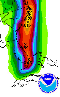 96L is slowly gathering strength in the northwest Caribbean Sea. The NHC indicates that winds are near 30 mph in the fairly broad low pressure area. It is not quite a depression just yet but any significant organization would lead to that classification rather quickly. Computer model guidance indicates that the system could become a tropical storm later today or early tomorrow and intensify to hurricane strength as it moves past extreme southeast Florida later tomorrow. In fact, the NHC's SHIPS model which is used to predict intensity, suggests that what would be Nicole, could continue to strengthen as it approaches the North Carolina coast on Thursday. The GFDL and HWRF models also suggest that this could be near hurricane strength as it moves rapidly up the coast once past Florida. A lot will depend on how tropical the system is as there are indications that it could take on more sub-tropical characteristics once it leaves the environment of the Caribbean Sea. This would likely lead to a larger and more spread out wind field with a lot of rain being drawn north of the low pressure area. It would not be quite as concentrated or focused as a true tropical storm or hurricane. It is still too early to know for sure if this transition will happen before it impacts the Carolinas or after. What seems almost a certainty is that a tremendous amount of rain fall is in store for southeast Florida first and then up a great deal of the East Coast, mainly east of I-95 as the graphic depicts. This could easily lead to major floodig issues, especially in portions of eastern North Carolina where copious amounts of rain have already fallen with a frontal boundary that impacted the region over the last 24 hours or so. Needless to say, people with interests in the Caymans, Cuba, the Florida Keys and across most of southern Florida should be monitoring this weather system very closely. Then, after tomorrow, it looks like North Carolina and Virginia could be in line for some rather rough weather as the storm races northward. I'll have another update here around 2pm ET this afternoon.
UPDATED: 12:45 pm EDT, September 27, 2010 by Mark Sudduth email me VERY WET PATTERN IN PLACE FOR PORTIONS OF THE SOUTHEAST The run of extraordinary good luck continues as we have yet to see a hurricane make landfall along the U.S. coastline this season. This is quite remarkable considering that so many intense hurricanes formed: Danielle, Earl, Igor and Julia. Alex was also quite strong as was Karl- but both of those made landfall well south of the U.S. As we end September, there is some potential for development brewing in the Caribbean Sea but even it looks to be more of a rain maker than anything. However, this rain is not to be underestimated. The NWS in Miami wronte in their discussion this morning that "excessive rain" was possible as the Caribbean disturbance lifts north over the next few days. This threat seems focused primarily on southeast Florida with as much as five to six inches possible out of this system. The NHC has indicated the moderate chance of development but so far, it is slow-going. Computer models show a fairly broad area of low pressure developing, intensifying some over the warm waters of the Caribbean and Florida Straits and then moving past south Florida and up the Southeast coast. It is possible that we could see a tropical storm form from this disturbance but it is likely to be stronger on its east side than west due to the dynamics of the atmosphere not allowing it to bundle its energy like a typical tropical storm would do. None the less, an unsettled pattern from the Caribbean to Florida and eventually the Carolinas looks like a good bet for the remainder of the week ahead. I'll cover this in detail on today's edition of the Weekly Hurricane Outlook video right here at 2pm ET. UPDATED: 10:45 pm EDT, September 26, 2010 by Mark Sudduth email me WET BUT NOT TOO WILD, AT LEAST NOT YET The pattern remains complex. A lot of moisture, low pressure, heat and energy are in place over the Caribbean Sea but nothing focused right now that looks to be a major problem other than a rain maker. The computer models are not much help as they all have different solutions. So instead of trying to figure out such a complex pattern, I think it is prudent to just sit back and see what develops. It's not like we won't know if a focused area of low pressure takes shape and begins to grow. The National Hurricane Center will certainly be on top of it. I know there has been a lot of talk about the presence of a potential hurricane affecting Florida as we get in to October. Well, until I see it and am packed and ready to head south for an intercept of such a hurricane, I am not too worried about it. I have seen the models that folks are talking about and that I too have discussed. But right now, they are only confusing the issue since there are so many differing "options" that they are predicting. So let's see what happens and we can look over things tomorrow in more detail- especially during the Weekly Hurricane Outlook broadcast at 2pm ET. UPDATED: 1:15 pm EDT, September 24, 2010 by Mark Sudduth email me HEAVY RAINS CONTNUE OVER CENTRAL AMERICA AS REMNANTS OF MATTHEW DRENCH REGION Once again, tropical rain fall is causing problems as the remnant circulation of TS Matthew slowly spins down over Central America. The heaviest of the precip appears to be over Guatemala but is moving towards eastern Mexico. The large circulation of the storm system is drawing in copious amounts of deep tropical moisture and it is getting squeezed out over the elevated terrain of the region. We'll have to wait and see what kind of impact this has on the area, hopefully it will not be too bad. Lisa briefly made it to hurricane strength yesterday over the far eastern Atlantic. This makes seven hurricanes to form this season- almost to the bottom end of most predictions of eight to ten total. Lisa is not forecast to move towards land and should eventually dissipate over the northeast Atlantic. The next area of concern will remain in the Caribbean Sea. I cannot begin to explain the complexities seen in the models as no one certain solution can be picked out just yet. What it looks like will happen is that another area of low pressure should develop somewhere in the Caribbean next week and move northward. How strong and focused it is depends a lot on how the upper level wind pattern plays out. Right now, it appears likely that the low could be spread out and resemble a sub-tropical storm more than a purely tropical one. This would mean a larger system with the wind spread out over a larger area instead of concentrated around a tight low pressure core. It is very complicated and it may come down to just waiting to see what develops, where it develops and then track it from there. The pattern favors additional development due to the low pressures across the Caribbean and people with interests in Jamaica, the Caymans, Cuba and Hispaniola need to keep an eye on future goings on across the region. I'll post another update here late tonight. UPDATED: 5:00 pm EDT, September 24, 2010 by Mark Sudduth email me QUITE A COMPLEX PATTERN SHAPING UP AS MATTHEW NOW INLAND OVER CENTRAL AMERICA TS Matthew had made landfall now over Central America and should begin to weaken over the next few days in to only a remnant low. The threat of heavy rain fall will continue for the region and with this, the threat of mudslides and flash floods will be a serious issue. Now we have to start watching the Caribbean Sea once again as it looks almost certain that another storm system will develop next week and track northward. The question seems to be not if something gets going, but more so, what kind of intensity would it have? There are indications that it could be not purely tropical in nature. This means it could be larger and more spread out than a truly intense tropical cyclone would be. While it is not quite the time of year to be looking for this type of sub-tropical system, it is not impossible to see at anytime. The different weather discussions that I have read from this afternoon suggest that we could in fact see additional storm development, but to what extent remains to be seen. Nothing is going to happen over the weekend of any significance so we'll watch and see what evolves early next week. It will be interesting to see exactly what takes shape. Water temps are certainly plenty warm, now it will be more of what the upper air pattern allows which will, in turn, determine just how tropical this potential system ends up. I'll have more here throughout the weekend. UPDATED: 11:40 am EDT, September 24, 2010 by Mark Sudduth email me MATTHEW NOT GOING TO BE AROUND TOO LONG BUT WILL A FUTURE NICOLE TAKE UP WHERE MATTHEW LEAVES OFF? TS Matthew is moving quickly towards the coast of Central America and should run out of time before it can become a hurricane. Even though water temps are plenty warm, the upper level wind pattern is not quite as favorable for development which is good news for the region. However, the wind is usually not the worry for Central America- it's the rain. Honduras and Nicaragua have had terrible tragedies over the centuries with tropical cyclones dumping excessive rain fall over mountainous terrain. It is too soon to know what kind of legacy Matthew will leave on the region but the slow moving track of the remnant tropical low later in the forecast period causes some concern. The NHC is forecasting Matthew to reach Central America later today and eventually fade away to a remnant low pressure from then on. This could lead to serious flooding issues, depending on how much energy the system is able to tap. We'll be watching this closely. As far as impact on the U.S. coast from Matthew, it appears that this storm will not be the one to affect Florida or the central Gulf Coast. What is becoming more likely, at least in several of the computer models, is that a second storm will form early next week somewhere over the central Caribbean Sea and move north towards western Cuba and then southwest Florida. This is shown most prominently in the GFS model, especially the last few runs. Other models are not quite as focused with the energy but I have to put some faith in the GFS as it has done pretty well this season with tropical cyclone formation. The bottom line is that even though Matthew does not appear to be a concern for the U.S. we could still see another tropical cyclone develop, which would be Nicole, and possibly impact Florida late next week. I'll post another update here around 5pm ET today with some more thoughts on the latest computer model guidance for the next week or so. UPDATED: 7:15 pm EDT, September 23, 2010 by Mark Sudduth email me TS MATTHEW GETTING BETTER ORGANIZED AS IT HEADS FOR CENTRAL AMERICA- UNCERTAIN FUTURE LIES AHEAD It has been a busy day in the tropics. We now have TS Matthew in the central Caribbean Sea- moving towards Honduras and Nicaragua. A hurricane watch and tropical storm warning is in effect for a portion of that region since Matthew is expected to intensify steadily over the very warm waters of the Caribbean Sea. The NHC indicates that the storm could become a hurricane rather quickly unless it interacts with land before it can do so. The first part of the forecast track is somewhat straight-forward. Matthew should move just north of due west and could make landfall along the north coast of Honduras. From there, it might be able to get back out over the water and then make landfall again along the coast of Belize. It is from this point on that things become very complex. The official forecast takes the would-be hurricane north and then east of north just straddling the coast of the east side of the Yucatan. This is extremely important to the future of Matthew. The more it stays over water, the stronger it should become which would have enormous impacts on Belize and portions of the Mexican Yucatan. Some computer models suggest that the storm will go farther inland, cut off from its warm water supply. If this happens, Matthew could weaken dramatically. It is very confusing to try and read the model guidance as there is also another issue. It the latest runs of the GFS model as well as ECMWF, a second storm develops in about five days or so east of where Matthew is now. A lot of talk across the "hurricane grapevine" suggested a situation similar to Charley or Wilma shaping up. What it tells me is that a very complex pattern is shaping up and it may be confused enough that we do not see any one intense system come out of this but rather a series of weaker storms, bringing a lot of rain and some wind to the islands of the Caribbean and eventually Florida and the Southeast. I cannot recall seeing anything quite like this set up and it will be interesting, to say the least, to see how things work out. We're going to have to wait and just be ready to react if the time comes. I'll have more here tomorrow morning with hopefully a clearer picture of what to expect in the coming days. UPDATED: 8:45 am EDT, September 23, 2010 by Mark Sudduth email me RECON TO INVESTIGATE 95L- COULD HAVE NEW DEPRESSION LATER TODAY The Hurricane Hunters are going to fly down to the Caribbean and investigate 95L to determine if a tropical depression is or has formed. The NHC has now increased the chances of development in to at least a depression to 80%. Computer model guidance is still iffy as to what will eventually happen with this system. I am not sure if it is the large scale area of low pressure and the pattern change that is making things tough to call or if in fact this system is not really going to do much. One would think that with exceptionally warm sea surface temps and low shear values that this has a chance to become a hurricane at some point. The GFS model seems to have the best consistency as of late- developing it in to a healthy tropical cyclone after about five days. The ECMWF, on the other hand, shows very little coming of it. Note that these models were not very aggressive with the development of Alex back in late June either. Sometimes we see this with large pockets of energy and low pressure which are somewhat different seedlings than the strong tropical waves that emerge from Africa. In any case, there is an organizing low pressure area in the Caribbean that bears close watching as it moves generally westward towards the western Caribbean. Interests in Jamaica, the Caymans and the Yucatan should be aware of any future developments of this feature. Once the recon crew gets in there later this morning, we'll know what we're dealing with and I'll post more info. UPDATED: 7:50 pm EDT, September 22, 2010 by Mark Sudduth email me WHEN WILL 95L DEVELOP? WILL IT DEVELOP IS ALSO A VALID QUESTION It seems the models are having a tough time figuring out what to do with 95L in the Caribbean Sea. On one run, they (specifically the GFS and ECMWF) show a robust tropical cyclone coming out of the Caribbean towards Florida or in to the southeast Gulf of Mexico. The next run, the energy is all strung out and not focused- leaving a weak, elongated area of low pressure. The hurricane specific models such as the HWRF and the GFDL are not too bullish on development either. So what do we believe? I can take a guess and see what happens. I believe that the computer models are not able to deal with the amount of energy and wide expanse of low pressure that is developing in the western Caribbean. If we look at the burst of strong Cape Verde hurricanes that we had, they were virtually given to the models on a silver platter- the hear and energy was already focused and ready to go. The models picked up on this, developed the systems such as Danielle, Earl and Igor, and off they went. Now we have a larger envelope of energy trying to organize like Alex and to some extent Karl. The models are trying to resolve when and if the focusing will happen. Thus you get periods when they nail it (in their world anyway) and periods when they still say, "I do not know what to do so I will just string out the energy". I think that we will see something develop out of the Caribbean as the pattern fits this scenario. Water temps are very warm, upper level winds are becoming more and more favorable and it is that time of year. Exactly when we see a true low level center take shape and then go on to become a tropical depression and beyond is out for debate. It's true that it may never happen but I feel as if the odds favor our next named storm originating from the Caribbean Sea within the next 120 hours or less. As of now, the feature is large and continues to spread scattered showers and tropical thunderstorms across a large portion of the Caribbean Sea. We'll see what happens- could be a fairly slow process but if it begins to take off, we could see quite a hurricane develop in the region. I'll have more here in the morning. UPDATED: 7:50 am EDT, September 22, 2010 by Mark Sudduth email me WESTERN CARIBBEAN DEVELOPMENT THE FOCUS OF ATTENTION NOW Now that Igor has cleared the pattern and Lisa is of no concern to land, our focus will be on what is going on in the Caribbean Sea. We are watching the progress of 95L, a loosely organized area of showers and thunderstorms, as it moves westward. Most of the computer model guidance suggests that eventually, it will become a tropical cyclone- but how strong and where it ends up is difficult to predict right now. There is a chance that it moves right on in to Nicaragua and Honduras and never recovers. Of course, a track just a little more north would allow it to gain strength over the very warm waters of the western Caribbean Sea. The GFS, CMC model (Canadian) and ECMWF show the most promise for the future of this system. I think that the only certainty right now is that it will take several days for the pattern to evolve to one that allows 95L to become better organized and thus be our next named storm- which would be Matthew. The rest of the tropics are tranquil as we transition from the very active Cape Verde season we had, which produced almost an entire hurricane season's worth of activity in just a few weeks, towards the latter part of the season where the development potential in the Caribbean, Gulf and southwest Atlantic increases. I will post another update here early this evening. UPDATED: 2:30 pm EDT, September 21, 2010 by Mark Sudduth email me TONIGHT ON HURRICANETRACK NEWS/TALK: WE DISCUSS IGOR'S IMPACT AND 95L'S FUTURE There is a lot going on this afternoon and we'll go over it in fine detail tonight on HurricaneTrack News/Talk at pm ET right here on the homepage. Our topics will include hurricane Igor's effects on Bermuda and now Newfoundland as well as developing 95L in the Caribbean Sea. It looks like a very busy time period coming up and potential for a hurricane landfall in areas that have been otherwise free of such so far this season. Join us right here at 9pm ET. If you can't tune in, the program will be archived on our Ustream channel. UPDATED: 8:45 am EDT, September 21, 2010 by Mark Sudduth email me NEWFOUNDLAND FEELING EFFECTS OF IGOR, LISA FORMS AND CARIBBEAN DEVELOPMENT COMES IN TO PLAY The predicted busy hurricane season is coming to pass. We are up to 12 named storms now, six of them became hurricanes, five have become major hurricanes (and all five actually category four hurricanes). None have hit the United States (no hurricanes). Will this incredible run of good fortune continue until November 30? We are about to find out. First, we have hurricane Igor racing past southeast Newfoundland this morning. By tonight, Igor will be far out in to the North Atlantic and we'll be done with it. In the eastern Atlantic, tropical storm Lisa has developed from 94L and poses no threat to land over the next five days and probably longer than that. The forecast does not indicate Lisa becoming a hurricane but it might be able to do so, further adding to the already above normal season we are having. The main concern is going to be the Caribbean Sea. I have been talking about the pattern change coming up and it is almost upon us. Most of the major computer models indicate the formation of a tropical cyclone in the western Caribbean over the course of the next week or less. Right now, the NHC has an area outlined just entering the eastern Caribbean. It should migrate westward and be situated in the western to northwestern Caribbean by the end of the week. At that point, development is likely to begin ramping up as conditions appear quite favorable going out in time. In fact, water temps in the western Caribbean are the warmest anywhere in the Atlantic Basin with extremely high ocean heat content. I need not remind you of the intense hurricanes that have come out of the northwest Caribbean over the course of history. We will need to keep a close eye on what goes on in this region from here on out as I suspect that a significant threat to land masses is in order. It is too soon to know if that threat includes Florida or elsewhere along the Gulf Coast. Right now, Jamaica, the Caymans and the Greater Antilles would be at risk from possible heavy rains and perhaps more as this system begins to organize. I will post an afternoon update around 2pm ET. UPDATED: 8:15 pm EDT, September 20, 2010 by Mark Sudduth email me TS WARNING FOR PART OF NEWFOUNDLAND AS IGOR SCRAPES PAST- WILL WE SEE "LISA" SOON? Igor is now racing in to the far reaches of the North Atlantic but not without one last swipe at a land mass. A TS warning is in effect for part of the coast of Newfoundland as the windfield of Igor could bring rather strong winds to the southeast coast tonight. It's interesting, the forecast track takes the remnants of the once powerful hurricane up towards Greenland of all places. Truly taking the heat out of the tropics! 94L looks like it is on the brink of becoming a tropical depression and possibly a tropical storm. If it does, it would be "Lisa". I do not see this affecting any land masses over the next week or so but the pattern seems ready to change- allowing for more development where we have seen little of it- in the Caribbean Sea. There have been some wild runs of the GFS and ECMWF as of late but I am not going to use them to spur any speculation about what may happen 10+ days down the road. The larger atmospheric signals suggest that we want to keep close tabs on the Caribbean and/or western Atlantic in the next week to 10 days. The Gulf of Mexico is nice and clear as is the Atlantic Ocean off the Southeast coast. So we may have a brief respite from the flurry of hurricanes that came and went but it looks like that break might not last too long. I'll have more here tomorrow morning before Noon ET. UPDATED: 9:00 am EDT, September 20, 2010 by Mark Sudduth email me IGOR MOVING AWAY FROM BERMUDA- NOW WE WATCH THE CARIBBEAN It was a rough day for Bermuda yesterday but not nearly as bad as it was when hurricane Fabian passed directly over the island in 2003 with 120 mph winds. Igor was weakening quite steadily as it passed by yesterday but still brought hurricane conditions which has knocked out power to many and disrupted, only temporarily, the tranquil life of the tiny Atlantic island. I hope to have some photos to share later today courtesy of our colleague and good friend Tim Millar who was on Bermuda to document the effects of the hurricane. His efforts to provide us with live video/audio yesterday were incredible and were much appreciated by many people. Tim should return home tomorrow if all goes as planned. Now that Igor has cleared Bermuda, it will race off in to the North Atlantic, passing far enough south of Newfoundland to keep the worst conditions out of there. The hurricane will transition in to a larger, non-tropical storm over the open ocean in the coming days. So what's next? Unfortunately, the break in activity will not last too long it seems. Computer models are getting to be more and more aggressive in developing a tropical storm somewhere in the Caribbean Sea over the course of the next week. The GFS has been the most consistent with this idea, showing it growing in to what is probably a hurricane later in the period. The ECMWF model is now fully on board with the development idea but has a different track solution than does the GFS. None of that matters now since we do not have a system developed yet. However, the pattern strongly favors development in that region later in the week and I believe that the tropical wave moving between 50 and 60 degrees west longitude will be the feature that sparks this development. It is already gaining in convection as it moves westward and will be in the Caribbean by mid-week. Otherwise, we are watching Julia and 94L - both of which pose no threat to land. I think 94L will go on to become a tropical depression later today and perhaps a named storm soon there after. If so, it would be Lisa. We shall see. I'll have another update here tonight near 8pm ET. Note: the Weekly Hurricane Outlook video will be live here at 2pm ET. |
|
UPDATED: 6:15 pm EDT, September 19, 2010 by Mark Sudduth email me BERMUDA GETTING ABOUT THE WORST IT WILL SEE FROM WEAKENING IGOR Hurricane Igor is almost at the same latitude as Bermuda and is west of the island. Thus, strong southerly to southeasterly winds will pound the island for a few more hours until the hurricane passes by. Even though Bermuda has been lashed all day by tropical storm conditions and some hurricane winds too, the weakening of Igor has been the saving grace. NHC reports that top winds are now just 80 mph- a far cry from where we saw those winds just a few days ago. As many folks have seen, the power of the Internet really came in to play with this event. Lots of folks were able to watch our live video feed from our friend and colleague Tim Millar. Ustream.tv had a few live feeds that had 1000+ viewers at any one time. Blogging from the island was popular and Twitter became an important tool for getting info out from the island. Now, it appears the power failures are taking their toll and our cam is down. It was great, however, watching the action raw and unscripted throughout the day and we appreaciate Tim and his crew out there taking the time to bring us the video and audio while it lasted. A valiant effot to be sure! Igor should clear Bermuda by 10pm tonight and move on quickly to the north and northeast with time. It is possible that southeast Newfoundland could get swiped by the large circulation of Igor as it transitions in to a powerful ocean storm over the cooler waters of the North Atlantic. Also, the swells and rip currents will be a continuing problem for a good deal of the East Coast for the next three days. I was out in the water today at Wrightsville Beach, NC and was impressed by the waves there. Not many people at all, save for surfers, were in the ocean. The run up was incredible with large waves reaching up the sand well past the normal high tide line. Let conditions calm before heading out. Oncw Igor has cleared the pattern, we must look to the Caribbean Sea for possible development in about a week or so. There is computer model support for the eventual development of a tropical storm there sometime before the end of the month. I will cover this extensively tomorrow on the Weekly Hurricane Outlook video at 2pm ET. For our new subscribers, please remember to log in and catch the Daily Hurricane Outlook and Discussion tomorrow at 11am ET (will also have a special update tonight at 9pm ET). It has been a busy weekend for us with tracking Igor. I'll have more here tomorrow morning. UPDATED: 10:00 pm EDT, September 18, 2010 by Mark Sudduth email me IGOR BRINGING RAIN AND WIND, ALONG WITH HUGE WAVES, TO BERMUDA It is the last night before Igor makes its closest approach to Bermuda. I believe that Igor will be past the island by this time tomorrow night as it looks like the hurricane has picked up some forward speed. This will be good in the regard that it could limit the amount of time that strong winds will buffet the island. It is also noteworthy that the hurricane is losing some intensity as winds are down to 100 mph- far off the peak of 155 mph just a few days ago. There is still enough warm ocean to allow for some re-strengthening but I think that stronger upper level winds and some dry air intrustion might limit or prevent this from happening. We'll know a lot more tomorrow as the bulk of the hurricane gets to within radar range of Bermuda. As for the East Coast of the U.S., I cannot say it enough- be careful if you are going to the beach tomorrow or Monday. High surf advisories, rip current advisories and even coastal flooding issues are common from Maine to Florida. I suggest you visit weather.gov for the latest concerning your area. The rest of the tropics are of little concern right now but there are signs that we will see development farther west later next week which means the Caribbean Sea could be the region to watch closely as we begin the last part of this very busy hurricane season. Our live camera will be back online after sunrise on Sunday assuming the power and Internet access are still available where our friend and colleague is located. If all works out, we'll see and hopefully hear the full effects of Igor as it impacts Bermuda. I'll have more here throughout the day tomorrow. |
|
UPDATED: 2:10 pm EDT, September 18, 2010 by Mark Sudduth email me WEATHER LOOKS TO GO DOWNHILL IN BERMUDA AS IGOR NEARS The clouds are thickening and the wind is picking up. All as hurricane Igor, once a 155 mph hurricane, closes in on the island of Bermuda. We have been able to watch the live feed above thanks to our friend and colleague Tim Millar. He is there with an elite group of "hurricane chasers" (not really the best terminolgy but it will do) who are going to document and collect data while Igor passes by. Their video and weather data will help to better understand the effects of the hurricane and will be passed on to the Bermuda Weather Service as well as the National Hurricane Center. And now, through the incredible power of the Internet, we can be there virtually thanks to the technology and Tim's willingness to give us a look inside of Igor. Already, we are seeing reports of large waves impacting the island as well as other land masses around the western Atlantic Basin. In fact, some areas along the East Coast could see the potential for ocean overwash, especially in the NC Outer Banks, around the times of high tide over the next few days. The reason behind this is due to the amount of wind energy put in to the ocean byu Igor over the last several days. This energy gets translated very well in to the ocean and radiates outward, traveling 1000s of miles in some cases, to reach shore as thundering, crashing waves. This hazard will cause bech erosion and rough surf conditions through early next week for a good deal of the East Coast and the Canadian Maritimes. Not every beach location will feel the same effects as a lot of it has to do with the shape of the offshore shelf (called bathymetry) and other local geographic considerations. Please be careful if you are going to the beach these next few days. As Igor bears down, the rain squalls will pick up and so will the wind. The pressure is already falling in Bermuda and if they get the eye, it could be a calm event lasting for perhaps an hour. It all comes down to where the hurricane turns- if it is earlier, then Igor will pass to the east of Bermuda, if the turn is later or right on top of the island, then they could get the full brunt of the hurricane. We'll be watching for as long as the live feed stays up at Tim's hotel. Elsewhere, we are watching a few areas for possible development including an area of disturbed weather just east of Texas in the western Gulf. If it were not so close to land, it would probably develop in to a tropical storm rather quickly. None the less, it will bring more rain and squalls to coastal Texas this weekend- moving inland where more rain could fall in the shadow of TS Hermine recently. I'll have another update here around 9pm ET tonight. UPDATED: 11:55 pm EDT, September 17, 2010 by Mark Sudduth email me IGOR HEADING FOR CLOSE CALL WITH BERMUDA- CONDITIONS WILL BEGIN TO WORSEN TOMORROW Looking at the latest satellite pictures, Igor seems to be trying to regain some strength once again. The powerful hurricane has been on the maps since September 8th! Tomorrow, it will really begin to bear down on Bermuda and make its closest approach, if not go right over the island, on Sunday. Tropical storm winds extend out some 345 miles from the center- quite a bit more than normal. Hurricane force winds extend outward up to 105 miles from the center. Bermuda will be lashed no matter how close the core gets. It is probably going to take another day of computer model runs to know just how close the eye will pass to the island and even then, it may come down to the final hours as Igor closes the gap. Large swells are already impacting Bermuda and portions of the East Coast of the United States, the Virgin Islands and Puerto Rico. These hazards will continue throughout the weekend and will actually get worse for portions of the U.S. coastline. It is critical that people going to the beach heed the advisories from the local NWS office on surf conditions. Beach erosion will be possible in some of the more vulnerable areas that see this type of problem during hurricanes and Nor'easters. I will post more here during the day Saturday and we should have the live camera back on after sunrise from our friend and colleague Tim Millar in the Ustream player above. UPDATED: 6:00 pm EDT, September 17, 2010 by Mark Sudduth email me KARL NOW INLAND AS IGOR BECOMES THE MAIN FOCUS OVER THE WEEKEND There was some good news with hurricane Karl today- it dramatically weakened pressure-wise right before landfall which should have kept the winds from being as bad as they were earlier in the day. The main threat now will be torrential rains over the mountains of Mexico. Also of note- there is a large moisture envelope, for the lack of a better way to describe it, over the western Gulf of Mexico as pressures are fairly low. This area of rain and squalls will move inland over Texas this weekend and bring tropical-storm like conditions in the heftier squalls. Keep an eye on the skies and if you're going to beach or boating, be mindful of this feature. Igor is now just about to spread its cirrus outflow over Bermuda. The Moon will shine through this canopy of high clouds tonight as pounding surf rattles the beachfront of the tiny island. Tomorrow, the clouds will thicken and rain will begin to fall in the late afternoon. Then, on Sunday, the worst of the weather will arrive and bring a possible extended period of tropical storm and hurricane conditions to Bermuda. Just how bad things get will ultimately depend on how close the core of Igor passes to the island. It looks like there is a chance the core could pass east of there and spare them the worst. None the less, it will be a battering hurricane with Igor's huge wind field and I can assure you the people there will be tired of it all by the time Igor passes on. For the East Coast of the U.S. and the Canadian Maritimes, be ready for large swells to impact your beaches in the coming days. Igor has sent out enormous amounts of energy in to the Atlantic and this will be translated in to ocean swells that will be a delight for surfers but possibly deadly for swimmers. My best advice is to check weather.gov and input your ZIP Code. The latest hazards should be in bold red on the return homepage that you'll be taken to. Read those advisories and know the risks if you're planning a trip to the ocean this weekend along the U.S. East Coast and other surrounding land masses of the western Atlantic Basin. Igor's energy will be felt far and wide. I'll have another update late tonight- near Midnight ET with the latest info and model data on Igor and a look at the rest of the tropics. The live video feed above is courtest of our friend and colleage Tim Millar of the Cyclone Research Group in Miami, FL. We will offer the feed here on our homepage for as long as it is available. Thanks Tim for the excellent shot! Good luck to you and your team, be safe! UPDATED: 9:00 am EDT, September 17, 2010 by Mark Sudduth email me VERY SERIOUS SITUATION UNFOLDING FOR MEXICO AS INTENSE KARL CLOSES IN Hurricane Karl is closing in on becoming the 5th category four hurricane of the season. That in and of itself is remarkable but in this case, it has potentially very deadly ramifications. Karl is fairly small in size, not too unlike Charley in 2004. Its effects will be severe on the precise stretch of coast that it hits later today or tonight. I hope that people in the region are aware of what's coming and are taking the needed precautions. After landfall, Karl will likely produce terrible flooding in the mountains of Mexico. There is not much to say on the positive side of things about this- except that Karl is not larger and not a category five. Otherwise, this is about as bad as it can get for people in the path of a hurricane. Obviously, the other story is Igor. Looking at the latest satellite pics, it looks as though Igor is not as well organized as earlier in the week but mark my words, it is still a formidable hurricane. In fact, tropical storm force winds extend out up to 290 miles from the center. Hurricane force winds extend out up to 105 miles. This means that Bermuda could be lashed with at least tropical storm conditions for perhaps 40 hours or more. Couple that with the battering waves and rain that will accompany the hurricane and it will make for a very rough time on the tiny Atlantic island. I think it will be another 36 hours before we know just how close the eye will pass to Bermuda- the best case is for it to be well east of the island- here's hoping. The rest of the tropics are of no issue right now. We are following a brand new area of interest south of the Cape Verde Islands for possible development. For now, the focus will be on Karl and Igor. I will have another update here this afternoon near 5pm ET. UPDATED: 8:00 pm EDT, September 16, 2010 by Mark Sudduth email me IGOR TAKES AIM ON BERMUDA WHILE KARL CLOSES IN ON MEXICO- JULIA REMAINS NO THREAT TO LAND There is not a lot of new data tonight on our hurricane threats- Igor continues to look like a significant threat to Bermuda over the weekend while Karl, also a hurricane now, looks to make landfall tomorrow night in Mexico. Taking a closer look at Igor, the good news is that it is probably going to stay about where it is now for intensity and not get too much stronger. It may go up or down some 10 mph as it moves off the northwest but I doubt that we'll see any unexpected jumps or losses in intenisity before it reaches Bermuda. It looks now like late Sunday is when Igor should pass the closest to Bermuda though there is still time for it to change course enough to miss west or east. The best case would be if it missed far to the east- keeping Bermuda on the usually weaker west side of the hurricane. Large and damaing swells will being to affect Bermuda long before the winds get there. This will also be case along a good deal of the East Coast, Puerto Rico, the Bahamas and eventually the Canadian Maritimes. The NHC urges people to monitor their local weather forecasts for conditions on a localized level, including possible beach closures due to rough surf. Hurricane Karl is fairly small in size but packs a solid punch. Top winds are 80 mph but could approach over 110 if conditions allow. Folks in Mexico need to be preparing for a possible major hurricane landfall later tomorrow night. The moisture will get squeezed out of Karl over the mountains of Mexico later in the weekend, resulting in possible life-threatening mudslides and torrents of rain roaring down streams. It is simply amazing to think that we have had all this severe hurricane activity and not a single one has managed to impact the U.S. more than just by glancing blow conditions. TS Hermine has caused the most damage so far with its flooding event in Texas and Oklahoma. We are about to see if things get really bad for Bermuda and Mexico and will hope for the best of outcomes for those areas. Whether or not the United States can manage to get to November 30 without calamity remains to be seen. So far, luck has apparently been very much on our side. I'll have a new update tomorrow morning by 9am ET. UPDATED: 9:30 am EDT, September 16, 2010 by Mark Sudduth email me BERMUDA THREATENED BY IGOR BUT HOW CLOSE WILL IT PASS TO THE ATLANTIC ISLAND? ALSO, KARL GETTING STRONG FAST AS IT HEADS FOR MEXICO  Hurricane Igor regained some of its intensity overnight and made it back up to 145 mph. It looks like it is fluctuating some now as the eye is not quite as clear as earlier. We'll have the first recon plane in to Igor later this afternoon which will provide a more accurate measurement of what is going on inside the core of the hurricane.
The latest forecast by the NHC takes the center of Igor very close to Bermuda (just east if you follow the center forecast position precisely). In fact, looking at the most recent HWRF hurricane model graphic, you can clearly see that Igor could pass very near Bermuda. The graphic I posted is from Dr. Ryan Maue at Florida State University. It shows the wind field at about 3000 feet above the ocean surface and the model representation of the structure of Igor in 96 hours. You can see where Bermuda is located and though small, it could be well within the right-front quadrant of Igor and thus within the worst conditions. A lot will depend on how much Igor un-winds as it moves north. Cooler water temps and stronger upper level winds may be the saving grace and keep Igor from being as strong as it is now. The best case scenario would be for Igor to turn eastward while still south of Bermuda- possible but not shown in the model guidance just yet. We'll be monitoring the progress of Igor closely and I encourage folks with interests there to use Twitter especially to follow news outlets and veteran hurricane chasers who are traveling to the island to document the situation. As for the East Coast of the U.S. and other land masses in the western Atlantic, large swells from Igor will begin impacting beaches today and will only increase as the weekend draws near. I cannot urge people enough to be extremely careful in these rough conditions. It is likely that high surf advisories will be posted at some point for a good deal of the Atlantic Seaboard. Heed those advisories and know your limits while in the warm, later summer ocean this weekend. In the meantime, TS Karl is getting better organized over the Bay of Campeche and should become a hurricane later today. A final landfall looks to take place later tomorrow in central Mexico. Note too that Karl is accompanied by a large envelope of moisture and upward motion in the atmosphere. This is resulting in a lot of rain and squalls far out from the small center of Karl. These areas of rain will move onshore across Texas throughout the next couple of days. I will post more here early this evening- around 7pm ET. UPDATED: 10:00 pm EDT, September 15, 2010 by Mark Sudduth email me HURRICANE IGOR ENORMOUS IN SIZE, THREATENS BERMUDA WHILE KARL MAKES ITS MOVE FOR MEXICO Igor is about 10 degrees of longitude wide- roughly 300 miles across. It's also about that distance from north to south, truly an exceptional Atlantic hurricane. I will have to do some research as to how this compares to other infamous hurricanes (or typhoons) such as Ike, Carla, Katrina or the Great 1944 Atlantic hurricane. It is a good thing, obviously, that Igor is not near a land mass. However, that could change as indicated by the official forecast from the National Hurricane Center. Their latest update, as of 5pm ET, suggests that the center of Igor could pass very close to Bermuda this weekend- if not right over the island. So what are the odds of a direct hit? Well, the four day and five day positions have been prone to errors as large as 250 nautical miles (at five days). So it is quite possible that Igor will not make a direct hit on Bermuda. If it did, that would be an incredibly accurate track forecast by the NHC- something not impossible given their talent and state of the art model guidance. Hopefully, in this case, Igor will shift one way or another and take the track forecast farther from the island over the next couple of days. No matter, huge swells from the large hurricane will begin to impact the area soon. This will also be the case for the northern Caribbean Islands and the East Coast of the United States as we approach the weekend. Even with Igor well to the east of the United States, its effects will be felt along the beaches in the form of rolling swells. Please be advised of this hazard and take note of any beach closures resulting from too rough surf conditions. Karl is close to emerging in to the Bay of Campeche and should ramp up rather quickly to hurricane strength and make a final landfall in central Mexico. It will be far enough south of Texas so that any significant impacts will be well south of the border. Julia continues to be a non-issue but is helping to pile on the ACE index (accumulated cyclone energy index) which is now approaching 95, well above where we were last year at this time and getting towards higher than normal values in a hurry. The rest of the tropics are quiet, with little room actually for anything else to develop right now. I will address the upcoming pattern change more once we are finished with Igor and Karl as I want to focus on their effects over the coming days. I'll have a lengthy post here tomorrow morning by 10am ET. UPDATED: 2:30 pm EDT, September 15, 2010 by Mark Sudduth email me IGOR TAKES AIM ON BERMUDA, MAYBE, WHILE KARL MOVES ACROSS YUCATAN HEADING FOR MEXICO Folks in Bermuda are probably all a buzz about hurricane Igor and righyfully so. The NHC track has the hurricane passing very close to the small Atlantic island in about four days or so. This is a long time out in terms of hurricane track forecasting and it could very well be that Igor passes over 200 miles either side of the island. The odds of a direct hit are quite small, especially considering the average track forecast error at 96 hours is 200 nautical miles. None the less, interests in Bermuda should be thinking hurricane preparedness right now in case the threat increases. I do not see much chance of Igor remaining as strong as it is now when it passes near or over the island but none the less, hurricane conditions are not out of the question some time over the weekend. Karl is inland over the Yucatan peninsula and is weakening due to the effects of land. Once back out of the warm waters of the Bay of Campeche, Karl should start to strengthen rather quickly and could easily become a hurricane before making a final landfall in central Mexico. There is simply no mechanism in the atmosphere to steer Karl north towards Texas or Louisiana. Julia is a non-issue and will eventually turn out in to the far reaches of the North Atlantic and fade from existence. Looking down the road a bit, the GFS model in particular is very insistent on developing a tropical cyclone near the Caribbean Sea in about a week. It has been very reliable this season at detecting the birth of what we have seen already and when it has not indicated development, that is also been almost spot on. While not perfect, I think the accuracy of the GFS with tropical cyclones this year has improved. This leads me to believe, coupled with the fact that upper level conditions should be about as favorable as they have been all season, especially in the western Atlantic and Caribbean, that we will see the development of a tropical storm or hurricane heading in to the Caribbean in about a week. The details of exactly where and when are not important just yet but the pattern looks to favor farther west development than we have seen in recent weeks. Just keep this in mind as we stay focused on Igor and Karl- not long after they are gone will we have to begin watching for lower latitude development that will likely be more west with time. I'll have another post here late tonight- near 11pm ET. UPDATED: 10:00 pm EDT, September 14, 2010 by Mark Sudduth email me TROPICS LIVING UP TO PRE-SEASON PREDICTIONS OF ACTIVE SEASON I must say that I think the pre-season predicitions of a very active season are easily coming to pass. We have Igor, Julia and now Karl to deal with but none pose a significant threat to land. Let's take a look: Julia This hurricane will remain far out in the Atlantic and bother only shipping interests. It is already at a fairly high latitude and has no reasonable chance to get back west and south enough to affect the Lesser Antilles much less the United States. Igor From the looks of things, Igor is on its way to becoming close to cat-5 once again. The satellite presentation is simply incredible and it's a good thing the hurricane is far from land. There is still room for it to fluctuate in intensity up or down before it begins to encounter increasingly negative conditions. The official track forecast suggests that Igor will track very close to Bermuda on its way north and eventually away from the East Coast of the U.S. However, the latest ECMWF model paints a different picture and gets Igor back to 70W by 30N in five days. The NHC position at that same time is 33.0Nand 65.5W so it will be interesting to see if the Euro model has any significant advantage over the other models which do not bring Igor that far west. The only thing I can think of is that the model (the Euro) is seeing more high pressure edging over Igor and keeping it much more west-bound with time. It is still too soon to completely dismiss any chance of Igor impacting the East Coast directly but I think we're getting rather close. Perhaps tonight's global models will give us more confidence and hopefully not any additional anxiety. Karl TS Karl formed from 92L which itself was born from a trough of low pressure that migrated off of the northern coast of South America. Sometimes we get this kind of development and it usually takes a while before things really start to crank up- just as we saw with 92L, now Karl. The storm should move inland over the Yucatan sometime tomorrow and remain fairly weak overall. We are not talking about some powerful hurricane here so if you have plans to visit Cancun or Belize, keep them! Karl will pass on through and the weather will be great afterwards. As for the final landfall in central Mexico, that could be a different story depending on how quickly Karl intensifies over the Bay of Campeche. Water temps are warm but not as warm as the Caribbean Sea so a steady but perhaps stout strengthening trend should commence once the storm moves westward off the Yucatan towards the latter part of the week. Elsewhere, nothing to speak of right now. We will be watching for a possible major pattern shift that would allow for more development farther west. This is typical for late September and right in line with what the forecasts suggest for the latter part of the season. There is nothing specific to focus on right now but just be aware that once we are finished with Igor, Julia and Karl that we may see only a short period of time, if at all, when things are quiet. I'll have more here tomorrow before Noon ET. UPDATED: 6:45 am EDT, September 14, 2010 by Mark Sudduth email me IGOR POSES NO DIRECT THREAT TO U.S. BUT BERMUDA ON ALERT Powerful hurricane Igor has begun to make the turn from its due west course. This has been anticipated and hoped for and is a sign that the hurricane will eventually move north and then northeast away from the United States. The only land mass in its path over the next week is Bermuda. The good news there is that Bermuda is a small island in a big ocean. It would take a precise direct hit to bring severe conditions to the island- not impossible to accomplish but tough none the less. The only visible effect from Igor along the shores of the western Atlantic land masses will be large swells that have been, and continue to be, generated by the hurricane's wind field. These will arrive in the Caribbean islands soon and eventually along the East Coast of the U.S. and Bermuda by the weekend. Another great surfing period is coming up but people need to remember that rip currents and rough surf can be deadly for those not accustomed to such conditions. Julia is now a hurricane and will turn north and on out to sea over the next several days- keeping the string of good luck going of no hurricane landfalls this season outside of Alex in late June. Beyond the exits of Igor and Julia in the next week or so, it looks as though we will see activity begin to shift south and west with time. Computer models are beginning to indicate the development of tropical cyclones in lower latitudes as the western Atlantic high pressure (Bermuda High) strengthens. While it is too soon to know where such development will occur, it should not be surprising to see a tropical storm or hurricane moving towards the Lesser Antilles within about 10 days. This is very typical of a La Nina pattern where the most active part of the season extends beyond the normal peak time of mid-September. For now, at least, we can track the hurricanes as they travel far away from land. UPDATED: 9:40 am EDT, September 13, 2010 by Mark Sudduth email me RUN OF GOOD LUCK LOOKS TO CONTINUE It is perhaps hard to believe that the third major hurricane of the season to form and track seemingly right at the East Coast of the United States will not ever make it. Yet, that appears to be the case once again- this time with Igor. While not a done deal and we can all walk away and have not a care in the world about it, the odds are now greatly in favor of Igor turning north and then northeast before reaching 70 degrees west longitude. The worry is still strong for Bermuda, although it is a very small target, if you will, making a direct hit very difficult. However, Igor is a large hurricane is should grow in size even if it loses intensity. This will generate enormous swells that will radiate out in all directions, eventually impacting the East Coast of the U.S. and Bermuda. Surfers get ready, you're in for a heck of a treat as we get in to the latter part of the week. So why are all of these powerful hurricanes not hitting the U.S.? It's simple. The pattern is not one that allows them to. We are lacking a stronger Bermuda High that would normally receive the hand off of westward moving hurricanes from the Azores High. Instead, there is a gaping hole in the western Atlantic steering pattern that allows these hurricanes to slip through like a helium balloon floating up, up and away. This path of curvature out to sea just happens to be far enough off the East Coast to keep cities like Miami, Charleston, Wilmington, New York and Boston all hurricane-free. Will the pattern change? It might, but time is running out for major hurricanes to impact the East Coast without them suffering from shearing winds and gradually cooling sea surface temps. The focus is going to begin to shift, in about 10 days, to the western Atlantic and the Caribbean Sea- very typical of a La Nina pattern. I will show in today's weekly Hurricane Outlook video broadcast what other major La Nina hurricane seasons looked like and how some are heavily weighted on the back end, meaning the last half had more impact than the first half or even the peak period of mid-September. I'll also take a look at 92L which should begin to come to life as it approaches the Yucatan peninsula. As for Julia, it's almost a certainty that it too will remain far out to sea, bothering only shipping interests. The weekly video will be broadcast live right here at 2pm ET and saved in our video archive on our Ustream channel. Hope to see you then. UPDATED: 10:00 pm EDT, September 12, 2010 by Mark Sudduth email me IGOR TO SURPASS EARL FOR INTENSITY BUT WHAT ABOUT TRACK? Hurricane Igor is going to boost the ACE index big time. That is the number used to measure the true output of energy from tropical cyclones in a season. The higher the wind speed and the longer those winds stay high, the more energy is output and the higher the ACE value. Igor may take us above 100 if it stays powerful long enough. The good news is that, so far, it is doing its job of bleeding off built-up heat in the tropics without affecting land. Will it remain that way for its entire life-span? Probably so but there are a couple of "what ifs" that need to be looked at. The NHC track takes Igor on a path that aims it right at the North Carolina coast if nothing changed and it went on a straight line from the five day position forward. But we know this is not the case. Weather is dynamic. Igor may not even get to that forecast point- it could be well east or well west (south too). The big key is once again how much high pressure is to the north of Igor as it continues west. The stronger and firmer the high is, the more west Igor travels. And then comes the critical turn to the northwest. Will it happen? If so, to what degree? It may not be enough to get Igor far enough north to allow it to eventually turn out to sea. We are still talking over a week away. That's 168 hours! So much can change that will affect the outcome of Igor's ulitmate track. I would suggest that folks with interests in Bermuda keep a really close watch on Igor since it is already a powerful hurricane and likely to become a category five before all is said and done. One thing is for sure- the waves from Igor will pound the East Coast, Puerto Rico, Bermuda and eventually the Canadian Maritimes much like hurricane Bill did last year. Surfers will have another shot at some excellent swells coming for the coast. Swimmers will need to be extra careful in the latter part of next week. I have no absolute answers and neither does the NHC. Beyond the five day time period, there is too much variability with what can happen so we all need to just watch and wait. In the meantime, 92L is looking less and less likely to ever develop and TD 12, which I have not paid much attention to, is of no concern except for the Cape Verde Islands. We have so much more to deal with concerning Igor to even speculate on what will happen with what should become Julia in short order. I will have much more here tomorrow including the 2pm ET Weekly Hurricane Outlook video. For our Premium Services members, please remember to log in and catch the daily Hurricane Outlook and Discussion live video at 11am each weekday. We are proud to have added several new members with the close call that Earl gave us- use that membership and join in the chat, the live video and more. UPDATED: 12:00 pm EDT, September 12, 2010 by Mark Sudduth email me PATTERN CHANGES COULD LEAD TO ANOTHER CLOSE CALL AS IGOR LOOKS TO TRACK MORE WEST AND SOUTH Hurricane Igor is gaining intensity in the open Atlantic as it moves basically due west. A well developed eye is clearly seen in visible satellite images- a sign of a healthy hurricane. The NHC forecasts Igor to reach 145 mph in the coming days and it is possible that winds could be even higher than that under almost ideal conditions in the atmosphere. The track forecast is becoming more and more interesting. It looked like Igor was going to turn harmlessly out to sea a few days ago- at least that is what a vast majority of the model guidance was indicating. Now, there is some change in that tune. Most notably, the ECMWF has shifted its track almost 12 degrees of longitude to the west in just 24 hours. Additionally, the UKMET hurricane model keeps Igor on a WNW track with no bend to the northwest or north. It is possible that Igor could swipe the northern Lesser Antilles especially since the models predict a very large hurricane developing over time. Beyond the 3 to 5 day forecast period, everything rides on how strong the Bermuda High is and what, if any, high pressure can move off the North American continent and in to the northwest Atlantic- blocking Igor from turning north. This could have huge impacts on the future track of Igor- especially out at the 6 ot 7 day time frame and beyond. It is still too soon to know if the latest trend west will continue and/or amplify or if it was a temporary pause in the otherwise inevitable turn around 65 west longitude that most models have been showing for several days. We will just have to wait and see how it all turns out but I suspect we'll have a much greater idea by Wednesday morning as to what will ultimately happen with Igor. The rest of the tropics are brimming over with activity. We now have td #12 out near Africa and it is forecast to become a hurricane as it reaches a high latitude fairly early. No reason to even speculate on whether this could affect the U.S. or other land areas outside of the Cape Verde Islands at this point. Of more immediate concern is 92L in the eastern Caribbean Sea. It is beginning to show signs of organization with deeper thunderstorms developing around its broad area of low pressure. Some of the computer models "see it" and some do not. I suspect it will develop just because of where it is and the time of year we are in. Once again, folks in Jamaica, the Caymans and the Yucatan need to follow the progress of this system closely. It will bring torrential rains to the mountainous regions of the Greater Antilles, including Haiti, over the next few days. So regardless of development, this feature has the potential for creating havoc with its tropical rain fall. Where it eventually tracks in the long term is still a large unknown. Odds favor a generally west track towards the Yucatan and then central Mexico well south of Texas. But it is getting later in the month and tracks can shift north as high pressure is moved around by approaching upper level troughs. If you live in south Texas, don't ignore this system. I'll post another update here tonight by 10pm ET. UPDATED: 8:10 pm EDT, September 11, 2010 by Mark Sudduth email me TROPICS VERY BUSY BUT STILL NO MAJOR IMPACTS TO LAND SEEN We have Igor which is almost a hurricane, 92L in the eastern Caribbean, 93L just off the coast of Africa and a new area of interest way up in the north-central Atlantic. With all of this activity, it is still amazing that nothing is threatening land. However, 92L is producing showers and thunderstorms that could affect Puerto Rico, portions of the northern Leeward Islands and Hispaniola over the next few days. The threat is for mudslides in mountainous terrain and especially so in Haiti where earthquake relief efforts are still very much ongoing. There really are no big changes in the model guidance this evening as we await to see how Igor interacts with the break-down of the high pressure area that is currently pushing it westward. I don't think we'll have a solid handle on where Igor will end up until early next week at best. As for 92L, it is losing its convection tonight and unless and until it persists, which none of the global models really indicate, it won't do much more than bring squalls to the Greater Antilles. I'll have another update tomorrow morning before Noon ET. UPDATED: 11:30 am EDT, September 11, 2010 by Mark Sudduth email me IGOR OF NO CONCERN FOR THE TIME BEING BUT 92L IS TS Igor has become stronger overnight with top winds now of 70 mph. It appears to be struggling again this morning, possibly due to the overwhelming amount of dry air in the mid levels of the atmosphere still present over the central Atlantic. Igor should overcome this hurdle as it moves farther west and in to warmer sea surface temps. In fact, the NHC has increased its intensity forecast and now calls for Igor to reach 125 mph within five days. The track should be generally west for several days followed by a turn to the norhwest as the persistent upper-level trough comes in to the western Atlantic and takes out the Bermuda High- what little of it there actually is. This should result in Igor turning north along 60-65 west longitude and possibly threatening Bermuda. None of the computer models bring Igor to the East Coast of the United States although it is too early to know for certain that the U.S. is safe from Igor. The more pressing issue will be the development of what should become TS Julia in the Caribbean Sea. The area of low pressure around 14N and 63W is becoming better ogranized and seems well on its way to becoming a tropical depression- perhaps later today. It is forecast by the major computer models to move off in the general direction of the Yucatan peninsula. Folks in Jamaica, the Caymans and along the Yucatan peninsula from Cancun south to Belize really need to monitor what goes on with this developing tropical cyclone. Intensity models suggest that it could ramp up to become a hurricane over the very warm waters of the western Caribbean Sea. Whether or not it tracks north enough to later affect Texas remains to be seen but building high pressure over the Central Plains should keep it far enough south to only affect Mexico. Lastly, there is a new tropical wave with potential for development just emerging off the coast of Africa. It is almost a certainty to develop but should turn out in to the open Atlantic rather quickly and never be of any consequence for land. I'll post another update here around 8pm ET tonight. UPDATED: 4:50 pm EDT, September 10, 2010 by Mark Sudduth email me IGOR GETTING STRONGER, MOVING WEST AS PIECES OF THE PUZZLE SLOWLY FALL IN TO PLACE Igor is getting better organized and is now moving quickly off to the west. Deep convection has developed closer to the center of circulation and undoubtedly, the pressure is beginning to drop. The NHC intensity now calls for Igor to become the 3rd major hurricane of the season as it travels over warmer and warmer waters under almost ideal upper level conditions. As for the track, it looks as though a straight west path should continue for at least the next three days. The HWRF model keeps Igor moving west for five days. Beyond that time, we are still waiting for the larger scale weather patterns to evolve that will ultimately affect where Igor ends up. There are a variety of solutions right now from turning out to sea around 60W or missing the connection with the weakness over the western Atlantic and coming west enough to impact the Southeast or Bermuda. Nothing is set in stone, not even close. At this time of year, we typically see large areas of high pressure move off the North American continent and over the northwest Atlantic- blocking hurricanes from turning out to sea. Will this happen in time to trap Igor and send it west? There's just no way to know this far out in time. The bottom line is that Igor is forecast to become a very strong hurricane, and a large one too, as it travels generally west for the next several days. We have plenty of time to monitor and react accordingly. In the meantime, we will continue to also watch the possible development of 92L in the southeast Caribbean Sea. This looks to be a rather slow process but the odds keep increasing for this to become a tropical depression over the next three or four days. Computer models are mixed as to what happens with this system- some develop it while others do not. In any case, people all across the northern Caribbean islands need to watch the progress of this feature over the weekend. I will post another update here tomorrow in the early afternoon. UPDATED: 9:30 am EDT, September 10, 2010 by Mark Sudduth email me IGOR GAINING STRENGTH IN THE EASTERN ATLANTIC WHILE 92L BEGINS TO SHOW SIGNS OF DEVELOPMENT After struggling some yesterday, it looks as though Igor is finally starting to get it self organized. As was mentioned in the early morning discussion from the NHC, the tropical storm is becoming embedded within the deep easterly wind flow across the tropics which will provide excellent conditions for intensification. It won't matter much as far as land interaction, Igor can get as strong as it wants to because it will be far away from any land masses for at least the next week. Indications are that the East Coast will once again be saved by the lack of a strong Bermuda High to steer Igor westward enough to cause problems. While this is not a guarantee, I am seeing enough evidence right now to suggest that Igor turns north and away from the East Coast before ever reaching 65w longitude. We may see some flip-flops in the models from time to time but I am just not seeing much to make me too worried about Igor right now. On the other hand, 92L is a real problem in the making. The low pressure area is getting more organized this morning and should steadily strengthen over the very warm waters of the Caribbean Sea. The global models, mainly the GFS and ECMWF, show this system heading westward towards the Yucatan peninsula and then in to central Mexico after crossing the Bay of Campeche. Conversely, the HWRF and GFDL hurricane models take the system more northwest and across the Greater Antilles to near the southeast Bahamas. If we split the difference, then the implied threat could easily be towards Jamaica, the Caymans and eventually the southern Gulf of Mexico- perhaps near or north of the Yucatan. The issue here too is strength. The highest ocean heat content in the region lies ahead of this system if it travels towards the northwest Caribbean. As long as shear remains light, this has the potential of becoming a strong hurricane- something very common this time of year and in this region. Once a low level center forms, we'll get a better idea on where it might track. For now, folks in the Lesser Antilles will be dealing with squally weather as 92L slowly moves past the area and on in to the eastern Caribbean. We'll see what the NHC says about it on their 2pm outlook as I am sure it won't be long before they schedule recon to go down and check things out. I'll post more here around 5pm ET this afternoon. UPDATED: 9:40 pm EDT, September 9, 2010 by Mark Sudduth email me TROPICS PLAYING HIDE AND SEEK I wrote in the late afternoon update that Igor was struggling. It sure does not look like it is too much anymore. Satellite images indicate a large area of deep thunderstorms (convection) developing on the western side of its circulation. Although still disorganized as compared to what it could be, this is likely a sign that it is ready to intensify. Shear is very light across its future track and water temps will be plenty warm. There is not much reason to doubt that this will become a hurricane before the weekend is over. As far as the track in concerned, I noticed that the 00z fix of the center had shifted south some. We'll see if this is verified on the official NHC update at 11pm. It does not matter too much really because it looks like Igor could ride almost due west for several days- possibly even moving just south of due west at times. The reason is a strengthening eastern Atlantic area of high pressure to the north of Igor. This would keep it hauling west for quite a few days. Then comes the complicated part- again. The models show varying degrees of low pressure in the upper levels of the atmosphere coming in to sort of jack-hammer the high pressure away and allow Igor to gain latitude (move more northward). When this happens is critical- if it happens at all. It is possible that Igor could travel south of 20 degrees latitude for a week or more and eventually threaten the Bahamas. It is also possible, and probably more likely, that Igor will eventually get north of 20 degrees latitude and get picked up by an upper level trough of low pressure- sweeping it safely out to sea. This is the way things look as of tonight. It can all change over the next few days and there are signs that pressures are going to build over the northwest Atlantic as we get deeper in to the month. Bottom line is that Igor is another one of those "we will have to wait and see" events as it could end up being closer to land areas than was first thought. On the other hand, 92L has lost a lot of its deep thunderstorms but apparently still has potential for slow development. We'll see how things look throughout tomorrow and whether or not is can develop organized convection around a low level cemter. For now, it is only an area of interest. I'll have more here tomorrow morning near 10am ET. UPDATED: 5:15 pm EDT, September 9, 2010 by Mark Sudduth email me 92L COULD BE A PROBLEM WHILE IGOR STRUGGLES Igor has weakened to a depression this afternoon but should make quite the comeback in the days to come. It poses no threat to land at all right now and is more than likely going to remain out away from the East Coast of the United States. There is some chance that it misses the connection with a large trough out over the central Atlantic and bends back westward but the recurve pattern seems fairly entrenched for now. Of greater concern is 92L in the extreme southeast Caribbean Sea. This has the potential of becoming quite an intense hurricane as it gets better organized over the next few days. That really is the key, I believe, to whether or not this affects the U.S. The quicker it develops, the more north it should track and could end up being a U.S. concern in about a week. For now, the main issue will be for the Windward Islands and then possibly Jamaica and the Caymans as the system moves off to the west-northwest. I think too that there is a threat here to the Yucatan as the GFS and Euro models suggest. In fact, the longer this takes to develop, the more of a threat it will likely be to the Yucatan peninsula. A lot is going on and more development seems possible in the coming days as we near the tradtional peak of the hurricane season. I will post another update tonight after a look at the evening computer model runs. Next post should be online by 10pm ET. UPDATED: 9:15 am EDT, September 9, 2010 by Mark Sudduth email me IGOR NOT AN ISSUE AS DEVELOPMENT CLOSER TO LAND BECOMES CONCERN TS Igor is really having a tough time getting going this morning. Strong winds coming from Africa and competition from another piece of energy over the far eastern Atlantic are both taking their toll on the fledgling storm. Eventually, it should all come together for Igor and the NHC still expects it to become a hurricane over the central Atlantic. Although the official forecast only goes out to five days, it looks as though in the longer range, Igor will never get past 65W longitude. Once again, a large trough of low pressure should keep the Bermuda High weak and allow Igor to turn north around 60-65 W longitude and then away from land. This is what most of the long range models indicate at this point. We have many days to watch and see how the pattern evolves but it looks as though we may never have to deal with this year's "I" storm. Of greater concern is 92L which has developed near 12N and 60W out of an area of low pressure just off the coast of South America. This begins the development period farther west than we have seen with Danielle, Earl, Fiona, Gaston and now Igor. Computer models indicate that 92L will become a tropical storm as it moves generally west-northwest across the Caribbean Sea. The NHC is giving it a 40% chance of development right now and I expect this will go higher later today. Interests in Jamaica and the Cayman Islands should keep close tabs on this system. The Caribbean Sea contains some of the highest ocean heat content anywhere in the world right now and is 100% untouched this season. This system has the potential to develop quickly if it can consolidate and develop a low level center. Elsewhere, the tropics are quiet with no issues seen in the Gulf of Mexico or western Atlantic. I'll post another update here later this afternoon around 5pm ET. UPDATED: 8:15 pm EDT, September 8, 2010 by Mark Sudduth email me TROPICS ABOUT AS BUSY AS COULD BE EXPECTED The tropics are making news even if not directly. Take a look at the remnants of TS Hermine in Texas, Oklahoma and Arkansas as an example. A tornado watch, with confirmed tornadoes on the ground, is in effect for a portion the region due to the unstable air mass in place resulting from the circulation of Hermine. Add to this the extreme rain fall totals and the problems associated with that and it all adds up to quite a mess. All of this from a tropical storm that made landfall near the TX/MX border. And then we have TS Igor near the Cape Verde Islands. Top winds are 45 mph as the system organizes and deals with a nearby batch of energy and convection. Once everything comes together, Igor should be quite a hurricane in the central Atlantic. Where it ultimately tracks is a question that cannot be answered right now. Odds seem to favor it turning north around 60W longitude and never affecting land but this is not a guarantee- not this early. Elsewhere, the NHC has outlined an area of interest near the Windward Islands in the extreme SE Caribbean Sea. This feature has some potential to become a tropical depression as it moves little right now. Computer models indicate an eventual drift to the WNW or NW as the weekend nears. Folks in Jamaica and the Caymans will want to monitor this feature closely. The forecasts for a very busy hurricane season appear to be spot on. We are up to nine named storms before the traditional peak of the hurricane season which is on the 10th of this month. I imagine that the next few weeks will probably just as busy, if not more so, than the last few. Our luck has been remarkable wit no major impacts- although TS Hermine is certainly leaving its mark in Texas and Oklahoma; a reminder that even tropical storms can cause major disruptions. We really do have a long way to go and plenty to keep track of. I'll post more here in the morning update, around 9am ET. UPDATED: 11:10 am EDT, September 8, 2010 by Mark Sudduth email me NHC NOW ISSUING ADVISORIES ON TS IGOR IN FAR EASTERN ATLANTIC That did not take long at all. We now have Igor, the 9th named storm of the season, just off the coast of Africa and moving westward. In fact, it will threaten the Cape Verde Islands with possible tropical storm conditions. Current forecast track takes it generally westward over the next five days as it steadily strengthens. Igor should become a hurricane in that time period as well but will not be a factor to threaten any additional land areas for at least a week, if not longer. I'll have a complete update on Igor and the rest of the tropics this evening by 8pm ET. UPDATED: 8:50 am EDT, September 8, 2010 by Mark Sudduth email me REMNANTS OF HERMINE STILL DROPPING A LOT OF RAIN AS WE BEGIN TO TRACK WHAT WILL BECOME IGOR It looks like another day of heavy rains for portions of Texas, Oklahoma and Arkansas as the remnants of TS Hermine continue to spin across the region. The excessive rains have caused numerous problems since beginning on Monday as the storm approached south Texas from the Gulf of Mexico. It is going to take another couple of days for the slowly dwindling system to move out of the area. This just underscores the importance of understanding the power of any tropical cyclone. This was not a major hurricane hit but is causing problems for millions of people across a region that normally does not see much influence from tropical systems. Better weather will return soon and the weekend ahead looks nice across the affected areas. In the far eastern Atlantic, we are watching 91L slowly organize near the Cape Verde Islands. A quick refresher as to what a "91L" is: the NHC assigns a number and a letter, in the case of the Atlantic, the letter is "L". The numbers range from 90-99 and then begin again. So 91L is simply the label assigned to this particular area of suspect weather. The next area to pop up that could develop would be called "92L" and so forth. It is also a means of assigning more resources to the system such as satellite, computer models, air craft recon, etc. The global models are in unamimous agreement that this system will eventually develop in to the next named storm: Igor. This name replaces Ivan which was retired from the list after the 2004 season. The future of this system seems fairly straight forward for now- a mostly west track to about 50W in five days or so. From there, it all comes down to where the break in the subtropical high pressure area is. So far, it has taken up residence between 60 and 75 west longitude, keeping the likes of Danielle and Earl out to sea (although Earl did make landfall in Nova Scotia). There are hints that we may see a stronger Bermuda High this time around though we are talking 10 days down the road. All it takes is for the pattern to allow a large hurricane to track west for a day or two longer than we have seen recently and our run of good luck comes to an end. For now, there is absolultely no threat to land other than the Cape Verde Islands which will receive showers and thunderstorms from the passing embryonic storm. We'll be on top of it every step of the way. I'll have another update here tonight by 8pm ET. UPDATED: 8:55 pm September 7, 2010 by Mark Sudduth email me ROUGH WEATHER IN TEXAS, OKLAHOMA AND KANSAS AS A RESULT OF A TROPICAL STORM As hard to believe as it may be, tropical storm conditions have been felt deep inland over Texas in such locations as Austin, San Antonio and other rural areas. Why? The remnants of TS Hermine are moving through and are only slowly weakening. The reason is more than likely due to the fact the conditions in the atmosphere were so primed and favorable that the storm did not get to reach its full potential over water- it ran out of time. So, instead of simply dying away quickly, it still tried to maintain strength even while over the Texas landscape. Several inches of rain has fallen casuing road closures and numerous problems throughout the eastern half of the Lone Star State. The same conditions, though perhaps a little less organized, will move in to southern Oklahoma and Kansas over the next couple of days. Along with the extreme rainfall rates, there is also the threat of severe weather as the circulation of Hermine encounters dry air from the land and the heating of the day. Isololated tornadoes are possible and people need to be aware of rapidly changing weather across the region. Elsewhere, we now have 91L way out in the eastern Atlantic. This is the system that almost all of the major computer models are developing in to "Igor" over the coming days. Early indications are that it will track basically due west, perhaps just south of west, under a building area of high pressure across the eastern Atlantic. It poses no threat to land areas, except perhaps for the Cape Verde Islands. We'll have plenty of time to monitor the progress of this developing system. The rest of the tropics are nice and quiet- even ex-Gaston is now pretty much a non-issue. I'll have a morning update online by 9am ET. UPDATED: 9:00 am EDT, September 7, 2010 by Mark Sudduth email me HERMINE CONTINUES TO BRING HEAVY RAINS AND STRONG WINDS TO TEXAS 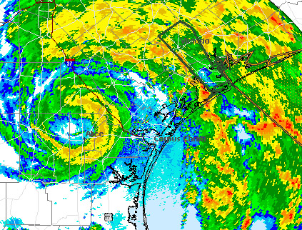 A quick-developing Hermine is still packing quite a punch over south Texas this morning. Heavy rains continue across a good deal of the eastern part of the state north of Corpus Christi. The center is clearly visible on radar near Alice, TX and is moving on a course for San Antonio later today. Make no mistake, the torrential rains from this system will be big news across Texas and perhaps even Oklahoma. Hermine is expected to track northward in to Oklahoma as what is called a post-tropical depression or low, meaning it is no longer a true tropical cyclone but still retains its low pressure and precipitation field. While this event will do much to restore water levels across Texas, this much rain this quick will cause significant flooding issues across the region. Be mindful of the situation and plan accordingly.
In the rest of the tropics, things are at a temporary lull as we await the next impulse of energy to fully emerge in to the eastern Atlantic from Africa. Computer models are almost in 100% agreement that we'll see "Igor" form from a complex of thunderstorms off the Cape Verde Islands towards the weekend. In fact, the pattern looks ripe for another round of several named storms coming up. The good news is that I see nothing that will affect land which is fine considering what Texans are dealing with. Tonight on HurricaneTrack News/Talk, we'll take a look back at Earl, including photos and data that we collected on the NC Outer Banks. We'll also discuss the upcoming peak of the season and what we expect will be a very busy September ahead. It all begins at 9pm ET right on the homepage. I'll post another update this evening before the program. UPDATED: 10:45 pm EDT, September 6, 2010 by Mark Sudduth email me HERMINE MAKES LANDFALL 10 MPH SHY OF BEING A HURRICANE- GASTON ALMOST GONE TS Hermine, which really ramped up today, has made landfall along the coast of northern Mexico- very near to where hurricane Alex and TD #2 did earlier this season. The wind will come down but the rain fall totals will really begin to mount as the remnants move northward in to Texas over the remainder of the week. Do not underestimate the power of tropical rain fall. Upwards of 5 inches could fall in many places and I strongly suggest you visit weather.gov for the latest info specifically for your area. Just input your ZIP Code and read the forecasts, especially the discussions, they contain excellent information for your local region, not just on a national scale. Elsewhere, the remnants of Gaston are just about finished. Dry air is winning the battle and I really do not see this system coming back- and neither do the major computer models. The remnant low pressure area with its intermittent showers and storms will bring squally conditions across the northern Caribbean Sea tomorrow and Wednesday. Other than that, I think we are done with Gaston. The next area to monitor will be the west coast of Africa as a strong impulse moves off the coast and tries to develop. The GFS is most bullish on seeing "Igor" form from this feature and so now it will be a wait and see situation. That model has done fairly well this season with tropical cyclogenesis- so we'll see if it can continue its streak. I'll have a full update here by 9am ET tomorrow. UPDATED: 9:20 am EDT, September 6, 2010 by Mark Sudduth email me TS HERMINE PROMPTS WARNING ALONG TEXAS COAST WHILE EX-GASTON STRUGGLES TD 10 became much better organized over night in the southwest Gulf of Mexico and has now become TS Hermine. Top winds are now 45 mph and it is expected to strengthen further, reaching near 60 mph before landfall in northern Mexico. The overall system is large and is spreading rain to the Texas coast this morning. In addition, a tropical storm warning is in effect from Baffin Bay to the mouth of the Rio Grande river. This is the third tropical system to affect the same region this season in the wake of Alex and TD 2. Flooding is going to be a big problem, especially considering the size and overall moisture content of this storm. After landfall, the track shifts back to the east so that it looks as though a big rain event is in store for interior Texas all the way to the coast. Not everyone will receive heavy rain but it looks to be quite a wet week ahead. I will cover this in more detail on today's Weekly Hurricane Outlook video at 2pm ET. In the central Atlantic, we are still watching what was once tropical storm Gaston. The low pressure area is still intact but weak. Dry air surrounding the low is keeping deep thunderstorms from developing and sustaining. None of the global models, except for the UKMET, develop it to any degree. It is interesting too that the SHIPS intensity model makes it a strong hurricane in five days. I have my doubts and would not be surprised to see Gaston become only a remnant low, pretty much what it is now, and fade off in to the sunset. It will bring showers, storms and gusty winds to portions of the northeast Caribbean Sea today and tomorrow as it passes through. Think of it more as a vigorous tropical wave than anything. Off the coast of Africa awaits the next named storm. Conditions are favorable for development out that way as a strong surge of moisture has emerged with a tropical wave. The GFS model in particular, which has been pretty good at tropical storm prediction this season, develops a cyclone out near the Cape Verde Islands this week and moves it westward. Other global models indicate this as well and we are nearing the peak time of the hurricane season, so it makes sense to look at this area for development. If anything does get going, it would be almost a week from the Leewards if it were to threaten at all. I'll have a complete video update at 2pm ET right here on the homepage with an in-depth look at Hermine and ex-Gaston plus the potential for Igor to form this week. Next full update to the commentary will be around 9pm ET tonight. UPDATED: 8:15 pm EDT, September 5, 2010 by Mark Sudduth email me GASTON REMNANTS FACING DRY AIR WHILE WE WATCH SOUTHWEST GULF The NHC indicates that a research mission from a NSF G-V high altitude jet has found that Gaston's remnant cicrulation is embedded within quite a dry air mass. This is preventing it from growing the deep tropical thunderstorms needed to allow it to grow and sustain. The pulsing up and down of these storms is a sign of this struggle and until this ceases, if the low level circulation can last that long, not much will come of the system. If it can hold together, it looks as though strong high pressure to the north will keep it on a track nearly due west or slightly south of west for the next five days. Regardless of any significant comeback, people in the Leeward Islands need to keep a close watch on this system since it is likely to at least bring squally weather over the next couple of days. Meanwhile, 90L, the large disturbance in the southwest Gulf of Mexico, does show promise to become a tropical deprssion before it moves inland in a couple of days. It is fairly low in latitude so it should not have much chance to come north and affect Texas. It will produce heavy rain for a good deal of the Mexican coastline along the western end of the Bay of Campeche. I'll have another update here by 10 am ET tomorrow. UPDATED: 11:00 EDT, September 5, 2010 by Mark Sudduth email me SOUTHWEST GULF COULD HAVE DEPRESSION FORMING WHILE WE WATCH GASTON TRY FOR A COMEBACK A tropical disturbance is trying to organize in the SW Gulf of Mexico and the NHC has it 60% of developing. Computer models suggest it will remain tucked away in the region and not be able to track more north towards south Texas. However, a large surge of moisture is making its way north from the low pressure area and could bring heavy tropical showers to some areas along the Texas coast. There is a good chance that this feature goes on to develop and if it were to be named, it would be "Hermine". I do not see it getting too strong as it will run out of water before it can really ramp up. The biggest threat will be heavy rain is as typical for these large, southern Gulf systems. In the Atlantic, we are watching the low pressure area associated with what was briefly TS Gaston for possible re-development. Now that the low has crossed 50W longitude, it seems to be developing deep thunderstorms around its center- something it has lacked for the last couple of days. The global models show it dissipating completely as it travels west (except for the UKMET which makes it an intense hurricane by five days). Looking at the other intensity models, the GFDL waits until it reaches the central Caribbean before making it a hurricane while the NHC's SHIP model indicates steady strengthening and especially so at around 72 hours. The relatively new HWRF model also indicates modest strengthening and takes the system north of the Caribbean Islands, leaving it stuck north of Puerto Rico in about five days. Looking at recent water vapor images, it is clear that the low is moving in to an environment with more mid-level moisture. This could be the trigger that gets the deep convection going again as we are seeing so far this morning. The key will be whether or not this convection persists or pulses up and down. Folks in the Lesser Antilles and points west should keep an eye on the progress of this system. I'll have another update on both features by 8pm ET tonight. UPDATED: 5:00 pm EDT, September 4, 2010 by Mark Sudduth email me EARL MOVING RAPIDLY ACROSS GULF OF ST. LAWRENCE AS NOW BEGIN TO FOCUS ON DEEP TROPICS ONCE AGAIN Earl is quite a large tropical storm this afternoon with 70 mph winds affecting a large area around the Gulf of St. Lawrence after passing over Nova Scotia earlier today. The storm will race out in to the north Atlantic and become most remembered for the close call it provided the East Coast of the U.S. Now we have to focus on the deep tropics again and specificially, the low pressure area associated with Gaston. It may have fizzled out for a few days but it looks to make a comeback and could threaten the Lesser Antilles next week. Most computer model guidance indicates a fairly westward track as high pressure builds over the western Atlantic Ocean. This pattern would also favor intensification and in fact, the SHIPS intensity model used by the National Hurricane Center indicates Gaston becoming a powerful hurricane in five days. This one has the potential for tracking much closer to Puerto Rico as well so people should pay close attention to the progress of Gaston over the coming days. Also of note is a disturbance in the Bay of Campeche that has a chance to develop if it can remain over water. There is a chance that this becomes a tropical depression or even a tropical storm before it moves inland over northern Mexico. I think that areas along the extreme southern Texas coast could see some rain from this tropical system next week. As long as it stays south, it should not directly impact southern Texas but we'll keep an eye on the steering pattern just in case. It is only September 4th and the tropics are probably going to remain extremely active for the next 4 to 6 weeks. We were lucky with Earl in that it was not just two degrees of longitude west of where it actually tracked. If it had come north along 77W longitude, a major disaster would have unfolded for millions of people from North Carolia to New England. I hope that the forecasts of a very busy season are now being taken seriously by everyone with interests along the coast. We have to be ready in case luck is not on our side next time around. I'll have another post here tomorrow morning and for our new Premium Services subscribers, do not forget, part of the benefit of signing up is our daily Hurricane Outlook and Discussion that resumes on Monday at 11am ET. Log in for an in-depth live video discussion of the latest goings on in the tropics. I will also produce the Weekly Hurricane Outlook video on Monday afternoon via our Ustream channel right here at 2pm ET. UPDATED: 10:00 pm EDT, September 3, 2010 by Mark Sudduth email me IMPACT OF EARL ON NC COAST AND MID-ATLANTIC MINIMAL AND SHOULD BE THE SAME FOR NEW ENGLAND AND NOVA SCOTIA Earl has come and gone along the coast of North Carolina. Winds gusted to hurricane force in some areas but the majority of the area only received moderate tropical storm force winds. Scattered power outages, some superficial damage to siding, awnings and the like along with moderate beach erosion and some overwash is the calling card of Earl's closest approach to the Tarheel State. If you have plans to come to the Outer Banks this weekend, KEEP THEM! Enjoy the beaches, just be aware of the swells still moving towards shore and the possible rough surf still churned up by Earl's passage. It was a close call but the region saw worse weather during last winter's barrage of Nor'easters. What's next for New England? A rainy and windy night for a good deal of eastern Massachusetts, coastal New Hampshire and Maine. The bulk of the worst weather will remain to the southeast of Cape Cod but in the stronger bands of rain, tropical storm conditions could prevail for a few hours. Still, this is nothing compared to a full-on hurricane, much less a major hurricane like Earl was just a day ago. When Earl finally makes landfall in Nova Scotia, it will likely track up the Bay of Fundy. It will be interesting to see what the effects are felt in the region and in fact, Mark Robinson from the Cyclone Research Group and the Weather Network (Canada) will be in the region capturing data, video and reporting on the situation. I will have info here tomorrow afternoon and Monday from Mark and his reports. I want to extend an enormous thank you to all of the people (100s of thousands of you) who were with our efforts to report live along the NC Outer Banks these last three days. We streamed video during every waking moment (and even during times of brief naps), updating our audience in real time as to what was going on along the Outer Banks and what the folks upstream from Earl could expect. I realize the importance of also providing a written commentary here and will make sure we do better with that during the next event. Technology is great but a written summary of conditions, even if posted a few times per day, still goes a long way. We'll figure out how to keep it all integrated within the mix of emerging innovations, social networking and traditional text reports. It was a successful mission and we welcomed many new members to our Premium Services site. This helps to directly fund our work and we appreciate it more than you know. Please remember that your membership does not stop after this mission. I will have the daily Hurricane Outlook and Discussion resuming on Monday (11 am ET) as we continue through the hurricane season. I will also work with colleague Mike Watkins to compile our wind data for presentation here next week. There is still a lot of hurricane season left to go still and the tropics look to remain active in the days and weeks to come. I'll have another update here tomorrow afternoon. UPDATED: 10:00 am EDT, August 31, 2010 by Mark Sudduth email me THE FUTURE FOR EARL STILL UNCERTAIN Rarely are we able to say that we know with a high degree of accuracy almost exactly where a hurricane will hit three or four days out. Sometimes the parameters are solid enough to make a good call early on. Isabel in 2003 was a great example and the NHC had the track almost spot on at 120 hours before landfall. Sure there was some tweaking here and there but overall, that was an excellent forecast. How will Earl shape up in the end in terms of the forecast this far in advance? We are going to find out- that is the only certainty. So here's the latest: Looking at satellite images, it is obvious that the eye has become clouded over. There may be some shearing winds starting to impact the hurricane. Dry air in the mid levels might be getting involved in the circulation. What ever the reason, it looks like Earl may have reached its peak last night at 135 mph. That would be good. Now what we need to look for is if the eye re-emerges and does so larger than before. This would expand the wind field some, pushing the winds farther out from the center. The effect down the road could mean more areas receive tropical storm force winds than if the hurricane were tighter and stronger. This is something to keep a close watch on but it appears very likely that Earl will weaken some before making its closest approach to the East Coast. Now the question is- how close will Earl track to North Carolina and then New England- with a final landfall in Nova Scotia? It will all come down to timing and when the turn back to the east begins. The later that happens, the more impact will be felt in eastern North Carolina and perhaps up the coast to New England. Also, the angle of the turn will be crucial. Due north is zero or 360 degrees, depending on how you look at it. Just east of north would be 10 to 15 degrees on a compass. Anything like 45 or 50 degrees east of north is considered moving northeast. Taking that in to account, if Earl turns at 10 or 12 degrees once at the latitude of Cape Hatteras, and it is as far back as that location (roughly 35N and 75W) then Earl could easily track over eastern Massachusetts if it did not gain any more easterly component. But this is all relative to where Earl is when that turn comes. The farther west it gets, the bigger the problems, obviously. We will not really know until tomorrow how soon Earl should begin that turn. Today, it is still moving between WNW and NW or about 295 degrees to 300 or 310, depending on the wobbles. It has a long way to go to get to that 360 motion- due north. As far as effects go and what to expect- for now, an increase in surf is imminent with very rough conditions setting up along the East Coast over the next few days. Beyond that, we will have to continue to monitor the progress of the hurricane to get a better handle on what to expect and where. Again, a larger wind field would mean more people could possibly be impacted- but that too is 100% dependent on how far west Earl gets. The rest of the tropics are quite active with TS Fiona stuggling along and newly designated 98L out in the far eastern Atlantic. We can deal more with these systems in the coming days. Neither of them poses a direct threat for significant impact on any land areas. I will have another update here early this afternoon- around 5pm ET with a look at our plans for covering Earl's effects with our field team. UPDATED: 11:15 pm EDT, August 30, 2010 by Mark Sudduth email me EARL POSES SERIOUS THREAT TO PORTIONS OF THE EAST COAST- HOW SERIOUS REMAINS TO BE SEEN Things are starting to look a little more ominous for portions of the U.S. East Coast as powerful hurricane Earl churns in the southwest Atlantic. The NHC reports that top winds remain at 135 mph- a category four hurricane. The discussion from Dr. Pasch, the forecaster tonight, was excellent. He outlines the fact that Earl could be in almost ideal conditions for future strengthening but has backed off, just a little, of the previous forecast of 150 mph. None the less, Earl is expected to be a very intense hurricane as it approaches North Carolina these next few days. High surf will begin impacting portions of the Southeast over the next couple of days as large swells from Earl radiate out from its strong core. Then, it all comes down to how far west Earl gets before it turns north and then east of north. The NHC track has shifted west ever so slightly once again- enough so that there is cause for concern that hurricane conditions could impact the NC Oter Banks. Any further shift west before Earl fades back to the east would mean a direct hit over Cape Hatteras or even points west. People in eastern North Carolina should begin thinking about their hurricane plans- how to get boats moored, etc. That time might be coming. After a really close call or possible landfall in NC, the next problem is New England. Right now, the core of Earl is forecast to remain off the Massachusetts coast, but again, the critical aspect of the track has to do with when Earl turns east of its north progress. The later this happens, the more people will be affected- possibly by a rather strong hurricane. People with interests from the Carolinas to Nova Scotia need to be watching the progress of Earl very closely from here on out. For more local info on weather conditions for your area, I highly recommend going to weather.gov and putting in your ZIP Code. From there, a wealth of local info will be available especially as watches/warnings are issued. Become hurricane smart, know the enemy and what effects to expect- it's out there, you just have to know where to look and weather.gov is excellent. Since Earl is forecast to bring at least some effects to the North Carolina coast, I am heading out tomorrow afternoon to the Outer Banks where I will make plans on how to best report on conditions in the area. I will be joined by colleague Jesse Bass and perhaps Mike Watkins and Tim Millar (Tim is with the Cyclone Research Group). We will provide round-the-clock coverage (unless we are asleep of course) of Earl's progress overall and its impacts on the Outer Banks. I will begin streaming live video right here on the homepage around 8:30 am tomorrow morning as I begin preps for the field mission ahead. A lot rides on what the next couple of model cycles indicate and we will be on top of it to the best of our ability. I'll have more here in the morning. UPDATED: 10:50 pm EDT, August 30, 2010 by Mark Sudduth email me WAITING ON NEW INFO RE: EARL THEN WILL POST UPDATE Just waiting on the latest regarding Earl and then I will have another update here. Shouldn't be more than 20 mins from now. UPDATED: 5:20 pm EDT, August 30, 2010 by Mark Sudduth email me EARL MOVING AWAY FROM NORTHERN CARIBBEAN ISLANDS- NEXT FEW DAYS CRITICAL FOR EAST COAST OF U.S. AND NOVA SCOTIA Hurricane Earl is so far on a rapid intensification trend. Top winds are now 135 mph and are forecast to peak at 150 mph- upper end category four. The good news is that this will likely take place over the open southwest Atlantic and not affect land directly. However, the swells about to be generated will be significant and will likely result in coastal watches and warnings at the very least. The latest forecast track is a little closer now to the Southeast and Mid-Atlantic states as the model guidance has once again shifted west some. This is probably due to their correction over time as the Bermuda High strengthens and the models pick up on that. It will be this high pressure area coupled with an approaching upper level area of low pressure (trough) that will seal the fate of where Earl ends up. If the Atlantic high is stronger or larger in the atmosphere, then Earl will be steered even more west with a potential landfall across eastern North Carolina. However, if the high moves, is smaller or gets eroded some by the approaching upper level energy (like a jack-hammer pounding away at rock) then the hurricane could turn just soon enough to keep its worst effects away from land. It will all come down to timing. And with the forecast being far enough out in time, any more significant trends west could put Earl on a course with land. I should note too that Earl is not expected to be as strong as it will be at peak intensity even if it does cross land. Stronger winds aloft to disrupt its tall thunderstorm clouds and cooler sea surface temps will likely help to weaken it some as it moves north. All of the aforementioned has to do most with the Carolinas. Let's talk about New England and Nova Scotia. The same general idea applies- the sharper the turn to the east, the less chance Earl has to directly impact places like Cape Cod or Rhode Island. The official track takes the hurricane right in to southwest Nova Scotia on Saturday and this angle of approach also has huge ramifications for effects there. A landfall in the Bay of Fundy would be worse than a side-swipe. People in Nova Scotia are in greatest peril as of now and should be thinking about their hurricane plans seriously. As for New England, we're just going to have to keep watching as Earl moves on. The differences in track angle, etc. is so subtle that it would not take much of a westward adjustment to really have problems for millions of people from NC to ME and beyond. Now there is Fiona. I wish we did not have to deal with this right now. The bottom line with Fiona is that it is weak and is not forecast to become a hurricane in the near term. Models are split as to what will happen and for those who follow the tropics closely, you know that the Euro model has been suggesting a significant hurricane impact for somewhere along the Southeast coast for several days now. Let's wait and see what happens. It just might be that we get a break and Fiona never gets out of the gates! Since Earl is forecast to pass fairly close to the NC Outer Banks, I am going to head out there tomorrow afternoon to begin live reporting and data collection. I will have the HIRT Chevy Tahoe camera streaming live here via our Ustream channel during the entire mission. Our Premium Services members will have additional access as noted below. I'll post more about when I expect to depart SE NC later tonight with another update near 11pm ET. I have also received several emails asking about our Premium Services site. People want to know what it is all about. It provides a more in-depth level of access. We have a live chat, constantly going, where we post updates, answer questions, share links and ideas. Then, I produce a daily live video at 11am ET that addresses current issues in the tropics. Our members watch and interact with each other and our staff. In addition to the video, Premium Services has 30 frame satellite and radar loops, additional tracking maps, a message board/forum and perhaps most importantly, and where it all began five years ago, access to our remotely operated streaming cams during hurricane missions. It is a way for folks to get involved beyond what we can do on the main site here. Obviously, 100s of thousands of people are not going to sign up (would solve all of our funding needs though) so for the folks that do, Premium Services provides a level of access and personalization that makes it more like the members are involved and not just watching from the outside. I hope this explains a little more about what it is that we offer. We have had several new members sign on these last few days as things have become more active. If you're interested, just click the green "GO" button to the right. UPDATED: 4:50 PM EDT, August 30, 2010 by Mark Sudduth email me WORKING ON LATEST- EXTREMELY BUSY AFTERNOON IN TROPICS With all kinds of new information regarding Earl coming in, and Fiona being named just now, I am working as fast as possible on a new update. Should be online in about 15 minutes. All the maps are updated linked above. UPDATED: 10:00 am EDT, August 30, 2010 by Mark Sudduth email me EARL CLOSE TO BEING A CATEGORY THREE AS IT LASHES NORTHERN CARIBBEAN ISLANDS- UP NEXT, POSSIBLE HURRICANE CONDITIONS ALONG PORTIONS OF THE EAST COAST TO NOVA SCOTIA Hurricane Earl is now passing just to the north of Anguilla on its way WNW towards the northern extent of the British Virgin Islands. With a little luck, the core should pass north of the remaining islands- including Puerto Rico. However, strong rain bands are passing over the entire region, making for a rough Monday for sure. Earl is now just on the fence of being a category three hurricane. Weather conditions will improve tomorrow but then there is the next system to watch for. More on that in a moment. Once past the northern Caribbean Sea, Earl will continue on its WNW path while under the influence of the high pressure area over the west-central Atlantic (Bermuda High as most people know it). Because the high is not large and does not extend over in to the Southeast, Earl cannot continue on its current path without turning more north. It is this turn to the north and when it happens that holds the key to who feels what effects from the Carolinas to Nova Scotia. A turn soon enough keep almost all the rough weather well offshore. A turn later or more broad would mean hurricane conditions could scrape the extreme eastern portions of North Carolina, Cape Cod and eventually Nova Scotia. Obviously, any more of a track west would result in a significant hurricane landfall in North Carolina to points north. What are the odds that the worst case here could happen? Just by going on the latest computer models, it would seem unlikely that Earl would get to 76 or 77 west longitude by 34 to 35 north latitude before the turn to the east. While a majority of the computer models show it remaining off shore, some of the so-called ensemble runs indicate a landfall. Ensemble models are runs of the computer models with slighly different variables to affect the final outcome. Think of them as "what if" models. What if the high were stronger to the east? What if the hurricane tracks more west now and turns north later? Those kinds of variables but not quite that simple. In any case, there is a chance that Earl passes close enough to the coast, especially the North Carolina coast first, to bring hurricane conditions. The NHC reminds us on their latest discussion that four and five day track forecast errors can be as much as 300 miles! Let's assume for moment that the average error was only 150 miles at days four and five. If they were off too far east, and Earl were 150 miles west of this morning's forecast plot, then Earl is sitting over extreme eastern North Carolina and from there, it could easily track over Rhode Island, eastern Massachusetts and even Maine. It's that angle of turn that will be so critical. Right now, it favors a "wow, that was close" scenario but still has room for a more significant impact. I wish we had better answers but when they run up the coast like this, any subtle changes in track can have huge consequences later on. As far as intensity, Earl could easily become a category four hurricane as it moves over warmer and warmer water and experiences very favorable conditions aloft. There is good news in that Earl should weaken some as it turns north- how much and how soon remains to be seen. Once again, very dangerous ocean swells along with rip currents will be prevalent along portions of the East Coast. Surfers will continue to enjoy phenomenal wave action but average swimmers need to pretty much stay very close to shore. I expect a bevy of coastal advisories to come out over the next several days. Then we have 97L or as some call it, Fiona-to-be. This is a very large tropical wave with a developing low pressure area around 14N and 45W. Many who follow hurricane development closely have seen the dreadful predictions by the ECMWF model and much has been talked about it on weather forums. There is plenty of time to monitor how this evolves and it would not be a threat to land areas for another three or four days. I hate to say it, but it looks like a possible impact to the Lesser Antilles by the weekend. How much so depends largely on how quickly Earl departs the region. I do expect that the NHC will upgrade it to TD 8 by later today. We'll see what they have to say about it at that time. I will have a live video update here at 2pm ET right here on the homepage. I will go over the very latest on Earl and what could possibly be TD 8. The video will be embedded in the page here via our Ustream channel. If you cannot watch live, it will be saved and linked to below. I have also received several emails asking about our Premium Services site. People want to know what it is all about. It provides a more in-depth level of access. We have a live chat, constantly going, where we post updates, answer questions, share links and ideas. Then, I produce a daily live video at 11am ET that addresses current issues in the tropics. Our members watch and interact with each other and our staff. In addition to the video, Premium Services has 30 frame satellite and radar loops, additional tracking maps, a message board/forum and perhaps most importantly, and where it all began five years ago, access to our remotely operated streaming cams during hurricane missions. It is a way for folks to get involved beyond what we can do on the main site here. Obviously, 100s of thousands of people are not going to sign up (would solve all of our funding needs though) so for the folks that do, Premium Services provides a level of access and personalization that makes it more like the members are involved and not just watching from the outside. I hope this explains a little more about what it is that we offer. We have had several new members sign on these last few days as things have become more active. If you're interested, just click the green "GO" button to the right. As always, I will provide 100% free information here as we have done since 1999. Next update will be around 5pm ET this afternoon. UPDATED: 8:45 pm EDT, August 29, 2010 by Mark Sudduth email me ROUGH NIGHT FOR NORTHERN CARIBBEAN ISLANDS AS EARL STRENGTHENS Earl is really starting to crank up. The pressure continues to fall as its organization improves. This is not unexpected and I hope that people in the path are ready for a rough night. As I mentioned in the post from earlier today, an intensifying hurricane packs more punch (this is our team's experience from personal observations) than one that is level or weakening. As far as pin-pointing exactly where Earl will track over the next 24 hours, it's tough to call as wobbles here and there could bring the core over a certain island or, conversely, keep it off. Why do they wobble? A lot of it has to do with a hurricane spinning like a top on a table (see the movie "Inception"?) and the axis seems to move around the common area of rotation. A hurricane's core bounces around inside the larger area of circulation and so we get the wobbles instead of a perfectly straight path. In any case, the area of the northern Caribbean Sea will experience quite a squally night with some areas actually receiving hurricane conditions. The latest data indicates that Earl should miss Puerto Rico to the north. This is obviously good news for that island. But, we cannot be absolutely sure until the center has passed by. Heavy rains and windy conditions along with rough surf are a sure bet. The weather will improve by Tuesday. As for a possible impact on the U.S.- the latest run of the global models from late this afternoon continue to suggest that Earl will remain just far enough off the East Coast to keep the worst weather off shore. We are talking still only a hundred miles or so and that meaning the difference in a breezy day with rain and possible hurricane force winds, tidal flooding and torrential rains. I think the key remains how strong the ridge of high pressure is between Earl and departing Danielle. If it holds firm or inflates some, like a large balloon, then it could easily push Earl more west and closer to the NC coast and then Cape Cod or Maine. Folks in Nova Scotia seem especially in the line of fire and now we're looking to see if Earl goes in to the Bay of Fundy (very bad) or skirts the coast to the southeast (much better). So still no conclusion as to what Earl will do in the end. I do expect that tonight's major global model run will yield more solid clues. I know it's tough to want to know what will happen in definitive terms, but it's not usually that easy. For those wondering about 97L and future Fiona, it is coming. The system is very large and is taking its own sweet time to develop. While you may think this is good news, it really isn't for the longer these enormous Cape Verde tropical waves take to develop, the farther west they usually track. This may be why the ECMWF model now shows it getting in to the Gulf of Mexico going past south Florida and over Cuba. I will address this more and more throughout the week but we need to keep a calm about ourselves and deal with Earl first. Fiona-to-be is not going to impact land for several days if at all. As is always the case, we will get more pieces to this complex puzzle with each passing model cycle. I will have another update here tomorrow morning by 10am ET (and yes, I plan to be on time with this one, sorry tonight's was later than I had planned. A lot is going on and I am trying to keep up). UPDATED: 11:30 am EDT, August 29, 2010 by Mark Sudduth email me HURRICANE EARL BEARING DOWN ON NORTHEAST CARIBBEAN SEA AND COULD COME CLOSE TO MID-ATLANTIC Earl was upgraded to hurricane status earlier this morning. Top winds are 75 mph and are expected to go much higher. All the while, it is tracking very close to the northern Leeward Islands. Conditions there are rapidly deteriorating as the outer rain bands approach. I want to mention that it has been our experience during our hurricane field missions that a hurricane that is intensifying typically has more pronounced effects than one that is weakening or holding steady. It seems to have to do with the convective bursts, or deep thunderstorms, pulsing up high in to the atmosphere. This brings down strong winds from the circulation much more effeciently than a stable or weakening hurricane. So people in the islands who think that it being a category one and not a big deal could be in for a rough 24 hours to come. The official forecast track keeps Earl off of Puerto Rico but if it does not gain much more latitude, the hurricane could pass close enough to bring very strong winds to that area. As it is, rough surf, squalls and an increase in wind is expected over the course of the day today and through tomorrow. Beyond that time frame, Earl is forecast to pass east of the Bahamas and Florida as it turns north around the western side of the high pressure air mass over the central Atlantic. Think of this as a big water balloon. Earl is a smaller, less dense water balloon. It cannot go through the bigger balloon so it must go around it. But, the bigger balloon has the ability to expand and contract at will. If it expands (or shifts) west, then Earl comes dangerously close to the NC coast and perhaps Cape Cod or eastern Maine. If the balloon remains generally the size and shape that it is now, or even shrinks some, then Earl passes safely by to the east- with only minor effects. When will we know? It is going to be a close call and the data is ever-changing. It might not be until later tomorrow or early Tuesday that the forecasters get a better idea of what the high pressure area is going to be like later in the week. The one advantage is that NOAA will be flying all kinds of recon missions to put extra data in to the computer models- which will help to better resolve subtle differences in how the pattern evolves. People along the NC coast all the way to Maine should keep a close watch on the progress of Earl. So far, it looks like we can avoid a direct hit, but it could be too close for comfort. Meanwhile, we are also watching 97L, the strong tropical wave way out in the open Atlantic. It is forecast by the major computer models to also become a hurricane and has indications that it will not turn north like Danielle and Earl. I believe we will need to be mindful of where this future system tracks after we are done dealing with Earl. The upper steering pattern is changing to one more conducive for getting hurricanes to track farther west. The NHC is close to upgrading 97L to TD 8 and may do so later today. Plenty of time to monitor how it progresses but it looks to be a much more significant threat to land masses in the western Atlantic than Earl. I'll have another post here by 8pm ET tonight. For our Premium Services members, especially our newest ones, we are actively discussing the tropics on our live chat and will have a live video update today at 4:30 pm ET. Log in and check out what is going on. And I would like to thank our new members for supporting our work by signing up. I think you will find our interactive discussions very educational and informative. If you're not a member, check out what we offer beyond the bascis here on the main site by clicking the green "GO" button. UPDATED: 12:30 am EDT, August 29, 2010 by Mark Sudduth email me NEW GFS DATA INTERESTING BUT NOT CONCLUSIVE The new run of the GFS operational model has additional upper air data incorporated in it via the NOAA G-IV jet that flew the environment around TS Earl this afternoon and evening. The data is supposed to help fill voids over the open Atlantic and initialize the computer models with more data. So, with that being said, what was the outcome? Nothing drastic that I can see. The model takes Earl very near the northern Leeward Islands and close to Puerto Rico, but perhaps just far enough away to keep potential hurricane conditions out of the area. From there, what would presumably be hurricane Earl turns north along roughly 72-73 west longitude and then fades it east of north and on out to sea. A close call but definitely not a landfall- anywhere. Is this the solution that will come to pass? We'll see. It's one more model run and far enough out in time that folks in the Carolinas to the mid-Atlantic and Northeast should keep a watchful eye on the situation. If we see each run, and the other sophisticated models showing basically the same outcome, then we have a much more reliable track to put our faith in. As for future-Fiona? Well, let's see it get named first and then worry about it. Plenty of time and other issues to deal with first. I'll have more here tomorrow around Noon ET. UPDATED: 7:00 pm EDT, August 28, 2010 by Mark Sudduth email me EARL CLOSING IN ON THE NORTHEAST CARIBBEAN AS IT BEGINS TO INTENSIFY TS Earl will be the main topic of conversation over the next few days as it is a sure threat to the northern Leeward Islands. In fact, it might be that the storm, soon to be hurricane, passes directly over one or more of the islands. Even Puerto Rico is now well within the cone of uncertainty in the shorter term forecast range. People in the region need to pay attention and be ready for rapidly changing weather over the next 48-72 hours. As for the U.S. it looks as though Earl could track closer to the NC coast than had originally been forecast by the computer guidance. A lot will have to do with how far west Earl gets before it turns north around the back side of the central Atlantic area of high pressure. If that high bulges west more, it could easily send Earl right across eastern North Carolina and in to southeast Virginia by late next week. It also looks like Earl will be an intense hurricane so people really need to be ready to act if needed along the mid-Atlantic and Carolinas. The one absolute in all of this is the threat of major beach erosion and additional life-threatening surf conditions. Beyond that, we'll just have to keep watching to see where Earl is headed. Looks to be some anxious days ahead. Then we will have to deal with Fiona. While not named yet, it's coming. Models show it threatening the Southeast by early September as a powerful hurricane. This is getting serious and folks along the entire East Coast from FL to ME need to be ready in case the threat increases and warnings are issued. There is not a lot of new information overall, but I did want to post some thoughts this evening and will have another brief update late tonight- probably near Midnight ET. UPDATED: 12:00 pm EDT, August 28, 2010 by Mark Sudduth email me EARL LOOKS TO BRING TROPICAL STORM CONDITIONS TO PORTIONS OF THE LESSER ANTILLES The tropics are about as busy as we ever see them. Hurricane Danielle is churning away well to the southeast of Bermuda and is finally turning away from western Atlantic land masses. Please keep in mind that the swells generated from Danielle's intesne winds will be affecting portions of the U.S. East Coast, obviously Bermuda, and the Canadian Maritimes. For anyone hitting the beach, just check your local weather forecast via weather.gov or other reliable source for current advisories concerning the threat of rip currents. It is a wonderful weekend along the East Coast and this will lure a lot of people to the beach. Be aware of the conditions. Earl is steadily getting better organized though it is still struggling some as the outflow channel of Danielle is sending rather strong winds over the storm. Once this lets up, Earl will become a hurricane and probably a strong one at that. As it stands now, a tropical storm watch is in effect for the extreme portion of the northeast Caribbean Sea- from St. Martin to St. Eustatius. This may expand west later today depending on the forecast output from computer models. Once past 60 degrees west longitude, Earl should begin to turn more to the west-northwest and then northwest. How soon or late this takes place will have a big impact on where Earl tracks from there. The operational GFS model has been pushing Earl more and more west with each run, nothing dramatic, but enough so that folks along the Southeast coast, especially the North Carolina Outer Banks, need to pay close attention over the next few days. The key here is how much high pressure in the steering layers can build in and push Earl west before it turns north. If Earl is too far south, it could also miss the connection to turn north and move much closer to the Bahamas. While this is not out of the question as a possibility, it looks like a long shot. For now, the greatest impact will be felt first in the northern Leewards and possibly Puerto Rico. After that, it's the usual wait and see situation. Note that Earl will also begin sending large ocean swells towards the Southeast U.S. in the next few days. Then the we have 97L out in the eastern Atlantic. This system is forecast to become a tropical storm by all of the computer models as it too heads generally westward over time. There is great concern in the longer range that what would be "Fiona" could track quite a bit farther west than Danielle or Earl. This is shown most dramatically in the usually reliable ECMWF model which brings a significant tropical cyclone (I do not want to call it more than that since it is so far out in time) very close to the Carolina coast in about 10 days. The detail of the placement in the model field is not as important as what the pattern is showing. And that is a trend towards more high pressure building over the northwest Atlantic and Northeast United States. This is the type of pattern that allows hurricanes to get much closer to the coast and is something we'll need to watch closely. I'll have several updates each day right here and on our Facebook page. UPDATED: 10:00 am EDT, August 27, 2010 by Mark Sudduth email me HURRICANES TO MAKE NEWS HEADLINES OVER THE NEXT 10 DAYS I suppose few people are wondering where the hurricane season is that was forecast to be very active. This is about as active as it can get and yet, there are signs it will grow even more so down the road. But for now, let's focus on what is known. Danielle If you are a surfer, this weekend and next week are going to be ideal for you along portions of the Atlantic coast. Now that Danielle is a solid category four, it will generate some tremendous swells (6 to 8 feet in many locations with periods of 10 to 15 seconds) and send them towards the East Coast. This is setting people up for a very dangerous weekend at the beach. A large high will build in, temps will be above normal, the beaches will be packed. Rip currents will be the dominant threat and I urge anyone going to the beach this weekend to read up on rip currents and pay close attention to what the advisories are for your area. The best bet is to check Weather.gov, input your ZIP Code and look for "Hazardous Weather Outlook" or "Special Weather Statement" on that landing page. I am very serious about this. The swell issue will be around for several days, possibly a week or more with the approach of Earl and then Fiona-to-be. As far as the track of Danielle, it will eventually turn north and then northeast and head away from all western Atlantic land areas. Earl Earl is expected to become a strong hurricane over the next few days and track close enough to the northeast Caribbean islands to warrant some concern there. The UKMET model seems to be the closest approach in about four days. Other models keep Earl farther to the north, but not by much. This situation is going to have to be watched closely and it would not surprise me to see at least tropical storm watches posted for portions of the NE Caribbean in the next couple of days. The storm is forecast to become a hurricane and then a major hurricane by the time it is in the southwest Atlantic. The question then becomes: where will it track next? While the major computer models ALL agree that Earl will turn north between Cape Hatteras and Bermuda, this is a week away or more. So much can change between now and then, enough so that any appreciable deviation to the west would bring at least tropical storm conditions to portions of the Bahamas and eventually the Carolinas. Add to this the increase in swell from Earl next week, and you see the concern here as even no-hitters bring with them their own set of issues. A lot of how far west Earl tracks will have to do with how strong the western Atlantic high becomes. Danielle has exerted quite some influence on this high pressure area and the longer Danielle takes to clear the pattern, the more the odds favor Earl turning north soon enough to miss the Southeast. However, this could put Bermuda in the line of sight. So we'll have to just watch closely as the upper air pattern evolves with time. We saw a fairly significant trend west in the models yesterday which has settled down now for the most part. 97L (Fiona-to-be) As if Danielle and Earl were not enough to keep us busy, we also have 97L off the coast of Africa. I am not going to say too much about it except that the models all agree that this will develop and come west for several days. You know the rest: we'll just have to watch and wait. Since things are so busy and the weekend is here, plus the added threat of this rip current situation, I am going to produce a live video update covering everything at 2pm ET today. It will be via our Ustream feed and will be broadcast right here and on our Ustream Facebook app. If you miss the live broadcast, it will be saved on our Ustream channel and linked to below. UPDATED: 10:40 pm EDT, August 26, 2010 by Mark Sudduth email me TROPICS RAPIDLY BECOMING EXTREMELY ACTIVE BUT STILL NO DIRECT THREATS TO LAND As you are aware of by now, we have hurricane Danielle, TS Earl and now another area that is destined to develop just off the African coast. And to go beyond that, there are several strong impulses over the interior of Africa that could eventually make their way in to the Atlantic. With all of this activity, it is simply incredible that nothing is threatening land. Danielle will turn out to sea and not even really bother Bermuda. There is going to be an increase in ocean swells from Danielle, something I will address much more tomorrow. Earl is forecast by the NHC as well as long range models to possibly track more west than Danielle. In fact, how quickly Danielle clears the pattern may play a role in how far west Earl travels before it too tries to turn north. Last but not least, we are probably going to be tracking "Fiona" by the latter half of the weekend- the system currently just off the coast of Africa. We have plenty of time to monitor how the steering patterns evolve. I plan to produce a live video update tomorrow on our Ustream feed just to catch everyone up on the latest information before the weekend arrives. The live broadcast will be at 2pm ET tomorrow right here on the homepage. I'll also have the normal text update in the morning. UPDATED: 8:10 am EDT, August 26, 2010 by Mark Sudduth email me GOING TO THE BEACH THIS WEEKEND OR NEXT WEEK? YOU NEED TO BE CAREFUL Hurricane Danielle is not going to hit the United States. It is almost a certainty now with excellent agreement among the major computer models and of course, the forecast from the National Hurricane Center. What Danielle will do, however, is still be a lethal force by means of large ocean swells generated by its wind field. And when I say lethal, this time I do mean to scare people. Why? Because rough surf and rip currents take people by surprise, especially children. This is a big weekend coming up, the un-official last weekend of summer. A lot of people will be heading to the beach along the U.S. East Coast and thus a lot of people will be at risk. It looks as though the swells will begin reaching portions of the East and Southeast coasts by Saturday and will last well in to next week. Waves of 6 to 9 feet can be expected with possibly higher values. Surfers will have a field day but even they have to be mindful of the unusual conditions. I expect that EMS and beach rescue teams will be very busy over the next several days as Danielle and then Earl send a tremendous amount of energy towards the coast in the form of these ocean swells. As for how to know what to expect in your area? I would go to weather.gov and input your ZIP Code. Look for any special weather statements or advisories. Read them and understand what they say. Then, when you go to the beach, simply don't stray too far out in to the ocean. Large, breaking waves contain a lot of force and can easily tumble your body around, causing back and neck injury. Rip currents can pull you out, exhausting you. This is serious and should not be taken lightly. As for Danielle's forecast- it looks very likely now that it will not be coming back west enough to directly impact the weather in Bermuda or the United States. The swells will be an issue but no landfall threat is in the cards. Earl is still far enough east, and may be reforming a center farther to the south of its previous center, that we will just have to watch the evolution of the pattern over the next week. As of this morning, steering currents would favor a turn away from the U.S. like Danielle. However, this can change, and I don't say that to keep you coming back to read more later. Upper air patterns are transient, things do change over time. What may look to be a re-curve pattern now might be more of one that sends Earl west and in to Florida or the Carolinas. There is no way to know for sure although the reliable global models do suggest a corridor for Earl to follow, much like Danielle is doing now. The rest of the tropics are generally quiet which is fine by me- we have plenty to track for the time being. I'll have another an update later this afternoon. UPDATED: 5:00 pm EDT, August 25, 2010 by Mark Sudduth email me HURRICANE SEASON HAS LOTS OF BARK BUT WILL IT BITE? I cannot say it enough, we have been extremely fortunate thus far this season with no major calamities from the tropics. Haiti for one has escaped without adding insult to the horrible situation there in the wake of the earthquake. We managed to avoid a hurricane crossing the oil disaster and further adding to anxiety in that region. Some one has a heck of a lucky rabbit's foot or something. Now that we have the real hurricane season (and by that I only mean it ramps up to furious levels this time of year) upon us, will this luck hold? Here's what we're up against: Danielle This hurricane needs to be watched closely by folks in Bermuda first and foremost. The latest trends in the model guidance suggests a threat to Bermuda over the next several days. It's small island but it can be hit and it does not take a direct hit to cause major problems. Beyond that, the NHC has continued to indicate a decrease in their forecast confidence with Danielle as the spread among the major models increases. It is getting to the point now where every degree west will really count. Some of the models and their ensemble members (versions of the model with a slightly different set of variables to change the end result) show a very close call with the mid-Atlantic or Northeast United States after passing close or over Bermuda. It's odd, there are so many tracks now running together in the GFS ensemble maps that it is hard to tell what is what. I do want to address one certainty too- and that is the coming swells from Danielle. This is going to be a huge problem over the weekend and next week for people along the East Coast including the Atlantic coast of Florida (excluding SE FL due to the Bahamas blocking a lot of the energy). I will post a link to the Wave Watch model tomorrow as more data comes in. Surfers will be delighted in what's coming- probably 6-10 foot waves in some locations. The Outer Banks of NC will have spectacular but dangerous surf conditions. I will comment more about this set up tomorrow, we still have a day or two before the swells begin to show up. As for the eventual track of Danielle, the odds still favor it riding north along 62-65 degrees west longitude and then turning out to sea. But now we really are looking at only a few degrees more west and it making things very interesting for the Northeast and/or Canadian Maritimes. As much as I hate to say it, we'll just have to wait. The NHC is in the same boat and believe me, they are putting all they can in to it. We'll see as each model cycle comes and goes what the guidance suggests. Earl Now we have TS Earl. It too formed from a tropical wave emerging from the coast of Africa. I believe that this will NOT affect the northeast Caribbean Islands at least with the available data from the major models. They are in excellent agreement about taking Earl WNW over the next several days which would keep it from impacting Puerto Rico or the Virgin Islands directly. In the longer run, there is speculation out in the hurricane blogosphere that Earl will simply follow Danielle where it goes. Maybe, but it is rare to see that. What may happen is that the subtropical high pressure area builds in enough to close the door on Earl, sending it more west towards the Bahamas. Note- none of the available computer models that I have seen indicate this. I am just pointing out what we typically see happen when a succession of tropical cyclones lines up across the Atlantic. Some turn out, some come west. Remember 2008 with Ike, Hanna and Josephine? History can be a tool but each year is different and it is entirely possible for Earl to never reach land. Last but most certainly not least is the Gulf of Mexico. A weak area of low pressure may develop and head generally west towards Texas with a bend north over the next day or two. I do not see much evidence to suggest anything strong will evolve from this set up. Rain chances should be on the increase over the next few days and we'll watch for possible tropical cyclone development though I think chances remain slim at the moment. It is a very busy time and seemingly out of nowhere for people who have not been keeping up with the latest info. There is nothing to panic about and there are no immediate threats to land. As I said, we've had luck on our side and may keep it through November 30. Just in case we do not, you might want to re-visit your hurricane thought process and consider some "what if" scenarios. It seems that luck always favors the prepared. I'll have more tomorrow morning. UPDATED: 8:00 am EDT, August 25, 2010 by Mark Sudduth email me TROPICS LOOKING TO BECOME VERY ACTIVE AS WE END AUGUST As busy as things are now with Danielle and 96L, we are likely to see even more development before the month closes out. First, let's take a look at hurricane Danielle and what its future may hold. Once again, dry air has become an issue for the hurricane, as I mentioned yesterday, tropical cyclones must have a very high moisture content in the mid-levels of the atmosphere or their deep thunderstorms (convection) collapse. Without this constant upward motion, surface pressures cannot fall much, if at all, and the cyclone cannot strengthen. Also of issue this morning for Danielle is an upper level low pressure imparting strong winds across the top of the hurricane, further adding to the hurdles it has to overcome. The life of a hurricane is not typically an easy one. It makes you wonder how we ever get hurricanes like Katrina, Andrew or other intense ones from the past. A special set of perfect conditions must be present and persist and for now, Danielle is not in a perfect environment. As for the future track- the westward trend in the models has stopped for now and we see Danielle not getting past about 62 degrees west longitude. A lot will have to do with how much weakening takes place today considering the dry air and shearing winds. A weaker, less vertically stacked hurricane would be prone to track more west- even if only for a short time. And for Bermuda, as an example, each degree now becomes critical. So far, the official NHC track keeps Danielle comforably east of Bermuda but again, add another 100 miles or so to the westerly component of the track and Bermuda could be right in the hurricane's path. Obviously, many are wondering what impact Danielle might have on the United States. So far, none of the computer models indicate a landfall along the U.S. coast. There was growing concern yesterday afternoon that perhaps a big trend west was taking place. It now appears that the large high pressure area forecast to build over the eastern and northeast U.S. will not do so enough over the Atlantic to block Danielle and steer it back westward. Instead, the hurricane should move in a sweeping arc between that high and another one over the central Atlantic. It is the break between the two, like a valley between two mountains, that will likely allow Danielle to miss the U.S. The main effect will be an increase in swells generated by the strong winds putting energy in to the ocean's surface. Surfers will be delighted at this news but the big holiday weekend coming up spells trouble for swimmers as rip currents and rough surf could be a real problem, especially in the latter half of the weekend. As for additional development- it looks as though 96L will become a tropical depression and probably a tropical storm before too much longer. It is tracking just north of west over the open Atlantic and could be in a similar location to where Danielle is now in several days. There is also another strong tropical wave about to emerge from the coast of Africa and this too has potential for becoming a tropical depression as we get in to early September. In fact, the long range models keep the tropics busy as pulse after pulse of energy moves off of Africa and in to the Atlantic. We'll also be watching the western to southern Gulf of Mexico for a weak area of low pressure to develop. None of the computer models indicate anything significant springing up, but an increase in convection is likely with a slim chance of seeing a tropical depression or weak tropical storm develop over the next two or three days. I'll post another update late this afternoon after the mid-day model runs are complete. UPDATED: 11:55 am EDT, August 24, 2010 by Mark Sudduth email me HURRICANE DANIELLE SUCCUMBS TO DRY AIR Have you ever aimed a hair dryer at a steamed up mirror in the bathroom? Sure you have. What happens to the moisture on the mirror? It vanishes like magic. Why? Mainly because the air coming out of the hair dryer is just that: dry. It does not hurt that it is also very warm. My point? Danielle has collapsed significantly since last night because it ingested dry mid-level air. This is my theory anyway looking at water vapor imagery. Hurricanes cannot survive without moist, unstable air, especially in the mid-levels of the atmosphere. The hurricane grew too big for its own good and tapped in to the drier air out to its west and down went the thunderstorms. I see no other reason behind the sudden drop in intensity. Now, the question from here going forward is two-fold: will Danielle make a comeback down the road and will this change the track? Computer model forecasts indicate modest strengthening over the next several days as the hurricane moves over increasingly warmer sea surface temps. But this won't matter much if that dry air does not get mixed out of the circulation. Assuming it does, Danielle could still get close to becoming a major hurricane with winds over 110 mph. The other aspect to this weakening event is the future forecast track. A larger, well developed hurricane reaches higher in to the atmosphere and is thus steered by larger scale weather features. A shallower, less developed system would be more influenced by mid to lower level steering patterns which are generally east to west in the tropics. What I am watching for is to see whether this collapse of the hurricane leads to a more westward track over time. It might, but then again, if Danielle recovers soon, it may still be influenced by the trough of low pressure coming in to erode the Bermuda-Azores High and allow Danielle to turn north near 60W longitude. Only time will tell. It is worth noting that some of the recent GFS ensemble members, those are runs of the GFS with slighly different variables that lead to a different outcome, are showing a turn towards the North Carolina or mid-Atlantic coast in the longer time frame. This may become more important considering the events of today's weakening. Elsewhere, we are watching a well developed tropical wave in the far eastern Atlantic. I expect that this will become TD7 later today and go on to become TS Earl from there. We have all kinds of time to be watching this and speculation on where it might end up is pointless this early on. We'll also monitor the southern Gulf of Mexico for possible in-close development. An old frontal boundary is draped across the region and is the focusing mechanism of numerous showers and thunderstorms. The GFS model has indicated the possibilty of development somewhere in the extreme southern Gulf. This looks to be weak and would be mainly a rain threat from the data I am seeing now. Just something to keep in mind as the week progresses. Tonight on HurricaneTrack News/Talk, we'll go over the latest concerning Danielle and the rest of the tropics. Things are getting very busy now and look to remain that way for probably the next 6 to 8 weeks. Join us tonight at 9pm on the homepage for an in-depth discussion of all the goings on. UPDATED: 6:40 pm EDT, August 23, 2010 by Mark Sudduth email me HURRICANES GOING TO BE THE BIG STORY FROM HERE OUT BUT NONE AFFECTING LAND JUST YET The real hurricane season has arrived. A true Cape Verde hurricane has developed out of a tropical wave which had its origins over the African continent several days ago. Of course, I am talking about Danielle, now a strengthening category one hurricane. It has increased in organization all day and is now forecast to become a category three, or major hurricane. So the big question everyone is asking: where will it track from here? Let's take a look at some possibilities. Just looking at today's model runs, almost all of them, if not all, show Danielle moving WNW for now then turning more NW and eventually north to the east side of 60W longitude. This would put no land masses under any direct threat except from an increase in swells (more on this in a moment). However, I noticed on the 12Z run of the GFS that Danielle begins to slow down considerably beyond five days as the steering pattern changes. In other words, this is not the classic quick re-curve up and around the subtropical high pressure sitting out over the Atlantic. As I watch the 18Z data come in (this means the data was initialized at 2pm ET or 18 Zulu aka UTC) I see even more of a slow down and this time, Danielle breaks just west of 60W while south of 40N. Are we seeing the beginnings of a shift in the model guidance? Not sure. Two runs does not equal a substantial trend. I am also intrigued by what should become TS Earl. The 12Z GFS shows Danielle absorbing the energy from Earl-to-be late in the run and then that energy comes back around and just hangs out over the northern Atlantic. So you see the situation here- fairly straight forward now but perhaps getting more complex later. As I mentioned in an earlier post, this is like an ever-changing massive jig-saw puzzle. Just when you think you got it figured out, it changes on you just enough to make things more difficult than they were before. Adding to this is the notion that we may see a lower latitude system develop later in the week and head for the Caribbean Sea. Some of the global models are indicating this as well. The bottom line is that we are entering a period, probably 8 to 10 weeks, where we will see very few days without a named storm or hurricane on the maps. We are doing well in terms of impact to land. And if nothing at all hits from here on out, we should consider ourselves very lucky. I'll have more here tomorrow morning. UPDATED: 8:45 am EDT, August 23, 2010 by Mark Sudduth email me DANIELLE ON ITS WAY TO BECOMING HURRICANE #2 OF THE SEASON WHILE EARL APPEARS TO BE ON DECK  TS Danielle is well on its way to becoming a hurricane and should actually make a run at becoming a category three before all is said and done. Conditions appear quite favorable for the most part though not ideal, so rapid intensification is not very likely. The good news with Danielle is that it is not near any land areas and not expected to be anytime soon- if ever. Luck has played in our favor again with the upper air sterring currents and it is probable at this point that Danielle will be able to escape through a break in the large subtropical area of high pressure that often dominates the Atlantic this time of year.
As you well know, this is not always the case and a great example is hurricane Ike in 2008. It managed to track north of 20 degrees latitude for quite some time as the Bermuda High built in solidly, even forcing the hurricane southward, utlimately sealing the fate of its Texas landfall. Imagine what it takes for a tropical wave from Africa to develop and travel for thousands of miles across the Atlantic while not being torn apart by upper level winds or land masses. It does happen, obviously, but not very often (thankfully). And it looks as though it won't happen this time with Danielle. We will, however, not turn our backs on the developing storm, you never say never. The next system to watch is now emerging from the coast of Africa and is situated farther south than Danielle was. The GFS, which did an excellent job of "sniffing out" Danielle's genesis, is also showing this next tropical wave coming to life and moving WNW with time. I also believe that the southern Gulf of Mexico or western Caribbean may be the scene of development within about 10 days. None of this comes as a surprise as we are entering a very busy time of the hurricane season, even if it were a normal season. Add to this the fact that conditions are expected to be much more favorable then normal, and you see the reason for having quite a bit of activity in the coming days and weeks. I will cover Danielle and the rest of the goings on in the tropics on today's Weekly Hurricane Outlook video LIVE right here on the homepage. It is broadcast at 2pm ET via our Ustream channel. I'll have the player embedded in the page when the broadcast time nears. UPDATED: 10:50 pm EDT, August 22, 2010 by Mark Sudduth email me DANIELLE GETTING STRONGER AS CONFIDENCE INCREASES THAT IT WILL NEVER GET PAST 60W The latest from the NHC indicates that Danielle is getting better organized. Indeed, you can see this on satellite picture as very cold cloud tops are seen, meaning extremely strong thunderstorms are developing and thus lowering the surface pressure. The result is an increase in surface winds, now to 50 mph. The foreast calls for Danielle to become a hurricane as it moves across warmer and warmer ocean waters. The only inhibiting factors would be possible strong winds in the upper levels of the atmosphere and maybe some drier air to the north of the storm. This may keep Danielle from become a major hurricane (cat-3 or higher) but this cannot be ruled out. As far as track is concerned, the latest info suggests that perhaps we are seeing more confidence in the forecast that Danielle will never cross 60W longitude. This would keep it away from the Lesser Antilles, Bermuda and of course, the U.S. While obviously not a done deal, it looks like we're getting closer to shutting the door on any possible land impacts down the road. I would like to mention the chance of ocean swells being generated and depending on how large Danielle becomes and how strong, surfers from Puerto Rico to the U.S. East Coast may be in for a treat next weekend. More on that later. I'll have a full update tomorrow morning and a great presentation planned for the 2pm ET Weekly Hurricane Outlook video which will broadcast via Ustream right here. UPDATED: 4:40 pm EDT, August 22, 2010 by Mark Sudduth email me HURRICANE DANIELLE LATER IN THE WEEK? LOOKS POSSIBLE TD 6 is now TS Danielle and is still in its formative stages this afternoon as it struggles with a few inhibiting factors- all of which should be overcome with time. The intensity models have backed down some though the longer range global models indicate a significant tropical cyclone, probably a hurricane, sitting in the Atlantic later this week. The big question is: where will it end up? While the last few days of model runs has indicated a near certainty that this would turn north and eventually northeast, away from land, it looks now like that possibility is lessening. However, before you run out and stock up on supplies, consider that the models are for guidance, not gospel. They help to provide clues or pieces to a complex puzzle that has an ever-chaning outcome. Imagine that. Trying to solve a jig-saw puzzle whose picture is always changing. That's what tropical cyclone forecast is on a very basic level. So for now, we'll just keep tracking the progress and as each day passes, we get a new piece of that big puzzle. In the end, the final picture may be one of a hurricane turning out to sea or one threatening some land area. We'll just have to wait and see. I'll have another update late tonight and a full write-up plus the Weekly Video Outlook tomorrow. UPDATED: 11:00 pm EDT, August 21, 2010 by Mark Sudduth email me TD 6 ALMOST A SHOE-IN TO BECOME A HURRICANE The tropics continue to ramp up as expected for this time of year. The NHC began issuing advisories on TD #6 earlier this evening. The depression had long been forecast by most global computer models and so far, it has come to pass. The forecast from the NHC is fairly straight forward with little room for conjecture. The depression should steadily organize under quite favorable conditions and eventually become a formidable hurricane over the open waters of the Atlantic. How strong it becomes will have a lot to do with how the tropical cyclone interacts with increasing southwest winds aloft in a few days. The stronger these winds, the more the then-hurricane would weaken. The good news is that it will be tracking over the vast expanse of the tropical Atlantic and only a bother to shipping interests. In the longer term, the computer model guidance strongly argues for a turn to the north and then eventually back out to the northeast and away from the United States. This has been the general look of the models for several days but there is a however coming up. However, this is far enough out in time that we cannot completely turn our backs on the possibility that the system comes more west after the mechanism that turns it northward some passes by. This is not late September with a fall pattern in place. The Bermuda and Azores high pressure areas are prone to being broken down and weakened by upper level energy eroding these massive mountains of air. But like a hot-air balloon that is collapsing, if the burner is turned back on, it re-fills rather quickly. That's the key here, in my opinion, to where this system ends up. The odds are that it will never cross land, at least not west of 65W longitude but it is not a 100% certainty. For that reason, we'll be on this closely over the coming days. The rest of the Atlantic is quiet but not so in the east Pacific. We are watching TD #9 there (called TD 9-E for east Pacific) just off the coast of Salina Cruz, Mexico. It is forecast to become a tropical storm and eventually a hurricane as it tracks fairly close to the Mexican coast. Folks with plans to visit the big resort towns will want to keep up with the latest on this developing tropical cyclone. I'll post more on its progress and what should be TS Danielle tomorrow morning. UPDATED: 8:00 pm EDT, August 19, 2010 by Mark Sudduth email me EAST ATLANTIC SHOWS POTENTIAL FOR DEVELOPMENT It looks like the real meat of the hurricane season is about to begin. A large and slowly organizing tropical wave has emerged from the coast of Africa and is now situated in the far eastern Atlantic, just south and west of the Cape Verde Islands. Total precipitable water values (TPW) are increasing as the region becomes more and more rich with low to mid level moisture. This is important for development since it will aid in destabilizing the atmosphere and allow for deep tropical thunderstorms (convection) to grow and sustain. This in turn will lead to a lowering of the surface pressures which then draws in more air to replace the rising air and the process repeats. All the while, the system grows in organization, developing a spiral banding structure and a closed center of circulation. This is indeed what the computer models are indicating and it is almost a certainty now that we will have our next named storm from this feature. As far as potential track down the road- two major models, the U.S. generated GFS model indicates the future tropical cyclone will turn north before ever reaching the Leeward Islands or the United States. This is also what the ECMWF model, also known as the Euro, indicates. The reason for the turn north would be due to a weakness or break in the large high pressure area that normally resides over the subtropical Atlantic. Think of this high as a large hot air balloon, a really, really big one. Then, think of the tropical cyclone (storm or hurricane) as a smaller hot air balloon. It cannot go through the larger one unless there is a rip in it. Then, it could escape through that tear and float away. But if that rip fills in before the smaller balloon esacpes, then it turns towards the weakness but not going through it. Thus it would resume a more westerly course, trying to find another break in that large balloon that we call the subtropical ridge. Will this future system make that turn? Most likely it will based solely on what I am seeing on the longer range models. But this is not set in stone. We're talking more than five days out in time and it is possible that the models do not "know" how strong the ridge actually is. One reason for this is because there are no upper air samples out over the vast reaches of the Atlantic so the models have to go on satellite derived data only. It will be interesting to see how things play out as we track what could very well be "Danielle" in the coming days. I am all finished with a wonderful day at The Weather Channel. It was great to have our work put in the spotlight but I have to make sure you all realize that there are numerous universities and other private groups who are also out there risking life and limb to collect data and video. I am honored to have been a part of The Weather Channel's programming today. Mike and Jesse could not join me due to their day jobs but I think I speak for them too that we all appreciate the opportunity to discuss our efforts on a national stage. I'll have another update here in the morning. UPDATED: 6:00 am EDT, August 18, 2010 by Mark Sudduth email me CAPE VERDE SEASON LOOKS TO GET STARTED From the looks of the major computer models, it appears that the beginning of the so-called Cape Verde season is upon us. For several days now, these models have indicated at least one tropical cyclone forming west of the Cape Verde Islands, just off the coast of Africa. When exactly this will happen is still uncertain, perhaps within the next 48 to 72 hours. The GFS model in particular has been remarkably consistent in developing a long track storm or hurricane out of a tropical wave or perhaps series of waves emerging from Africa. Conditions in the east Atlantic are becoming more and more favorable and it is only a matter of time until we see development out that way take place. So what should you do about this news? Use it as an excuse to get that generator out and checked. Or perhaps to call your insurance agent and just follow up on what is and is not covered. The point is there is still time for preparedness activities to take place- plenty of time. Granted, most of the major tasks such as storm shutter installation need much more time, these simple suggestions only need some motivation behind them. The threat of potential hurricane strikes should be motiviation enough. This is serious stuff we're talking about here. Even "weak" hurricanes can cause significant damage under the right conditions. And we know all too well what the really strong ones are capable of. As I have mentioned more than once in this commentary as of late, we have been darn lucky all season. Will we continue to be that lucky? The one absolute certainty out there is that we will find out. There are no issues in the tropics right now but that could change over the next week to 10 days. Please remember too that I am not talking about only U.S. interests. The islands of the Caribbean as well as Mexico, Central America, Bermuda and Nova Scotia to Newfoundland are all at risk. Let's be ready if in fact the hurricanes begin showing up. We cannot say we weren't warned. I'll have more tomorrow. Note: I am traveling to Atlanta this morning to meet with folks at The Weather Channel. I'll be interviewed live tomorrow morning and throughout the day as part of their Hurricane Week programming. I'll have the HIRT Chevy Tahoe and some of the equipment that we use to monitor hurricanes and tropical storms and hope to be able to show the audience what it's all about. There are several universities and other private weather research companies who study hurricanes at landfall, few people realize just how many people do this for the better understand of the impacts of hurricanes. I think it is a real privilege to be asked to talk about it to a national audience. I will post updates on Twitter as to when I am going live tomorrow and if you can tune in, check it out. UPDATED: 10:45 am EDT, August 17, 2010 by Mark Sudduth email me EAST ATLANTIC WILL BECOME THE FOCUS OF OUR ATTENTION The remnants of TD 5 have now moved on shore in SE Louisiana with little consequence. Some areas received several inches of rain but overall the effects were not as bad and this can be attributed to the strong upper level winds that did not allow the ex-depression to better organize during its short trip back out over the northern Gulf. The entire mass of weather should be well inland over inerior Louisiana by tomorrow and will slowly dissipate over the Southeast U.S. We now begin to turn our attention to the east Atlantic where the African tropical waves are starting to show signs of coming to life. It's been no secret for those who follow the long range models that the GFS in particular develops at least one system and brings it across the Atlantic. On some runs, it turns harmlessly out to see through a weakness in the Bermuda-Azores High. On other runs, the model indicates a threat to the East Coast or Bermuda. Anything past about five days is highly suspect in terms of the details. The bigger picture tells us that the real meat of the hurricane season is about to begin. So now is the time, as I have reminded people to do before, to talk with your insurance agent, find out what your policy does and does not cover. Check that generator, make sure it is ready for the next eight weeks as things could get very busy. Also think about your cash situation. Can you afford to take out $200 and use it in case you lose power for a week, 10 days? ATM machines need power. Cash is the way to do business after a major disaster, be ready if you can. These types of simple tasks can be taken care of now with little stress involved. We have been very fortunate to not have any major impacts thus far in the season. How long that luck will last is impossible to know. We'll be watching things closely as the busy part of the 2010 hurricane season gets set to take off. We will discuss this and more tonight on HurricaneTrack News/Talk- 9pm ET right here on the homepage. Hope you can join us! UPDATED: 10:00 am EDT, August 16, 2010 by Mark Sudduth email me TROPICS BECOMING MORE ACTIVE BUT STILL NO MAJOR CONCERNS The mid part of August typically signals the arrival of the ramping up of the hurricane season- in any given year. This season, it would appear that notion is even more valid considering the forecasts calling for much above normal activity. So what's going on out there? Let's take a look. First, we have the remnants of TD 5 now back out over the northern Gulf of Mexico. The GFS model was very persistent about this happening and has done a good job so far in handling this system. The NHC has increased the chances of this developing in to a depression or a storm to 60%. Upper level winds are northeast right now and are just a tad too strong, thus the deep thunderstorms are being blown off to the southwest. Water temps are very warm, above normal in fact, so that is not a limiting factor. Computer models indicate only slight strengthening as the system eventually turns westward and makes landfall in Louisiana in about 36 hours or so. The main threat will continue to be torrential rains over areas that have had plenty of rain as of late. Seas will build to around 8 feet in some coastal locations where an onshore flow exists and coastal flooding is a possibility. Things could be a lot worse considering the time of year but for now, it looks like if this makes a comeback, it won't be much of one. Elsewhere, I do expect to see a tropical storm form out in the far eastern Atlantic later this week. Again, the GFS model has been remarkably persistent in developing a tropical cyclone from a wave coming off of Africa. Other global models indicate this as well and it seems almost a certainty that the Cape Verde season is about to begin. Early indications are that any development would likely turn away from the Lesser Antilles due to a break or weakness in the Bermuda-Azores High. I'll show this in detail on today's Weekly Hurricane Outlook video at 2pm ET. I will also have much more on the re-development potential of TD 5 at that time as well. UPDATED: 5:25 pm EDT, August 15, 2010 by Mark Sudduth email me WATCHING NORTHERN GULF FOR REGENERATION OF TD 5 We are closely watching the remnants of TD 5 as the low level center spins over southern Georgia and Alabama. The track from last week's short-lived depression took it inland over the Deep South where it hung around for the last several days. Of particular interest is the operational GFS model which has suggested re-development of this system ever since it made landfall last week. Now it looks like we'll find out whether or not the model is doing well or is having issues. So far, looking at satellite shots, it appears that the system is trying to gain more organization even as it remains over land. Upper level winds will be favorable for development, as the NHC indicated in their recent outlooks. Water temps are plenty warm and it looks like it will be a question of how long the system can remain over water before coming ashore again in Louisiana later this coming week. Obviously, the longer it has over the Gulf, the more it could intensify. However, wind is probably not going to be the main issue with this- rather it will be heavy rain fall. Models suggest at least 6 inches in many places with close to a foot in isolated areas. The fairly slow movement will allow for copious amounts of rain to pile up in New Orleans and surrounding cities along the Mississippi, Alabama and Louisiana coast lines. This rain threat should not be taken lightly. Right now, my plan is to leave North Carolina tomorrow morning for the central Gulf Coast. This developing system presents an interesting case study since it is quite rare to have a tropical cyclone move onshore, exist in a weakened state over land, and then move out over the water again to re-generate. Ivan did this back in 2004 but took a much larger loop after landfall in Alabama. Assuming my plans do not change, I will begin live streaming video coverage here and on our Ustream Facebook page by 9am ET tomorrow. I'll have one more update later tonight. UPDATED: 10:50 am EDT, August 15, 2010 by Mark Sudduth email me TD5 TRYING TO MAKE A COMEBACK ALONG CENTRAL GULF COAST The remnants of TD5 have been hanging around over the Deep South for the last several days and are now about to emerge over the northern Gulf of Mexico. The GFS computer model in particular has been showing the energy associated with the system surving intact over the region and develops it rather quickly over the very warm Gulf Waters. The key here will be how far out in to the Gulf the ex-depression can make it. The NHC is giving it a low chance of development right now but I suspect that this will go up. One thing is almost a certainty- a lot more rain is coming for areas along the Florida panhandle and points west. The HPC forecast for precip over the next 72 hours suggests over six inches of rain is possible out of this system due in large part to the slow track. Regardless of whether or not this becomes a tropical storm, the threat of more torrential rain is a serious issue and it looks like the system will once again move onshore in Louisiana with a turn back to the north, bringing even more rain to areas inland. In the far eastern Atlantic, the main part of the hurricane season is about to begin. All of the major global computer models develop at least one Cape Verde tropical cyclone over the next five days and move it generally WNW over time. This is right on cue for the time of the season that we are in as August 15 marks the usual start of the major ramping up in activity. We'll have plenty of time to watch and track what ever forms off the coast of Africa. The bigger story for now will be the return of TD5 to the Gulf. I'll have more here later this afternoon. UPDATED: 12:30 pm EDT, August 13, 2010 by Mark Sudduth email me NO CHARLEY THIS YEAR- NOT EVEN CLOSE Hard to believe it has already been six years since Charley slammed in to the southwest coast of Florida with category four winds. This year, at least so far, we have had no such calamity. In fact, as you well know, it has been a remarkably quiet season in terms of impact on the U.S. and most areas of the Atlantic Basin. Only hurricane Alex, which was a formidable hurricane, stands out thus far. Any change on the horizon? Not really. We will be watching the remnants of TD 5 as the energy associated with it drifts around over the Deep South. There is some chance, albeit small, that it could re-generate over the northern Gulf of Mexico next week. The only other area worth noting will be the waters off the west coast of Africa. The GFS model in particular has suggested a tropical cyclone will develop out there within a week. We'll see. Speaking of Charley, in case you have not seen our experiences with the category four hurricane, here is a link to the video of that day on our YouTube channel: Hurricane Charley (TS Bonnie too) UPDATED: 2:30 pm EDT, August 12, 2010 by Mark Sudduth email me REMNANTS OF TD 5 BRINGING TORRENTIAL RAINS TO PORTIONS OF THE LA/MS COASTS Even though the NHC discontinued advisories on TD5 yesterday afternoon, the remnant envelope of moisture and energy still remains. The broad area of low pressure is now slowly moving onshore in SE Louisiana and western Mississippi. Heavy rains, upwards of 6-10 inches, can be expected as the low slowly tracks on to the coast and perhaps stalls for a few days. This underscores once again the need to pay attention to ALL tropical cyclone hazards and not just the headline makers such as wind and storm surge. There is a chance the energy associated with the former depression will move back out over the Gulf in a few days and try to regenerate. This is shown most prominently by the operational GFS model and is just something we will have to monitor. Elsewhere, the tropics are amazingly quiet for this time of year but there are indications that later in the month, as would be expected at that time of the year, things will become much more active. This is no surprise since climatologically we would look for an upturn in tropical storm formation as the month nears its end. For now, we can enjoy hot, sultry weather along the coastal areas of the U.S. and surrounding nations of the Atlantic Basin. I'll have more here tomorrow. UPDATED: 5:30 PM EDT, August 11, 2010 by Mark Sudduth email me NHC CLOSES THE BOOK ON TD 5 BUT THREAT OF HEAVY RAINS STILL AN ISSUE The streak of weak tropical cyclones continues. It seems that post-Alex, nothing can get going and this is music to the ears of coastal residents all around the Atlantic Basin. This is especially true for the Gulf Coast where the tourist season was all but wiped out by the threat of oil covered beaches. The region cann ill afford a tropical threat of any kind much less a hurricane. TD 5 has dissipated and never really had much chance. The global models have done a great job this year- when they do not indicate development, that is indeed what took place. I suppose that when and if they begin to really show development that we should pay close attention. For now, the remnants of the depression will move onshore along the central Gulf Coast bringing heavy rains and ocassional gusty winds. That will be the extent of it- but as always, be sure to know as much about the weather conditions as you can. Check out your local info at weather.gov and then inputting your ZIP Code. The key is to be knowledgeable and up to date on the latest. Heavy rains can cause problems so just be mindful of this over the next few days. I'll have more here tomorrow morning. UPDATED: 10:35 am EDT, August 11, 2010 by Mark Sudduth email me TD 5 REMAINS WEAK, DISORGANIZED BUT HAS A SMALL WINDOW TO STRENGTHEN So far this morning, early visible satellite pics indicate that TD5 remains void of any significant deep thunderstorm activity or convection. Without this, pressures cannot lower much and the depression will remain weak. Water temps are plenty warm, on the order of 85-88 degrees over its path. Upper level winds are not terrible but not ideal either. There is a fair amount of dry air in the mid-levels of the atmosphere and nothing seems to choke off a tropical cyclone quicker than dry mid-level air. There must be a sufficient amount of high moisture content in the atmosphere to fuel the deep convection that I mentioned earlier. Without this, all the other ingredients can be present and yet the cyclone will not intensify. In any case, the NHC is showing a landfall in western Mississippi late tomorrow night or very early Friday morning. Heavy rains and squally conditions are a good bet for most of the central Gulf Coast west of Morgan City, Louisiana. As long as no surprises come along, TD5 should not be much more than a nuisance. I'll follow closely and post several more updates today. The rest of the tropics are in good shape for now. I see no issues developing anytime soon. UPDATED: 11:00 pm EDT, August 10, 2010 by Mark Sudduth email me DEPRESSION REMAINS WEAK AND DISORGANIZED TD5 is a mess which spells great news for coastal residents along the northern Gulf Coast. Upper level winds are going to be the main inhibitor this time around as sea surface temps are plenty warm. It's just not in the cards for the depression to gain much strength as it moves towards a landfall along the Louisiana or Mississippi coastline later on Thursday. There still remains some chance for organization which could lead to a moderate tropical storm impacting the region but odds favor a rainy, breezy day and not much more. The rest of the tropics are fairly quiet with no solid areas of development seen over the next several days at least. We could not ask for a better outcome so far this season- especially considering the forecasts which were recently updated and continued to indicate high levels of tropical activity. There is still plenty of time for that to happen but so far, luck has prevailed in our favor. I do not see that changing anytime soon. I'll have more here in the morning. UPDATED: 8:35 pm EDT, August 10, 2010 by Mark Sudduth email me TD #5 FORMS IN SOUTHEAST GULF- TROPICAL STORM WARNING ISSUED As expected, but not this soon perhaps, a tropical depression has formed out of 94L which itself was part of an old frontal boundary and low pressure area that originated off the Florida east coast a few days ago. The NHC is not giving it much of a chance to develop further- topping out its winds at 40 knots (45 mph) before landfall later in the week. Right now, it looks like the main threat will be heavy rains and some coastal flooding as a stiff southeast wind ensues across portions of the central Gulf Coast. There is perhaps a small window of opportunity for the depression to get stronger than the official forecat, but I doubt it- not by much. The dynamics just aren't there for significant strengthening which bodes very well for people in the warning area. For specific information concerning your community, I highly recommend reading the Hurricane Local Statement issued by your local NWS office. You can obtain it by going to weather.gov, input your ZIP code and it should be at the top of the page in red lettering. This will provide important local information on what impacts to expect. We'll discuss TD5 and more on HurricaneTrack News/Talk at 9pm ET right here on the homepage. I'll have another full update near 11pm ET tonight as well. UPDATED: 9:40 am EDT, August 10, 2010 by Mark Sudduth email me 94L SLOWLY TAKING SHAPE IN SOUTHEAST GULF The one main area of interest today continues to be 94L in the southeast Gulf of Mexico. The NHC is giving it a 60% chance of becoming a tropical cyclone within the next two days. This means it could become either a tropical depression, tropical storm or a sub-tropical version of those two phenomenon. What is the difference? A purely tropical system has a warm central core with highest winds usually found near that core. A sub-tropical storm is more like a mix of a mid-latitude storm like a Nor'easter and a tropical storm- a hybrid. Winds are usually spread out over a larger area within a sub-tropical storm. Either way, it looks as though development in to a named storm is likely. The good news is that intensity models are not bullish at all on this feature ramping up too much. The GFDL model has indicated that it will become a hurricane while the more conservative HWRF and SHIPS models do not- keeping it a minimal tropical storm overall. Movement right now has pretty much stalled. The models show a track off to the WNW to northwest over the next three days with a landfall somewhere along the central Gulf Coast. This would bring rather unsettled weather to the region but could also bring heavy rains which may help to further break up the oil slick. This could be especially true for the sensitive marsh areas though not much research has been done on this so it is hard to know for sure. One would think though that tropical rains could really help to dillute and cleanse that crude oil even if only by a little- we'll take all we can get. I'll be monitoring closely and may decide to head down to the area (I was just there last week) for live coverage as early as tomorrow. The rest of the tropics pose no problems even though we still have pesky 93L on the map- still sitting at high probability for development. It will scoot out to sea no matter how strong it ever gets. I will post another update here this afternoon. For our newest Premium Services members, please remember to log in around 11:05 am ET for the live Hurricane Outlook and Discussion video. This daily feature is part of your benefits of being a member and supporting our efforts- take advantage of it. You can also participate with other members in the live chat box on the Premium Services homepage. UPDATED: 10:55 am EDT, August 9, 2010 by Mark Sudduth email me GULF OF MEXICO DEVELOPMENT POTENTIAL GOING UP The week will start out busy it appears with two systems on the map. One is 93L out in the open Atlantic. This has been sitting at "high potential" for a while now and may never get off the ground. Even if it does develop further, it will remain far out at sea. The other area of interest, and more of a concern, is the weak low pressure area slowly developing in the eastern Gulf of Mexico. The NHC has designated this as 94L and has increased its chances of development to around 20%- still rather low. Computer models suggest that it could in fact strengthen as it moves WSW and then more WNW with time. The plus side to all of this is that none of the intensity models show it becoming very strong at all- maybe a moderate tropical storm. The only concern I have is that if the system moves farther out in to the Gulf on this WSW heading, it will have more time to transition completely in to a purely tropical system. Its origin is from an old frontal bounday, a natural focusing point for showers and thunderstorms, but not warm and full of energy like an African tropical wave would be. Sometimes these boundaries do spawn areas of low pressure that gradually take on tropical characteristics- especially this time of year and through the remainder of the hurricane season. So I think the key to a more intense system will be how far out in to the open Gulf this feature gets. For now, people living along the central and western Gulf Coast should monitor the situation- as I expect you would being that it is hurricane season. I'll have an in-depth look at this system and the rest of the tropics today at 2pm ET on the Weekly Hurricane Outlook video right here. UPDATED: 1:45 pm EDT, August 8, 2010 by Mark Sudduth email me A LOT GOING ON IN THE TROPICS BUT NOTHING VERY SERIOUS The NHC's map that shows storms, hurricanes and areas of interest is becoming a bit more colorful this afternoon as a new area was added just off the Florida coast in the Atlantic Ocean. In addition to Colin, which is now a depression, we are watching 93L out in the east-central Atlantic and this new feature, designated as 94L recently, off the coast of Florida. While this represents a busy scene, none of the systems are strong and pose little threat to land areas outside of some rain and increase in winds and seas. Looking specifically at 94L, there is some potential for it to cross the peninsula of Florida and move in to the eastern Gulf of Mexico where it might have more of a chance of development. Several of the global computer models indicate this to varying degrees. None seem to indicate anything too strong but we will watch it since these small systems over warm water can develop relatively quickly (think of Humberto in 2007 and Edouard in 2008). I think though that the odds favor a weaker system in this case since the original low pressure area that we have now is non-tropical in nature and not a large African tropical wave. The difference can be important since a tropical wave is already a heat source, ready to tap in to favorable conditions where as a non-tropical low has much more work to do in order to take on more tropical-like characteristics. I will have more here tomorrow morning and during the 2pm ET Weekly Hurricane Outlook video right here on the homepage. UPDATED: 5:00 pm EDT, August 2, 2010 by Mark Sudduth email me COMPLEX SCENARIOS FOR TD 4 THAT HOLD KEY TO ITS FUTURE The latest forecast discussion from the NHC is simply incredible. The forecaster, Stacy Stewart, writes so well and explains things in a way that even the layman can just about understand it all. I was very impressed. So what is he saying? Well, basically, it is going to be a matter of whether or not TD 4 leaves its small cocoon of safety. Upper level winds could be quite hostile, as I mentioned in the this morning's post. However, there is some chance that the depression, which very well could become a tropical storm tonight, might be able to stay underneath an upper level high pressure area- the cocoon so to speak. If this happens, it could become stronger than indicated by the current forecast. We'll see, interesting days ahead. As far as track goes, there are two camps of models- one group turns the tropical cyclone out to sea basically (almost total recurve but not quite) while the other group keeps it on a more WNW to NW track towards the Southeast U.S. But it won't matter where it tracks if it is weak or dissipated in the face of strong upper level winds. So stay tuned, this one could go either way and there are no easy answers just yet. I'll have more here tomorrow morning. UPDATED: 8:30 am EDT, August 2, 2010 by Mark Sudduth email me TROPICAL DEPRESSION LIKELY FORMING IN CENTRAL ATLANTIC We are watching a large tropical wave and associated surface low pressure area in the open waters of the central Atlantic. The NHC gives it a 90% chance of becoming a tropical depression or storm at any time now. Overall, the conditions are seemingly favorable for development as the system moves steadily westward. However, it is curious to note that the major computer models all but lose the system over the coming days due to very unfavorable upper level winds ahead. What I am seeing is that a strong area of cyclonic flow in the upper levels of the atmosphere will be present as the low moves west. This is the opposite of what would need to be in place to allow significant strengthening. In fact, the SHIPS intensity model, which was calling for this to become a hurricane, now keeps it as a moderate tropical storm. The GFS and ECMWF models also depict the system as remaining quite weak. So while there is a lot of talk about this feature, I do not see it having much potential at this point in time. We know that things can change but as was the case with TS Bonnie recently, there is a reason the global models do not indicate much development and that reason would seem to be because it won't. It may still become a depression or even a named storm, but anything more than that would be a surprise to me as of now. There is something just not right yet in the atmosphere in the Atlantic Basin that is keeping the lid on prolific development. All of this is great news for anyone living along the coast. Will it continue for the remainder of the season? I guess we'll find out but so far, so good. This week I am heading back to the central Gulf Coast for a look at life nearly five years after Katrina. I depart on Wednesday morning for Mississippi where I will meet up with Kathleen Koch, the author of Rising from Katrina. She and I will drive along the coast of Mississippi on Thursday as I stream live video of what we are seeing. We will talk about the progress made, the struggles and the hope for continued renewal of the region. The event will be streamed on our Ustream channel right here on the homepage starting Wednesday morning when I leave North Carolina. I'll discuss this in more detail this afternoon on the Weekly Hurricane Outlook video at 2pm ET. UPDATED: 9:45 am EDT, July 30, 2010 by Mark Sudduth email me NO ISSUES FROM THE TROPICS THIS WEEKEND- JUST WATCHING A FEW AREAS FOR POSSIBLE DEVELOPMENT The weekend ahead looks quiet along our coastal waters with no threats looming from the tropics. We are watching a couple of areas for possible development as conditions slowly become more favorable across much of the Atlantic Basin. However, the emphasis here is on slowly. We are still at the tail end of July and thus not quite at the climatological ramp up of the busiest part of the hurricane season. It may take a few more days for things to come together but the global computer models are indicating a busy August. For this weekend, there are no worries. Just a reminder about next week: I am traveling back to Mississippi on Wednesday for a live video tour of the coast on Thursday with special guest Kathleen Koch, author of Rising from Katrina. She and I will drive along Highway 90 in Mississippi and talk about the progress that has been and the struggles still yet to be overcome. Then on Friday, I will head over to New Orleans for a similar look at conditions there since Katrina struck almost five years ago. The video tour will be broadcast live right here on the homepage through our Ustream channel. I'll post more details early next week. UPDATED: 2:15 pm EDT, July 29, 2010 by Mark Sudduth email me TROPICS BECOMING MORE ACTIVE AS NHC OUTLINES TWO AREAS OF INTEREST As I mentioned yesterday, changes appear in the works as the tropics transition from being hostile for development towards more conducive. The NHC now has two areas outlined for potential tropical storm formation though both are currently low in terms of probability. The long range computer models continue to demonstrate a fairly solid consensus that we may see two storms form within the next week to 10 days. Right now, there is little to be concerned with but it is a great time to review your hurricane plan, talk to your insurance agent, find out exactly what your policy covers, check your generator, things like that. As we get in to August, just going on climatology alone, one wouuld expect an uptick in hurricane activity. Be ready for it as no one knows exactly where anything that does develop will track. We all need to be as ready as can be. I will have more here tomorrow morning. UPDATED: 10:30 am EDT, July 28, 2010 by Mark Sudduth email me LOOKS LIKE ANOTHER WEEK OF QUIET AND THEN IT IS TIME Changes are coming. After a nice and quiet period, relatively speaking, since Alex, it appears that August will become quite busy. The evidence to suggest this is seen in the various global computer models which all develop African tropical waves beginning next week. The upper levels are relaxing with less and less shear, water temps are plenty warm and the large outbreaks of Saharan dust are diminishing. All of this is to be expected this time of year and comes as no surprise. There is no reason to speculate on where any future development might impact, it's just too far out in time to worry about things like that. The bottom line is that we are about to begin the most active part of the hurricane season. If you're not ready for it, now is a good time to re-evaluate your plans. Speaking of next week, I will be traveling to the central Gulf Coast on Wednesday for a unique live video tour of the Mississippi coast on Thursday and then New Orleans on Friday. Kathleen Koch, who was our guest last night on HurricaneTrack News/Talk, has written a book titled Rising from Katrina. It chronicles the remarkable efforts that have been made to bring the Mississippi coast back from the brink of total destruction in the wake of hurricane Katrina- now almost five years ago. Kathleen will accompany me on this video tour as we travel from Jackson county, through Harrison county and finally ending up in Hancock county where she spent a good deal of her childhood. You are invited to join us for this virtual tour of the region. The live event will be playing right here on the homepage. Our Premium Services members may follow along as well and chat with us through the exclusive chat interface that we have set up. Then, on Thursday evening, I am hosting a meet and greet in D'Iberville at the Outback Steakhouse. Anyone in the area is welcome to come out, interact with other people who we have come to know over the years through the site or our work in Mississippi. See our Facebook page for more info. UPDATED: 10:30 am EDT, July 27, 2010 by Mark Sudduth email me REMEMBERING KATRINA IN A SPECIAL WAY Next month will mark five years since hurricane Katrina made history. Five long years. So much has happened since that fateful day yet the portions of the central Gulf Coast that were impacted so severely have moved forward as best they could. While progress has most certainly been made, there is still much to do and much pain lingers. Katrina will be the subject of tonight's edition of HurricaneTrack News/Talk. Our guest will be Kathleen Koch- former CNN Washington, D.C. correspondent and author of the new book Rising from Katrina. It tells numerous stories of how not only her hometown of Bay St. Louis has dealt with the aftermath, but also how the entire Mississippi coast has picked itself up to start anew in the wake of such a devastating event. The program begins at 9pm ET tonight right here on the homepage and if you cannot listen in (and watch too, as we'll have numerous photos from the book displayed on the video broadcast), it will be archived via our Ustream channel. Next week, on Thursday, August 5th, Kathleen will join me along the Mississippi coast for an incredible ride along as I travel on Hwy 90 from Biloxi to Waveland all the while streaming live video/audio. Kathleen will narrate what she sees and feels as we make the trek along the newly paved route that once was populated with some of the most prestigous homes in the South. Now, there are more concrete slabs, overgrown with weeds, than homes and businesses- though the region is making a comeback. Kathleen and I will openly talk about what it was like for us to deal with Katrina in our own capacities as it related to our work. The journey will last for about three hours, ending in Waveland and Bay St. Louis, ground zero for the worst of Katrina's storm surge. I hope you can join us for this unique live event which will be broadcast over our Ustream channel right here on the homepage. We will talk more about it tonight on HurricaneTrack News/Talk. As for the tropics- things are quiet as we round out July and it looks to stay that way for at least the next five days. Beyond that time, there are indications that the pattern will evolve to one more conducive for development. August and September are traditionally very busy months, no matter what the forecast is for the season. I have little doubt that things are going to pick up dramatically by the middle of next month. For now, though, things remain tranquil and that is good news, we'll take it. UPDATED: 10:30 am EDT, July 25, 2010 by Mark Sudduth email me QUIET START TO THE WEEK It looks as though things will be fairly quiet this week in the tropics. Once again, I see nothing in the global computer models to suggest any significant development across the Atlantic Basin. There is some deep convection blossoming in the western Caribbean Sea and this region has been the main incubator for development this season. Overall, we are in a pattern not conducive for tropical storm formation but that is likely going to change once we get in to early August. For this week, it looks to be calm out there. Tomorrow night on HurricaneTrack News/Talk, our guest will be Kathleen Koch, former award-winning CNN correspondent who covered the White House- and the ocassional hurricane. One such hurricane was Katrina. Kathleen has written a book about the Mississippi coast and how the region has dealt with the aftermath of this historic hurricane. We will discuss her own experiences with Katrina, starting with the first email that went out indicating that she would be covering the event at all. Join us tomorrow night, 9pm ET right here on the homepage for an incredible coversation with Kathleen Koch as we approach the five year anniversary of hurricane Katrina. UPDATED: 10:20 am EDT, July 23, 2010 by Mark Sudduth email me BONNIE BRINGING HEAVY RAINS TO SOUTH FLORIDA BUT NOT MUCH ELSE As expected, the main issue with TS Bonnie is rain. Heavy tropical rains have been falling across portions of south Florida since early this morning and more is on the way. The center of Bonnie is nearing Biscayne Bay with squalls and some embedded thunderstorms reaching up the coast towards Ft. Lauderdale and westward to Naples. The bands of rain will rotate counter-clockwise around Bonnie's weak circulation as the entire system moves westward across the region. I cannot emphasize it enough that people should be mindful of this heavy rain potential and slow down while driving. It will all be over by later tonight. As for the Gulf edition of Bonnie, it should be a non-issue overall. In fact, do not be surprised if Bonnie simply opens up to a tropical wave and moves across the Gulf with little deep convection. Conditions simply are not favorable right now which spells great news for many along the anxious northern Gulf Coast. We'll see what the NHC says in its next update but I am not expecting Bonnie to accomplish much after its trek across Florida. UPDATED: 10:45 pm EDT, July 22, 2010 by Mark Sudduth email me THE BONNIE SITUATION The second named storm of the season is not looking very healthy tonight. This is a result of the fairly negative environment that it is embedded within. Strong upper level winds are the main factor limiting development and this spells excellent news for south Florida and beyond. Just looking at satellite photos, it is easy to see that the storm is spread out and not consolidated like we have seen with other notable systems in the past. In fact, it would not be surprising to see the storm pretty much completely weaken as it moves closer to the Florida coast tomorrow. As I have mentioned already, the main issue that Floridians, as well as folks in the Bahamas, will deal with is the heavy tropical rains that are typical of any tropical cyclone. Beyond that, this will not amount to much more than an interesting weather day for the region. Beyond Florida, it looks as though Bonnie could open up in to a tropical wave again although the forecast calls for it to maintain storm intensity. You never say never with tropical systems but this one looks to be quite benign when all is said and done. I'll have more on Bonnie and the rest of the tropics tomorrow morning. UPDATED: 4:55 pm EDT, July 22, 2010 by Mark Sudduth email me TD #3 STILL RATHER DISORGANIZED AS IT MOVES THROUGH THE BAHAMAS A Hurricane Hunter crew has been flying through tropical depression three this afternoon and their observations, coupled with satellite imagery, indicates that the depression is still disorganized. The culprit in this case is a persistent upper level low pressure area imparting strong winds aloft over the cyclone. This prevents it from developing and maintaining deep thunderstorms which in turn drive the lowering of surface pressures and thus the chain reaction. However, the shearing winds could relax some tomorrow and allow the depression to become a tropical storm. It won't matter much as far as wind goes as the main hazard will be tropical rain fall across a good deal of south Florida. This should not be taken lightly, I cannot emphasize that enough. We have huge population centers with the potential for torrential rains over the next day or so. Be careful and mindful of this situation. Once past Florida, the depression or storm will head in to the southeast Gulf of Mexico. None of the sophisticated computer models indicate much chance of it strengthening but this cannot be ruled out. The main issue will again be the potential for heavy rains across portions of Louisiana and Texas. There should be little in the way of major impact to the oil disaster region although the system will stir up the Gulf and cause some disruption in the efforts to clean up the mess. The other concern is for Mexico and 98L. This system has great potential for dumping very heavy rains over areas flooded by Alex and TD2. Although not a classified tropical cyclone, it will bring deep moisture to Mexico and south Texas over the next couple of days. There is still a window of opportunity for this to develop in to a depression or storm before reaching Mexico later tomorrow. The season is beginning to get busy and keeping up to date on the latest info is important. I'll have several postings here each day but urge you to make use of several different resources that you trust for hurricane info. I'll post more here by 11pm ET tonight. UPDATED: 11:30 am EDT, July 22, 2010 by Mark Sudduth email me 97L BECOMES TROPICAL DEPRESSION THREE The NHC is now issuing advisories on TD #3 after data indicated that it has developed a closed low-level circulation center. Top winds are 35 mph and it is forecast to become a tropical storm over the warm waters of the southest Atlantic Ocean. Thus tropical storm warnings are in effect for a portion of south Florida along the east and west coasts. The official track forecast takes the depression, strengthening in to a tropical storm, through the Florida Straits and in to the Gulf of Mexico. While this would keep the center from making landfall in Florida, it will not matter- the system is disorganized and somewhat spread out. Showers, thunderstorms and general squally weather will overspread the southern portion of Florida, coming from the Bahamas, over the next couple of days. Do not take this weak system lightly. Tropical rain fall is always a big concern. Take note of any local information concerning potential flooding. It does not take a hurricane to cause major issues. Speaking of hurricanes, the forecast does not show this becoming a hurricane and in fact, most of the global models weaken it over the Gulf of Mexico due to increasingly unfavorable conditions. The only help I can be on this matter is to point out that NHC intensity forecasting is where the least amount of skill lies. In other words, they readily admit that forecasting the intensity of tropical storms and hurricanes is the toughest aspect of their forecasts. While it is possible that this becomes a hurricane at some point, the current evidence from computer models suggests that it will not. Obviously, people along the northern and western Gulf Coast will want to stay on top of the situation. We are also watching 98L in the southwest Gulf of Mexico for possible development. It is moving westward towards mainland Mexico and looks to be getting more organized with time. The issue here is obviously another tropical cyclone impact for Mexico but also the large envelope of moisture is reaching up in to Texas. This means more heavy rains off and on for coastal Texas- this is on top of what fell with Alex and TD #2 in recent weeks. Again, this is something to be aware of as freshwater flooding seems to escape our minds as being a problem until it is upon us. I'll have another update here around 5pm ET today. UPDATED: 5:45 pm EDT, July 21, 2010 by Mark Sudduth email me GETTING BY WITHOUT ANY SIGNIFICANT PROBLEMS SO FAR The forecast for this hurricane season by several agencies, both here in the U.S. and abroad, was for it to be a very busy hurricane season. I suppose it is all in how you look at it since we did have category two hurricane Alex in late June along with several strong disturbances that came close to developing. The bottom line is that, so far, the United States and most areas of the western Atlantic Basin have been fortunate. It appears that this run of good luck will continue as it looks as though 97L, the strong tropical wave nearing the Bahamas, is not going to develop much more. Conditions just are not too favorable and this proves once again that warm sea surface temps alone will not do the trick as far as setting off hurricane development. It does appear that the Bahamas, portions of Cuba and eventually Florida will receive tropical rains, some gusty winds and maybe, just maybe, this becomes a depression before reaching land this weekend. This should not be taken lightly- tropical waves of African origin pack a good punch. Ask anyone from the Lesser Antilles especially who have to deal with these systems on a regular basis. So just be aware of the situation, monitor your local weather conditions and we'll see what happens. Odds favor a continued run of good luck and I do not see that changing anytime soon. Can't get much more pleasant than that in a season such as this, yes? I'll have more here tomorrow. UPDATED: 9:00 am EDT, July 21, 2010 by Mark Sudduth email me 97L STRUGGLING AT THE MOMENT It looks like we are catching a break with 97L. The fairly rapid organization that we saw yesterday has ceased and even reversed this morning. Deep convection or thunderstorm activity has waned considerably. It no longer looks like it is on its way to becoming a tropical depression- not anytime soon. Thus all recon missions planned for today have been put off until needed. I find it comforting that the global models have not been bullish on this system developing and it looks like that is exactly what is happening. There is still some potential for additional development but nothing I see indicates a hurricane threat. We will certainly keep an eye on this tropical wave as it moves to the west-northwest and towards the Bahamas and south Florida. Squally conditions will begin to overspread the southeast Bahamas and eventually the Florida peninsula. Whether or not we see more than that remains up in the air for the time being. I'll have another update here this afternoon around 2pm ET. UPDATED: 10:20 pm EDT, July 20, 2010 by Mark Sudduth email me TOMORROW BIG DAY FOR TROPICS Tomorrow we will know. We will know whether or not 97L has in fact become a tropical depression or even a tropical storm. Why? Because we will have the gift of aircraft data from the disturbance itself. NOAA and the Air Force are sending out numerous missions to begin recon in and around the tropical wave that is slowly gaining strength in the waters north of the Greater Antilles. Their on-site data will tell us about the structure of the system, the environment around it and just how strong it is. All of this data will help to better initialize the computer models and thus should yield better track results down the road. For now, the tropical wave is becoming better defined and may be developing a low level circulation. Assuming that this happens, then we could be looking at a tropical depression or even tropical storm by tomorrow afternoon. Obviously, a lot of people want to know where it's headed and how strong it will be when it gets there. I wish I knew. The best guess is that it looks possible that south Florida, but the Bahamas first, could be dealing with a tropical storm by the weekend. For tonight and a good deal of tomorrow, Puerto Rico and the Dominican Republic will feel the effects which include heavy rains, gusty winds and general squally conditions. This will pass as the wave of low pressure moves off to the west-northwest. So for now, let's wait on the recon info tomorrow and another round of global computer model output tonight as we monitor the evolution of this latest system. The rest of the tropics are quiet but there is a small window of opportunity for another tropical wave passing off of the Yucatan now to organize before reaching mainland Mexico. Although the NHC does not have it circled as an area of interest, it's worth keeping an eye on since it will mean more rain for the same region affected by Alex and TD2. I'll have more here in the morning. For our Premium Services subscribers- remember to log in and catch the daily Hurricane Outlook and Discussion video with the live chat. If you miss the live broadcast, it is archived on our Premium Services site. So if you're a subscriber and have not logged in so far this season, now is an excellent time to get re-acquainted with our features. I'll have a live video update for subscribers tomorrow morning at 11:05am ET. UPDATED: 5:00 pm EDT, July 20, 2010 by Mark Sudduth email me ACTIVE FEW DAYS AHEAD WITH 97L AND POSSIBLE SOUTHERN GULF DEVELOPMENT The tropics are all of a sudden springing to life, something that can happen even in the face of seemingly quiet periods. We are monitoring two areas for tropical storm formation- one which could affect Florida this weekend. The first area is 97L, the strong tropical wave near the vicinity of Puerto Rico. It continues to get better organized as upper level winds support a steady development trend. It may not be too much longer now before we see this become a tropical depression. The NHC is sending a lot of resources out to the region tomorrow including NOAA and Air Force missions to further investigate the disturbance. Right now, it looks as though a track towards the southeast Bahamas is likely with an eventual landfall perhaps in south Florida this weekend. A lot of this will depend on how strong the southeast U.S. ridge of high pressure is. If it is strong enough, it would block much northern movement of the system and could steer it in to and through the Florida Straits. If this happens, then we could see a Gulf of Mexico issue develop later down the road. Most of the computer models suggest a course towards southeast Florida anywhere from the Space Coast to Miami. Since it is still in the development stage, we will just have to monitor conditions as they unfold. As for intensity, this too is a tough call. There is an upper level low pressure area to the northwest of the system which is providing some decent upward motion or outflow, not the most ideal conditions, but enough to help spawn the convective activity we are seeing today. How these two features interact with each other will in large part determine how strong this can get. I will refrain from any speculation since we do not even have a closed circulation at the surface yet. I think that if I lived along the southeast coast of Florida that I would keep a close eye on this developing weather situation and react accordingly. I will say this, as of now, I am planning to head to Florida tomorrow afternoon to meet up with colleagues in Miami and Ft. Lauderdale in case this does in fact develop and threaten a landfall this weekend. I'll post more on these plans later tonight and tomorrow morning. As for the other area to watch- another tropical wave is moving through the western Caribbean Sea. There is a chance that this too could develop before reaching the Mexican coast in a few days. The main issue here is more un-needed rain in areas that Alex and TD2 drenched in recent weeks. I will keep on top of this as well and post more info here around 11pm ET tonight. UPDATED: 8:25 am EDT, July 20, 2010 by Mark Sudduth email me FLORIDA SHOULD KEEP CLOSE EYE ON 97L The tropics are becoming more active now in the Atlantic and especially so with 97L, the strong tropical wave near Puerto Rico. I was hoping we could get out of July without any issues but that does not look like it will be case. The NHC is slowly increasing the chances of 97L developing and it won't be too long now before we see a recon plane dispatched to the region to check things out. While the system is rather small and disorganized now, there are beginning to be indications in the computer models that it could in fact develop as it heads generally towards Florida. The good news is that nothing I have seen thus far suggests that this system will get very strong. Of course, we cannot rule out the fact that the models may be missing something, but generally when the powerful global models all agree, more or less, with each other, it is usually a good sign. So for now, the tropical wave will continue to bring periods of heavy rains, gusty winds and locally rough seas to Puerto Rico and points west towards the southeast Bahamas. I'll post more on this developing situation this afternoon. UPDATED: 1:00 pm EDT, July 19, 2010 by Mark Sudduth email me MY MONEY IS ON NO DEVELOPMENT ANYTIME SOON If you look out at the satellite pics this afternoon, you might be concerned. While we do have a tropical wave that is flaring up, and it has been designated as 97L, my money is on it NOT developing. Why? Conditions are just not favorable. We have seen this pattern in place for several weeks now and I think it will only get worse (worse meaning less favorable than we are seeing now). Of course, this spells nothing but great news for people living and vacationing along the coast. I just do not see any indication that a shift in the pattern is imminent. In fact, the 15 day MJO forecast from the GFS, which depicts areas favorable for enhanced tropical convection, shows a massive area of sinking, dry conditions moving in to the Atlantic Basin between now and early August. Can something develop despite this apparent negative environment? Yes. But as of now, I am not seeing any real opportunities for tropical storm formation. I'll go over the reasons in more detail on this afternoon's edition of the Weekly Hurricane Outlook video at 2pm ET. UPDATED: 1:15 pm EDT, July 17, 2010 by Mark Sudduth email me STILL NICE AND QUIET OUT THERE The tropics remain quiet this weekend with only one area to watch- the Caribbean Sea. There is a considerable amount of convection across a good deal of that region but nothing that appears organized. None of the global computer models seem to develop anything significant out of that area so perhaps it will just remain disorganized. In fact, looking ahead, there is nothing to indicate any solid development potential for probably the next week. Enjoy the weekend! I'll have more here on Monday including the Weekly Hurricane Outlook video at 2pm ET. UPDATED: 10:50 am EDT, July 16, 2010 by Mark Sudduth email me TWO AREAS TO MONITOR OVER THE WEEKEND While it won't be as quiet as it was last weekend, things are still fairly tranquil across much of the tropics. However, there are a couple of areas to monitor for possible development. Let's take a closer look. The first is the area that the NHC has circled in the SW Caribbean Sea. Most of the global computer models go on to develop this system over the course of the next five days or so. They all seem to be in good agreement on a track very similar to that of hurricane Alex and TD #2. There is just something about the pattern we're in. None of the models seem to indicate a very strong system developing, but we'll want to watch that region as it has been the breeding ground for both of this season's Atlantic Basin tropical cyclones to date. Meanwhile, there are some scattered showers and thunderstorms in the Gulf of Mexico associated with a weak tropical wave moving through the region. It needs to be watched simply because it is there and at least one model, the NAM, tries to develop it on its way to Texas much like Edouard did in 2008. We could be looking at more rain for portions of the Texas and Louisiana coastlines as the weekend progresses but I do not see anything from the HPC precip forecasts to indicate very heavy amounts overall. It is just something to be aware of- even without tropical cyclone formation, it is an area that boaters will want to avoid. The rest of the tropics are a non-issue right now and should remain that way for the next five to seven days. I'll have more here tomorrow morning. UPDATED: 12:30 pm EDT, July 15, 2010 by Mark Sudduth email me SUBTLE CHANGES IN THE TROPICS AS WE ENTER SECOND HALF OF JULY It has been very quiet over the last several days and this has been mainly due to fairly dry, stable conditions and strong upper level winds prevailing in the tropical Atlantic. With the exception of TD #2 which came on the heels of hurricane Alex, July has been nice and quiet, especially in the Atlantic Ocean. I do see signs though that things are about to change. Nothing drastic, as this is a slow process, but the changes are certainly there. To start off, the Saharan Air Layer is beginning to loosen its grip over the extreme eastern Atlantic as the pressures begin to fall across the region. A very strong Azores High was in control for much of the month to date, now it is starting to fade some, allowing for less of a burst of winds coming off the dry, dusty continent of Africa. This will eventually allow the tropical waves to gain more moisture as they work westward, but as I mentioned, it will take time. We can also see that the strong upper level trough which has been dominant over the Atlantic and Caribbean is starting to lift north and weaken. This will reduce the amount of shearing winds that tear the tops off of developing tropical cyclones. But this will be a slow process, not something that goes away in a day or two. The point is, this time of the season is typically very inactive. We are moving closer towards the climatological ramping up of the tropics and this season, it will likely be quite dramatic. We still have record warm sea surface temperatures in the Atlantic and Caribbean. The Gulf of Mexico has cooled some but is obviously warm enough to support hurricane development. I think we have perhaps another week of quiet conditions before we begin to see the changes take hold and the tropics become more active. For now, enjoy the lull, it should stick around for a little while longer. UPDATED: 10:15 am EDT, July 13, 2010 by Mark Sudduth email me ATLANTIC QUIET BUT EAST PACIFIC ABOUT TO GET ACTIVE AGAIN The Atlantic Basin is about as tranquil as you'll ever see. Dry, stable air covers a great deal of the region from Africa extending westward in to the Caribbean Sea. Strong high pressure is in control and this is keeping the Saharan Air Layer intact over the eastern Atlantic. As I said yesterday, we will not see much chance of development until this large scale hindering factor releases its grip some. So far, I see no indication that we'll have to deal with anything significant over the next five to seven days and probably longer. In the east Pacific, a disturbance off the coast of Central America looks like it has some potential to develop in to the next named storm. Computer models genreally indicate it moving WNW just off the coast of Mexico s it slowly organizes. This may be the beginning of a new pulse of activity that could eventually spread in to the Atlantic Basin towards the end of the month. We'll just have to wait and see about that. Tonight on HurricaneTrack News/Talk, we'll speak with Jill Hasling of the Weather Research Center/Weather Museum in Houston, Texas. Our discussion will focus on hurricanes, obviously, and specifcially Ike. We'll also get her thoughts on the 2010 hurricane season as well as what the Weather Museum is all about. Join us tonight at 9pm ET right here on the homepage. UPDATED: 9:25 am EDT, July 12, 2010 by Mark Sudduth email me ANOTHER QUIET WEEK IN THE TROPICS It looks like another quiet week ahead in the tropics. The Atlantic Basin has no organized areas of convection to speak of and dry, stable air covers a great deal of the eastern Atlantic. This is quite common this time of year no matter how busy the season is forecast to be. Not until the last few days of July and then getting in to August do we expect an increase in activity climatologically speaking. Will this season follow the normal pattern? We'll see. Right now, none of the global computer models indicate any development in the Atlantic over the next five days at least. I do believe that we'll see another named storm in the east Pacific as a tropical wave has moved in to the region just off the western Central American coast. Otherwise, the week starts off nice and quiet. I will be moving the Weekly Hurricane Outlook video to 2pm ET starting today. It will be streamed via Ustream and saved in the archive for viewing later if you cannot watch live. Today, I will take a look at why conditions are not favorable for development, including a fairly significant drop in sea surface temperature anomalies across a good deal of the Atlantic and Gulf of Mexico. Hope to see you at 2pm right here on the homepage. UPDATED: 11:30 am EDT, July 9, 2010 by Mark Sudduth email me TROPICS LOOK TO REMAIN QUIET FOR A WHILE The upcoming weekend will be a nice one along our coastal waters- and that goes for the entire western Atlantic Basin. There are no areas of suspect weather that look to develop in to tropical storms or hurricanes on the map this morning. The only item worth mentioning is an upper level low with some surface reflection near the North Carolina Outer Banks. However, this system is cyclonic in nature all the way up in to the upper levels of the atmosphere- which is not conducive for tropical cyclone development. I do not see any indication that this will develop in to a more traditional warm-core system with any appreciable effects. Looking ahead, the global computer models do not show any real chances of tropical storm formation over the next several days at least. Conditions are simply not favorable right now with fairly strong westerly shear over the tropics and dry, dusty air covering a good deal of the far eastern Atlantic. Not until this pattern changes will the chances of tropical development increase. So enjoy the weekend! Program note: the Weekly Hurricane Outlook video will be moved from 11am ET to 2pm ET starting this Monday, July 12. It will be saved on our Ustream channel just as before but broadcast live at 2pm instead of 11am. UPDATED: 5:15 pm EDT, July 8, 2010 by Mark Sudduth email me SECOND DEPRESSION IS INLAND AND DYING OUT BUT RAIN THREAT CONTINUES TD 2 Made landfall earlier today over extreme south Texas and with it there is an abundant surge of deep tropical moisture. This will continue to be the case for the next day or so and people in the region should be aware of possible flooding issues. I cannot emphasize this enough, be alert and be smart about any rising creeks, rivers, culverts, etc. Tropical rainfall can be deadly. The Gulf is now quiet and should remain so for the next several days at least. We are watching an upper level low pressure area off the North Carolina coast for possible transition to a more warm-core like feature. I do not think this happen but it cannot be ruled out. It has helped to break the heat wave over portions of the East Coast and may bring some relief in the form of showers and thunderstorms. We might also see an increse in surf for the coastal areas so be aware of that if heading to the beach this weekend. Otherwise, things are not too bad for this early part of July. I'll have a complete update on the tropics and a look ahead to the next couple of weeks in tomorrow's post. UPDATED: 10:45 am EDT, July 8, 2010 by Mark Sudduth email me TD TWO A RAIN MAKER BUT THIS NEEDS TO BE TAKEN SERIOUSLY The second tropical depression of the season is not likely to get much stronger as it approaches the coast near the Texas and Mexico border but it will bring a major problem- more rain. On the heels of hurricane Alex just a week ago now, this latest tropical event will only add to the flooding and saturated ground along the Rio Grande river valley. Tropical rainfall is often overlooked by the public as being a hazard- especially from weak systems such as TD2. However, several inches of rain can lead to flooding which then leads to a host of issues that can last for days after the storm system has passed. For local information on what flooding issues may arise, I again encouarage folks to visit weather.gov and input your ZIP Code for specific bulletins from your local NWS office. Elsewhere in the tropics, a sprawling area of dry, dusty air is in firm control over the eastern Atlantic due to an outbreak of what is known as the Saharan Air Layer from Africa. This should aid in keeping the eastern portion of the Basin very quiet over the next week to 10 days. Off the Carolina coast, we are watching a non-tropical area of low pressure that has some potential of acquiring more tropical-like characteristics as it moves slowly over very warm water. This system could bring more clouds and a chance of rain to the Outer Banks of NC over the next few days. We will just have to watch and see how much deep thunderstorm activity develops near the center. If it sustains enough deep convection, then it just might be classified as a sub-tropical storm at some point. I'll have another post early this evening. UPDATED: 10:30 am EDT, July 7, 2010 by Mark Sudduth email me 96L HAS A SMALL CHANCE TO DEVELOP BEFORE MOVING INLAND NEAR WHERE ALEX DID A WEEK AGO The tropical disturbance known as 96L continues to move towards the general area that hurricane Alex impacted about a week. This time, things will be different. The pattern is just not favorable for much in the way of development but it is not entirely hostile either. There seems to be a chance, in about 24 to 30 hours, for this system to get better organized and perhaps become a tropical storm. The intensity models suggest this but do not really go beyond a moderate tropical storm, which is good news for people in south Texas and northern Mexico. One concern however will be excessive rains. These tropical systems can dump several inches of rain in short order and this region has seen its share of rain over the last week. Be aware of this potential as the system gets closer to the coast over the next day or two. The rest of the tropics are fairly quiet. There is an interesting upper level low over the Atlantic Ocean well off the coast of the U.S. that could transition in to more of a hybrid or sub-tropical low over the very warm waters. This will be something to monitor as we approach the weekend as sometimes these cold-core systems do become more tropical in nature. But as I said, elsewhere, things are very quiet and I do not see any solid indication of tropical storm formation for at least the next five to seven days. A nice lull in activity considering the nature of the season that we are in. UPDATED: 5:45 pm EDT, July 6, 2010 by Mark Sudduth email me A LOT OF RAIN HEADING FOR TEXAS BUT AT LEAST NO HURRICANES The tropics are quiet in terms of any hurricane threats. I see nothing in the computer models or in the real world to indicate any significant development for the next several days at least. However, 96L and its parent moisture envelope are heading towards Texas and even Louisiana where rain has been rather excessive in places lately. Do not underestimate the power of tropical rains such as this. Flooding from freshwater such as rain and swollen creeks and rivers is a killer and should be taken seriously. It may be a few days of off and on periods of heavy rains for much of the Texas coast. Otherwise, the bigger story is the incredible heat being dealt with in the Northeast where records are falling as the heat soars. Tonight on HurricaneTrack News/Talk, we'll discuss 96L and the rest of the tropics and why things are quiet right now. We'll also open up the live chat this evening for you all to post questions for us. Join Mike Watkins, Jesse Bass and me tonight at 9pm on the homepage for an interactive program. If you have a question for us, about the hurricane season, what ever, so long as it is related to the tropics, feel free to join in the dicsussion this evening. UPDATED: 1:30 am EDT, July 6, 2010 by Mark Sudduth email me 96L THE ONLY AREA OF CONCERN AND EVEN IT IS NOT TOO BAD Wanted to post an update since I was up late getting caught up on things. It looks like 96L, the tropical wave in the NW Caribbean Sea, is the only area to watch over the next few days. Earlier on Monday evening, 95L, the small low pressure area that scooted across the northern Gulf, finally moved inland over southern Louisiana- almost making it briefly to tropical storm strength. So what lies ahead for the wave in the Caribbean? Probably not much. It seems that we are in a period of rather slow activity and I just don't see this system, or any others for that matter, doing much over the next three to five days. I am not saying we won't see anything becoming of 96L, but the pattern just doesn't seem right for development at the moment, something is missing. So, until that elusive spark shows up, we'll take the quiet period and enjoy it. But just for good measure, keep up to date on what is going on in the tropics, although surprises are rare these days due to a constant vigil being kept on the tropics, one never knows when something comes along and stirs everything up. I'll have a more thorough update later in the day Tuesday. UPDATED: 2:15 pm EDT, July 4, 2010 by Mark Sudduth email me TROPICS GETTING MORE ACTIVE AGAIN BUT NO PROBLEMS FOR LAND AREAS The NHC now has two areas outlined as being possible suspects for development over the next couple of days. One is 95L in the northern Gulf of Mexico. The other, newly designated 96L in the Caribbean Sea. 95L is small and rather weak. It has a chance to develop more deep thunderstorms before moving inland early next week but I don't think this has much of a chance to be anything more than a nuisance to the local area it impacts. The other area of interest, 96L, is moving steadily through the Caribbean Sea- not too far off track of where Alex began. There is more of a chance for this to develop as it heads generally towards the Yucatan peninsula this week. The computer models are not much help right now but if we go strictly by the ECMWF, which handled Alex very well, then it looks as though a tropical storm could in fact form and head across the southern Gulf of Mexico this week. I do not see any indication that the oil disaster region will be directly impacted by this system- so far, we have been very lucky in that regard. I'll have more here tomorrow morning including the Weekly Hurricane Outlook at 11am ET right here on the homepage. Also, I have set up a page where those who are interested can order a color poster of hurricane Alex as it made landfall along the Mexican coast. It is a glossy 13" by 19" poster of the history-making hurricane. Check it out here. UPDATED: 5:30 pm EDT, July 3, 2010 by Mark Sudduth email me THREE AREAS WORTH KEEPING AN EYE ON BUT NOTHING TO SUGGEST MAJOR PROBLEMS We are watching three areas in the Atlantic Basin for possible tropical or sub-tropical development over the next few days. Let's look at them one at a time. First, 95L in the Gulf. This system remains rather weak and disorganized. It is over very warm water but upper level winds are simply not favorable for significant development. It should move slowly to the west over the next few days and bring periods of squally weather to the oil disaster region but nothing that should interfere too much. There is a slight chance that this system develops in to a tropical or sub-tropical depression but the models are not very bullish on this happening, which is obviously great news. The next area is a possible low developing off the Southeast coast near the Bahamas. The GFS in particular is showing what could be a sub-tropical system (this means is has both tropical characteristics and non-tropical mixed in, not purely tropical in nature) forming over the next three to five days. I read a few discussions from area NWS sites and they are not buying that the feature will actually develop. Water temps in this region too are very warm, quite a bit above normal, so it is possible that any low that does develop at the surface could acquire enough deep thunderstorm activity to lower the pressures and develop. Again, this does not like like a major problem- perhaps an increase in rain and wind along the Sooutheast coast this coming week. Last, there is a large area of deep convection growing in the Caribbean Sea that certainly warrants some attention. This region generally has lower than normal surface pressures and has very high ocean heat content. Some of the global computer models indicate that low pressure could originate from this area and work in towards the southern Gulf of Mexico later next week. We are in a period of transition though, with a lot of areas of strong upper level winds and dry air in the mid-levels. I am not sure we will see much more than possibly a named storm or two come from any of these systems. The pattern just does not appear ripe to support any real chance of hurricane formation anytime soon. We shall see. I'll post more here on all of these areas tomorrow. UPDATED: 4:15 pm EDT, July 2, 2010 by Mark Sudduth email me WEEKEND NOT TOO BAD TROPICS-WISE BUT THERE ARE A COUPLE OF AREAS TO WATCH While we are watching 95L in the extreme NE Gulf, it is not developing very quickly. Scattered showers and thunderstorms will persist with the low pressure area, off an on, as it moves further out in to the Gulf of Mexico. It needs to overcome quite a bit of dry air in the mid-levels before it can go purely tropical and lower the pressures at the surface. This may happen, but it is certainly not a guarantee. Only the GFS model seems to latch on and show the system doing much as it moves WSW and then back west around the back side of a developing area of high pressure over the Southeast. Just be aware of it while enjoying the coastal waters this busy weekend. The other story is the possibility of more development coming out of the Caribbean Sea and SW Gulf later next week. The ECMWF model, which was very accurate with its modeling of what would happen with Alex (once it saw the storm would actually develop), is now seeing another tropical cyclone spin up in about five days somewhere in the vicinity of the SW Gulf. It moves it inland over the same general area that Alex impacted. This is not unprecedented as tropical cyclones can often follow a similar steering pattern that sets up in the atmosphere. So this too will have to be monitored but it will have ZERO impact on the 4th of July holiday coming up, no worries what so ever there. I'll have much more tomorrow morning and of course will post bits and pieces of info on our Facebook page and via Twitter. UPDATED: 11:30 am EDT, July 1, 2010 by Mark Sudduth email me JUNE ENDS WITH A RECORD HURRICANE- JULY SHOULD BE QUIETER, TO START AT LEAST Alex is now well inland over Mexico and is slowly dying away. It set records for a June hurricane, including the #2 strongest ever, behind only Audrey in 1957. For folks in Texas, this was a lucky outcome, had Alex been knocking on the door of Corpus Christi or Galveston when it began to deepen like it did, the results would have been devastating. As it turned out, the hurricane made landfall in a fairly sparsely populated region of Mexico. We may never know just how strong it was in the absence of surface obs, but its satellite appearance was that of a category three hurricane- easily. We'll see what the final result is after the season is over and the folks who look at such things can do a complete analysis of the hurricane. So what now? Hopefully a quiet period. Do you realize that we have been either watching an area of interest (92L, 93L, 94L) since June 12. One of them became Alex and Alex of course went on to become a powerful hurricane. It has been non-stop for over half the month of June. We all need a period of quiet now. Will we get it? I think so. The global models do not suggest anything significant developing anytime soon but we do have a lot of tropical energy and the cold front dropping south off the Southeast coast. These can sometimes become the focusing mechanism for development and we'll watch closely for that. Along the central Gulf Coast, unsettled weather will be the rule over the next few days associated with the front and tropical moisture that has hung up over the region. Again, there is a small chance that something could develop but I am not seeing anything definitive in computer guidance to latch on to. I'll have more here tomorrow including a look at current sea surface temperature anomalies for the Atlantic and how we compare to last year and 2005. UPDATED: 11:35 pm EDT, June 30, 2010 by Mark Sudduth email me ALEX MOVING INLAND OVER MEXICO AS IT LEAVES ITS MARK IN HURRICANE HISTORY There is not much to add concerning Alex at this late hour. The hurricane made landfall as a 105 mph hurricane with a pressure of 947 millibars. This could have easily been a category three or four hurricane had it more time over water- considering the favorable upper level environment it had. Thankfully, the NHC indicates that Alex struck an area that is fairly sparse in terms of population. None the less, the people who experienced this record hurricane will never forget it. Hopefully we will get some information and photos/video out of the region tomorrow. It will take some time for the large circulation of Alex to spin down and dissipate. As such, a large portion of the Gulf of Mexico coastline will continue to feel the effects until the center fills and the pressure comes up- this is already happening and will do so in a more rapid fashion throughout the day tomorrow. As I mentioned earlier, despite the date being wrong on my updates today (they are corrected now), the weekend looks great across the Southeast and Gulf Coast. No hurricanes threaten and none are seen in any of the major computer models over the next week to 10 days. But get ready, another weather story will break next week for portions of the East- a major heat wave is on the way, another striking similarity to the 2005 season. I think that most people are believers now that the current hurricane season is something we need to take seriously. Texas was lucky this time around, Alex could have been a devastating event for places farther up the coast. As it turned out, the U.S. was spared the worst effects but it should serve as a reminder that the season could be very busy and that we need to be ready. I'll have more in the morning. UPDATED: 5:00 pm EDT, June 30, 2010 by Mark Sudduth email me STRONGEST JUNE HURRICANE IN A GENERATION ABOUT TO MAKE LANDFALL  Alex is nearing landfall in northern Mexico. It is now the strongest hurricane in June in more than 25 years. Top winds are at least 90 mph with a pressure of 959 mb. The satellite photo, as shown here, is impressive. A classic western Gulf hurricane that is large in size. The impacts will be felt for another day or so over quite a large area until the circulation weakens over Mexico starting tomorrow.
The threat to areas where Alex comes ashore will be mostly storm surge and high winds. Obviously the heavy rains are an issue too but right at the core is where the highest winds and storm surge be felt. Hopefully the hurricane will get on the coast before it can get any stronger- aircraft recon in the region will keep us all posted with fequent info. The remainder of the tropics are nice and quiet as we approach the 4th of July weekend ahead. I see nothing that indicates any significant chances of development once Alex is gone. June will end on a very busy note but at least the first part of July should start quieter, once we're rid of Alex. I'll have one more post late tonight. UPDATED: 11:00 am EDT, June 30, 2010 by Mark Sudduth email me LARGE HURRICANE ALEX CLOSING IN ON MEXICO COASTLINE The latest info from the NHC tells us that Alex is still an 80 mph hurricane. This is hard to believe considering the pressure is down to 961 millibars. None the less, on-site recon data is the proof needed and their data does not indicate stronger winds. One possible reason for this is due to the overall lower background pressures in the region, similar to 2005. If the overall pressure field is lower, then the gradient, or difference in pressure over distance, is not as steep, resulting in lower surface winds. In any case, Alex is forecast to become a category two hurricane before landfall late tonight. This would make it the strongest June hurricane since 1996 I believe, when hurricane Alma reached cat-3 intensity coming up out of the Caribbean Sea. (You may see past tropical storm and hurricane tracks on our archive maps here. The impact of Alex on Mexico will be considerable but it is not hitting a very densely populated area. Storm surge is likely to be greatest on the north side of where the center makes landfall. Heavy rains and of course the strong winds we expect from a hurricane will also be prevalent. Conditions will worsen for the region as the day progresses. All along the Texas coast and even extending up across the north-central Gulf Coast, Alex's effects are being felt. Rain bands extending far out from the center are moving around the enormous circulation and associated low pressure area associated with the hurricane. It is a good thing Alex is not a powerful hurricane hitting a major city. Its size is unusual especially for June. As I mention often here, one of the best sources of local information is the NWS office in your area. Simply go to weather.gov and input your ZIP Code. From there, you will find plenty of local information including well written text products outlining what to expect form tropical cyclone events and other severe weather. I cannot emphasize enough the importance of these locally issued sources of information. I'll have an update on Alex later this afternoon near the 5pm ET adivsory package. UPDATED: 10:45 pm EDT, June 29, 2010 by Mark Sudduth email me HURRICANE ALEX BEARING DOWN ON MEXICO AND SOUTH TEXAS BUT EFFECTS FELT FAR AND WIDE Not since 1995 have we had a hurricane in June. Not even the infamous 2005 season featured a June hurricane so Alex is in unique company. The NHC upgraded it to a 75 mph hurricane tonight as the pressure has steadily dropped and the organization has improved. Now the question is- how strong will it get? That is tough to answer as the inner core of a hurricane is extremely difficult to predict. There is a chance it could get stronger but it all depends on factors beyond the scope of today's modern computer modeling. The best bet is for people in the region to remain alert and be ready for its arrival later tomorrow. As far as impact to Mexico, areas just to the north of the center will likely receive the highest storm surge due to onshore flow. Even the mouth of the Rio Grande and vicinity could be inundated with a few extra feet of Gulf water as the center moves inland tomorrow night. In addition, the usual heavy rains, occurring in bands, will increase with time as the wind picks up. I want to encourage you to check out our broadcast of HurricaneTrack News/Talk for tonight which featured a lot of discussion about Alex's effects on Mexico. Our guest was Tim Millar from the Cyclone Research Group who was in the region when hurricane Dolly struck two years ago late July. The archived broadcast is linked below. The remainder of the Gulf coast from Texas to the AL/MS line will also have some effects due to the large and sprawling size of the hurricane. Onshore winds and the spiral bands will bring periods of rough weather to a huge extent of the Gulf Coast. As I mention in the videocast, a great resource is not only the NWS site (weather.gov) but specifically the Hurricane Local Statement. A wealth of excellent info is contained within that product. I'll have much more concerning Alex tomorrow morning along with an update on the rest of the tropics as we round out the month of June. UPDATED: 9:40 am EDT, June 29, 2010 by Mark Sudduth email me SO FAR NO SURPRISES WITH ALEX Once the computer models calmed down and came in to better agreement with each other, the forecast for Alex turned relatively easy. All indications are that it will make landfall south of Brownsville, TX on Thursday as a hurricane. Of course, Alex is a very large tropical storm and its effects will be felt all along the western Gulf of Mexico. Heavy rains, high surf and windy conditions will prevail for portions of the lower Texas coast while squally weather will extend farther north. The greatest impact will be felt near where the center comes ashore and likely just to the north, in the right-front quadrant. For specific info for your area, I highly recommend going to weather.gov and inputting your ZIP Code. From there, read the Hurricane Local Statement issued by the local NWS office. You will find a lot of detailed info on what to expect in YOUR community from this report. As for the storm itself, it is nearing hurricane intensity and should be a solid category one by the time it reaches the coast. With it being so large and having spent a day over land, it should not have time to rapidly intensify but that cannot be ruled out. Understanding the inner core of a tropical cyclone, especially a hurricane, is tough at best. A lot can happen with intensity up or down- the track forecast seems pretty straight forward. The remainder of the Atlantic and east Pacific are quiet for now. I do think we'll see some development between Africa and the Lesser Antilles next week. The waves of low pressure coming off of Africa are strong for this time of year and sea surface temps are running well above normal. Computer models do suggest a busy July which is to be expected considering how the season as a whole is foreacast to be. I'll post another update this afternoon around the 5pm ET advisory time. Also- tonight on HurricaneTrack News/Talk, we will speak with Tim Millar of the Cyclone Research Group. He was in northern Mexico when hurricane Dolly made landfall two years ago. We'll talk to him about the region, what the folks there can expect and some about his work in studying hurricanes- especially outside of the United States. That's tonight at 9pm ET right here on the homepage. UPDATED: 5:00 pm EDT, June 28, 2010 by Mark Sudduth email me BETTER NEWS FOR TEXAS AS ALEX SLOWLY, AND I MEAN SLOWLY, MAKES ITS MOVE The latest news from the NHC suggests that Alex will not make landfall in Texas- which is obviously excellent news for the Lone Star State. However, what's good for Texas is bad for Mexico. Here's the breakdown: It now looks as though the ridge of high pressure to the north of Alex should build back in enough to send the storm, soon to be hurricane, more to the west with time. Even though it is moving NNW right now and doing so very slowly, this should change in the coming days as the high pressure "bubble" builds in and sends Alex on a more WNW track. It should also pick up some forward speed and landfall somewhere south of Brownsville should take place on Wednesday night. Of course, no one in Texas, especially the lower Texas coast, should let their guard down. You don't need me to tell you this but none the less, there's the reminder. What effects might Alex have on Texas? There could be tropical storm conditions for areas such as South Padre Island and vicinity. The onshore flow will create dangerous surf and higher waves- along with a small storm surge. Be sure to refer to your LOCAL NWS office for detailed info on what to expect. It is located within the Hurricane Local Statement for your specific region. In Mexico, people need to prepare for a hurricane. How bad it gets is obviously tied to how strong Alex becomes. Right now, indications are that it will peak at 90-100 mph. We know all too well how bad intensity forecasts can be so my advice for people in the watch area, be prepared for one category higher- that should do the trick. If it comes in weaker, then it's a win-win situation. The rest of the Atlantic is quiet for now for the most part. I'll have another update here late tonight. UPDATED: 9:00 am EDT, June 28, 2010 by Mark Sudduth email me WILL JUNE END WITH ALEX BECOMING A HURRICANE? AND WHERE IS IT HEADED? As we near the end of June, we have the first tropical storm of the season already causing concern for the western Gulf of Mexico. Before I go any further, let me emphasize once again that Alex poses no direct threat to the oil disaster region of the Gulf. It may send swells in that direction over the coming days which could impact the region but it would be minimal compared to a direct hit by a hurricane. Alex continues to slowly gather intensity over the southern Gulf as it moves quite slowly to the northwest. The NHC is forecasting it to knock on the door of becoming a major hurricane- with winds near 110 mph in about three days. The thing to watch for is how quickly the storm can develop a well defined inner core and an eye feature. The sooner it does this, the sooner it will intensify and with that, the potential for it to ramp up quickly exists. It is remarkable to see upper level conditions so favorable this early in the season, something that we should take note of for August and September especially. As for the track- the NHC mentions that the overall model package has shifted north just a little. None the less, the official track is forecast to put the center of Alex in to Mexico and not Texas. Since Alex is a large storm and could grow larger in coverage, it is likely to bring heavy rain and an increase in wind to the southern coast of Texas- assuming it does not track any more northward than indicated. So what is the chance of it doing that? From what I have read, the odds are creeping up, but only slightly, that Alex will make landfall in the United States. The GFS, GFDL and HWRF models, to name a few, do show landfall just south of Corpus Christi between three and four days from now. However, as mentioned in the NHC discussion, other models such as the Euro and UKMET put Alex on the coast well south of Brownsville. What it looks like is happening is that the two camps of models are working to converge and meet in the middle. Therefore, if I lived in south Texas, I would be keeping a close eye on what Alex is up to these next few days. That goes without saying, and folks in Texas know hurricanes quite well, so I am sure they'll be on top of this. Tonight is an important model period as new data from a variety of sources over the Gulf will be input in to the global model package- hopefully yielding an even tighter clustering of results. I'll be on LIVE today at 11am ET with the Weekly Hurricane Outlook video. It will appear above the commentary block. If you cannot watch live, it will be saved on our Ustream channel and linked below. UPDATED: 10:00 pm EDT, June 27, 2010 by Mark Sudduth email me ALEX BACK OVER THE WATER, BEGINNING TO RE-STRENGTHEN BUT WHERE WILL IT TRACK NEXT? Things have not become much easier with regards to Alex which is now back out over the very warm waters of the Bay of Campeche/Southern Gulf of Mexico. Upper level winds favor this becoming a hurricane quickly and already, the recon plane in the area is showing a pressure of around 991 mb- lower than when it was over land. The official NHC forecast makes Alex a hurricane over the next few days. So where is it heading next? I wish I knew. The computer models are not much help overall as some still show a Mexico final landfall with others showing a Texas landfall. How will we know which group of models to believe? That is also too tough to answer right now. A lot depends on how the steering currents evolve early this coming week. It is quite complicated, that much is certain. So while I do not have much new information tonight, I will urge coastal Texas residents to keep watching Alex- as if you need me to suggest that? It is possible that it could head your way- but exactly where, if at all, is quite uncertain. We are trying to decide whether or not to pack up the Tahoe and head out on Tuesday morning so believe me, if we had a solid idea, I'd share with you. I encourge you to watch the live Weekly Hurricane Outlook video tomorrow morning at 11am ET. I will go over the very latest concerning Alex, including the 11am advisory info as it comes out. The video will play right here on the homepage and if you cannot watch, it will be saved on our Ustream channel for later viewing. UPDATED: 11:00 am EDT, June 27, 2010 by Mark Sudduth email me THE FATE OF ALEX SOMEWHAT UNCERTAIN- UNDERSCORES IMPORTANCE OF NOT FOCUSING ON CENTER FORECASTS Alex has weakened over the terrain of the southern Yucatan peninsula. This will likely be only temporary as the cyclone moves back out over the water this evening. Sea surface temps in the southern Gulf of Mexico are very warm and it is likely that Alex will become the first hurricane of the season. How strong it gets from there is highly dependent upon where it tracks. That is the question- where will Alex end up? The NHC has mentioned in its last two discussions that there is uncertainty in the track forecast due to complex weather patterns over North America. Right now an area of high pressure to the north of Alex is keeping it on its current motion- towards the west-northwest. This high is forecast to break down as a decent cold front sweeps in and exerts its influence. This will effectively remove the block that is keeping Alex to the south and allow the system to gain latitude or come farther north. Then, and here is where it gets interesting, the high pressure should build back in, bringing a return to heat and humidty to the Deep South and Southeast. This would turn Alex back more towards the west and in to northern Mexico in about four days. However, if this high pressure is slower to build in or is weaker, then Alex could directly impact the Texas coast. There are several models that show this and in fact they bring Alex as far north as Port Arthur and vicinity. On the other hand, another group of computer models keep Alex on a west-bound track and in to Mexico. Either way, the next few model run cycles are going to be very important and people anywhere along the western Gulf of Mexico coastline should be monitoring Alex closely. I will have another update here tonight, around 10pm, and will discuss Alex in great detail on tomorrow morning's Weekly Hurricane Outlook video. For our Premium Services members, be sure to log in this afternoon for a live video discussion at 2:15pm ET. Not a member? check out the benefits of signing up. UPDATED: 12:40 am EDT, June 26, 2010 by Mark Sudduth email me FIRST DEPRESSION OF THE SEASON NOT IN A BIG HURRY TO GO ANYWHERE The latest info from the NHC tells us that TD #1 is still getting better organized but only slowly. It is still a large system and it is trying to pull in the available energy in its surrounding environment. Fortunately, it should run out of ocean before it can really crank up. None the less, the depression is moving fairly slowly- less than 10mph right now. This will result in heavy rains for portions of the Central American land mass. We have often seen the consequences of such torrential rains and there is the possibility of life-threatening flash floods and mudslides across the region. The intensity forecast calls for modest strengthening over the warm waters of the NW Caribbean Sea. While it is not forecast to become a hurricane, this cannot be totally ruled out. Once the system crosses over the Yucatan, depending upon how far south it is in the Gulf of Mexico or Bay of Campeche, it could gain some of the intensity that it should lose while over land. How strong is tough to say. Keep in mind that the intensity forecasts for tropical cyclones is poor overall. A lot can happen after the first landfall along the Yucatan but the track should be towards northern Mexico or perhaps extreme south Texas in a little over five days. The reason it should not come more north next week is due to a large area of high pressure in the steering layers of the atmosphere that will act to shove the storm on a westerly course- instead of allowing it to find a weakeness, like water rushing in to a gully, and turn north. The NHC seems fairly confident in the track forecast and I see no reason to believe that this system will affect the central Gulf Coast if it affects the United States at all. For those with interests south of the border, you'll want to keep a close eye on this system- it could be quite a slow mover and no matter how strong it gets, it will be a prolific rain producer. I will post more here during the day on Saturday with frequent updates on Twitter and our Facebook page. UPDATED: 6:15 pm EDT, June 25, 2010 by Mark Sudduth email me FIRST TROPICAL DEPRESSION OF THE SEASON HAS FORMED- NO THREAT TO DEEP HORIZON EFFORTS It is official, we now have TD #1 in the Caribbean Sea. The NHC has upgraded 93L to depression status as of 6pm ET. The depression is large in size and still has a fairly broad area of low pressure. It is not ready to rapidly intensify- but we never say never. The foreact track takes the depression, likely to become TS Alex, towards and over the Yucatan peninsula this weekend. From there, it shoud cross the southern Gulf of Mexico and regain some intensity after losing some punch over the Yucatan. The five day forecast keeps the system off of the Texas/Mexico coast as it looks to be a relatively slow mover. The main threat from TD #1 will be torrential rains and occasional gusty winds in squalls. If you are planning a trip to Cancun, Cozumel, etc. keep everything as scheduled. This is not going to be like Wilma or other powerful hurricanes that impacted that region. As far as problems for the Deep Horizon oil disaster, there is almost no indication that this system will affect that region of the Gulf. I will have another update late tonight. You can track TD #1 on our maps linked below. UPDATED: 5:10 pm EDT, June 25, 2010 by Mark Sudduth email me SO FAR, NO UPGRADE FOR 93L BUT IT SURE SEEMS CLOSE The Hurricane Hunter crew has been investigating 93L since early this afternoon and thus far has not found that it has become a tropical depression just yet. One key thing to note here is that a depression needs a fairly well organized low level center of circulation. A broad center that is still trying to develop usually does not cut it. So for now, it looks like we'll just wait and see what 93L does. It could move inland over Central America tonight which would limit development but dump copious amounts of rain on the region. This rainfall alone can be life-threatening and is a concern for portions of Central America. An upgrade could come at anytime so check our Twitter posts or Facebook feed below for instant information. I will have a complete update, including thoughts on the future of this system, plus the new Atlantic area of interest (94L) later tonight. UPDATED: 8:05 am EDT, June 25, 2010 by Mark Sudduth email me NHC SAYS TROPICAL DEPRESSION LIKELY FORMING IN THE CARIBBEAN- RECON WILL TELL FOR SURE After several days of sputtering along, it looks like 93L is on its way to becoming a tropical depression. Surface pressures are falling and are around 1006 millibars or so across the area. This is probably the spark that will set the system off to becoming the first named storm of the season (Alex). A Hurricane Hunter crew will investigate the system this afternoon and will provide on-site data as to whether or not a depression has in fact formed. For now, unsettled weather will continue to spread across the Cayman Islands and portions of the Yucatan peninsula. Obviouisly this is not nearly as disruptive as a hurricane would be but heavy rains and breezy conditions are possible across this region of the Caribbean Sea as the system moves slowly through. As for impacts to the U.S. next week- there are two distinct camps of models showing two completely different scenarios. One is the reliable ECMWF model which takes the system across the Yucatan and then makes landfall in Mexico well to the south of Brownsville in about five days. The other group of models, such as the GFDL and to some extent the GFS, latch the system on to an approaching trough like a steel ball to a magnet and move it northward to the central Gulf Coast. I have posted what the folks at the HPC (Hydrometeorological Prediction Center in Wash. D.C.) say about this. I find it very helpful in understanding what may happen over the next few days: REGARDING THE TROPICAL WAVE IN THE WESTERN CARIBBEAN...MODELS GENERALLY AGREE THAT THE WAVE WILL REACH THE BAY OF CAMPECHE BY EARLY DAY 3 BEFORE CONTINUING ON A NORTHWESTWARD MOTION INTO EITHER NORTHERN MEXICO OR EXTREME S. TEXAS DAYS 4-5. ONCE EXCEPTION TO THE THIS TRACK CONCERNS THE HWRF WHICH QUICKLY CURVES THE SYSTEM NORTH-NORTHEASTWARD TOWARD APALACHICOLA BY DAY 5. THE CANADIAN REMAINS THE STRONGEST OF ALL THE GUIDANCE FOLLOWED BY THE HWRF...WITH THE GFS/ECMWF INDICATING ONLY LITTLE OR NO STRENGTHENING. WHILE CONDITIONS FOR INTENSIFICATION ARE EXPECTED TO IMPROVE ENTERING THE MEDIUM RANGE PERIOD...MODEL CONSENSUS AND CONTINUITY WITH THE COORDINATED TROPICAL POINTS FROM YESTERDAY SUPPORT VERY FEW CHANGES WITH THIS PACKAGE. The bottom line is that while it may be possible that the first named storm of the season is developing now in the Caribbean, the threat to the United States, and even to the Yucatan, is minimal. Even mainland Mexico, assuming the aforementioned scenario plays out, would likely not have much more than a strong tropical storm to deal with. I know there is great concern about this system affecting the oil slick region of the northern Gulf. I just don't see it happening with the available data. That does not make it impossible, just not very likely, not this time around. Elsewhere, another tropical wave is flaring up well east of the Leeward Islands and has some potential for development as it moves generally to the northwest this weekend. The computer models are fairly bullish on the idea of this becoming a tropical cyclone before it weakens in the sub-tropical Atlantic Ocean. It should stay well away from the Southeast coast but Bermuda might want to keep an eye on it in case inclement weather results as the system draws closer next week. I'll have more here as soon as the recon plane arrives in the Caribbean. For our Premium Services members, please don't forget that you have access to our daily live video outlook at 10am ET. If you have not logged in lately, check it out- there is a lot of information that I pack in to the presentation each morning. And of course, you can chat live with other members and myself before and after the video. Again, I'll have more here later today. UPDATED: 10:00 pm EDT, June 24, 2010 by Mark Sudduth email me NHC GIVING CARIBBEAN DISTURBANCE FAIRLY GOOD CHANCE OF DEVELOPING The convection is beginning to increase with 93L in the Caribbean Sea. It may be that the broad system is finally trying to consolidate and pull itself together. However, it is still a fairly slow process. This bodes well for interests in the Yucatan and points in between. Fortunately we are not looking at too much potential for a hurricane to develop out of this- at least that's the way it looks right now. Conditions are favorable, but just not ready to pop just yet. Tomorrow will be an important day in the evolution of 93L as if it becomes more organized, it could become a tropical depression and an Air Force recon plane will investigate. If it remains disorganized, it should run aground over the Yucatan this weekend and hopefully never recover. We'll see. I'll have a full update tomorrow morning. UPDATED: 11:00 am EDT, June 24, 2010 by Mark Sudduth email me 93L STILL HAS POTENTIAL BUT IT WILL NEED TO CONSOLIDATE FIRST All of the ingredients are seemingly in place. Water temps are plenty warm, upper level winds are favorable, a tropical wave is present, etc. So why is 93L not developing? I think it is because the system is stretched out with too much energy over too large an area. Tropical cyclones have to bundle their heat energy and focus it around a common area of low pressure in the center. This is not happening right now with 93L and until it does, it will not develop in to anything significant. Most of the computer models show little change in the system over the coming days with none suggesting a major threat to any land mass. The one thing to remember though is that even with a weather feature like this, heavy rains are already taking place. Portions of the islands in the western Caribbean can expect periods of tropical rain fall and gusty winds. Obviously any extended periods of heavy rain in Haiti would be a blow to the recovery efforts that are ongoing. For now, the energy remains spread out and I see no solid evidence that it is trying to focus and consolidate. Elsewhere in the Atlantic, a couple of tropical waves are migrating westard with little development expected. It's still quite early in the hurricane season and despite the forecasts of it being a very active one, the tropics are just not quite ready to start producing storms and hurricanes. No complaints there, right? I'll have an update later tonight. In other news, I am going to be appearing as a guest on the Barometer Bob Show. It airs tonight at 8pm ET here: The Barometer Bob Show. I hope you can tune in and listen as I get to be the one interviewed this time around! I am looking forward to it. UPDATED: 6:15 pm EDT, June 23, 2010 by Mark Sudduth email me 93L LARGE AND IN NO HURRY TO DEVELOP There is not a lot of news concerning the tropical wave, aka 93L, in the Caribbean Sea. It continues to slowly, and I mean slowly, organized as the large area of moisture, heat and energy tries to consolidate in to one common surface low. When and where that takes place will have a direct impact on the future track and intensity of the system. The latest run of some of the major computer models, such as the ECMWF, continue to indicate a significant storm or hurricane in the Gulf of Mexico but the trend is towards the western Gulf as of late. None of this really matters right now and won't really until we see a low level center form. Odds favor this system developing considering the time of year, the location of the disturbance and the above normal water temps. For now and probably for the next day or two, it will be a slow process and it's something we'll just have to monitor. I'll have much more here on tomorrow morning's update. UPDATED: 6:00 am EDT, June 23, 2010 by Mark Sudduth email me POTENTIAL GROWING NOW FOR 93L TO DEVELOP I wrote yesterday that little global model support existed for the tropical wave that is lurking in the eastern Caribbean Sea. That is beginning to change. A tremendous amount of energy is gathering in the region over water that is exceptionally warm for this time of year. What I am beginning to see in the computer models is beginning to concern me. First of all, the upper level pattern is evolving in a manner which would allow for development. A large area of light winds aloft is setting in across the western Caribbean and Gulf of Mexico over the next several days and this could allow for the system, labeled 93L, to get going. The track suggests a movement across the Caribbean Sea and possibly towards the Yucatan peninsula. From there, the global models that recognize the potential for development turn the system northward in to the Gulf of Mexico. This is certainly going to cause a stir once news begins to spread of this potential. In fact, the very latest ECMWF model, linked here suggests we really need to keep an eye on the evolution of this feature. I am not going to sugar coat the reality here- there is potential for a significant storm or even a hurricane somewhere in the Gulf of Mexico over the next week. This is not a season to pretend the hurricanes away and worry about being sensational. Water temps are well above normal, ocean heat content is already very high and to see this kind of activity originating from an African tropical wave in June is very serious. In the short term, Haiti and surrounding land masses are in for periods of heavy, tropical rains. This is not at all what is needed down there in light of the devastating earthquake. It is going to take a while for this system to move past the area as it is not moving very fast. In addition, another strong tropical wave well east of the Lesser Antilles is beginning to flare up. It went from being bone-dry (embedded in fairly substantial dry air known as SAL for Saharan Air Layer) to bursting with convection in a hurry. There is going to be a lot to keep up with this last week of June. I'll post another update concerning 93L later today and will keep shorter bits of info going on our Facebook and Twitter pages. UPDATED: 8:10 am EDT, June 22, 2010 by Mark Sudduth email me 93L HAS LITTLE MODEL SUPPORT Once again a strong tropical wave is causing quite a stir among people who track such things. We have 93L cruising through the Caribbean with a medium chance of development but I am skeptical of any development at all. Why? Looking at the overall pattern, one would think it is possible that we could in fact see something come out of this. But the reality is that the major computer models, the reliable global models, such as the GFS, ECMWF and UKMET all show next to nothing happening- ever. Yes, the ECMWF was the one screaming "hurricane" in the Gulf as recently as 24 hours ago. It has backed waaaay off now. And the GFS shows absolutely nothing to be concerned with over the next week to ten days. As for the UKMET, it develops a weak tropical cyclone and then loses it shortly there after. Am I too reliant on the computer models? Perhaps so but when this trio of models are in agreement with each other, either for development or against it, then I pay pretty close attention. So for now, all we have is a fairly well organized tropical wave in a position to possibly develop but until I see further evidence to suggest that from the models and from simple observation, I will remain skeptical of any significant development. One item to note- the tropical wave will bring heavy rain and occasional gusty winds to portions of the Caribbean Sea as it moves westward. This includes Haiti which we are watching extra closely this hurricane season- any heavy rains there will be more problematic than in recent years for obvious reasons. Tonight on our weekly HurricaneTrack News/Talk program, we'll be interviewing author Jay Barnes. His list of books includes North Carolinas's Hurricane History, Florida's Hurricane History and now the recently published Hurricane Hazel in the Carolinas. We'll speak with Jay about not only the newest addition to his fine collection of work, but also how hurricanes have shaped the history of the nation and what may lie ahead in the years to come. We invite your feedback and questions for Jay. Please post on our Facebook page, Twitter feed or plain, old fashioned email. The program begins at 9pm ET right here on the homepage- we hope to see you then! UPDATED: 7:45 am EDT, June 21, 2010 by Mark Sudduth email me DEVELOPMENT POTENTIAL ON THE INCREASE THIS WEEK It looks as though the quiet start to the season could come to an end soon. The ECMWF model, one of the more reliable global computer models, has been indicating the possibility of tropical cyclone formation in the Caribbean Sea for the past few days. Other models are also suggesting this but none seem to be as bullish as the ECMWF. The trigger would appear to be a tropical wave moving through the eastern Caribbean Sea now which has been labeled by the NHC as having a low chance of development over the next 48 hours. Beyond that time, perhaps four days from now, it should reach the western Caribbean and show signs of organization as an upper level high pressure area builds in across the region. This would provide the shelter needed from relentless strong winds aloft and allow for development. I am going to outline all of this on today's Weekly Hurricane Outlook video which will be broadcast live at 11am ET right here on the homepage. I will go over several of the models, including the ECMWF, to show what they are suggesting will happen. The bottom line is that it appears the pattern is going to change and allow for the potential for the first named storm of the season to develop over the coming week. This will be covered extensively on the video discussion at 11am. If you cannot watch live, it will be archived on Ustream for later viewing. UPDATED: 2:30 pm EDT, June 18, 2010 by Mark Sudduth email me EXCELLENT WEEKEND AHEAD So far, we have been given a gift- and that gift is a calm hurricane season. I do not see that changing much anytime soon and certainly not over the weekend ahead. We'll be watching 92L and its parent tropical wave as it traverses westward through the Greater Antilles and towards south Florida. There could be enhanced rain chances by Sunday for Florida but nothing extreme. None of the reliable computer models indicate that 92L will become anything more than perhaps a tropical depression in the southern Gulf of Mexico. That is several days away if it happens at all. So enjoy the beaches, keep an eye on the normal summertime weather and we'll see you back here on Monday morning with a complete update and the new weekly Hurricane Outlook video at 11am ET. UPDATED: 1:00 pm EDT, June 17, 2010 by Mark Sudduth email me ANOTHER COUNTRY HEARD FROM: UK MET OFFICE ISSUES STRONG FORECAST There is now a fairly solid concensus among the major climate forecasters that this season could be one for the record books. We have heard from Colorado State University, NOAA, the ECMWF folks, Accuweather and now the UK Met Office in England is out with their forecast. They too are calling for an extreme number of storms for the Atlantic Basin between July and the end of November. Let me make a very important point about all of this. I realize more than you know that numbers are just numbers. These headlines make for great, well, headlines. But what can you, the average coastal homeowner or business owner take away from these forecasts? Think of it this way: in any given year, there is always the potential for an "it only takes one" scenario like Andrew showed us in 1992. But in a year like this, which is very similar in set up to 2005, there are likely to be many "it only takes one" chances. In 2005 Katrina, Rita and Wilma were enormously destructive hurricanes for the United States. There were also plenty of others that year affecting much of the entire western Atlantic Basin. So while the numbers do not help in terms of knowing who is at greatest risk, it appears there will be a lot more darts in the cache to throw at the dart board. It seems almost inevitable that at least one will hit the bulls eye. I wish I knew where that bulls eye was but for now, we have to assume it could be in your back yard and be ready for when the bleep hits the fan. Speaking of that, so far, we are looking good. The tropics are calm on the Atlantic side and only a dead tropical depression and weak tropical storm to deal with in the east Pacific. What was TD #2-E is bringing copious amounts of rain to portions of the Mexican coastline but that seems to be fading as the system weakens. Meanwhile TS Blas, which formed this morning farther off the coast of Mexico, is moving steadily away over open water. It will die off in a matter of days over the cooler Pacific waters. I am going to be watching the far eastern Atlantic again in the coming days for possible low latitude development. The GFS has been fairly consistent run to run in developing a weak tropical system over the next week or so. Other models have not come on board with this scenario just yet but we'll see. The tropical waves are vigorous for this time of year and it won't be long before one of them goes the distance. I will also track the remnants of 92L west-northwest as they begin to interact with the northeast Caribbean and points west. It looks as though this wave could affect Florida in about five days with increased moisture, dewpoints and rain chances. Development in to a tropical storm seems unlikely at this point. I'll have much more here tomorrow morning. UPDATED: 8:45 am EDT, June 16, 2010 by Mark Sudduth email me 92L MAKING SOMEWHAT OF A LAST STAND- BUT CAN IT HOLD? As if offended by all the talk of its demise, 92L has made a bold comeback over night and has developed deep convection that has persisted for the last several hours. Upper level winds are supposedly too strong for additional development but with a void of upper air data in the open oceans (weather balloons are not launched over the vast oceans), it may be that models are over-doing the shear to some extent. The key now is to see if the deep thunderstorms hang around or if they in fact get blown off again to the northeast. We'll just have to wait and see. One thing that this recent burst of convection does is to keep the tropical wave energized and not allow it to further weaken. This has implications down the road as it moves farther and farther west. The islands of the Caribbean will be the first to be impacted by the passsage of the tropical wave in a couple of days. Some of the computer models are suggesting the possibility of the system organizing a little more as it nears the western Caribbean or southern Gulf of Mexico. This region is much more climatologically favored this time of year than is the eastern or central Atlantic. Elsewhere, the east Pacific is beginning to get quite active with a pair of tropical disturbances to monitor for additional development. Both are located just off the coast of western Mexico and could become tropical depressions as they move slowly in the region. Neither looks to be a major threat other than heavy rain fall for portions of the southern Mexican coastline. I'll have another update here this early evening on 92L and we'll see then if the convection has fallen off again or holds steady. I'll also have tid-bits of info posted on our Facebook page and Twitter feed througout the day. UPDATED: 7:45 am EDT, June 15, 2010 by Mark Sudduth email me GLOBAL MODELS CORRECT THIS TIME AROUND There was apparently a reason why the global models did not show 92L developing in to anything significant. The reason being that, in fact, it looks like the system will not develop much over the coming days. As impressive as it appeared on satellite imagery, it's just too early in the season to look for east Atlantic tropical cyclone formation. Upper level winds are still just too strong and other subtle environmental conditions are not in place. However, the tropical wave has an obvious well defined low pressure center associated with it and the entire mass of energy will move off to the west to west-northwest over the next several days. We'll have to wait and see if more conducive conditions await farther west, perhaps in the western Caribbean Sea. The very fact that this system looked (and still does to some extent) so well organized for this time of year is important because it signifies a change in the deep tropics over last season. Instead of dry, stable, sinking air, which was the rule for most of last year, we are seeing a much more favorable pattern of lower pressures, higher sea surface temps and overall upward motion in the atmosphere. Once we get closer to August, I believe things will become very active and remain so through the rest of the season. 92L is a warning shot for us to take notice that the season could be very serious. For now, we are doing okay in that no significant development is expected with this feature, or elsewhere, for the next few days at least. Tonight on HurricaneTrack News/Talk, we'll discuss 92L and take a look at what lies ahead for the rest of June. We'll also re-cap our recent extremely successful Stormfest event which was held in Wilmington, NC this past Saturday. Join us if you can at 9pm ET right here on the homepage. UPDATED: 8:00 am EDT, June 14, 2010 by Mark Sudduth email me CONVECTION BEGINNING TO INCREASE WITH 92L AS TROPICS BECOME ACTIVE There has been an increase in convection or thunderstorm activity with 92L over night. Deep tropical thunderstorms are what drive the heat engine of tropical cyclones. Without convection and upward motion in the atmosphere, the chain reaction cycle cannot be sustained. It will be important now to see if the convection persists or if it comes in bursts. Persistent convection will indicate a steadily strengthening system while bursting indicates one that is struggling. All of the factors that lead to additional development seem to be in place and thus the NHC is indicating a 60% chance that this will go on to become at least a tropical depression over the next 48 hours. In fact, sea surface temps along the path of 92L are running about two degrees F above normal and are only getting warmer. Upper level winds are favorable in the region as a large area of upper level high pressure builds out over the eastern Atlantic. This acts to shield tropical systems from strong winds high in the atmosphere, giving them room to grow and strengthen. What is odd, however, is the lack of development shown in computer models such as the GFS, ECMWF or UKMET. These are typically reliable models for picking up on the birth of tropical cyclones (tropical cyclogenesis) but are notably reluctant to develop 92L very much. I am very interested to see what happens- whether or not these models are that good and nothing much happens with this system or if it in fact goes on to become a tropical storm, how the models missed it. As I said, there are no obvious reasons for this not to develop but it is extremely early in the season for us to be talking about central Atlantic, deep tropical development. I guess we'll see as the week progresses. I will be producing the weekly Hurricane Outlook video at 11am ET this morning. The live broadcast will feature numerous satellite photos, graphics and model output charts to explain what is going on with 92L and what the future may hold. I will also show another system coming off of Africa now that is every bit as impressive as 92L was a few days ago. We really are at the beginning of what appears to be a very active hurricane season ahead. This is not hype anymore, the writing is on the wall and I will demonstrate as much of that as I can on today's video update. Again, if you cannot watch live, no problem- the video will be saved on our Ustream channel for viewing anytime. UPDATED: 9:20 pm EDT, June 13, 2010 by Mark Sudduth email me 92L LOOKS IMPRESSIVE BUT WILL IT DEVELOP? The presence of 92L has generated a lot of buzz on the hurricane blogosphere. People are concerned, they want to know if it will affect the Gulf of Mexico and many are just interested in what's going on. The key development tonight is that the system remains well organized but is not in a hurry to develop. In fact, I remain somewhat baffled at why the major computer models, those such as the GFS, ECMWF and UKMET, are not very bullish on this system getting very strong. Perhaps it is the time of year and this is why it's so difficult for storms to form east of the Caribbean until later in the season. Perhaps the models are missing the higher heat content this season. I do not know. They might be spot on and this well organized wave remains that way until it reaches a more climatologically favored area. The good news is that we have plenty of time to monitor conditions and react accordingly. I hope you can join me tomorrow morning for the Weekly Hurricane Outlook video which I broadcast live from my office at 11am ET. I will go over, in great detail, the latest on 92L and what the future may hold. If you cannot watch live, the broadcast will be saved on our Ustream channel for later viewing. For our Premium Services members, be sure to tune in an hour earlier for the Daily Hurricane Outlook and chat live before and after the video. I will spend a good deal of my time going over computer models and other tools to examine what might happen with this system and the week ahead. As always, please feel free to post your thoughts or questions on our Facebook page or via Twitter. Things are starting to get active now and we'll do our best to keep you informed. Remember- use other sources as well to help round out your knowledge base. I'll talk about some of the more reliable sites that we trust year in and year out for consistent hurricane info. UPDATED: 9:45 am EDT, June 13, 2010 by Mark Sudduth email me TRACKING 92L IN THE DEEP TROPICS- POTENTIAL EXISTS FOR DEVELOPMENT  Something very important is taking place out the east-central Atlantic that could have a significant impact on the rest of the hurricane season. A well defined tropical wave with a broad area of low pressure has flared up between 30 and 40 degrees west longitide. The NHC is giving it a medium chance of development citing favorable environmental conditions. The SHIPS intensity model goes so far as to make this system a hurricane over the next few days as it moves steadily WNW over the open Atlantic. Sea surface temps are much above normal and upper level winds have become exceedingly favorable in the region. There is every reason to believe that this will become our first named storm- Alex.
The significance of this happening is important. This time of year we would look for development much farther to the west, in the Caribbean Sea or the Gulf of Mexico. We would also look just off the Southeast coast for old frontal boundaries that stall out and spin up tropical storms. This is common during the early part of the season. What is not common is to see tropical waves coming off of Africa in June and then developing in the eastern Atlantic. This is very likely a sign that the season means business. To get deep tropics development now is rare and is about 60 days ahead of schedule. With sea surface temps running well above normal between Africa and the Lesser Antilles, it makes sense that this would happen, but I did not think it would be this early in the season. For now, the disturbance, officially labeled as 92L, should slowly continue to organize. It could become a tropical depression within a day as long as nothing un-foreseen happens and it falls apart. From there, we'll just wait and see. It is many days away from the Windwards and Leewards and we will have plenty of time to monitor how everything plays out. I will post another update on 92L this evening and have a full analysis tomorrow morning via live video for our Premium Services subscribers at 10am ET followed by the weekly outlook video at 11am ET right here on the homepage. I will also post short updates frequently on our Facebook page and Twitter feed. UPDATED: 12:40 pm EDT, June 10, 2010 by Mark Sudduth email me 10 DAYS IN AND SO FAR, SO GOOD One third of the month is gone and so far, we have had no tropical troubles. Obviously, there was an exception with TS Agatha that formed in the east Pacific, wreaking havoc on portions of Guatemala. Otherwise, in the Atlantic Basin, things have been nice and quiet. This is to be expected this early in the season, despite the predictions of way above normal activity. In fact, on Monday, during my weekly Hurricane Outlook video, I will show you some data that strongly supports this being a very busy season indeed. For now, everything remains rather tranquil from Africa to Texas and all points in between. The tropical wave we were watching yesterday has succumbed to strong upper level winds and has lost most of its deep thunderstorms. We'll see what happens once it reaches the western Caribbean and/or east Pacific in a few days. Just a reminder for our southeast North Carolina visitors, the NWS is sponsoring Stormfest 2010 in Wilmington this Saturday. It is a free event to learn about severe weather and hurricanes and will be held from 10am until 4pm at the Cape Fear Museum on Market Street. We'll be there along with numerous other agencies to talk hurricanes and severe weather and how both impact southeast North Carolina. UPDATED: 9:40 am EDT, June 9, 2010 by Mark Sudduth email me VIGOROUS TROPICAL WAVE ABOUT TO IMPACT THE WINDWARD ISLANDS It is a sign of what lies ahead. A strong and quite vigorous tropical wave is about to pass through the Windward Islands. Its effects will be felt by means of showers, thunderstorms and gusty winds. The NHC has outlined the region with its low probability circle, and in fact, gives it almost no chance of additional development. What makes this feature interesting is the fact that it is flaring up like this in early June. We would normally not look for Atlantic tropical wave development until later in July or August. Warmer than normal sea surface temps, a more moist overall environment and lower than normal pressures at the surface are all likely coming together slowly but surely to give credibility to the forecasts of an extremely active season. We'll watch this wave of low pressure as it traverses the Caribbean Sea over the next few days. Some computer models are showing hints of more organization once it reaches the western Caribbean or east Pacific. For now, our friends in the Windwards need to be aware of changing weather conditions throughout the day. I'll have another update here tomorrow morning. 
UPDATED: 10:00 am EDT, June 7, 2010 by Mark Sudduth email me ANOTHER QUIET WEEK SO IT'S TIME TO THINK PREPAREDNESS The tropics look like they will behave this week, typical of June even in an active year as this one has been predicted to be. So with the absence of activity, now is a great time to plan ahead and at least consider what actions you'll take when a hurricane heads your way. Here in southeast North Carolina, where I live, we are getting ready for Stormfest- an event organized by the National Weather Service to be held on Saturday in Wilmington. Jesse Bass is coming down from Virginia to join me as we participate in the day-long event at the Cape Fear Museum on Market Street. Local emergency management, the American Red Cross, HAM Radio interests, New Hanover Regional Medical Center, the National Weather Service and other agencies from around the area, including our major media outlets, will be a part of the event. It is a great opportunity for anyone living in southeast North Carolina or the Myrtle Beach area of South Carolina to come out and get caught up on hurricane preparedness. You'll have a chance to interact one-on-one with the very people who are involved with decision making, reporting the news, forecasting and more. Jesse and I will have the HIRT Chevy Tahoe along with our 5-meter wind tower and remote camera units on display. The event is from 10am until 4pm on Saturday. There is no charge to attend. We hope to see you there. And- hopefully other events similar to this one are being held elsewhere around the coastal regions of the country. I know budgets are tight to non-existent but the more people plan now, the better the outcome can be later. If you know of a scheduled event in your community, please post its info on our Facebook page. Tomorrow night on HurricaneTrack News/Talk, we'll have Tim Armstrong and Mike Farrow on as our guests. Tim is with the National Weather Service and has helped to plan and organize the Stormfest event. Mike is the program director for WGNI 102.7 here in Wilmington and has more than his share of experience in dealing with hurricanes from the media perspective. Our topic will be the Stormfest event as well as a quick run-down of any goings on in the tropics. That's tomorrow night, LIVE, right here on the homepage at 9pm ET. Also, after the event on Saturday, we are planning a meet and greet for anyone in the area to come by and get to know one another. We'll meet up at Longhorn's Steak House in Mayfaire Town Center. Read all about it here. Don't forget, I will be broadcasting the Weekly Hurricane Outlook right here at 11am ET today. If you miss it, I will archive it on our Ustream channel and link to it below. UPDATED: 9:00 am EDT, June 4, 2010 by Mark Sudduth email me TROPICS ARE QUIET FOR 1ST WEEKEND OF JUNE As we approach the first weekend of June, and the hurricane season, I am pleased to say that all looks good across the Atlantic Basin and east Pacific. I do not see any areas of organized deep convection, or thunderstorms, that look to develop in to a tropical storm or hurricane. None of the major computer models depict this happening anytime soon either. The weekend looks great, nice and hot for coastal areas- perfect for heading to the beach! I also want to mention an event that is coming up for Southeast North Carolina residents. Next weekend, Saturday, June 12, the National Weather Service is sponsoring/organizing what is called Stormfest. It is an opportunity for anyone living in and around the Wilmington, NC area to learn about storm preparedness and in particular, hurricanes. Here's what makes the event so unique- it is being attended by several major media outlets, including WWAY, WECT and WGNI. In addition, local emergency management, Red Cross, US Coast Guard and of course, HurricaneTrack.com, will be participating in the event. It is open to the public, costs nothing and the best part of all, in my opinion, it will be held at the Cape Fear Museum of History and Science. Jesse Bass is coming down from Virginia to join me as we display the HIRT Chevy Tahoe, our wind tower and other equipment used to track and study hurricanes. We are pleased that the initiative was taken by the NWS to organize this important event. For more information, check out the link below. Also- on HurricaneTrack News/Talk for Tuesday night, our guests will be Tim Armstrong of the Wilmington NWS and Mike Farrow, program director for Cumulus Radio here in Wilmington. We'll discuss Stormfest with Tim and Mike during the hour-long program. More on that on Monday's write-up. UPDATED: 9:30 am EDT, June 1, 2010 by Mark Sudduth email me NEW HURRICANE SEASON, NEW SET OF CHALLENGES June 1 has rolled around again and here we are at the start of another Atlantic hurricane season. The forecasts are out, most credible agencies are citing numerous factors that could lead to a potentially very active season. Let's take a look at some issues that could make this season very challenging for more reasons that you might expect. Number one concern: Haiti. If a tropical depression parks itself over Haiti and dumps the kind of rain fall that we have come to expect over the years, that nation will be tormented beyond belief in the wake of the devastating earthquake several months ago. The fact of the matter is that Haiti could be affected by multiple systems this season from now through late November. I rarely use sensational remarks but Haiti and its precarious situation scares me- it is an epic disaster waiting to happen on the heels of an already unpleasant event. We will be watching Haiti very closely this season. Second concern: Gulf of Mexico. The oil crisis in the Gulf speaks for itself. There is so much unknown about how a hurricane or tropical storm might affect the situation that it lends itself to getting out of control in a hurry. What I mean is if we get a category four or five hurricane (or any hurricane probably), I can see the rumor mill starting up that spreads false information about all kinds of nightmarish scenarios as the oil and hurricane do battle. My belief and hope is that a hurricane could be just what the doctor ordered and could actually help to clean out the marshes and drastically dillute and disperse the oil. On the other hand, Gulf of Mexico sea surface temps are running well above normal in most locations (see yesterday's video linked below) as they were in 2005. I think the Gulf is our #1 concern in terms of American interests this season. A lot is riding on what happens over the next few weeks with the oil blow out. It is only a matter of time until we find out in real life what happens when a hurricane intersects. I caution though, people need to read the facts and not get carried away by vicious rumors and false information that is certain to crop up on the Internet when that hurricane comes calling. Third concern: Florida. It has been five years since ANY hurricane has hit Florida. Two things have happened in those five years 1) lots of people have moved to Florida who have zero hurricane experience and 2) lots of people moved out of Florida who left behind foreclosed, empty homes. Both situations warrant concern. Obviously people who have never dealt with a hurricane, especially a major hurricane, have no idea what life can be like after such an event. As for the empty homes, and make no mistake, there are 1000s of them, condos too, that are unkept, half-built or in need of repair. Who will deal with that issue when the time comes? I hope we don't have to find out but hope won't keep hurricanes away. We'll be watching how this plays out very closely especially in south Florida where the concentration of empty homes and condos is greatest. I know this commentary is not painting a rosy picture but it's time to wake up. Putting your head in the sand and getting upset about the very thought of hurricanes isn't going to help. Education, preparedness and action will make the difference. It's that simple. Not everyone can afford $50,000 worth of hurricane mitigation. But everyone who is reading this can read and learn about their specific vulnerability. From there you can formulate a plan based on YOUR situation, not your neighbor's (although working together with neighbors is a great way to deal with the aftermath). It's a fact- those with the least amount of money are the most at risk. At the very least, figure out how you will get your family through a hurricane disaster safely. If you need to evacuate due to storm surge or high wind (mobile homes, etc.) then plan NOW where you will go. Surely there are friends and/or family close by (50 miles or less) who can take you in. Our lives are so busy these days with work, kids, school, more work, kids' activities, Facebook, dinner, family issues, you name it! All I am asking is that you take a minute to ponder this one simple question: what will I do if a life-changing hurricane is heading my way? It is fairly easy to deal with a 80 or 100 mph hurricane as long as common sense prevails. Once you get in to the major hurricane categories- above 110 mph, then things take a lot more planning. Look back at Katrina, Andrew, Hugo, Camille, Ike, Rita, Donna, etc. Consider how you would deal with such an event and do the best you can. FEMA is not going to show up and hand out bricks of 100 dollar bills. You must take responsibility for yourself so that those who are truly at the mercy of the storm can be helped- possibly by you! Hurricanes are serious. They can change the course of history in a single day. They have shaped our nation in more ways than you can ever imagine. For the next six months, possibly longer, we will watch and wait for their formation. When they show up, let's be ready. UPDATED: 12:30 pm EDT, May 31, 2010 by Mark Sudduth email me TOMORROW NIGHT HURRICANETRACK NEWS/TALK RETURNS WITH SPECIAL GUEST, JOE BASTARDI Tomorrow begins the Atlantic hurricane season and to start things off, we are firing up our third season of HurricaneTrack News/Talk tomorrow night. The LIVE broadcast will begin at 8pm ET right here on the homepage. For this one broadcast only, we'll feature video as well as the usual audio broadcast. Join Mike Watkins, Jesse Bass and me as we discuss the season ahead and why experts are calling for it to be so busy. All of that will be during the 8 O'clock hour. Then, at 9pm, we will welcome Accuweather's Joe Bastardi to the program for his insight on all things hurricanes. We invite you to post your questions, thoughts, suggestions, etc. on our Facebook page and/or our Twitter page. We'll try to integrate as many as possible in to tomorrow night's program. Can't listen/watch live? No problem, it will be archived on Ustream for later viewing. I would like to welcome our newest sponsor, PhysicianWork to the family. We have been working on the sponsorship since last Fall and are pleased to have their support this year. Check out their site via the logo on the right hand column. Our medical professional visitors may find it quite useful and perhaps familiar. Again, our many thanks to PhysicianWork for their forward thinking and support of our efforts. We hope to see as many of you as possible tomorrow night! The program begins at 8pm right here on the homepage. Our Premium Services members can join us via live chat on the Premium Services homepage. UPDATED: 9:45 am EDT, May 31, 2010 by Mark Sudduth email me WEEKLY HURRICANE OUTLOOK VIDEO BEGINS TODAY- 11am ET Today marks the beginning of a new feature here that I think people are going to get a lot of use out of. It is called the Weekly Hurricane Outlook. It is a live video broadcast where by I will go over any potential development in the tropics, discuss important aspects of the season such as sea surface temperatures and dust outbreaks off of Africa and much more. The video will be broadcast via Ustream in the player below. If you are not able to watch live, no worries, each week's video will be archived and linked to. Starting with today's video, I will post a quick summary of what I plan to go over- so you'll know what to expect. Going forward, I invite our audience to submit questions or topics for discussion via our Facebook page or our Twitter feed. Yes, plain old-fashioned email works fine too. This week's video will go over sea surface temps, a look at ex-TS Agatha, current conditions across the Atlantic Basin and a look down the road via computer models for the next five days. UPDATED: 11:30 am EDT, May 24, 2010 by Mark Sudduth email me LARGE OCEAN STORM OFF SOUTHEAST COAST NOT LIKELY TO POSE TOO MUCH OF A THREAT TO LAND The storm system that most computer models predicted would form has indeed done so and is still sitting well off the coast of the Southeast United States. Latest satellite images show that it has become better organized overall but still lacks a core of deep thunderstorms. In other words, the storm is quite spread out and does not appear to be getting too strong too quick. While it is an interesting feature to watch on satellite, it should pose little problems for the coast as it remains offshore just kind of looping around. I do not see anything in the major computer models that leads me to believe this will ever affect land directly. So does its existence at all mean we are definitely in for a rough hurricane season? It is my opinion that it does not. Why? First of all, this storm system formed because of larger scale weather originating off the North American continent. It was a product of the upper level environment more than anything and not due to a tropical wave. This is important because tropical waves, which are born over Africa in most cases, have a lot of heat energy associated with them. This results in the subequent tropical storm/hurricane being warm core with the strongest winds closest to the center. In the case of the system over the Atlantic today, its winds are far more spread out and not concentrated near the center. Second, it is not uncommon to see this kind of development when powerful upper level features work out over the Atlantic- whether it be May or September. However, it were later in the hurricane season, there would be more of a chance for this system to transition to warm core by taking advantage of much warmer water temps. Bottom line: while it is likely to be an active hurricane season, I do not see this system as being a symptom of such. When we get true tropical development, that will be the sign that the horse has left the barn. I'll have more here throughout the week. I am currently in Ft. Lauderdale for the FL hurricane conference and will post updates here and on our Facebook and Twitter pages. UPDATED: 12:00 pm EDT, May 22, 2010 by Mark Sudduth email me ATLANTIC NON-TROPICAL STORM, ALSO KNOWN AS 90L, NOT LOOKING LIKE MUCH OF AN ISSUE The system that we are watching well off the Southeast coast remains disorganized and will probably remain that way. The NHC did designate it as an area of interest, also known as an Invest, and labeled it 90L. For those who do not know what that means, the NHC will officially label an area of suspect weather with a number, 90-99, and the letter "L" for Atlantic. This allows them to run internal computer models, allocate satellite resources to the system and even schedule recon flights to further investigate. This system, 90L, is the first such designation for 2010. As far as its future, most computer models show only modest development since water temps are not really warm enough to sustain deep tropical thunderstorms. We may see it flare up for a time as it approaches the Gulf Stream early next week. The impact to land looks minimal with only an increase in rain chances and rougher than normal surf. The ocean storm should move on out to sea later next week and that will be the end of it. I'll post another update on this feature tomorrow morning before departing for Florida and the hurricane conference in Ft. Lauderdale. UPDATED: 11:45 am EDT, May 21, 2010 by Mark Sudduth email me WATCHING THE ATLANTIC FOR THE POSSIBILITY OF A SUB-TROPICAL STORM AS CARIBBEAN DEVELOPMENT SEEMS LESS LIKELY All of the major computer models, from the U.S. generated GFS to the European Center for Medium Range Weather Forecasting, indicate that a vigorous low pressure area will develop over the Atlantic well northeast of Puerto Rico. The genesis of this low is not the same process that we see when looking out for tropical storms and hurricanes. Therefore, it is likely to be non-tropical at first with a chance to work in the deep convection, or thunderstorm activity, needed to drive the heat engine of a more tropical-like system. What is most interesting is the models are showing it moving back towards the North Carolina coast over the next several days. In particular, the ECMWF shows a fairly significant storm, whether it be tropical or not, impacting the NC coast by early next week. Other models are not as strong and seem to have issues focusing the possible development of deeper convection. Water temps off the Carolina coast are not warm enough to sustain any serious tropical thunderstorms though the Gulf Stream might help if the system moves over it slowly. This is something that we'll need to watch since it could mean a higher chance of rain, windy conditions and rough surf. I see nothing that warrants much concern outside of a foul weather day or two. The other area that was a candidate for possible pre-season development is not looking as likely anymore. None of the models show anything beyond a weak low forming as conditions just aren't there yet, outside of warmer than normal water temps. This spells much better news for Haiti especially since we rather not see any organized tropical systems nearing that area for a long time. Sure, they need rain fall, but many inches of it at once is not the way to go. So far, things look much better for Haiti over the next week to 10 days at least. I'll post more here tomorrow and Sunday- then, I am off to Ft. Lauderdale for the FL hurricane conference all next week. Other short posts and pieces of info will be posted on our Twitter and Facebook pages. UPDATED: 11:30 am EDT, May 19, 2010 by Mark Sudduth email me A CHANCE WE GET TWO NAMED STORMS BEFORE JUNE 1? LET'S TAKE A LOOK There is at least a chance that we could see two named storms before we ever reach June 1. The upcoming pattern just might support such a rare occurrence but I am not sold on it just yet. Here are the facts: Sea surface temps are running anywhere from .5 to almost 2.0 degrees C above normal across the Gulf of Mexico and Caribbean Sea. This anomaly is fairly significant but it is not enough, by itself, to produce tropical storms and hurricanes. Looking at the latest computer models, specifically the GFS and ECMWF, both of which are pretty good at sniffing out development, we see that both indicate the chance for development in two different areas. The GFS is forecasting a low pressure area to form in about five days well to the norheast of Puerto Rico. Taking a look at the FSU Cyclone Phase Diagram for this event, which helps to determine whether or not a cyclone or storm system is warm core (tropical) or cold core (non-tropical), we see that initially, this low would be warm core and fairly symmetric- meaning it could warrant being named if in fact it forms at all. However, the system would quickly move over cooler waters and likely transition in to an eztra-tropical storm, losing its warm, tropical characteristics. Both the GFS and the ECMWF "see" this system developing within about five days. It will be something to keep an eye on but doubt it would play any role in the weather for land areas. The next area to watch will be the SW Caribbean Sea. The GFS has been forecasting the development of a weak tropical cyclone in this region for the last several days. However, the run to run consistency has not been very solid, meaning that sometimes it shows up well organized, other times it does not. The argument for development is also the fact that a more favorable upper level wind pattern should set up across the Caribbean Sea over the next week to 10 days. But this is uncertain to be sure and thus I believe that anything that does try to get going in the Caribbean would be more of a rain maker than anything else. However, this poses a big problem for Haiti should any such development get too close to that country. Even a tropical wave or depression could bring several inches of rain to the region in short order- so we'll want to keep an eye on anything that tries to organize in the Caribbean Sea this season. The bottom line is that we are approaching the start to the Atlantic hurricane season. Water temps are running at record levels above normal in a good deal of the Atlantic Basin and so the potential for a very busy season lies ahead. This time of year is not favored for development but it cannot be ruled out. The good news is that nothing appears to be threatening the Gulf of Mexico and we see nothing that suggests a hurricane is in the works anytime soon. I guess the real concern is again for Haiti as any rain maker will be trouble for recovery efforts and the ongoing post-earthquake crisis. I'll have another full update here on Friday with occasional pieces of info, links and quick thoughts posted on our Facebook page and via Twitter. UPDATED: 10:00 am EDT, May 17, 2010 by Mark Sudduth email me NEXT WEEK, THINGS GET BUSY, BUT HOPEFULLY NOT IN THE TROPICS As we make our way through the last couple of weeks of May, things are going to get a little busier, but probably not in the tropics. What I am talking about is related to hurricane preparedness activities. Sunday begins National Hurricane Preparedness Week which will run all of next week. Also on Sunday, the Florida Governor's Hurricane Conference kicks off in Ft. Lauderdale. National Hurricane Preparedness Week consists of five major themes in understanding and preparing for hurricanes. The week will start on Sunday with a look at hurricane history. Monday through Wednesday will address the main hazards of hurricanes. Thursday takes a look at the forecasting of hurricanes with Friday and Saturday dedicated to preparing and acting on those preparedness plans. I have posted a link to the NHC's preparedness homepage below. Each day next week, I will have my own thoughts concerning each topic that is covered on the NHC site. As I mentioned, the FL hurricane conference begins on Sunday with key training classes for emergency planners from a variety of business, industry and government sectors. I will head down to be a part of the exhibit showcase which is next Wednesday and Thursday. The conference exhibit will allow me (I will also be joined by Mike Watkins who lives close by) to interact with the same local emergency management and law enforcement officials that we would encounter should a hurricane threaten any of the represented counties. It is crucial for us to be able to work freely on the ground to deploy the wind tower and our remotely operated camera units. Developing personal, first-hand relationships with the people in charge of managing a hurricane emergency is paramount to our success- and safety. Mike and I both look forward to meeting new people and seeing familiar faces in the process. Then, before you know it, we'll be at the forefront of the Atlantic hurricane season. Just a reminder that on Monday, May 31, I will begin the weekly Hurricane Outlook video produced live right here on the homepage. This is going to be an exciting new feature similar to the daily outlook video that I produce for our Premium Services members. I'll discuss more details of the format later this week. In the tropics, the east Pacific hurricane season is officially under way but there are no areas of concern now or for the next several days at least. I'll have another post here on Wednesday. UPDATED: 11:30 am EDT, May 15, 2010 by Mark Sudduth email me EAST PACIFIC HURRICANE SEASON BEGINS TODAY- AND ALL IS QUIET May 15 is the official beginning to the east Pacific hurricane season. Conditions are typically a little more favorable on that side of Central America at this time of year, thus the two week head start on the Atlantic Basin. The NHC reports that there are an average of 15 named storms in the east Pacific each year with nine of them becoming hurricanes. We might see four major (category 3 or higher) hurricanes form in this region, depending on how busy the Atlantic is. Most east Pacific hurricanes will form and track westward towards the cooler waters of the open ocean, well away from Mexico and Central America. Some, however, will get caught by a weakness in the large high pressure that reigns over the eastern North Pacific and turn northward in to land. The resort areas of Mexico, including the Baja Peninsula, are at risk of being hit by hurricanes, sometimes intense ones, in any year. As with the Atlantic, there is no way to know with any degree of certainty how much risk there is for a specific area. I will post regular updates on any development potential for the east Pacific and will link to tracking maps when there is a named storm. Also, beginning May 31 with the new Weekly Hurricane Outlook video broadcast, I will provide a more detailed discussion for that region. Anyone with vacation, fishing or diving plans along the west coast of Mexico up through the Baja will want to keep up with the latest info. That being said, there is no indication of any tropical storm formation in the east Pacific in the near future. I would not expect to see development until probably the last week of May when a more favorable upward motion pattern emerges. I'll have more here on Monday. UPDATED: 10:45 am EDT, May 10, 2010 by Mark Sudduth email me COMING MAY 31: WEEKLY HURRICANE OUTLOOK VIDEO BROADCAST We are adding something new and hopefully very useful to our homepage starting Monday, May 31. It is called the Weekly Hurricane Outlook. I will host it and produce it from my office each Monday morning at 11am ET- LIVE. It will be broadcast via Ustream and anyone can watch. The outlook will be used to go over any potential development areas in the tropics- including east Pacific. When things are slow, I will use the video to discuss the many pieces to the hurricane puzzle, preparedness info, websites that we use and other related topics. I think this will be a great opportunity for our audience to learn something about more than just when the next tropical storm will form. And when we do have development, I will have an incredible set of tools to pull from in order to outline what the future holds. If you can't watch live, no worries, the video will be archived immediately on Ustream and YouTube with a link posted to each week's video below this commentary block. The first Weekly Outlook will be broadcast on Monday, May 31. Then, on Tuesday, June 1, at 8pm ET, we will produce a special edition of HurricaneTrack News/Talk- also a video broadcast. Among our scheduled guests is Accuweather's Joe Bastardi. We will also have a really interesting (and possibly quite humorous) "man on the street" type interview segment that I will shoot when I am in Florida in two weeks for the hurricane conference in Ft. Lauderdale. Mike Watkins and Jesse Bass will co-host with me and we'll open up the live chat feature for constant interaction. I will post more about the broadcast as we get closer to the date. And for a quick look at the tropics- none of the major computer models suggest any significant development in the Atlantic, Caribbean of Gulf of Mexico over the coming week to ten days. I'll have more here later in the week. UPDATED: 9:30 am EDT, May 5, 2010 by Mark Sudduth email me OIL SLICK VS HURRICANES: A RACE AGAINST TIME It is a race against time in the Gulf of Mexico- and not just for the obvious reasons that you may think. Not only is the effort to mitigate the impact of the oil leak critical in terms of actually stopping the leak and cleaning up the mess, it is also a race against the hurricane clock. As you know, hurricane season officially begins on June 1. Obviously the folks working in the Gulf to solve the crisis know this too. So what are the odds that a hurricane will form sometime during the remainder of this month? 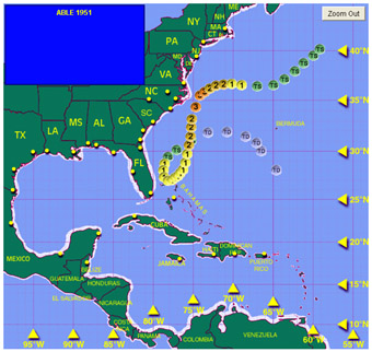 Looking at a chart from Dr. Chris Landsea from his work at the Hurricane Research Division, there have been 18 tropical storms to form during the month of May since 1851 (note that in 2007, there was sub-tropical storm Andrea in early May). Of those tropical storms, four went on to become hurricanes. The strongest of those hurricanes was "Able" in 1951 which became a category three hurricane just off the Outer Banks of North Carolina- the earliest in the year that has ever happened. No hurricanes have hit the United States during the month of May. Bottom line- the odds greatly favor NOT having a hurricane form over the next few weeks- based solely on past data. However, past data does not always dictate the future though it can be a handy guide. Let's now look at the pattern over the next two weeks for clues as to what might happen.
According to the GFS computer model (last night's run), upper level winds at 120 hours through the next week are forecast to remain highly unfavorable for development across the Gulf of Mexico and the western Caribbean. Even a look at the 10-day forecast shows strong westerly winds over the Gulf but you do notice the possibility of an upper-level high building over the southwest Caribbean. This is fairly far out in time for the model to resolve accurately, but the pattern does look hostile for development between now and May 15. What about after that time period? Let's look at the latest MJO forecast also from the GFS. The brown colors generally mean sinking air or lack of tropical convection. The green areas indicate regions of favorable upward motion in the tropics which can lead to deep thunderstorm development. The forecast shows that after the 15th the chances of a more favorable pattern could be setting up. This seems especially true as we get to around May 20. This MJO pulse can be tracked using several other methods but for now, this simple graphic will suffice. While there is no solid indication of tropical storm formation in the Atlantic Basin later in the month, it cannot be ruled out. What is more likely to happen is that we see a named storm form in the east Pacific. That region's season actually begins on May 15 and water temps in the east-Pac are plenty warm. It is something to keep an eye on and with the availability of these wonderful tools via the Internet, we can keep close tabs on any chances of development. Now, more than probably any season in recent memory, it is critical to keep hurricanes out of the Gulf of Mexico. Obviously no one can stop one if it is coming, but being able to sniff out development chances will at least help to give as much advanced warning as possible for the efforts underway on the sea as well as on shore. I'll have more here on Monday morning. 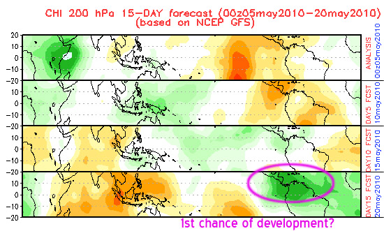 UPDATED: 8:30 am EDT, May 3, 2010 by Mark Sudduth email me SEA SURFACE TEMPERATURES TRULY GETTING OUT OF HAND I have never seen the sea surface temperature anomaly map look like the one below. It is the NHC's Reynolds method anomaly map which is updated once per week. This map gives an excellent representation of what is going on with SSTs across the Atlantic Basin and looking at today's edition, it is alarming. Such an enormous area, from Africa all the way to the western Caribbean, is at or above 1 degree Celsius above normal. That alone is enough to warrant serious concern for the upcoming hurricane season. However, the fact that a growing area of 2 degrees Celsius is now manifesting itself raises the stakes even higher. While it is true that sea surface temps alone do not cause intense hurricanes, seeing them this warm makes me wonder what will happen once the upper level winds relax and we do in fact get a hurricane to develop? Even the Gulf of Mexico, which was running well below normal until recently, is now mostly cleaned out of those cold anomalies. This has huge implications for the efforts to thwart the oil leak crisis in the Gulf- the last thing they need is a hurricane to come plowing through. So what is causing this incredible warm up in the Atlantic? I have discussed this earlier in the year but will address it again. Basically, lower than normal pressures in the sub-tropical Atlantic are causing the trade winds to be weaker and are thus not blowing across the deep tropics as strong, resulting in less evaporation and cooling. That is the simple explanation. Now it seems like it is feeding back on itself as the warm ocean leads to more heat and moisture and thus lower air pressure. Climate models suggest that this pattern will remain in place for the duration of the season ahead- but none of them have predicted this much warming that I can recall. I hate to sound like Mr. Doom and Gloom here but I am serious, I have never seen anomalies this warm across such a large area of the Atlantic- not even during the 2005 season. With only a few weeks left until the season begins, the Herculean effort in the Gulf to stop the leaking oil becomes that much more important. I do not want to think about what could happen if a hurricane, let alone a major hurricane, were threaten those efforts. I do not know much about how oil and the ocean interact with each other except only that oil is lighter than water. I wonder if a hurricane would act as the ultimate dispersement agent and break up the slick enough to render it far less problematic? The heavy rain, aggitated sea state and strong wind could do a lot to break down the slick and spread it out over a much larger area- resulting in less concentration in a single region. I suppose though that it is a matter of picking your poison. Unless the oil just goes away, there is no good outcome. However, with the clock ticking towards the start of the hurricane season, it is something that needs to be considered and I would assume that the powers that be who are involved with the efforts are well aware of this added urgency. I will post another update here on Wednesday with a look at long range computer models as well as some thoughts about our June 1 broadcast as we open the 2010 hurricane season. 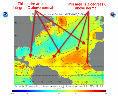
UPDATED: 9:00 am EDT, April 26, 2010 by Mark Sudduth email me HUGE DIFFERENCE BETWEEN 2009 AND NOW FOR HEAT CONTENT I have discussed the sea surface temperature anomalies in the Atlantic since the early part of the year. We know that they are running well above normal across the entire hurricane breeding ground region from Africa to the Caribbean. What you may not realize, however, is how significantly different the amount of true energy, or heat content, there is now as compared to last year at this time. First, let's talk about TCHP or tropical cyclone heat potential. The best way to describe it is to think of it as extra fuel for tropical cyclones. If the surface of the ocean is very warm, but only to a few feet deep, then just about any aggitation of the water will result in its cooling, thus bleeding off energy that would otherwise be used to power the cyclone. On the other hand, if the warm water remained warm to a depth of 50, 100, 300 feet or more, then we are talking about vast quantities of heat energy being available even in the face of strong surface winds and an aggitated sea state. This is what scientists refer to as upper oceanic heat content and the more of it there is, the more energy is available to spawn powerful tropical cyclones. There have been a variety of methods employed over the years to quantify TCHP and I won't go in to that- but just understand that when we see areas with high TCHP, we know that there is at least the potential for significant strengthening of a given tropical cyclone. Now, let's take a look at the graphic below. It comes from NOAA's Hurricane Research Division and displays TCHP for the Atlantic Basin. Notice last year at around this same time. There was very little TCHP anywhere in the Atlantic- totally within the norm for that time of year. Next, take a look at the same map for April 23 of this year. To say that it is above normal is an understatement. The values of TCHP in the Caribbean are what we would expect in late summer- near the peak of the hurricane season. This means that there is already an enormous amount of stored energy in the Caribbean and portions of the Atlantic- much more so than we would normally see. Is it possible for it to dissipate and return to a more normal state? Yes. That would require an increase in the trade winds which would in turn cool the water just like blowing across hot coffee to cool it off. However, there is little evidence to suggest that these trends will reverse. I bring this up because it is important in how the upcoming hurricane season could be shaped. This is factual information, a piece of the puzzle that suggests the potential exists for very intense hurricanes to form in this region. Whether or not they do remains to be seen- no one knows the details of what is or is not going to happen in the months ahead. There are many other factors that go in to the development of tropical cyclones. Warm water alone is not enough. Dry, sinking air can kill off almost any chance of development should that condition be present. Strong wind shear in the upper levels will limit development too. These are all things that cannot really be forecast this far out in time. We will monitor how this map evolves over time. We are close enough to the hurricane season now that things like this begin to become more and more important. I will post another update no later than a week from now. 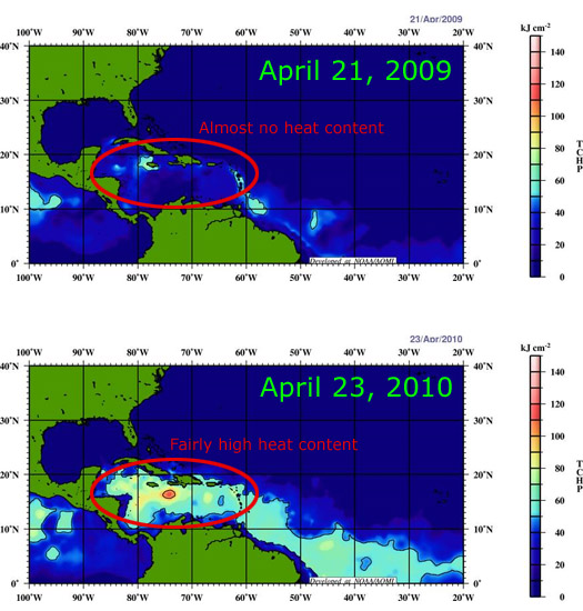
UPDATED: 1:15 pm EDT, April 20, 2010 by Mark Sudduth email me ASH VS DUST I have received several emails from people asking me if the Icelandic volcano will have any impact on the upcoming Atlantic hurricane season. The short answer is no, it will not. But this brings up an interesting topic- of ash from a volcano versus the dust that we often hear about wafting off the coast of Africa during the summer months. First, let's look at the volcano in Iceland. The country itself is located around 64 degrees north latitude- that's very far north of the tropics so any ash that is ejected in to the atmosphere is not likely to be transported in to the tropical regions of the world. If the volcano were in the tropics, like many active ones are, then perhaps the ash and other particulate matter would help to block out sunlight, thus reducing the temperature of the ocean's surface. But what if a hurricane passes over or near an erupting volcano? I am not sure about how often this has happened in recorded history but if it did, and the volcano were more of an ash-producer than lava, I imagine that an incredible amount of mud and other rain-soaked ejecta would cascade down across the region. It would be a horrific sight to behold, that is for sure. Tropical rains and volcanic ash are never a good mix but the ash itself would not be much of an impedement to the hurricane. Now let's consider the large dust outbreaks that take place over the far eastern Atlantic Ocean each year. This phenomenon is much more of a hurricane killer than any volcano, at least on a more frequent scale. It has to do with what is called the Saharan Air Layer or SAL. When a large sub-tropical area of high pressure is present over the eastern Atlantic and north Africa, strong winds blow from the east to the west across the dry, dusty Sahara Desert. This air is warm, stable and often filled with fine silicate matter, typically sand grains. This air mass moves out over the ocean and spreads westward with the trade winds. The dust is thick enough to block some incoming solar radiation and acts to cool the surface waters. However, it is the presence of the stronger trade winds that really act to knock down the sea surface temps- just like blowing across the surface of a hot cup of coffee to cool it. The net affect of the SAL is to put a lid on the development of hurricanes but the dust itself is not the true killer, it is just a visible symptom of the overall air mass over the Atlantic. The more often we see strong outbreaks of the SAL, especially during the height of the hurricane season, the less likely we are to have strong Cape Verde type hurricanes. So while the volcano in Iceland is making news headlines for the travel issues it is causing, it should have no appreciable impact on this year's Atlantic hurricane activity. We will be watching closely, however, the SAL events off of Africa. And by the way, the higher than normal sea surface temps in the tropical Atlantic this year are directly attributed to the lack of a strong subtropical high pressure area in the eastern Atlantic. Thus, the SAL outbreaks this season might not be very strong- another indicator that we may in fact be in for a very active season. UPDATED: 9:40 am EDT, April 12, 2010 by Mark Sudduth email me OUR PLANS FOR THE HURRICANE SEASON As we approach the official start to the hurricane season, I thought I would talk about our plans for the months ahead. Weekly edition of HurricaneTrack News/Talk resumes Tuesday, June 1 What began as an Internet radio program in 2008 will continue as a new and improved video broadcast. Each week, starting June 1, and then each Tuesday night there after, we will produce a live video cast that will cover news in the tropics, a look at computer models, in-depth analysis of forecasts for named systems, preparedness info and much more. We will also have guests join in from time to time and, when ever possible, they will do so via video link-up. The program will be broadcast via Ustream right here on the homepage at 8pm ET beginning June 1. If you cannot watch live, no worries, it will be immediately archived for later viewing. We will strip out the audio and create an mp3 file for those who want to listen on their iPod or other media player. Note that Ustream is available to iPhone users. The weekly broadcast will be a really nice enhancement for the season ahead. It will be very similar to the daily Hurricane Outlook and Discussion that I produce for our Premium Services members but more topical in scope with featured guests coupled with a look at the tropics. I think you will be quite pleased with this new and improved version of HurricaneTrack News/Talk. I will post more about the season kick-off program as we get closer to June 1. Tropical storm and hurricane field missions live video from the HIRT Chevy Tahoe Last November during the hurricane Ida field mission, we began using Ustream to provide access to the Tahoe's dash cam on the home page. It was extremely successful and very popular. Because of the business model that Ustream adopts, we can now offer that live feed for any tropical storm or hurricane landfall event. There will be a special "mission mode" home page set up that will feature the Ustream feed from our Chevy Tahoe. You can see and hear everything that goes on during our field missions. This will be very important as we can update you with instant information as soon as we access it from our sources. We will continue to offer our Premium Services option which has more features, more on that in a moment, but this free access to the Tahoe cam will be a tremendous benefit to anyone who has an interest in our work. We will turn it on the moment we depart for any field missions that we undertake this season. I will be doing a test of the special home page next month when I travel to Ft. Lauderdale for the Florida hurricane conference. Premium Services continues to improve What began in 2005 as a means to control the costs of streaming live video has evolved in to an important aspect of our business model. This year, we are continuing to offer an exclusive chat feature that allows our members to chat with us while they view the Tahoe cam and the remote Storm Case cams. This is not going to be available on the home page or via Ustream. For one, we could have literally tens of thousands of people trying to chat all at once. And two, our paying subscribers are not going to wreck the chat by posting foul language or snide remarks (trolls). In fact, when we implemented the chat last season, several members remarked at how that feature alone was worth the subscription cost. We have developed quite a close-knit family with our long-term members who frequently use the chat window to pop in and say hello. We are also going to continue the daily Hurricane Outlook and Discussion, Monday-Friday, beginning Monday, May 31. This was a close second in terms of popular features for our subscribers last year. The video is produced live each weekday morning, around 11am ET, and is exactly what the title suggests- an outlook of potential development areas in the tropics plus a discussion on what to expect in the days ahead. Members can tune in live and chat before and after the video if they have questions, etc. It took some getting used to, having a live video broadcast to do each day, but I have to admit, it is a lot of fun, I enjoy doing it and our subscribers seem to really appreciate it. I look forward to continuing this service for the 2010 season. And of course, our subscribers will have exclusive access to our remote Storm Case cams that we place in areas where we dare not be when the hurricane makes landfall. For those who saw the success of this project during Ike, you know how far we have come since the early days waaaaaay back in 2005. We have made some improvements to the remote cams for this year including our best quality yet in the streaming video. We have three fully operational units ready for the season with two on stand-by if needed. Our members will have full access to those streams, along with the Tahoe cam, all on one page. When it is fully up and running, it is quite impressive. Last, but certainly not least, our members have access to our own 30 frame satellite and radar loops, a message board and special tracking maps and other model output maps that are available only on the Premium Services site. Membership numbers rise and fall with each season, depending upon how active it is, but I have to tell you, there is a core group of subscribers who have been a part of it since the very first time we went out on a live mission- Katrina. Premium Services is not meant to be entertainment nor to make us rich. It is a tool that if used properly, can give its subscriber base insight to not only what is going on in the tropics, but also an opportunity to become part of the mission through the interactivity that we offer. If you're interested in joining up, you could not have picked a better year. Our level of service and dedication, especially during the field missions, is second to none. For more info, click on the link in the upper right corner of the page. All of the above-mentioned improvements will be a part of our overall continued effort to provide relevant, timely and useful hurricane news and information. I will continue to update the commentary each day during the season- even when things are quiet. And when they are quiet, I will say that and not manufacture some reason to keep you coming back. We all know that there are periods of time when the tropics are simply dead and we also know, all too well, the opposite of that coin. I will be working with a great team of people, including Jesse Bass and Mike Watkins, to produce the content you see on this page. While it may be my name as the by-line, there is much more to it than that! I also encourage feedback, questions and comments on our Facebook page and/or via Twitter. We will take full advantage of social media this season and will be working on some tools of our own to throw in to the mix. We have less than 50 days now until the hurricane season gets started. We are working on being ready- please make sure you do the same. I'll have more here next week but will post misc tid-bits via Twitter and on our Facebook page. UPDATED: 9:30 am EDT, April 3, 2010 by Mark Sudduth email me COLD GULF ABOUT TO GET VERY WARM I am back at the home office now after attending the National Hurricane Conference in Orlando, FL. It was a great week of learning, discussions and seeing long-time friends and colleagues. Now, it is time to get ready for the upcoming hurricane season which begins in less than two months. A lot of talk has been made about the very warm water that has been prevalent in the tropical Atlantic since the beginning of the year. I have written a few posts about it and it seems that this has the potential to play quite an important role in this year's hurricane season. However, the Gulf of Mexico still remains well below normal, sea surface temp-wise, in most of that region. That is about to change. Take a look at the graphic below. It is today's SST anomaly map from NOAA/NESDIS. As you can clearly see, the Gulf is painted in mostly blues and even some purples- indicating significant departures from normal on the negative side. But notice the Loop Current nosing its way up through the central Gulf. Also notice the positive anomalies in the Caribbean, getting warmer the farther east you go. Those two features, coupled with the strong and increasing sun angle, will mean that Gulf SSTs will be back to normal, and possibly above in some places, very soon. The reason the water is so cool, relative to average, is because of the relentless onslaught of storms this winter that brought cold air and strong winds to the open Gulf. This is reversing now and with the abundant warmth in the East and South, water temps are rebounding quickly. This is all part of the overall larger picture of SSTs that are running as much as two degrees C above normal across the entire tropical Atlantic- roughly south of 20 degrees latitude. As I have mentioned in earlier posts about this, the weaker sub-tropical high, or Azores High, has lead to lighter trade winds blowing across the Atlantic, thus allowing SSTs to warm to above normal levels. In fact, this is exactly what an El Nino is in the Pacific. Perhaps there needs to be a name for the Atlantic version. Sea surface temps are only part of the overall equation when dealing with tropical cyclones. While there is mounting evidence to suggest that a very busy hurricane season is coming, it is no guarantee and no one knows where any hurricanes that do form will ultimately end up. None the less, people who are looking forward to fishing, boating and enjoying the usually warm Gulf, it's coming. 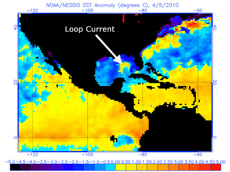
UPDATED: 9:30 pm EDT, March 31, 2010 by Mark Sudduth email me THOUGHTS FROM THE NATIONAL HURRICANE CONFERENCE I am in Orlando attending the National Hurricane Conference and thought that I would post a few observations and key points from today's opening general session. The afternoon session began a little after 1pm with an intro from former NHC director Max Mayfield. He then introduced the current director, Bill Read. He did a quick overview of the paltry 2009 hurricane season an emphasized that even though the coastal areas of the Alantic Basin were relatively lucky last year, that it could all change this coming season. His biggest concern was for Haiti and for obvious reasons. It would not take even a strong hurricane to do great damage in the earthquake-torn nation. In fact, just a big rain making tropical storm or depression could inflict more misery on the region. Read concluded his presentation with an outline of the future of the U.S. hurricane program- noting that it won't be too many years before we will see seven day track forecasts- and that we still have a long way to go with intensity prediction. He also made mention of the changes to the watch/warning info which has been posted on the NHC's site for several months now. Next up was FEMA director Craige Fugate. Floridians will remember him as the director of emergency management in the Sunshine State- up until he took the job in Washington. His main theme was team work. Sounds like a simple concept but its meaning goes far deeper. He cited problems during the 2005 hurricane season that could easily be rectified with some coordination and team work. I was also pleased to hear him address the use of social media for hurricane emergencies. This is a huge topic in and of itself, one that I have covered to some extent on this site a few times already. There is great potential for the spreading of information and sharing of ideas through social media between the public and the government. Mr. Fugate also discussed Haiti and how there were people he met who were charging cell phone batteries off of a regular 12V car battery, an inverter and power strips (this is how WE do it in the Tahoe and on our field missions- been doing that for almost six years). He saw the innovation using simple, off-the-shelf products to solve a problem. It is his concern too that Haiti will need to be watched closely this hurricane season- something I believe we will hear a lot about once we get there in a little over two months. Next up was Lt. General Robert L. Van Antwerp, Chief of Engineers, USACE. His main focus was on the role of the Corps in helping to manage disasters, floods and of course, the levee issues in New Orleans. He had a lot of positive things to say, several warm stories to tell and a nice sense of humor- pretty refreshing to see. He addressed how conditions can change year to year in our ports and navigable rivers with silt, sediment and seasonal flood patterns. His presentation was fairly short and to the point. The crowd took a break for about 45 minutes and returned to hear David Halstead, Interim Director, Florida Division of Emergency Management speak about Florida via Haiti. Most of his content was about Haiti and the repatriation of its populous that came to the U.S. in the days and weeks after the quake. Google what that term means- repatriation. Interesting stuff that went on in Florida that I was not aware of. His point seemed to be that we can learn a lot from the Haiti experience and use lessons learned to better equip the U.S. for the next major disaster. He seemed to really know the ropes and has had many years of experience- which is a huge plus in this business. We moved on to Joe Becker, Senior Vice President of Disaster Services, American Red Cross and his quiet, low-key presentation cocerning the role of the Red Cross in this country. He echoed what a lot of us are facing- that money is tight, there is less of it to go around but that we still need to do our part to be ready and not leave anyone out who needs help. I am not sure that he was totally in support of the use of social media- it seemed that he gave pause to the fact that it could open government and other agencies up to a flood of people looking for information in a world where it is expected to be instant and available. Who will man that effort? Good point. Someone has to be able to answer to so and so county's Facebook "fan" page with 4000 tax payers wanting to know when debris will be picked up or the power turned back on. This is an issue that if it back-fires, a lot of people will be angry and use the same social media to voice such frustations. That is what I took from a portion of his talk. One of my favorite presentations of the afternoon was from Forrest Masters, University of Florida. He basically outlined how what the public knows as "storm chasers" or "hurricane chasers" need to work together to coordinate and share their data. There are mutliple efforts from universities and private firms alike which are all aiming to improve the science of understanding hurricanes. We use some meteorological tools with our sole 5-meter wind tower. But over the years, more and more of our data is visual in the form of fixed-camera video from our remote Storm Case cams. Dr. Masters believes that a "quantum leap" in hurricane science can be made with (obviously) more funding and more remote sensing devices such as wind towers, mobile Doppler trucks and even underwater surge measuring devices dropped by helicopters in the path of a hurricane. It was a fascinating look in to the deep grit of the scientific community and their effort to study hurricanes and other severe weather. I promptly introduced myself to him and offered to send our video (time lapse) for him to see how we do what we do while on our hurricane field missions. There are some bright minds out there, let me tell you! I hope the funding can allow these people to continue. Finally, we heard from Dr. Phil Klotzbach and his mentor Dr. Bill Gray. After an incredible intro from Dr. Gray, Dr. Klotzbach spoke about the upcoming hurricane season and his thoughts on why it is likely to be "well above average". I recorded this portion of his talk and have posted a link to it below. Let me say this- there is strong evidence to suggest that we will see a very active hurricane season ahead. Of course, and he made this very clear, no one knows where the future storms and hurricanes will strike- if at all. We will just have to wait and see how it all plays out. The session ended with an energetic presentation from Dr. Gray. He went over in fairly solid detail the whole idea behind why we are in an active period of hurricane activity and how it is NOT at all related to increased levels of C02 in the atmosphere. His evidence to the contrary was compelling and he made it a point to mention that we need to fear the hurricanes- not man-made weather catastrophes. There are far more pressing and urgent issues in the world today, he proclaimed. I would tend to agree. We are likely to see this current period of increased hurricane activity for another decade- perhaps two. People may have their opinions about his work, style and motives, but his science appears to be firmly planted in real evidence, not fear-based sensationalism. He just wants people to understand that when coastal populations increase like they have since the 70s, and then you bring in a more active period for (especially) major hurricanes, the recipe for unprecedented damage and loss of life is set. Hard to aruge that. UPDATED: 11:00 am EDT, March 15, 2010 by Mark Sudduth email me CFS MODEL CONTINUES TO INDICATE DEMISE OF EL NINO- PLUS, OUR MEET AND GREET PLANNED FOR APRIL 1 There are several computer models that predict the ocean's temperature patterns over the coming weeks and months. One such model is the Climate Forecast System or CFS. I have included the latest graphic from its output below. You can plainly see that the trend is downward in terms of temperatures of the tropical Pacific- specifically the central Pacific (aka Nino 3.4 region). Now, this is an ensemble spread or several models shown on the plot. Some are above zero or neutral anomaly, some are below. It looks like those that favor a slightly cooler than average anomaly win out which should mean that we will see conditions generally in the neutral range (plus or minus a half degree Celsius). This would in turn be an enhancing factor for the development of Atlantic hurricanes. However, there are many other aspects of the equation that need to be taken in to consideration, but this one piece of the hurricane short-term climate puzzle looks fairly clear as of now: we will be leaving the El Nino behind over the next few months. In other news- I have set up our meet and greet for April 1 in Casselberry, FL (near Orlando) at the Buffalo Wild Wings. It will be from 7pm until 10pm or when ever. Mike Watkins will join me along with Tim Millar from the Cyclone Research Group. The idea is to get together with you, the people who have supported our work over the past eleven years. We can talk hurricanes, share stories, show you some of our technology up close and just have a nice evening getting to know each other. We simply would not have much reason to be here without YOU, so if you live anywhere near Orlando, bring the whole family out on Thursday, April 1. Here is the direct link to the event on our Facebook page. If you have any questions, feel free to email me.  Latest CFS forecast for Nino 3.4 region showing steady forecast decline of SST anomalies
UPDATED: 9:00 am EST, March 8, 2010 by Mark Sudduth email me NATIONAL HURRICANE CONFERENCE COMING UP- WE'LL BE THERE, PLANNING A MEET AND GREET The 2010 National Hurricane Conference is being held in Orlando, FL this year. It begins on March 29 and will conclude on April 2. I am going to head down there for the general sessions beginning Wednesday, March 31 and will stay through the closing session on Friday. I will post video clips and text updates here and on our Twitter feed. On Thursday evening, April 1, I am planning a meet and greet for anyone in the Orlando area who would like to stop by and say hello. Exact time and location are being worked out now. Mike Watkins will be joining me from south Florida for this and we hope to use the opportunity to get to know the people who have supported and followed our work over the years. I will post an update here once I firm up a location and pin down a time (probably 7p to 9p). I'll also have the info scheduled as an event on our Facebook page. Mike and I look forward to putting faces to familiar names as well as catching up with long-time friends in the area. As for the tropics, the Atlantic continues to display an interesting signal of substantial warming in the deep tropics. From Africa all the way in to the Caribbean Sea, sea surface temps are running at least 1 degree C above normal. Several long range computer models foreacst this pattern to remain in place as the Pacific steadily cools to a neutral state. I am sure this will be discussed at the conference, especially at the closing session when Dr. Phil Klotzbach and his mentor, Dr. Bill Gray, present their updated thoughts for the hurricane season. Whether or not you feel that such forecasts are relevant, one thing is certain, there are strong global indicators that lend credibility to the notion that this hurricane season will be far different than last. None the less, there could 50 hurricanes but if none hit land, so what? We'll just have to wait and see how it all pans out. UPDATED: 9:30 am EST, March 1, 2010 by Mark Sudduth email me CHILEAN EARTHQUAKE AND RESULTING TSUNAMI EXCELLENT LITMUS TEST FOR SOCIAL MEDIA USE IN NATURAL DISASTERS I received a text message on my Sprint phone in the wee hours of Saturday morning notifying me that a powerful earthquake had struck off the coast of South America. Roughly 15 hours later, the world watched in morbid fascination for the possibility of death and destruction rolling in from the seas. Twitter, Ustream and Facebook were all buzzing with activity of the disaster- much of the content unfiltered and in real-time. I am not sure that I can recall a time when the Internet played such an integral role during a natural disaster. Sure, the Haiti earthquake sent proverbial shockwaves across the blogosphere, but Saturday, it was different. We were waiting on potential disaster to strike as millions of people tuned in to see what would happen in Hawaii. This really got me thinking about the role that social media will play during a major hurricane event for the United States. We have been using Twitter for a little over a year now and I have made it a point to try to stick to relevant content related to our work here at HurricaneTrack.com. We also have a Facebook page which has been in use since mid-summer last year. The two offer a great way for us to convey chunks of info, teases on upcoming events and to connect with each other on a more personal level. With our use of Ustream last November during hurricane Ida (and its Nor'easter ghost), we were able to broadcast our live video feed from the Tahoe to anyone who visited the homepage. This too has resulted in numerous friendships being established and even our installation of a weather station out on the Outer Banks- none of which would have been possible had these people not been connected with our work. I can now easily see how social media will play a major role not only in our work, but in the dissemination of news (good or bad) when the next major hurricane threatens our shores. But, as the famous line from Spider Man stated, "With great power comes great responsibility". We must tread carefully as there is much room for error, rumor and outright sabotage in this unbridled new world of social media- it can quickly turn to social mayhem. Trusting valued sources such as your local news station, emergency management office, county government is going to be the best way to filter through the inevitable garbage that will be put out there- some of it on purpose. Imagine the power of Twitter in spreading false information. One person or ogranization could send out wrong data, evacuation info or other misleading rumors and in 140 characters, an avalanche has been started that would propagate across the Internet in a matter of seconds. This could end up costing people precious time- and worse, their lives. Hopefully this is a worst-case scenario but I saw it on Saturday, several bits of flat-out wrong info being sent out over Twitter about what the buoys meant on a graphic displayed at the Tsunami Warning Center's site. In times of disaster, confusion is a slippery slope towards chaos. However, there is a far more powerful good side to this new method of instant info. For one, we plan to use it to put out new data, model info, breaking news updates, our plans for covering a storm or hurricane, etc. etc. Our Facebook page will allow us to interact with each other in ways that we never have before. Our use of Ustream will mean we can finally broadcast the Tahoe cam to potentially hundreds of thousands of people at once- giving them a look inside how we do what we do as well as real-time data and info from right where the hurricane is going to strike. We tested this during Ida and it was an amazing success- we will build upon that this season. The other side to this also includes the ability of friends and family to stay in touch and to let each other know that they are safe- or are in need of assistance. With text messaging typically working far better than voice lines after a hurricane, what better way to communicate than through a short update via Twitter or Facebook? I see this as an incredible benefit to those who are impacted (look at how the social media phenomenon helped after the Haiti earthquake) as well as to those who are working to get critical information in and out of a region. Millions watched as the sea ebbed and flowed in Hilo Bay on Saturday. That was an event with several hours of warning. I can only imagine what the social media scene will be like when we have days of advance notice as the next historic hurricane closes in. We will do our best to stay on the cutting edge of this technology and to put it to the best use possible. I would love to hear some feedback as to what you would like to see through our Twitter feed and Facebook page. If you're not connected to us through these sites yet, just click the appropriate icon in the right hand column. Of course, plain, old fashioned e-mail works just fine as well :-) UPDATED: 5:45 pm EST, February 24, 2010 by Mark Sudduth email me COMPLEX STORM SYSTEM TAKING AIM ON NORTHEAST- NUMEROUS WATCHES, WARNINGS AND ADVISORIES POSTED It's not a hurricane, not be any stretch, but the effects will be similar with coastal flooding, high winds, power outages and heavy rains. In the cold regions of the storm, snow will pile up, in some places it will be measured in feet- again. This is all part of the overall nasty winter that much of the U.S. has had to deal with. I produced a video webcast earlier today that attempts to explain what is going on, at least from what I know about these types of big time winter storms. Check it out via the link below. The storm is taking shape now off the Southeast coast and will really ramp up tomorrow as it retrogrades back to the northwest from the Atlantic. It is a rare weather event and one that has the potential for disrupting millions of lives. Be aware, alert and if you live in the affected area, be careful. UPDATED: 9:30 am EST, February 23, 2010 by Mark Sudduth email me MAJOR STORM TO BLAST THE NORTHEAST People living in the Northeast need to pay attention. A major, big time, epic winter storm is looking more and more likely. The set up is complex but is not too unlike a rogue Atlantic storm coming in off the ocean during hurricane season- except this one will produce FEET of snow. The information that I am looking at, including computer models, other blogs, etc., tells me that this is a potentially dangerous situation for a great deal of the major Northeast cities. It is impossible to know exactly which areas would be the hardest hit but I urge our friends in the region to visit their local NWS page at weather.gov by inputting your ZIP Code and then reading the forecast discussion and other local text products. I am also contemplating heading up to the region myself for live streaming coverage, much like we would do if a hurricane was threatening the region. I have until tomorrow morning to decide for sure. Bottom line, I wanted to make sure our readers were aware of this potentially life-threatening situation. Hopefully the models are dead wrong and it will be a bust- if it is not, and the models are right, then this will be THE single worst event of the winter season. We shall see what we shall see. I'll post more on it here tonight and via Twitter posts. UPDATED: 10:30 am EST, February 15, 2010 by Mark Sudduth email me SEA SURFACE TEMPS WORTH WATCHING Even though it is only mid-February, there are some interesting things going on with sea surface temperatures that are worth mentioning. Using the graphic below as a guide, you will notice first that the tropical Atlantic, areas south of 20 degrees latitude, is quite a bit above normal. This warm anomaly stretches from the coast of Africa westward in to the Caribbean Sea. From what I understand, this is most likely due to the strong negative Arctic Oscillation that has been dominate over the course of the winter- which tends to lower the trade winds across the eastern Atlantic and thus sea surface temps warm since they are not being cooled by strong easterly trade winds. This current pattern can easily change and those warm anomalies can disappear in a matter of days so it is not much concern as of yet. We'll see what things look like in about 90 days or so when the hurricane season is almost upon us. The other area of interest is the dwindling El Nino in the tropical Pacific. Sea surface temps have cooled steadily in the region from South America westward to about 140 degrees of longitude. In fact, the east Pacific is running right at normal to perhaps just a tad below normal. The cooling trend is expected to continue as we approach the summer months and we should be out of the El Nino well before the peak of the 2010 Atlantic hurricane season. This is right in line with what would be expected with a typical El Nino event- they usually do not last for more than a year. It will be interesting to watch as sea surface temps evolve in both basins over the coming months. The fact that there are tools readily available to allow anyone to monitor such things is wonderful. A lot can happen between now and the hurricane season to change what we are seeing today, but I thought it was worth talking about. I will keep a close eye on how this pans out and will post another update concerning sea temps in about a month. 
UPDATED: 9:45 am EST, February 3, 2010 by Mark Sudduth email me EL NINO MAY BE DYING OUT BUT ITS IMPACT FAR FROM OVER There are continued indications that the fairly strong El Nino that developed last year is in fact on its way out. Computer models and recent real-time data suggests that sea surface temps in the tropical Pacific will continue to decline steadily, reaching neutral conditions, for the most part, by summer. This has huge implications for the upcoming hurricane season- more on that in a few weeks. For now, however, the lingering effects of the El Nino will continue to be felt. The main issue has been a strong southern storm track this winter with numerous systems coming out of the western Gulf and across the Deep South, Southeast and up the East Coast. Many river basins are at or nearing flood stage while heavy snows, ice storms and even severe weather has been a problem for areas from Texas to New England. Unfortunately, there is more to come. The next storm system is taking shape now over the western Gulf of Mexico. By the weekend, it will be fully cranked up off the NC Outer Banks- bringing wind, rain, snow, beach erosion and cold conditions for a large portion of the Mid-Atlantic region. While not as bad as the Ghost of Ida, at least it does not appear that way as of now, it will be another shot to the already torn up beaches of North Carolina, Virginia, Delaware and points north. As I often suggest here, vist weather.gov where you can enter your ZIP Code and then access detailed forecast information for your city. Read the Forecast Discussions as often as you can, they have excellent info, some of it fairly technical, but solid to be sure. The more you understand, the better you can prepare- no matter what kind of weather is headed your way. Another interesting note is the SOI or Southern Oscillation Index. I mentioned this in an earlier piece I wrote about the El Nino. The SOI is currently strongly negative, a sign of intense upward motion or energy parked over the western tropical Pacific. This energy, part of the MJO pulse that we watch closely during the hurricane season, will migrate eastward over the next week to ten days, bringing with it more challenging weather issues. It is probably the last gasp of the driving forces behind the decaying El Nino. February may well be remembered as one of the stormiest months we have seen in a long, long time. For coastal residents, it means more loss of protective dunes and increased vulnerability to any potential hurricane threats this coming summer. I'll post more here as needed and encourage you to follow along on Twitter as well- where I post occassional tid bits, links to graphics, satellite shots, etc. on a daily basis. UPDATED: 1:00 pm EST, February 1, 2010 by Mark Sudduth email me MAJOR COASTAL STORM TO DEVELOP AND LASH FRAGILE BEACHES ONCE AGAIN This has been a stormy winter, no doubt about it. It seems to have started back in early November when hurricane Ida transformed in to a monstrous Nor'easter type storm, leaving a trail of battered beaches in its wake. Since then, the East and Southeast has endured numerous winter storms, severe weather and flooding conditions as one system after another comes charging in across the country. There appears to be no end in sight. The latest event will take shape over the western Gulf of Mexico, the genesis point for many of this season's storms. By the weekend, it looks like it will spread heavy rain, winter precip and strong winds from Florida to the Mid-Atlantic states. Once again, the NC Outer Banks and SE Virginia could receive the brunt of the energy from the ocean. In fact, the latest computer models indicate a possible prolonged event as the storm sits and spins just off the North Carolina coast. This would churn up the Atlantic and send strong northeast winds in to the coast, piling up the water similar to what Ghost of Ida did. Farther inland, the problem could be ice and snow as cold, dense air wedges its way down the east side of the mountains. With many places digging out from the recent winter storm, this next looming storm has the potential of causing quite a range of problems. While not tropical in nature, it concerns me to see our beaches eroded so severely during the winter months. We are less than 120 days out from the start of the Atlantic hurricane season, we need all the beach we can get. I'll post more here concerning the developing storm throughout the week with various bits of info on our Twitter feed. UPDATED: 10:15 am EST, January 18, 2010 by Mark Sudduth email me GET READY TO SAY GOODBYE TO EL NINO As you probably know, a fairly strong El Nino has been in in place over the tropical Pacific over the past few months. It began last summer and helped to put a lid on the Atlantic hurricane season. Since that time, it has strengthened to the strongest El Nino event in more than 10 years. Now, we are seeing signs of its demise. A large driving force behind the development and sustaining of an El Nino is a weakening or reversal of the trade winds across the tropical Pacific. When those winds, which should normally blow from east to west, slow down or even reverse course, the Pacific warms along and near the Equator- thus giving birth to an El Nino. One way to know whether or not the trades are acting normally is to measure the pressure difference between Tahiti and Darwin. When the air pressure is lower in Darwin than it is in Tahiti, the natural flow of air is a normal east to west regime (high pressure moves to low pressure). When that pressure pattern is flipped, especially if it is significantly so, then the mass flow of air across the Pacific tends to be more westerly- thus aiding in warming the Pacific. Make sense so far? This is called the SOI or Southern Oscillation Index. When it is positive, as long as it is not strongly positive, a normal east-west trade wind pattern is in place. However, when the SOI is negative, especially for a long duration, the trades slow or even reverse, allowing warm water to build in the tropical Pacific. Ever since about early summer of last year, the SOI has been consistently negative with only a few short periods of time when it poked above zero. This led to the current El Nino we have now. So what about the future? Well, indications are that this El Nino has reached its peak, probably a few weeks ago. The SOI is now working its way up towards zero from being strongly negative. The result has been an increase in the normal trade wind pattern across much of the Pacific. Also, long term computer models suggest that the process will continue to evolve towards a more neutral state as we get closer to the summer months. Just looking at current sea surface temps across the Pacific, as shown below, one can see an obvious lessening of the warm anomalies working from east to west. It will take some time, these things don't just change over night, but it appears likely that this El Nino event is on its way out. This means that come summer, conditions might not be as hostile in the Atlantic, due to a more normal upper air pattern returning as opposed to the strong upper level winds that El Ninos typically bring across the tropical Atlantic. In the meantime, the warm water in the Pacific will contribute to a series of strong Pacific storms that will rake the West Coast of the U.S. with heavy rains, deep mountain snows and severe weather farther east. The presence of an El Nino throws a wrench in to the global weather patterns and we get wild swings in temperatures and in storm systems. For the next week or so, California will be especially hit hard with news making weather affecting the Golden State. We can expect to see a fairly active spring pattern too with more severe weather than we saw last year a strong possibility. The really nice aspect to this is that there are tools that we can look at each week to monitor the progress of El Nino. I will continue to post information here from time to time about conditions in the tropical Pacific, and soon, the Atlantic. All of these large puzzle pieces, as I like to call them, will begin to fit together and give us a clearer picture of what to look for this coming Atlantic hurricane season. For now, winter is still in full swing with plenty of non-tropical weather to deal with. I'll have more here in early February with occasional tid-bits and updates via Twitter. Tropical Pacific sea surface temperature anomalies from late October through last week. 
UPDATED: 9:30 am EST, January 12, 2010 by Mark Sudduth email me BIG WEATHER MAKER TO TAKE SHAPE TOWARDS THE WEEKEND As I mentioned in yesterday's post, a non-tropical yet potent weather system is going to develop in the NW Gulf of Mexico, promising to bring rain, strong winds and possibly coastal flooding to a good deal of the Gulf Coast. Likely a product of the current El Nino event, this southern storm will herald a nice warm up for areas hit hard by the recent cold snap. The bad side to this is the possibility of severe weather as the storm system works east and then northeast. Florida and points northward could see heavy rains with the storm, adding to already full river basins. It will be interesting to see how potent the system becomes as some of the models do indicate quite a notable event coming out of it. I will keep an eye on its evolution and probable track over the coming days. For those who live anywhere from the upper Texas coast to Florida, keep an eye on this developing weather system- El Nino induced Gulf storms have a history of being trouble at this time of year. I'll have more here next week and will also discuss the El Nino and what the long range models are "saying" about its future. UPDATED: 9:45 am EST, January 11, 2010 by Mark Sudduth email me NOT TROPICAL BUT POTENT STORM TO DEVELOP IN THE GULF Fro those of you who are tired of the cold, fear not, change is coming. However, we will be trading the cold for a stormy pattern these next few days, beginning with the Gulf of Mexico. From the looks of the global computer models, a strong storm system is likely to develop in the NW Gulf of Mexico later this week and track eastward. A period of heavy rain, strong winds and severe weather is likely as we near the weekend. The models show the storm tracking from Texas to the Carolinas with a return to much warmer air. The threat of tidal flooding in some areas will be a concern, especially where the wind blows on shore, piling up the water. I'll post more about this system throughout the week but wanted folks to be aware of it now. El Nino storms can often be quite strong, especially the ones that come out of the relatively warm waters of the Gulf. I'll post more here tomorrow morning and also on Twitter as more info becomes available. UPDATED: 12:00 am EST, January 1, 2010 by Mark Sudduth email me WELCOME TO 2010! HERE ARE OUR PLANS FOR THE YEAR AHEAD Happy New Year! Welcome to a new decade, hard to believe it huh? Time sure seems to fly lately, it does for me anyway. With the start of a new year, I thought I would outline some things that we have planned as we approach and enter the 2010 hurricane season. First up, a big thanks goes out to our corporate partners for their continued vision and support of our efforts in the year ahead. We have worked with Sprint since the summer of 2001 and have accomplished so much with their outstanding network. We positively could not do what we do in the field without Sprint- it was like they tailor-made the network just for us! We look forward to pushing the envelope as we utilize their new 4G technology. Sprint powers all of our remotely operated field projects and our live streaming video during hurricane missions. It is quite an honor to continue to have their generous support year after year. Last year, we welcomed All Road Sat, a satellite sales and rental outfit based in San Diego, to the site as a partner. Fortunately for coastal residents, we did not have to put their state of the art satellite based equipment to use in 2009 but are ready should the need arise this hurricane season. If we ever lose the terrestrial network, All Road Sat has provided us with mobile broadband and communications so that we can always have a link to the outside world- no matter how severe the situation at hand is. They are also supporting our attendance at the 2010 Florida Governor's Hurricane Conference in late May, something that we feel is very important in keeping in touch with the very people that we may encounter at some point this coming season. Again, we are so proud to have the support of these companies and hope to utilize their products in a manner that will foster education, information, research and so much more. So what are we going to do differently in 2010? First of all, we learned about the power of social media during hurricane Ida in November. Our one and only field mission in 2009 to the Alabama Gulf Coast and then to the NC Outer Banks showed us the true power of social media and networking. Through the use of Ustream.tv, Facebook and Twitter, we had thousands of people engaged for hours at a time with us as we traveled to our locations as Ida approached land fall. The interactivity was unprecedented and has allowed us to literally connect with so many new people who have either been long time fans of our work or were just introduced to us through their friends on message boards, Facebook or Twitter. We look to expand on that success and will continue to utilize the social media scene to post additional info, photos, videos, events, etc. and encourage others to get involved and share their own content as well. You can follow us via the links over on the right hand colmumn. One change for 2010 is that we have done away with our web cam, per se. It is no longer a static image being updated every so often. Instead, we will have a live video stream playing on the homepage, and our web cam page, 24 hours a day. The stream may be from my home office, a cam that we have on the NC Outer Banks or even the live cam from the HIRT Chevy Tahoe. It's just something different that we can now offer to any one who visits the site. You can see the live video stream on the right hand column or visit the web cam page linked under it. Another new feature which I think will add tremendous value to the site for 2010 is the addition of a Friday LIVE video outlook and discussion. Similar to the Hurricane Outlook video that I produce daily for our Premium Services members, the Friday outlook and discussion will be broadcast live from my office (time to be determined) and will be used to go over potential development areas in the Atlantic and East Pacific. I will also detail ocean temps, El Nino conditions, computer model forecasts and more as part of the in-depth analysis of the current and forecast conditions based on information as recently as that Friday morning. The video will stream via Ustream LIVE on the homepage and will last anywhere from 5 minutes to as long as 20 minutes- what ever it takes to detail the latest goings on in the tropics. I will post the video on Ustream.tv immediately upon its completion in case you cannot watch live. For our Premium Services members, you will continue to have access to the daily outlook video that I began this past year. I think this new offering will be very popular, especially when there is the threat of a hurricane impacting land. Stay tuned for more info on this as we get closer to June. Last but in no way least we will continue to offer the next level of hurricane information and unique interactivity for our Premium Services members. There is no way to thoroughly describe what it is exactly that makes being a member so special. For those who have joined and have taken advantage of the tools that we offer, they will tell you, there is nothing else like it on the Internet. We began the subscription service in 2005 as a video feed only product to offer our live streaming video. Now, it has expanded to include a live chat feature where by our members can interact with us and each other during our field missions. We also have the daily Hurricane Outlook and Discussion and a set of radar and satellite animations that offer 30 frames instead of the typical 12, 15 or 24. A message board and exclusive access to our remote video camera systems rounds out the menu for our members. We are especially grateful for the dedicated people who have been subscribers coming up on five years now. We added several dozen new members just during Ida, mostly due to the aforementioned social media success. I see this as the future of our program, where by we are supported almost entirely by our members, much like public radio, with additional support from corporate partners. If you're looking for something that will immerse you in to our work, like you're part of it, then you might want to sign up. It's not for everyone- some folks want to see all action, destruction, mayhem and excitement. That's not why we offer it. Our Premium Services offers something that no other site can and again, no amount of words can effectively relate what I mean. If you're truly interested, check out our Facebook fan page and just ask those who are members there what they get out of it. We offer an annual subscription for less than the cost of a movie, popcorn, candy and a drink. In return, you get to be part of our world and can interact with other people from all over the planet who all have a deep interest in learning more about hurricanes and their effects on the people that they impact. To learn more, click on the "click here to join" link in the upper right hand corner. We hope that 2010 brings you much prosperity and good health. Mike Watkins, Jesse Bass and myself, along with our good friends and colleagues who help to keep things running, look forward to providing you with the best hurricane news, information and live reporting that we can. There is no way to know for sure what the coming hurricane season will be like but it does not matter, we know that all it takes is the right hurricane in the wrong location and bad things can happen- even if it's to just one person or one family. Learn about the enemy. Ask questions, email us, follow our updates on Twitter and get involved on Facebook. Reliable information is critical and we'll do all we can to provide just that. Thanks for being with us whether it's been since 1999 or just now. Great to have you along, June 1 is not as far off as it seems. We'll be ready, will you? |