
|
This is the hurricane Dennis update page from the Hurricane Intercept Research Team (HIRT). We will post anything and everything we see and hear about the hurricane. This includes photos and reports as we see them from the affected areas. CLICK HERE for a list of the lat/lon pairs for Dennis. ...UPDATE AS OF 6:00PM EDT 8-27-99.... Wilmington, NC: Our headquarters if you will. Not much going on weatherwise...alot of people going to the store and Lowe's, Home Depot etc! Had a few showers and thunderstorms earlier in the afternoon. That's about it. We will be going to Wrightsville Beach this evening to check out the growing swells off the ocean. More to report later.
....UPDATE: 11:00PM EDT 8-27-99...
....UPDATE 11:00am edt 8-28-99.....
...UPDATE 9:45PM EDT 8-28-99.... ...update 12:00 am edt 8-29-99...
...update as of 11pm edt 8-30-99... We stopped along the way up US 17 to look at some old Hurricane Hugo damage. 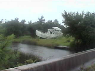 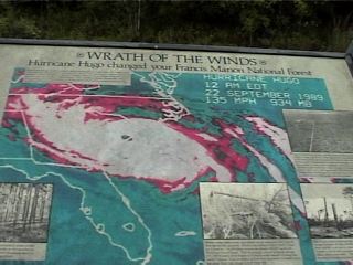 Upon getting into New Hanover county and down to Carolina Beach, there were already near gale force winds on the coast. It was also just getting dark and we had a long night ahead. This is Carolina Beach looking north-north west from the condo's 6th floor. 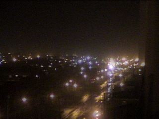 I set up the H.I.R.T. vehicle with all of its weather gadgets between two buildings, facing the wind with no obstruction. At this point, around 8:25 we had 30 to 40 mph winds with gusts to near 50. Rain was falling steady. The tide was noticeably above normal. A photo of the Isuzu Rodeo turned H.I.R.T. mobile weather station. 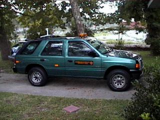 This is the beach. Not too much to see, but normally the ocean is much further back. 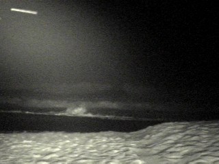 After the 10pm CNN live shoot, we did some more observations and the wind had increased to 40 mph with gusts to 55mph to 60mph. More rain and higher surf. There was also the beginnings of the "sand blizzard" that I'll elaborate on later. Here is a shot of our Davis Instruments Weather Monitor II: 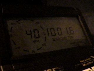 The satellite uplink truck from Charlotte, NC. 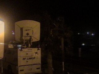 After the 11pm live shoot, I used the laptop and logged on to WeatherTap to get the latest NEXRAD radar out of Wilmington. It showed a nasty band of heavy rain and high winds coming onshore. After this look at the radar, I went out on a damage assesment tour and to get observtions all over the island. I phoned the Wilmington office of the National Weather Service frequently with my updates. Upon reaching the very end point of US 421 in extreme southern New Hanover county, the power went out to the island. There was a blue-green flash and lasting glow in the sky. No noise could be heard from where I was. At this point everything went dark. All of the ambient light that is cast off the bottoms of the low hurricane-clouds was now gone. Quite a humbling feeling to say the least. At the southern most point of US 421, winds were tropical storm force gusting to storm force (39mph to 58mph). Rain was increasing. Surf was not visible from my location. There was about 1/2 dozen sea gulls riding the wind..powerful wind at that. I got video and hope to place some snapshots of it here. Interesting in how the birds were not fighting the wind but rather riding its velocity and seemingly enjoying it. Kind of like how surfers enjoy the swells that precede a hurricane. ...update as of 6:45pm edt 9-1-99.... Well, here is our next set of pics from our Dennis: Part II story. We left Wilmington around 10:15am on Saturday, Sept. 4. I was joined by Dr. Brian Davis of UNCW. We were set on getting in front of Dennis and to do so we needed to get into extreme eastern Carteret county, North Carolina. NOTE: for a storm surge map of the area we worked in, CLICK HERE. The map will show the predicted levels of flooding for all hurricanes in the region we were in. Our first stop was the Crystal Coast of Atlantic Beach and Emerald Isle, NC. 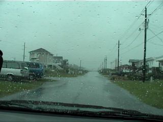 We took a shot of the swells moving in from the south and east at Atlantic Beach.  We found the infamous hurricane warning flags flying at Atlantic Beach. 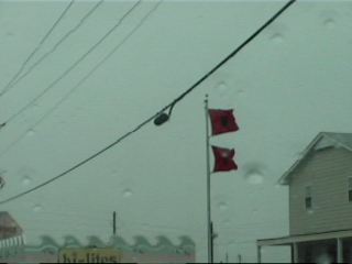 From Atlantic Beach we headed west into Morehead City. 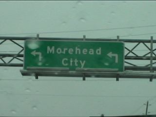 Venturing east on Highway 70 into a dark and murky afternoon. 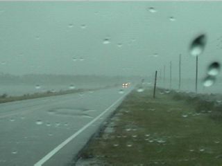 Stopping at the North River bridge, we took this shot. It was getting to be a wild ride! 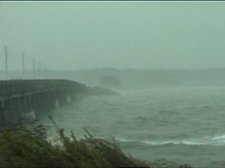 As we made our way east and deeper into Carteret county, we took Hwy 12...the mainland portion. Note that there is not usually that much water on both sides of the highway. 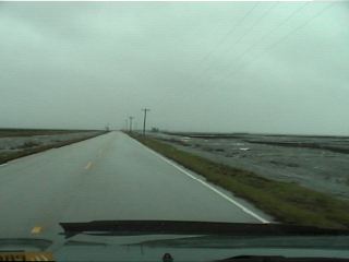 We stopped on the Monroe Gaskill Memorial Bridge to take some wind readings. This was the view into an increasingly wet Carteret county. 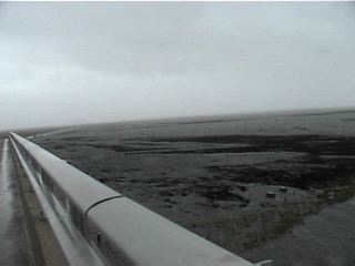 This is a shot of Dr. Brian Davis on the Monroe Gaskill Memorial Bridge. 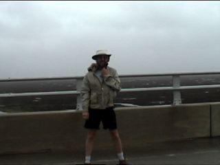 After leaving the bridge, we continued east. Our goal was to get to the Cedar Island Ferry terminal and await Dennis. We did not get that far because... 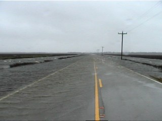 The Pamlico Sound was being pushed into this area of Carteret county. This is the essence of storm surge. With this area being so low, it fills in like a basin with water forced in by the tropical storm. It was getting tense as we were way out in the middle of nowhere. 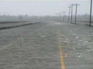 We did stop in the middle of some shallow storm surge. Ahead of us was a nasty surprise that would end our trip east and force us to turn around. 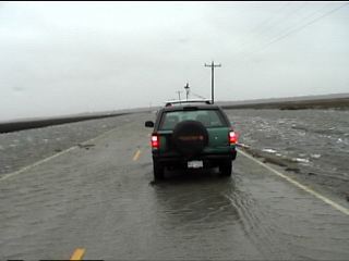 This was getting too deep to mess with, so we took some observations and turned around. 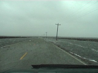 There were a few people out and about. This truck crossed with no problem, but the water was rising several inches as we were out there. 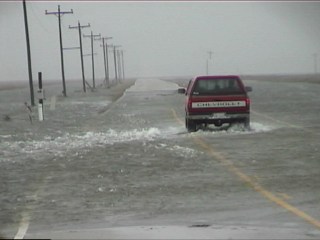 Another shot from the Monroe Gaskill bridge looking down on a fairly rapid rise in water. We got out with not too much time to spare. 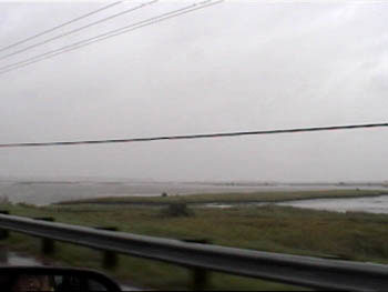 We left Highway 12 and got back onto Highway 70 and went to the town of Atlantic, NC. 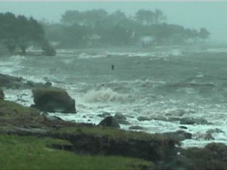 The water from the sound was rough and it was quite a site to see this small town being battered by high winds and pounding waves. 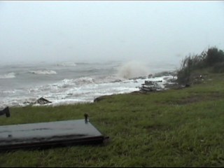 Another two shots at some larger waves crashing on the shore at Atlantic, NC. 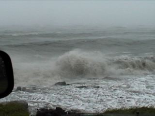 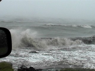 One interesting point is that these LIve Oaks are taking the winds very well. They have been around coastal Carolina for centuries and are capable of taking hurricane winds and salt spray; which is more than I can say for pine trees. 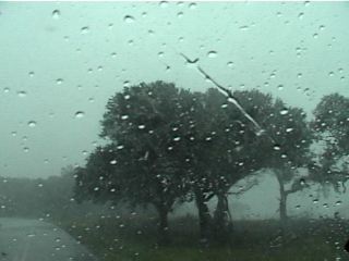 We left Atlantic and got back on to Highway 70 West towards the town of Stacy. Here is what we saw... 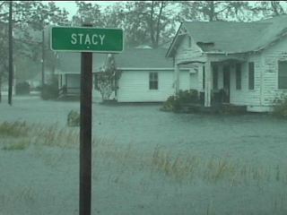 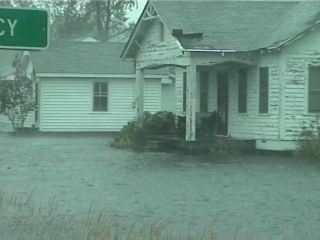 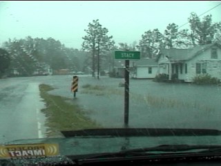 Another flooded house in Stacy, NC. 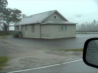 We managed to get some shots at wildlife including this Snowy Egret who was trying to keep dry. 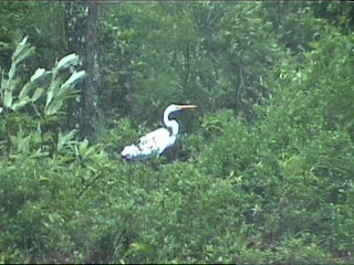 Once we left Stacy, things settled down a little. We went to another bridge and took these wind readings. 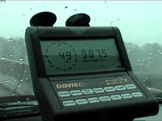 We also got a photo of me.... 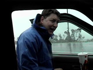 As we left the area and made our way back into western Carteret county, we found this seagull trying to fly into the wind. He did pretty good! 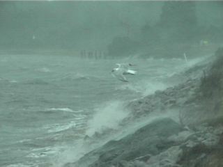   |