
|
The Hurricane Intercept Research Team (HIRT) witnessed Hurricane Floyd starting in Jacksonville, Florida and ended up back at our hometown of Wilmington, North Carolina for the landfall- which we documented at Wrightsville Beach, NC. Our report from the field is below: CLICK HERE for a nice list of the lat/lon pairs of Floyd's life-span. As of 2pm edt 9-14-99, the HIRT is in Jacksonville, FL. Team founder and leader, Mark Sudduth is joined by Eddie Smith. We have had a long trip down from Wilmington and after spending the night in Savannah at a relative's, we are in Jacksonville, FL. We have recorded some light rain showers and winds of 22mph out of the NE. Barometer is about 1010 MB. Temp is around 85 degrees F. We drove down from Wilmington, NC last night. Here are some photos of our trip so far.... ...update as of 5:15 pm 9-14-99.... Sorry that we do not yet have photos for you. Still working on that. Winds have picked up a bit here in Jacksonville. In fact, some pine trees near our hotel could be heard cracking in the gusts...very eerie. More to come later this evening.....
...UPDATE AS OF 7:23PM 9-14-99... This is the Hurricane Intercept Research Team Isuzu Rodeo...all ready to go meet Floyd. 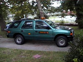 We are now in Savannah, Georgia...downtown in fact...these are beautiful Oaks that have withstood hurricanes for centuries...including the 1893 disaster... 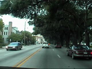 This is a taped up building in downtown Savannah...where an evacuation order went up this morning. 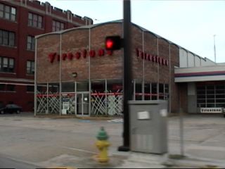 We thought these gentlemen riding around atop the plywood that might save their lives and property was a good photo. 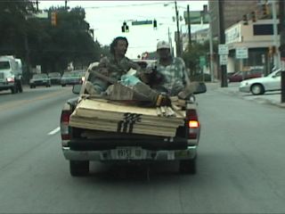 We left Savannah for Brunswick, GA and the islands near there. 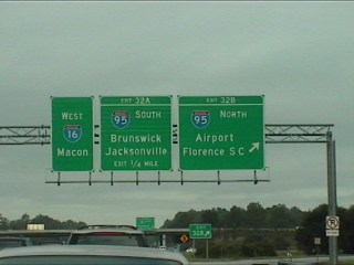 Once on the highway, we took this shot of evacuation traffic moving northward from the islands of lower coastal Georgia. It got alot worse, we hear, near Jacksonville, FL...our stop for the night. 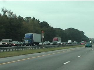 This is a rather un-dramatic shot of the parking lot of our hotel in Jacksonville, FL...this is from our room....where we are right now (7:33pm 9-14-99). 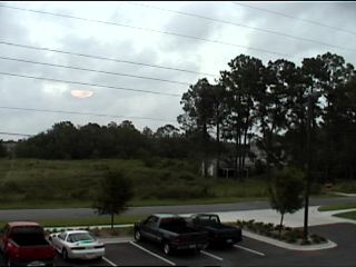 ...MORE TO COME....
...UPDATED 10:45PM EDT 9-14-99.... ....UPDATED 12:10AM EDT 9-15-99.... Well, we just had a vigorous squall come thru here in north Jacksonville. Winds really picked up...to about 34 mph....rain came down very hard and pelted the window of our hotel room....barometer down to 1003mb.....we are more concerned about the North Carolina coast now as we head back to Wilmington around 6:30am this morning....more to come.... Our trip back to Wilmington, via I-95 thru N. Florida and into Georgia... These are shots of the typical "hurricane sky" that occurs when a tropical cyclone approaches an area. This was about 6:55am Wednesday Sept. 15. 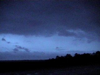 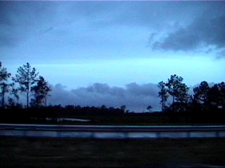 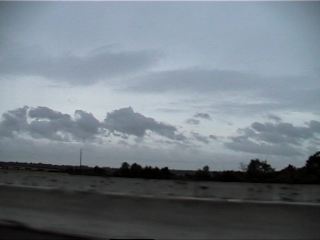 This sign was heeded as thousands of people fled Savannah, GA in anticipation of major damage from Hurricane Floyd. 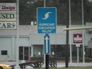 We took this shot of minor tree damage at a Hotel in Savannah, GA around 9:15am Weds. 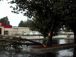 Another of the thousands of boarded houses in the Savannah area. 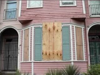 Even with the approach of a monster hurricane, people still managed to have a sense of humor... 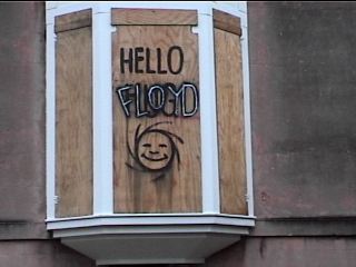 This is the bridge leading out of Savannah via US 17 north. Quite a site to see in person. 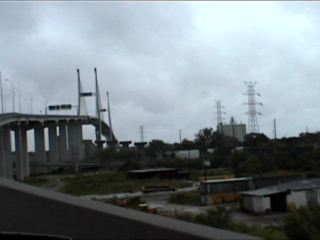 This is a marina just outside of Georgetown, SC. Pretty empty for obvious reasons... 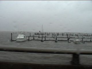 We stopped in Myrtle Beach to take the shots below: There is always the "swaying traffic lights" that intrigues us. 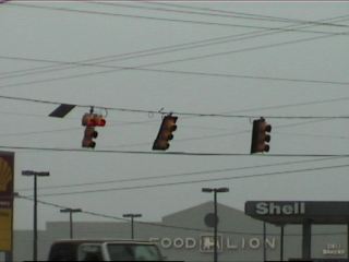 A site rarely seen in Myrtle Beach......NO TRAFFIC!!! We went down to the beach front to take this photo of an incredible Atlantic Ocean. 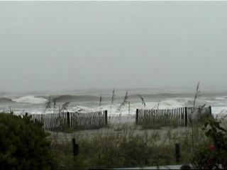 Eddie Smith and I were interviewed by a Pittsburgh, PA TV station on the beach at Myrtle Beach...this is Eddie getting interviewed. 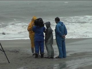 It was difficult to drive at times, even with a well equipped SUV, people were spraying up water as it piled in the streets. 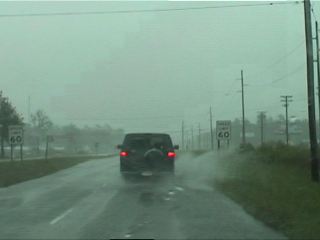 And the Palm Trees were blowing hard as usual... 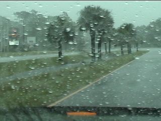 ...UPDATE AS OF 5:45 PM EDT 9-15-99.... We are home now...in Leland...just west of Wilmington, NC by 6 miles...had a long trip north from Jacksonville, FL...we left there around 6am and drove thru Savannah and Myrtle Beach. US 17 north thru Charleston was closed. So we made the long route via ALT-US 17 to Georgetown, SC and finally up thru Myrtle Beach, SC and into Wilmington. There is alot of flooding and some gusty winds....that's about all...so far...we expect that the eye of hurricane FLOYD will come on in to our area around 2am.... ...UPDATE AS OF 10:35PM EDT 9-15-99.... We have some shots now of our work today. . Back in good ole North Carolina... 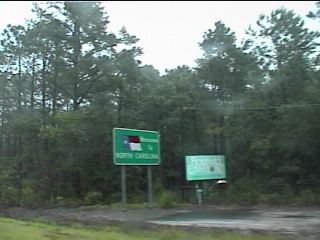 US Highway 17 began to flood as early as late Tuesday night into Wednesday morning. 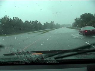 This is what I call a true water hazard 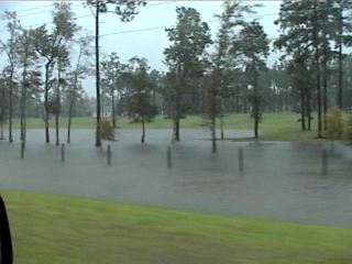 The rain pelts the windshield like bb's sometimes... 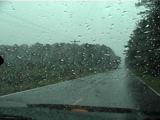 We are about to cross the Cape Fear Memorial Bridge into Wilmington, NC to check in at the EOC.  Ok, we are now up to Wednesday night, September 15, 1999. Eddie and I drove back from Jacksonville, Florida to witness the hurricane in our own backyard of Wilmington and vicinity. Eddie joined the crew at the New Hanover County EOC. Jamie Arnold joined up with me in Wilmington after a harrowing drive himself from Charlotte. So it was going to be Jamie and me in the field with Eddie Smith providing communications about Floyd's path and strength. It was about 9:35pm when we ran across this truck corssing moving flood waters in the Seagate area of Wilmington. 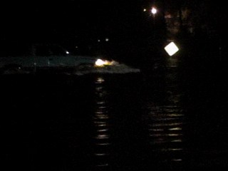 Here is a pet store and kennel in the same general area. 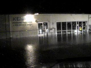 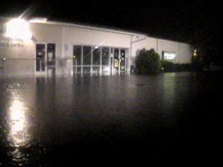 Mercer Ave., a few miles to west of the previous pictures, was flooded as well by Burnt Mill Creek. 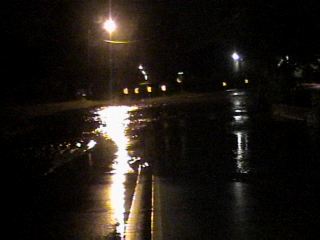 HumVee was the only means by which to cross...even that was taking a big chance in some instances. 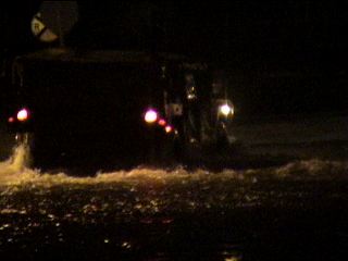 ...FLOYD AFTERMATH PHOTOS.... The day after...in fact, many days after, was nothing but more trouble for eastern North Carolina and other East Coast states. The flooding would be the major calling card of FLoyd. Although there was some wind damage to trees and some buildings, the toll would be taken by rising flood waters all across the Tarheel State. These shots were taken the night of September 16 into the 17 on the way back from Raleigh, NC. Getting there was an adventure in and of itself, getting home was a challenge to say the least. This is a common sight in North Carolina lately. Folks should not attempt to cross flooded roads. It's all too evident why. 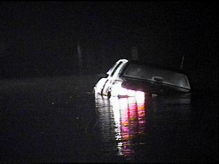 This car was still on as far as the electrical system. We did not know the whereabouts of the owner of the car. 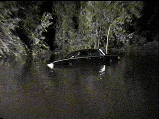 Another angle. 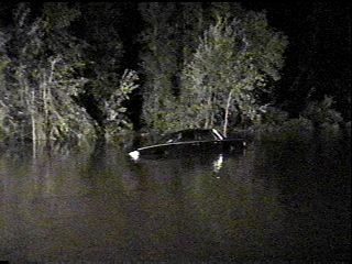 A little further south on this highway (US 421) I encountered a brdige that was slowly washing out. 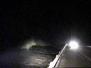 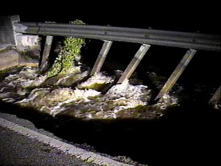 
|