Hurricane Gordon as studied by the
Hurricane Intercept Research Team
on Sunday, September 17, 2000
On September 13th, Gordon looked like it was going to explode into a monster hurricane. The system had what appeared to be great outflow as the upper cloud pattern whisked away in a clockwise pattern. All seemed to favorable for development. Nothing happened. The convection died away. By the 14th, at 11am EDT, tropical depression Gordon had formed along the coast of the Yucatan Peninsula of Mexico. It moved over land and had little chance of survival until it emerged back out over water. This happened on the 15th and by 11am EDT the center of the depression had just about moved back out over water. Then, things changed....
By 11pm EDT the 15th, what was now tropical storm Gordon had become much better organized and it again looked as if a powerful hurricane might brew and strike somewhere along the Gulf Coast. That did not happen. What did happen was that Gordon grew to minimal hurricane strength and tracked towards the west coast of Florida. Hurricane Watches were posted with warnings not too far off. Gordon was to be the new century's first landfalling cyclone.....and the coverage began.
At 2:30pm EDT on Saturday, September 16, the decision was made by the Hurricane Intercept Research Team (H.I.R.T.) to head to the Florida Gulf Coast; 50 miles either side of Cedar Key. By that evening, it was clear that Gordon would strike the west coast of Florida, but EXACTLY where was still uncertain.
At approx. 3am EDT on Sunday the 17th, Mark Sudduth and Eddie Smith departed southeast North Carolina for Florida. We decided to take only one of our two specially equipped vehicles to Florida in case Gordon made a bee-line across Florida and then up the East Coast. We would have Charles Costin (and his identically equipped vehicle as ours) ready to deploy to where a potential Atlantic bound Gordon might go.
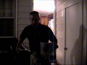
Here is Eddie Smith as he leaves his home in Lake Waccamaw, NC to join Mark Sudduth for the trip.
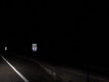
We made our way south on Interstate 95
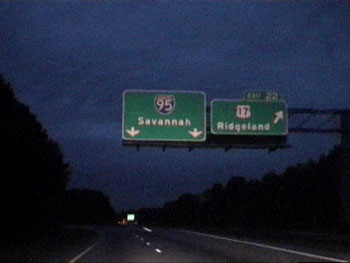
Here we are nearing Savannah, GA
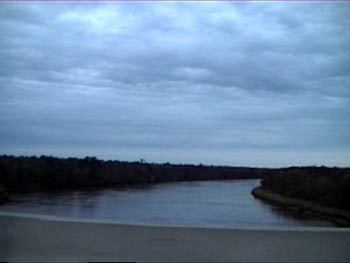
A shot of the Savannah River at the GA/SC line.
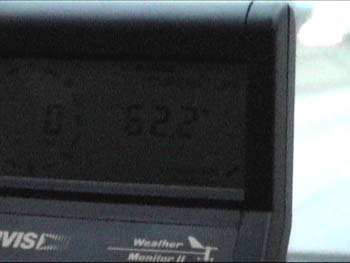
The outside temperature near Savannah was 62 degrees F. This is important as we would discover later in the mission.
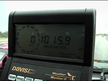
The barometer read 1015 millibars (MB) near the Savannah, GA area. It would go MUCH lower!
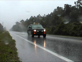
The still photo below also has a video clip associated with it. The clip shows a downpour that we experienced while on I-95 just inside the Florida border. It was interesting because we could clearly see about a mile down the road that there was an area of extremely heavy rain. As we closed in on the downpour, it seemed like a waterfall was coming right at us. And then we hit it head on and the rain drops sounded like large pellets hitting the windshield. There was no hail, the drops of rain were just large and plentiful!
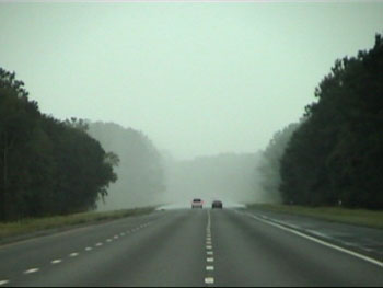
See the video clip here!!!
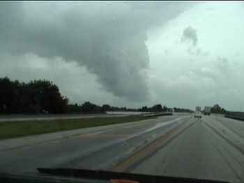
This is a neat picture of what looks like a menacing cloud (kinda looks like a funnel???). This is a thunderstorm cloud that was being blown and stretched out as it rose higher into the atmosphere. Remember, Gordon was being "sheared" and this distorted thunderstorm cloud is a great example of that on a small scale.
Mark and Eddie arrived in Gainesville, Florida at around 11:25am EDT on Sunday. We were tired but none the less ready to get moving and study this hurricane. We noticed on the way down by listening to our NOAA Weather Radio that the pressure had dropped during the night to 981 millibars....in other words, air pressurewise, the hurricane was strengthening. But, by the time we reached Gainesville, the hurricane's central air pressure had risen slightly and had begun to draw in dry, stable air. This would act to reduce the overall convection and thus preclude any heavy rain event that was likely over Florida and the Southeast.
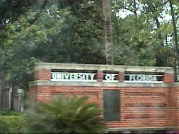
A shot of the University of Florida in Gainesville.
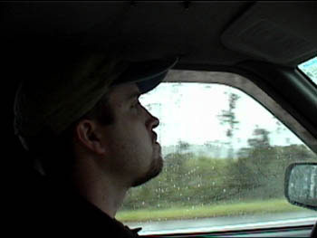
A photo of Eddie Smith at the wheel as we ride along Hwy 24.
Here is a shot of our Isuzu Rodeo with all its gadgets as we cruise west on Highway 24 towards Cedar Key.
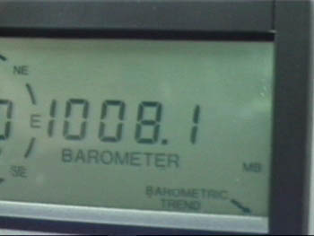
Another look at the falling barometer as we closer to the Gulf of Mexico.
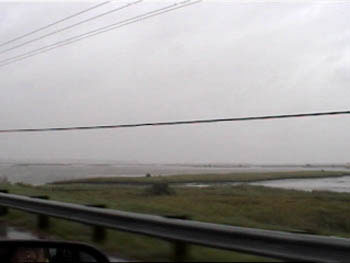
A shot of the marsh area along Hwy 24 as we approach Cedar Key, Florida. It is now about 1:15pm or so.
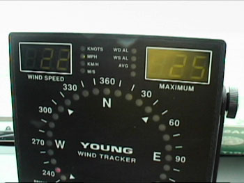
We stopped along a bridge just outside Cedar Key to get a good wind reading. 22mph gusting to 25 or so.....not bad.....yet.
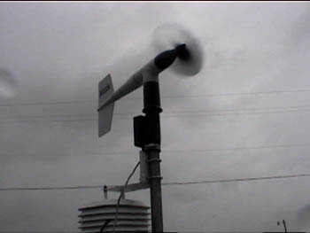
Here is a photo of our R.M. Young anemometer (measures wind speed and direction). It was cranking to about 30 mph at this point. It is now about 1:30pm.
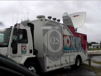
There were several satellite uplink trucks along the large concrete parking area along the waterfront of Cedar Key. This truck was out of Tampa.
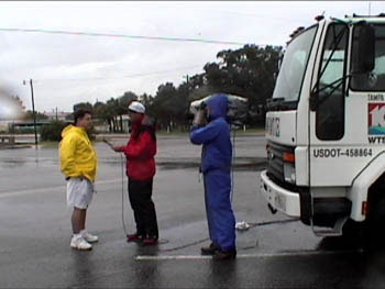
This is Mark Sudduth being interviewed by the Tampa, FL CBS station.
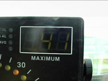
Now it is about 2pm and the wind gusts are increasing to over tropical storm force. This one was 41mph and climbing.
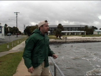
Eddie Smith along the walkway and railing at the Gulf of Mexico in Cedar Key.
Click Here to Go to Page Two!!!


|
|