Storm surge flooding from hurricanes historically causes significant damage and 90% of the deaths associated with a hurricane landfall. Although inland flooding has become the biggest killer in recent times, storm surge still holds the greatest potential for loss of life during a hurricane.
There is a misconception that storm surge is like a seismic tidal wave that comes sweeping across the coastline. Tidal waves, or tsunamis as they are properly termed, are created by an underwater seismic event. A hurricane storm surge is generated by wind and pressure forces acting upon the ocean. Then, the exact area that is affected by the storm surge will determine the overall height and consequenial damage of the surge.
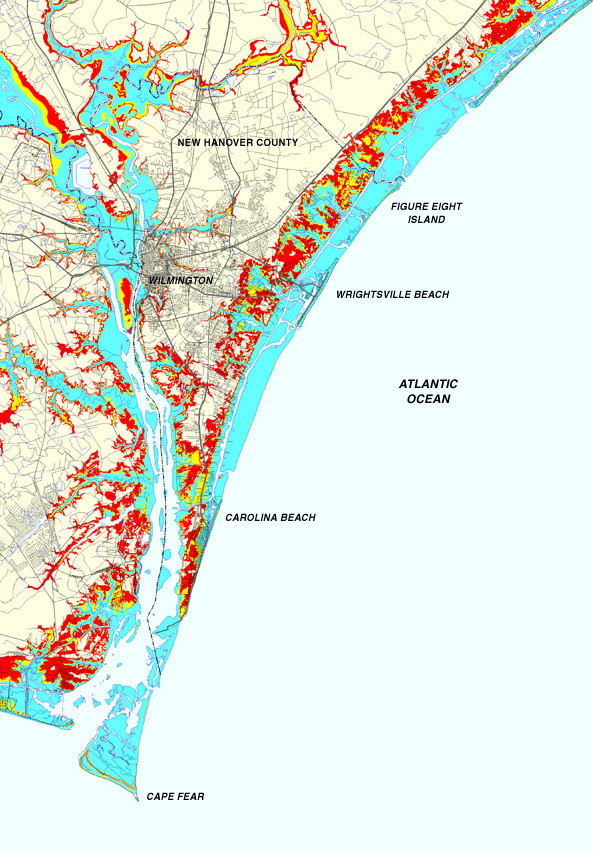
This is a storm surge inundation map. It is used to depict areas that are predicted to flood during a hurricane storm surge. The map was produced using the Sea, Lake, and Overland Surges from Hurricanes (SLOSH) model. It does not show the damaging effects of flooding rain, high winds and tornadoes.
This inundation map shows all of New Hanover county in southeast North Carolina as well as potions of eastern Brunswick county and southeast Pender county. Click on the map at left to zoom in to a higher resolution image.
There are some .AVI movies below of actual storm surge video taken by the Hurricane Intercept Research Team during tropical storm Dennis and Hurricane Floyd.
You can access all of North Carolina's storm surge inundation maps at the link below. A product of Hurricane Maps Enterprises